Australia
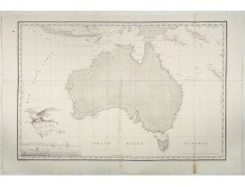
Location: 1811
Published: Paris, 1811
Size: 491 x 731 mm.
Color: Uncolored.
Condition: Several foldings as issued. Printed on heavy paper. Repair of one minor paper thinness on old foldings. Some very minor discoloration in lower part center fold. An attractive example of this important map.
FREYCINET, M.L. - Carte Generale de la Nouvelle Hollande. - 39968 - Australia - FREYCINET, M.L. - Carte Generale de la Nouve..
5,000€
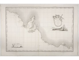
Location: 1811
Published: Paris, Imprimerie Royale, 1811
Size: 493 x 755 mm.
Color: Uncolored.
Condition: Fine uncolored condition and strong impression. Several foldings as issued. An attractive example of this important map.
FREYCINET, M.L. - Carte Generale de la Terre Napoleon (à la Nouvelle Hollande)... par M.L. Freycinet an 1808 - 39969 - Austr..
4,500€
Location: 1824
Published: Paris, 1824
Size: 180 x 215 mm.
Color: In original colours.
Condition: Very good condition. Some marginal spotting and marks in the margins.
LESUEUR, C-A. / PERON, F. - Terre de Diemen. Navigation. [plate XIV] - 40103 - Australia - LESUEUR, C-A. / PERON, F. - Terre..
200€
Location: 1824
Published: Paris, 1824
Size: 180 x 210 mm.
Color: Uncoloured.
Condition: In very good condition. Some marginal spotting and marks in the margins.
LESUEUR, C-A. / PERON, F. - Nouvelle-Hollande: Nouvelle Galles du Sud. Navigation. [plate XXIII] - 40112 - Australia - LESUE..
200€
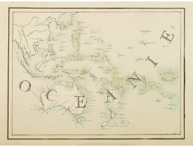
Location: 1850
Published: Ca. 1850
Size: 223 x 297 mm.
Color: Original colours.
Condition: Manuscript on paper. Professional repair of marginal tear, just attaining the border frame.
ANONYME. - Oceanie. - 01830 - Australia - ANONYME. - Oceanie. - 01830 - Australia..
300€
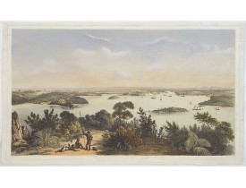
Location: 1852
Published: London, J. Hogarth, 1852
Size: 335 x 580 mm.
Color: In original colours.
Condition: Original hand-coloured tinted lithograph op heavy paper. Artist names and captions below image, 357 x 600mm. The title and publishers details cut-off. Paper discolouration to margins from old mount, slight soiling overall, minor repairs to margins and image. The sky with some later colour addition.
ANGAS, G.F. - (The City And Harbour Of Sydney From Near Vaucluse.) - 30913 - Australia - ANGAS, G.F. - (The City And Harbour..
3,500€
Location: 1906
Published: Lyon / Paris, 1906
Size: 680 x 930 mm.
Color: In original o/l colours.
Condition: In good condition. Lithography. With folding's, as issued. Small marginal tear of old fold.
MISSIONS CATHOLIQUES - Carte des missions Catholiques en Australie. - 31926 - Australia - MISSIONS CATHOLIQUES - Carte des mi..
800€
Showing 1 to 7 of 7 (1 Pages)


![LESUEUR, C-A. / PERON, F. - Terre de Diemen. Navigation. [plate XIV] LESUEUR, C-A. / PERON, F. - Terre de Diemen. Navigation. [plate XIV]](https://www.loeb-larocque.com/eshop/image/cache/catalog/image/new_upload/LESUEUR-C-A-PERON-F-Terre-de-Diemen-Navigation-[plate-XIV]-275x210w.jpg)
![LESUEUR, C-A. / PERON, F. - Nouvelle-Hollande: Nouvelle Galles du Sud. Navigation. [plate XXIII] LESUEUR, C-A. / PERON, F. - Nouvelle-Hollande: Nouvelle Galles du Sud. Navigation. [plate XXIII]](https://www.loeb-larocque.com/eshop/image/cache/catalog/image/new_upload/LESUEUR-C-A-PERON-F-Nouvelle-Hollande-Nouvelle-Galles-du-Sud-Navigation-[plate-XXIII]-275x210w.jpg)


