DE WIT, F. - Comitatus Flandriae Tabula, In Lucem Edita A Frederico De Wit.
 cliquez sur l'image pour l'agrandir
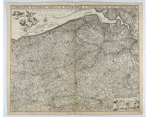
DE WIT, F. - Comitatus Flandriae Tabula, In Lucem Edita A Frederico De Wit.
Date: Amsterdam, 1680
Format: 460 x 555mm.
Color: Noir et blanc.
Condition: A dark and good impression on thick paper. In very good condition.
Description
Double page map of Flanders, the whole Belgian region northwest of Brussels, confined by Antwerp, Brussels, valenciennes, Arras, St. Omer and the Channel. Title heading above the map, coat of arms supported by cherubs, and scale of miles. Verso blank. In Latin.
100€
- Voir les autre produits par: DE WIT, F.
- N° Reference: 26811

![DIETH, H. - Hong Kong Piraten Strasse. [Pirate Street]. DIETH, H. - Hong Kong Piraten Strasse. [Pirate Street].](https://www.loeb-larocque.com/eshop/image/cache/catalog/image/new_upload/24363-275x210w.jpg)
