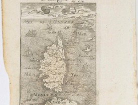
MANESSON-MALLET, A. - Die Insel Corsica - I. De Corse. Fig: CIV.
 cliquez sur l'image pour l'agrandir
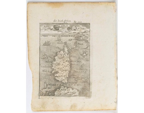
MANESSON-MALLET, A. - Die Insel Corsica - I. De Corse. Fig: CIV.
Date: Francfort, 1685
Format: 140 x 100mm.
Color: Noir et blanc.
Condition: Petites taches grisâtres en bas de planche, marge un peu rognée en bas à gauche. - Good condition, paper age-toned and marginal spotting.
Description
Carte de Corse avec le nord de la Sardaigne, ornée de nombreux bateaux. Publiée dans l'édition allemande de la "Description de l'Univers" : "Beschreibung des ganzen Welt-Kreisses". Von Alain Manesson-Mallet. Frankfurt am Mayn in Verlegung Johann David Zunners. Anno MDCLXXXV".
Charming map of Corsica shown in a perspective view of the Mediterranean Sea and embellished with fighting ships just off shores.
From the German text edition published by Davis Zunners of "Description d'Univers" (1683) by Allain Manneson Mallet (1630-1706), a well travelled military engineer and geographer who worked in 17th century France under King Louis XIV.
150€
- N° Reference: 34675

![LEVASSEUR, V. - Dépt. De La Lozère. N°47. [ Florac, Mende ] LEVASSEUR, V. - Dépt. De La Lozère. N°47. [ Florac, Mende ]](https://www.loeb-larocque.com/eshop/image/cache/catalog/image/new_upload/27126-275x210w.jpg)
