MANNESSON MALLET, A. - Plan de St. Malo / Platte Grond van St. Malo.
 cliquez sur l'image pour l'agrandir
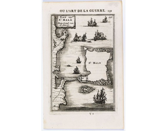
MANNESSON MALLET, A. - Plan de St. Malo / Platte Grond van St. Malo.
Date: Paris, 1683
Format: 143 x 95mm.
Color: Noir et blanc.
Condition: Bon exemplaire.
Description
Plan de St. Malo publié en 1684-85 dans l'ouvrage de science militaire "Les Travaux de Mars, ou l'Art de la guerre.". Allain Manneson Mallet (1630-1706), était ingénieur militaire et géographe du roi Louis XIV.
50€
- Voir les autre produits par: MANNESSON MALLET, A.
- N° Reference: 29528

![LEVASSEUR, V. - Dépt. De L'Isère. N°37. [ Grenoble ] LEVASSEUR, V. - Dépt. De L'Isère. N°37. [ Grenoble ]](https://www.loeb-larocque.com/eshop/image/cache/catalog/image/new_upload/27116-275x210h.jpg)

