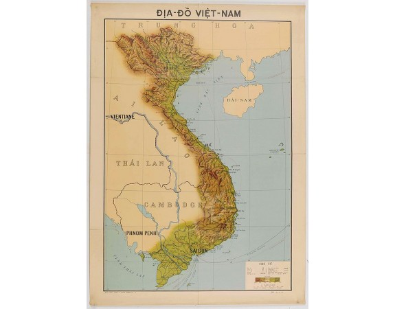
SERVICE GÉOGRAPHIQUE DE L'INDOCHINE. - Carte économique de l'Indochine.
 cliquez sur l'image pour l'agrandir

SERVICE GÉOGRAPHIQUE DE L'INDOCHINE. - Carte économique de l'Indochine.
Date: Hanoï, 1937
Format: 840 x 600 mm.
Color: Imprimé en couleur.
Condition: Offset. Fine condition. Several folds as issued. Repaired tear at upper part center fold 3 cm into image. Size of the sheet : 745 x 535 mm.
Description
Economic map of Indochina published in 1937 by the "Service Géographique de l'Indochine" and printed by the "Service Géographique National du Viet-Nam. Scale : 1:2 000 000.
Features Vietnam, Cambodia, Laos and part of Thailand. With a key referring to roads, railways, rivers, boundaries, forests, agricultural productions…
The map shows many productions and activities as fishing (shark finning, tortoiseshell), spices, rice, precious wood, mines, tea, coffee, salt works, cotton, coconut trees, sugar, natural rubber, etc.
400€
- N° Reference: 45664
Etiquettes :
SERVICE GÉOGRAPHIQUE DE L'INDOCHINE. - Carte économique de l'Indochine.
, Cambodge - Laos - Thaïlande - Vietnam


