Sea Charts
Location: 1666
Published: Amsterdam, 1666
Size: 422 x 518 mm.
Color: Coloured.
Condition: On double-ply paper as issued. Paper very mildly age-toned, as usual. A good and dark impression.
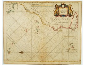
GOOS,P. - De cust van Barbaria Gualata, Arguyn, en Geneheo, van Capo S Vincente tot Capo Verde. - 12094 - Morocco - GOOS,P. ..
600€
Location: 1710
Published: Amsterdam, c.1710
Size: 505 x 575 mm.
Color: Coloured.
Condition: Good condition. Printers creases in lower left corner.
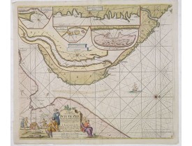
VAN KEULEN, J. - Paskaart van de Mont van de Witte Zee,. Beginnende van Tiepena tot Pelitza, als mede van C. Cindenoes tot C..
500€
Showing 1 to 2 of 2 (1 Pages)


