

Corsica Illustrata
| 534.0 | BORDONE, B. (Corsica). Venise, 1534. 83 x 147 mm. In "Libro di Benedetto Bordone … de tutte l'Isole del Mondo…" ; p. XXI, sign. "D iii" ; dernière ligne "deci…". Au verso, autre bois avec Palmosa, Elba et le Nord de la Corse. |  |
| 534.0 | BORDONE, B. (Corsica). Venise, 1534. x mm. In "Libro di Benedetto Bordone … de tutte l'Isole del Mondo…" ; p. XXI, sign. "D iii" ; dernière ligne "deci…". Au verso, autre bois avec Palmosa, Elba et le Nord de la Corse.  |  |
| 548.0 | LICINIO, F. Cirnus sive Corsica insula est in mari ligustico. Venise, 1548. 330 x 230 mm. Par Fabio Licinius, (1521-1565). Graveur | 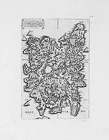 |
| 550.0 | MÜNSTER, S. (Partie de l'Italie avec la Corse et le nord de la Sardaigne). Bâle, ca. 1550. 170 x 155 mm. Texte en français. Orientée avec le sud en haut.  |  |
| 560.0 | ANONYME Isola di Corsica. . . Londres, 1560. 330 x 230 mm. |  |
| 560.0 | GASTALDI, Giacomo L'Isola di Corsica, con i territori, citta, et castelle forti. . . Venise, 1560. 312 x 209 mm. Fabio Licinio graveur. | 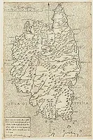 |
| 562.0 | MÜNSTER, S. Corsica. Basel, 1562. 120 x 75 mm. Nice miniature map of Corsica with monsters and ships in the sea. It is a typical woodcut illustration that makes these Münster maps fascinating and sought after by map collectors. From a German text edition of his Cosmographia, that great compendium of Renaissance knowledge. |  |
| 562.0 | MÜNSTER, S. Corsica. Basel, 1562. Col. 120 x 75 mm. Jolie petite carte de Corse, nord en haut. Ornée de bateaux et de monstres marins. | 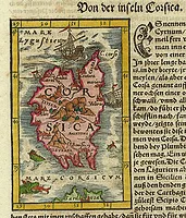 |
| 562.0 | BERTELLI, F. Cirnus sive Corsica Insula est in Mari Ligustico, . . . Venice, 1562. 306 x 193 mm. Représentation géographiquement peu fidèle mais très riche du point de vue iconographique, comme c'était généralement le cas pour les cartes de l'époque. Dans l'intérieur de l'île, constellée de villages et de grandes cités, on distingue des cours d'eau, des montagnes, des champs cultivés. La scène est animée d'hommes à pied ou à cheval, de gibier de différente sorte ainsi que, entre Corti et Capo Santa Maria, d'une scène de chasse avec deux chiens "cursini" attaquant un sanglier. Sur la mer avoisinante voguent d'élégants voiliers. | 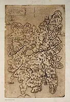 |
| 567.1 | MÜNSTER, S. Corsica. Bâle, 1567. 123 x 78 mm. Ornée de bateaux et de monstres marins. Texte en allemand recto/verso. |  |
| 567.0 | ALBERTI, L. L'Isola di Corsica. Venise, 1567. 245 x 170 mm. Première édition. Publiée dans "Isole appartenanti alla Italia, di F. Leandro Alberti Bolognese". | 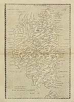 |
| 567.0 | ALBERTI, L. L'Isola di Corsica. Venise, 1567. 245 x 165 mm. Première édition. Publiée dans "Isole appartenanti alla Italia, di F. Leandro Alberti Bolognese". | 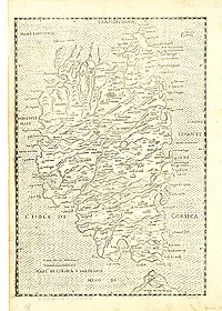 |
| 568.0 | CAMOCIO, G.-F. Cirnus sive Corsica Insula est. . . Venice, 1568. 200 x 290 mm. |  |
| 572.0 | PORCACCHI, T. / PORRO. G. Corsica. / Sardegna. Venise, 1572. 105 x 142 mm. Ensemble comprenant la Corse, la Sardaigne (105 x 142) et le texte complet (ff. 45-50). Texte en italien. In "L'Isole le più famose del Mondo...e intagliate da Girolamo Porro…" |  |
| 572.0 | PORCACCHI,Th./ PORRO. Corsica. Venise, 1572. 105 x 142 mm. In the stippled sea a compass-rose in the shape of a circular disc with indication of eight wind directions by means of the first letter of the Italian names: T, G, a Cross, S, O, A, P and M. Printed with Italian text page 46. |  |
| 573.0 | ORTELIUS, A. Corsica. Anvers, 1573. Col. ancien. 170 x 235 mm. Carte de Corse avec le nord orienté à gauche. | 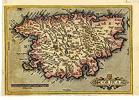 |
| 573.0 | ORTELIUS, A. Corsica. Anvers, 1573. Col. 165 x 240 mm. Sans texte au verso. | 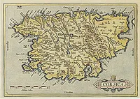 |
| 573.0 | ORTELIUS, A. Corsica / Marcha Anconae, olim picenum. 1572. Anvers, ca. 1573. Beau col. ancien. 330 x 240 mm. Carte de Corse avec le nord orienté à gauche ; sur la même planche en bas figure la Marche d'Ancone. Ortelius, pour réaliser sa carte de Corse, s'est basé sur les cartes d'Agostino Giustinani, de Hieronymus Bordonius, de Gastaldi et de Leander Alberti, auteurs qu'il cite dans son "Catalogus Auctorum". | 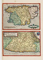 |
| 574.0 | CAMOCIO, G.F. Corsica. Venise, 1574. 150 x 200 mm. Avec le N° de pagination 78. |  |
| 575.0 | BELLEFOREST, F. de. Sardinia (avec Corse.) Paris, 1575. 235 x 100 mm. | 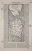 |
| 576.0 | ANONYME Corsica fol. 190 1576. 125 x 78 mm. Identique à la carte de Münster (Cervoni, 6) mais provenant d'un ouvrage de poche. |  |
| 580.0 | ORTELIUS, A. Senensis ditionis. . . / Corsica / Marcha Anconae. . . Anvers, 1580. Col. 326 x 482 mm. Three inset maps : on the left the Tuscan region in Italy with Sienna upper left, the island of Corsica upper right, and lower right the Ancona region along the coast of the Adriatic Sea. Oceans, mountains, rivers, lakes, cities and important towns are detailed on all three maps. Latin text on verso. | 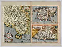 |
| 580.0 | ANONYME (FERRETI). Ragionevol' Forma et vera postura del' Isola di Corsica. Ancône, 1579 -1580. 130 x 90 mm. RARISSIMUM NON REPERTORIÉ PAR CERVONI. Provient de l'ouvrage de Francesco Ferreti, Diporti Notturni..., dont les gravures ont été gravées par Michel Angelo Marrelli, et qui a paru à Ancône, chez Fr. Salvioni, en 1579-1580. -"Livre devenu rare et dont les planches sont fort curieuses" (Brunet, vol. II, p. 1235). L'auteur anonyme s'est apparemment basé sur la carte de Tomaso Porcacchi de 1572. |  |
| 580.0 | ANONYME (FERRETI). Ragionevol' Forma et vera postura del' Isola di Corsica. Ancône, 1579 -1580. 130 x 90 mm. RARISSIMUM NON REPERTORIÉ PAR CERVONI. Provient de l'ouvrage de Francesco Ferreti, Diporti Notturni..., dont les gravures ont été gravées par Michel Angelo Marrelli, et qui a paru à Ancône, chez Fr. Salvioni, en 1579-1580. - "Livre devenu rare et dont les planches sont fort curieuses" (Brunet, vol. II, p. 1235). L'auteur anonyme s'est apparemment basé sur la carte de Tomaso Porcacchi de 1572. | 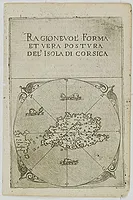 |
| 584.0 | ORTELIUS, A. Creta Iouis magni../Corsica../ Sardinia. Anvers, 1584. 340 x 491 mm. Figure la Crète, la Corse et la Sardaigne. - Islands are shown with place names and important locales as they existed in the Classical Period. Ortelius mentions as his classical sources Strabo, Palenses, Athenaeus, Livius and Plinius. |  |
| 588.0 | ALBERTI, L. L'Isola di Corsica. Venise, 1588. 245 x 17 mm. Carte de la Corse publiée dans la seconde édition de l'ouvrage de Leandro Alberti "Isole appartenenti alla Italia". Au verso texte en italien avec l'inscription suivante : "Descritt. dell'Isole d'Italia A5". |  |
| 598.0 | HEYNS, Z. Corsica Amsterdam, 1598. 170 x 140 mm. Le Miroir du Monde, ou, Epitome du Theatre d'Abraham Ortelius. |  |
| 599.0 | LANGENES, B. Corsica. Amsterdam, 1599. 88 x 123 mm. Edition avec l'ajout des degrés de latitude et de longitude inscrits dans l'encadrement et avec la mer gravée de vagues. Texte en néerlandais au dos.
- A miniature map centered on the island. Title cartouche in the upper left corner. First published in 1598 in his Caert-Thresoor, the plates were executed by the most famous engravers in Amsterdam, including Petrus Kaerius and Jodocus Hondius I. The atlas set a new standard for pocket atlases. The small map is extremely well engraved. The map reflect the level of cartography in Amsterdam at the turn of the century, where up to date information on newly discovered regions was readily available. |  |
| 600.0 | QUAD, M. / BUSSEMACHER. Corsica. Cologne, 1600. Noir et blanc. 230 x 315 mm. Quad's map of Corsica. With Latin text on verso, rare. |  |
| 600.0 | QUAD, M./ BUSSEMACHER Corsica. Cologne, 1600. 230 x 315 mm. Texte en allemand au verso. Description en latin sous la carte. |  |
| 600.0 | QUAD, M./ BUSSEMACHER Corsica. Cologne, 1600. Col. 230 x 315 mm. Texte en latin au verso. |  |
| 600 | BERTIUS, P. Corsica. Amsterdam, Cornelis Claesz, 1600. Col. 87 x 120 mm. La carte porte le n° de pagination 443 et le titre au-dessus de celle-ci est, de façon erronée, intitulée "Descriptio Ischiae" ainsi que le texte en latin au verso. Dans le même ouvrage la carte (105) s'intitule "Descriptio Corsicae". | 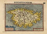 |
| 603.0 | ORTELIUS, A. Corsica. Anvers, 1603. Col. 86 x 116 mm. Carte p. 83, texte en englais au verso. |  |
| 604.0 | ORTELIUS, A. Corsica. Anvers, 1604. 86 x 116 mm. Carte p. 117, texte en allemand au verso. L3 remplacé par "Apu-" |  |
| 606 | LANGENES, B. / BERTIUS, P. Corsica. Amsterdam, 1606. Noir et blanc. 86 x 120 mm. A fine miniature map of the French island of Corsica, published by Petrus Bertius in Amsterdam early in the seventeenth century. The map features a strap-work title cartouche, and a rectangular mileage scale in each of the lower corners. The map has good topographical detail including; towns, hills and rivers. North is orientated to the left. Hatching in the sea. Bertius (1565-1629) was a Flemish cartographer, theologian, historian and geographer. Although he published much in the fields of mathematics, theology and history, he is perhaps best known as a cartographer. This example is from his Tabularum Geographicarum Contractarum, and was heavily influenced by the earlier works of Mercator, from the late sixteenth century. He was connected, by marriage to Jacobus Hondius and Pieter van den Keere - both excellent cartographers, who would influence his later life. Bertius was 'Cosmographer' to the court of King Louis XIII. Read more about Caert Thresoor by Berent Langenes. [+] |  |
| 607.0 | MERCATOR, G. / HONDIUS, J. Corsica. Amsterdam, 1607. 140 x 90 mm. Texte en latin au verso. Publié dans l'"Atlas Minor" en 1607. | 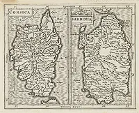 |
| 608.0 | MERCATOR, G. / HONDIUS, J. Corsica. / Sardinia. Amsterdam, 1608. Col. 141 x 178 mm. 2 maps of Corsica and Sardinia on the same plate. From the first French-text edition of Jodocus Hondius' Atlas Minor. Shortly after the publication of the big folio-atlases the need was apparently felt for a smaller-sized atlas, one that would be handier and above all, cheaper. The Atlas Minor was larger in format than other small atlases available at the time allowing for significantly greater detail and more place names than found in its rivals. | 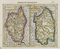 |
| 608.0 | QUAD, M. Corsica. Cologne, 1596 -1608. 230 x 315 mm. Texte en latin, p. 68. au verso. | 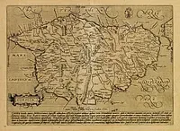 |
| 609.0 | LANGENES, B. Corsica. Amsterdam/Francfort, 1609. 85 x 123 mm. Edition non consultée par Cervoni. - A miniature map centred on the island. Title cartouche on the upper left corner. First published in 1598 in his Caert-Thresoor, the plates were executed by the most famous engravers in Amsterdam, including Petrus Kaerius and Jodocus Hondius I. "The atlas set a new standard for minor atlases. The small maps is extremely well engraved. The map reflect the level of cartography in Amsterdam at the turn of the century, where up to date information on newly discovered regions was readily available". |  |
| 609.0 | ORTELIUS, A. Corsica. Anvers, 1609. 86 x 116 mm. Texte latin au verso, page 101. |  |
| 612.0 | ORTELIUS, A. Corsica. Anvers, 1573-1612. 165 x 235 mm. Carte de Corse, avec le nord orienté à gauche. Sans texte au verso. | 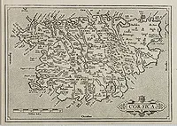 |
| 612.0 | ORTELIUS, A. Corsica. Anvers, 1573-1612. Beau col. ancien. 165 x 235 mm. Carte de Corse, avec le nord orienté à gauche. | 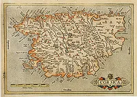 |
| 612.0 | ORTELIUS, A. Corsica. Anvers, 1573-1612. Col. 165 x 240 mm. Sans texte au verso. | 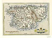 |
| 612.0 | ORTELIUS, A. Corsica. Anvers, 1573-1612. 165 x 240 mm. Sans texte au verso. |  |
| 612.0 | ORTELIUS, A. Senensis.. / Corsica.. / Anconae.. (3 maps) Anvers, 1573-1612. Beau col. ancien. 328 x 487 mm. Three maps on one plate. Upper right hand corner, early map of Corsica. Left hand sheet, map of the area south of Sienna, prepared by Cesare Orlandi; Lower right a map of Ancona, with south to the top. Copper engraving with Spanish text on verso. Abraham Ortelius (1527-1598) was a cartographer and publisher, who is born and died in Antwerp. Published first modern uniform Atlas, "Theatrum Orbis Terrarum" (Atlas of the Whole World). Very attractive original colours. |  |
| 616.0 | LANGENES, B. / BERTIUS, P. Corsica. Amsterdam, 1616. 95 x 135 mm. Texte en latin au dos. Carte p. 554. |  |
| 618.0 | BERTIUS, P. Corsica. Amsterdam, Hondius, 1618. 95 x 130 mm. Publiée en 1618 par J. Hondius dans l'ouvrage de Bertius "Tabularum Geographicarum Contractarum Libri septem." dont le titre français est le suivant : "La Geographie Racourcie de Pierre Bertius". Texte en français au verso. | 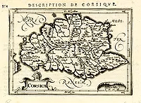 |
| 618.0 | LANGENES, B. / BERTIUS, P. Corsica. Amsterdam, 1618. 95 x 135 mm. Texte en français. Carte p. 554. |  |
| 618.0 | LANGENES, B. / BERTIUS, P. Corsica. Amsterdam, 1618. 95 x 135 mm. Texte en français. Carte p. 554. Publiée dans "Tabularum geographicarum..." | 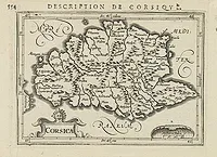 |
| 618.0 | BERTIUS, P. / HONDIUS, J. Corsica. Amsterdam, 1618. 95 x 130 mm. Texte français au verso. Page 554. |  |
| 619.0 | CLUVER, P. Corsicae antiquae descriptio. Paris, 1619. 290 x 190 mm. |  |
| 620.0 | PORCACCHI, T. / PORRO. G. Corsica. Venise, 1572-1620. 105 x 142 mm. La carte est complète de son texte en italien. Publiée dans "L'Isole le più famose del Mondo...e intagliate da Girolamo Porro…". |  |
| 620 | PORCACCHI,Th./ PORRO. Corsica. Venise, 1620. Noir et blanc. 105 x 142 mm. In the stippled sea a compass-rose in the shape of a circular disc with indication of eight wind directions by means of the first letter of the Italian names: T, G, a Cross, S, O, A, P and M. Printed with Italian text page 41. |  |
| 620.0 | MAGINI, G.A. Corsica Isola, olim Cyrnus. Bologne, 1620. 338 x 445 mm. Superbe carte avec le nord orienté à gauche, ornée de 2 superbes cartouches et de monstres marins. | 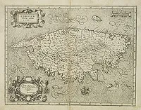 |
| 620.0 | MAGINI, G.A. Corsica Isola, olim Cyrnus. Bologne, 1620. 345 x 450 mm. Superbe carte avec le nord orienté à gauche, ornée de 2 superbes cartouches et de monstres marins. | 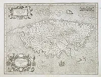 |
| 620.0 | MAGINI, G.A CORSICA Isola, olim Cyrnus. Gio Antonio Magini. Bologne, 1620. 342 x 450 mm. Superbe carte avec le nord orienté à gauche, ornée de 2 superbes cartouches et de monstres marins. | 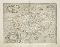 |
| 620.0 | MAGINI, G.A. Corsica Isola, olim Cyrnus. Gio Antonio Magini. Bologne, 1620. 345 x 450 mm. Superbe carte avec le nord orienté à gauche, ornée de 2 superbes cartouches et de monstres marins. |  |
| 620.0 | MAGINI, G.A. Corsica Isola, olim Cyrnus. Bologne, 1620. 342 x 450 mm. Superbe carte avec le nord orienté à gauche, ornée de 2 superbes cartouches et de monstres marins.
- Map of Corsica oriented with East on top. Decorated with sea monsters and 2 cartouches. |  |
| 620.0 | MAGINI, G.A. Corsica Isola, olim Cyrnus. Bologne, 1620. 345 x 450 mm. Superbe carte avec le nord orienté à gauche, ornée de 2 superbes cartouches et de monstres marins. | 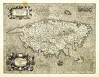 |
| 620.0 | MAGINI, G.A. Corsica Isola, olim Cyrnus. Bologne, 1620. 344 x 552 mm. Superbe carte avec le nord orienté à gauche, ornée de 2 superbes cartouches et de monstres marins. | 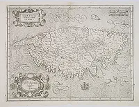 |
| 620.0 | MAGINI, G.A. Corsica Isola, olim Cyrnus. Bologne, 1620. 345 x 450 mm. Superbe carte avec le nord orienté à gauche, ornée de 2 superbes cartouches et de monstres marins. |  |
| 620.0 | MAGINI, G.A. Corsica Isola, olim Cyrnus. Bologne, 1620. 338 x 445 mm. Superbe carte avec le nord orienté à gauche, ornée de 2 superbes cartouches et de monstres marins. | 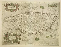 |
| 623.0 | MERCATOR, G. Corsica. Amsterdam, 1623. Col. ancien. 345 x 228 mm. Texte en latin au verso. | 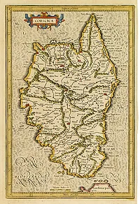 |
| 623.0 | MERCATOR, G. Corsica, Sardinia. Amsterdam, 1623. 345 x 465 mm. Texte en néerlandais au verso. | 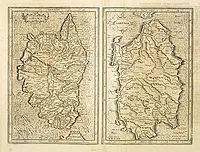 |
| 625.0 | ANONYME Corsica, Sardinia, Sicilia. c. 1625. 150 x 163 mm. 2 cartes sur une planche. A gauche sont figurées les cartes de la Corse et de la Sicile, à droite celle de la Sardaigne. Représentées à l'époque de la Rome Antique. | 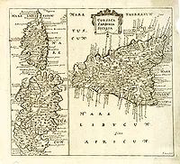 |
| 626 | BARLAEUS, Caspar / HONDIUS, Jodocus. Corsica / Sadinia. Amsterdam, J. Hondius, 1626. Col. 175 x 244 mm. Carte de la Corse et de la Sardaigne sur une même planche, publiée dans l'atlas de Caspar Barlaeus "Nova et Accurata Italiae Hodiernae Descriptio", Amsterdam, J. Hondius, 1626. La planche porte le numéro de pagination 400, le texte est en latin. | 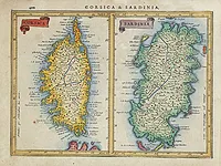 |
| 628.1 | MÜNSTER, S. Von der Insul Corsica. Cap. Lvviii. Bâle, 1628. 122 x 78 mm. Ornée de bateaux et de monstres marins. Texte en allemand recto/verso. |  |
| 630 | MERCATOR, G. / CLOPPENBURGH, J.E. Corsse et Sardaigne. Amsterdam, 1630. Col. 190 x 255 mm. Map of Corsica and Sardinia Islands from the rare Cloppenburg edition slightly larger format and more scarce edition of the Mercator/Hondius "Atlas Minor". Engraved by Pieter Van Den Keere. The Cloppenburg edition was continued for a couple of years but seems to have been suppressed after 1636 ... (Koeman Atlantes Neerlandici). Based on the 1595 Abraham Ortelius map, but with added decoration. |  |
| 633.0 | MERCATOR,G./ HONDIUS,J. Corsica et Sardinia. Amsterdam 1633. Col. 343 x 462 mm. Early depiction of the two islands, each with their own titles and scale-bars. A number of place-names and with mountains in relief appearance. Mercator was born in Rupelmonde in Flanders and studied in Leuven under Gemma Frisius, Dutch writer, astronomer and mathematician. The excellence of his work brought him the patronage of Charles V, but in spite of his favor with the Emperor he was caught up in the persecution of Lutheran protestants and charged with heresy, fortunately without serious consequences. No doubt the fear of further persecution influenced his move in 1552 to Duisburg, where he continued the production of maps, globes and instruments. Mercator's sons and grandsons, were all cartographers and made their contributions in various ways to his atlas. Rumold, in particular, was responsible for the complete edition in 1595. The map plates were bought in 1604 by Jodocus Hondius who, with his sons, Jodocus II and Henricus, published enlarged editions which dominated the map market for the following twenty to thirty years. |  |
| 634 | BLAEU, G. Corsica. Amsterdam, 1634. Col. 180 x 245 mm. Première édition et épreuve d'état avant la lettre "Corsica Insula" de cette carte de Corse publiée dans l'édition en allemand de 1634 de l'"Atlas Novus" de Blaeu. Exemplaire incomplet ayant appartenu à Johann Christoph Gesen (1639), Johann Rudolph von Metzradt (1651), Friedrich August II, roi de Saxe (1797-1854). P. van der Krogt mentionne deux variantes pour l'édition allemande de 1634 et seulement deux exemplaires contenant des épreuves d'état (Bad Münstereifel et Gotha). |  |
| 635.0 | BLAEU, W. Corsica Insula. Amsterdam, 1635. 180 x 242 mm. Sans texte au verso. | 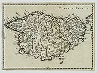 |
| 635.0 | BLAEU, W. Corsica Insula. Amsterdam, 1635. Limites en col. d'époque. 180 x 242 mm. Texte en latin. | 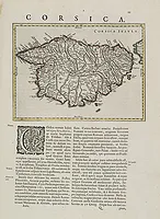 |
| 635.0 | BLAEU, W. Corsica Insula. Amsterdam, 1635. 180 x 242 mm. Texte en latin. | 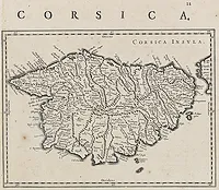 |
| 635.0 | BLAEU, W. Corsica Insula. Amsterdam, ca. 1635. . 180 x 240 mm. Carte de Corse orientée avec le nord à gauche. Texte en latin recto/verso. | 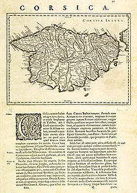 |
| 635.0 | BLAEU, J. Corsica Insula. Amsterdam, 1635. Limites en col. ancien. 180 x 240 mm. |  |
| 637.0 | TASSIN, C. Seigneurie de Gênes, Comté de Nice et Partie de l'Isle de Corse. Paris, 1637. 365 x 515 mm. Carte figurant la Seigneurie de Gênes et le nord de la Corse jusqu'à Niolo. Ornée de bateaux, d'un monstre marin et d'une rose des vents. |  |
| 638.0 | BLAEU, W. Corsica Insula. Amsterdam, 1638. Beau col. ancien. 180 x 240 mm. Map of Corsica in copper engraving on a sheet with letterpress with French text description of the island. As Willem Blaeu died in 1638 most of his maps are actually published by his son Joan. This maps carries his (engraved) signature and was actually published in volume II of a French edition of his "Le Theatre du Monde ou Nouvel Atlas", dated 1638, therefore published the last year of his life. From early on Willem Jansz. Blaeu aimed of publishing an atlas to compete with the Hondius-Jansson Atlas. By 1630, he had published at least 17 folio size maps. Blaeu was able to realize his plan soon after he had acquired the copper plates of the atlas maps by Jodocus Hondius. The "Appendix followed in 1630. In 1635 he finally realized a "international edition" of a world atlas, the "Theatrum Orbis Terrarum". This example is from a very rare 1638 French text edition, which has the same copperplates as the 1635 edition, however the text on the verso was reset in two text columns. This edition is the last version the great master printed under his patronage. |  |
| 638.0 | MERCATOR, G. / HONDIUS, J. Descriptio Corsicae Insulae. Amsterdam, H. Hondius, 1638. Col. ancien. 343 x 225 mm. Ornée de deux bateaux. Texte en latin au verso. |  |
| 640.0 | PORCACCHI, T. / PORRO. G. Corsica. Venise, 1640. 110 x 150 mm. Publié dans la dernière édition de "L'Isole le più famose del Mondo...e intagliate da Girolamo Porro…" | 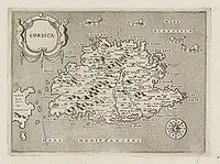 |
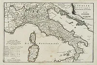
| 641.0 | SANSON, N./ MARIETTE, P. Italia Antiqua cum Insulis Sicilia Sardinia & Corsica. Paris, Tavernier, 1641. Limites en col. d'époque. 410 x 525 mm. Carte de l'Italie antique incluant la Corse, la Sardaigne et la Sicile. |  |
| 643.0 | MAXIMUS, a G. Provincia Insulae Corsicae. . . Rome, 1643. 220 x 320 mm. |  |
| 643.0 | MAXIMUS, a Guchen. Provincia Insulae Corsicae. Rome, 1643. 222 x 317 mm. Carte de Corse publiée dans l'Atlas des Capucins, à Rome en 1643. Ornée de bateaux, d'une rose des vents et de 2 cartouches. La carte est accompagnée du feuillet d'explication "Provincia di Corsica", richement orné.  | 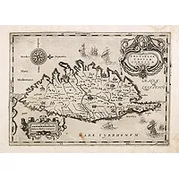 |
| 649.0 | BRIET, Ph. Corsica seu Cyrnus / Sardinia vetus Paris, 1649. 140 x 190 mm. Sur la même planche carte de la Sardaigne. Texte en latin au verso. Publiée dans : "Parallela geographica Italiae veteris...Parisiis... Sebastiani Cramoisy... MDCXLIX. | 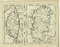 |
| 649.0 | BRIET, Ph. La Corse / La Sardaigne. Paris, 1649. 145 x 180 mm. Carte figurant la Corse et la Sardaigne sur une même planche. Publiée dans : "Parallela geographica Italiae veteris…Parisiis… Sebastiani Cramoisy… MDCXLIX. Rare sans le texte au verso. |  |
| 649.0 | MERCATOR, G./ JANSSON, J. Descriptio Corsicae Insulae / Descriptio Sardiniae Insulae. Amsterdam, 1639-1649. Col. ancien. 344 x 461 mm. Deux cartes sur une planche : "descriptio Corsicae Insulae" et "descriptio Sardiniae Insulae". Carte de Corse ornée de 2 bateaux. Texte en français au verso. |  |
| 658 | SANSON, N. Carte Generale de l'Italie et des Isles et pays Circonvoisins. Paris, Mariette, 1658. Limites en col. d'époque. 410 x 562 mm. Belle carte de l'Italie par N. Sanson figurant également la Corse, la Sardaigne et le nord de la Sicile, ornée d'un grand cartouche de titre. Titre complet : "Carte Generale de l'Italie et des Isles et Pays Circonvoisins Nouvellement dressée apres Magin et Autres autheurs les meilleurs de ce temps;Par N. Sanson ingenieur et Geogre. Du Roy. A Paris Par Melchior Tavernier Idrographe & Graveur ordre. Du Roy pour les Cartes Geographiques et autres Tailles douces et a present Chez Pierre Mariette ruë de S. Iacques, a l'Esperance. Avec privilege du Roy renouvelé pour 20 A. 1658". |  |
| 658.0 | SANSON, N. Isle de Corse. / Isle et Royaume de Sardaigne. Paris, 1658. Limites en col. ancien. 390 x 557 mm. |  |
| 658.0 | SANSON, N. / MARIETTE, P. Isle de Corse. / Isle et Royme de Sardaigne. Paris, 1658. Limites en col. ancien. 390 x 553 mm. Corse et Sardaigne présentées côte à côte. |  |
| 658.0 | SANSON, N. Isle de Corse. Paris, 1658. Limites en col. d'époque. 390 x 250 mm. Corse seule. | 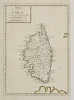 |
| 658.0 | SANSON, N. Isle de Corse. Paris, 1658. Limites en col. d'époque. 385 x 255 mm. Corse seule. | 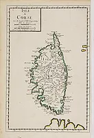 |
| 659.0 | CLUVER, P. Corsicae antiquae tabula. Paris, 1659. 120 x 60 mm. |  |
| 662.0 | BLAEU, J. Corsica Insula. Amsterdam, 1662. Beau col. d'époque. 380 x 520 mm. Rare et belle carte de Corse en coloris d'époque et rehaussée d'or. Publiée dans "Atlas Major, sive Cosmographia Blaviana… Italia", à Amsterdam en 1662.
Ornée de 4 cartouches comprenant le titre, l'échelle, le blason de la République de Gênes et la tête de Maure. | 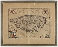 |
| 664.0 | LEVANTO, Francesco Maria. Carta Maritima della Costa Ligustica… Con l'Isola di Corsica et altre Circonvicine. Gênes, 1664. 400 x 510 mm. Carte éditée dans le "Specchio del Mare", atlas maritime de la Méditerranée qui ré-utilise les cuivres de l'atlas hollandais "De Lichtende Colomne ofte Zeespiegel" publié, en 1643, par Anthoni Jacosz. Porte le N° 10.
- Nel Cinque-Seicento si ebbe una larga fioritura di portolani-atlanti regionali, probabilmente ispirati da opere simili di origine nordica: nel 1664 il genovese Francesco Maria Levanto produsse La prima parte dello Specchio del Mare nel quale si descrivono tutti i porti... del Mediterraneo, riutilizzando - come precisa lui stesso nella didascalia di una carta - le matrici di un'opera simile olandese, probabilmente De Lichtende Colomne ofte Zeespiegel, pubblicata da Anthoni Jacobsz nel 1643 e riedita con gran successo fino al 1715. |  |
| 666.0 | JANSSONIUS, J. Insulae Corsicae Nova & accurata Descriptio. Amsterdam, 1666. Beau col. 390 x 510 mm. RARE. Texte en latin au dos. Ornée de 3 cartouches comprenant le titre, l'échelle et la tête de Maure. | 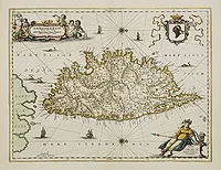 |
| 670.0 | PRIORATO, G. Gigeri In Africa (avec la Corse et la Sardaigne). Vienne, ca. 1670. 300 x 370 mm. Représentation de Gigeri avec au large les îles de Sardaigne et de Corse. La carte est accompagnée à droite d'une table de renvois en italien. Publié dans l'ouvrage de Gualdo Priorato "Historia di Leopoldo Caesare, Wien, 1670." | 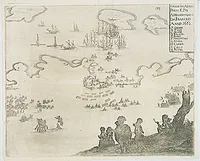 |
| 680.0 | JANSSONIUS, J. Insulae Corsicae Nova & accurata Descriptio. Amsterdam, après 1680. Beau col. ancien. 390 x 510 mm. Rare et belle carte de Corse publiée sans texte au verso et rehaussée d'or. Publiée dans l'édition tardive (après 1680) de l"Atlas Novus" de Jansson, qui est une réédition de l"Atlas Major" sans le texte. Ornée de 3 cartouches comprenant le titre, l'échelle et la tête de Maure. |  |
| 680.0 | CLŰVER, Philip. Insularum SARDINIAE et CORSICAE Antiqua descrip. Insular Aliquot Aegaei Maris Antiqua Descrip. Ex Conatibus geographicis Abrahami Ortelij. c.1680. Col. ancien. 160 x 210 mm. |  |
| 680.0 | WIT, F. de Insularum Sardiniae et Corsicae Descriptio. Amsterdam, 1680. Beau col. ancien. 575 x 490 mm. Très belle carte représentant la Corse et la Sardaigne. |  |
| 680.0 | WIT, F. de Insularum Sardiniae et Corsicae Descriptio. Amsterdam, 1680. Beau col. ancien. 575 x 490 mm. Très belle carte représentant la Corse et la Sardaigne. |  |
| 682.0 | CLÜVER, Philip. Sardiniae Antiquae Descriptio./ Corsicae Antiquae Descriptio. Amsterdam, 1682. 140 x 203 mm. Sur la même planche carte de la Sardaigne et de la Corse, ornée de bateaux. |  |
| 683.0 | MANESSON-MALLET, Allain. I. de Corse / Corse. Paris, Denys Thierry, 1683. 143 x 100 mm. Ensemble comprenant la carte, le costume et le texte (ff.259 -264). Edition en français. |  |
| 683.0 | MANESSON-MALLET, Allain. I. de Corse. / Corse (pl. 263). Paris, Denys Thierry, 1683. 143 x 98 mm. Carte de Corse avec le nord de la Sardaigne, ornée de nombreux bateaux. / Chasseur Corse. Avec le texte concernant la Corse en photocopie. |  |
| 683.0 | MANESSON-MALLET, Allain. I. de Corse. Paris, Denys Thierry, 1683. 142 x 99 mm. Carte de la Corse avec le nord de la Sardaigne, ornée de nombreux bateaux. Texte au verso en français. | 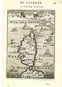 |
| 683.0 | MANESSON-MALLET, Allain. I. de Corse. Paris, Denys Thierry, 1683. 143 x 98 mm. Carte de Corse avec le nord de la Sardaigne, ornée de nombreux bateaux. |  |
| 685.0 | SCHENK, P. / VALK, G. Insulae Corsicae Nova & accurata Descriptio. Amsterdam, ca. 1685. Col. ancien. 382 x 492 mm. Carte de la Corse avec le nord à droite. Ornée de 2 cartouches et de la tête de Maure. | 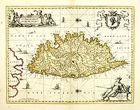 |
| 685.0 | SCHENK, P. / VALK, G. Insulae Corsicae Nova & accurata Descriptio. Amsterdam, ca. 1685. Col. ancien. 383 x 502 mm. Carte de la Corse avec le nord à droite. Ornée de 2 cartouches et de la tête de Maure. | 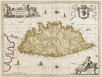 |
| 685.0 | ANONYME Die Insul Corsica. 1685. 115 x 70 mm. Très rare carte de Corse non répertoriée par Cervoni, issue de l'ouvrage "Die Weltberühmte sehr alte, schöne am Ligustischen Meer ligende Haupt-Stadt und mächtige Republic Genua mit dero theils zugehörigen, theils benachbarten Ländern, Städten ... und denen Insulen Corsica, Capraria und Ilua. Augsburg, J. Koppmayer für J. Enderlin, 1685". L'échelle est donnée en Milles italiens et allemands. | 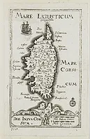 |
| 685.0 | KOPPMAYER, J. Die Insul Corsica. 1685. 115 x 70 mm. Très rare carte de Corse non répertoriée par Cervoni, issue de l'ouvrage "Die Weltberühmte sehr alte, schöne am Ligustischen Meer ligende Haupt-Stadt und mächtige Republic Genua mit dero theils zugehörigen, theils benachbarten Ländern, Städten ... und denen Insulen Corsica, Capraria und Ilua. Augsburg, J. Koppmayer für J. Enderlin, 1685". L'échelle est donnée en Milles italiens et allemands. | 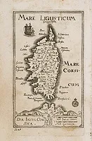 |
| 685 | MANESSON-MALLET, A. Die Insel Corsica - I. De Corse. Fig: CIV. Francfort, 1685. Noir et blanc. 140 x 100 mm. Carte de Corse avec le nord de la Sardaigne, ornée de nombreux bateaux. Publiée dans l'édition allemande de la "Description de l'Univers" : "Beschreibung des ganzen Welt-Kreisses". Von Alain Manesson-Mallet. Frankfurt am Mayn in Verlegung Johann David Zunners. Anno MDCLXXXV". Charming map of Corsica shown in a perspective view of the Mediterranean Sea and embellished with fighting ships just off shores. From the German text edition published by Davis Zunners of "Description d'Univers" (1683) by Allain Manneson Mallet (1630-1706), a well travelled military engineer and geographer who worked in 17th century France under King Louis XIV. |  |
| 692.0 | CORONELLI, V.M. Isola di Corsica, dedicata Venise, 1692. Noir et blanc. 600 x 450 mm. Grande carte très décorative ornée de 4 cartouches dont un cartouche de titre, un d'échelle et un figurant la tête de Maure. |  |
| 692.0 | CORONELLI, V.M. Isola di Corsica, Dedicata all' Em;mo e Rmo: Principe, il Sr. Cardinale Carpegna, Vicario di Sua Santita. Dal Cosmografo Coronelli. Venise 1692. 600 x 450 mm. Grande carte très décorative ornée de 4 cartouches dont un cartouche de titre, un d'échelle et un figurant la tête de Maure. Texte au verso en italien décrivant l'île de Corse. | 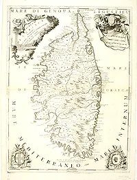 |
| 692.0 | CORONELLI, V.M. Isola di Corsica, Dedicata all' Em;mo e Rmo: Principe, il Sr. Cardinale Carpegna, Vicario di Sua Santita. Dal Cosmografo Coronelli. Venise, 1692. 600 x 450 mm. Grande carte très décorative publiée dans "Corso geografico universale…". Elle est ornée d'un cartouche de titre et d'un cartouche d'échelle et d'éléments décoratifs dont un figurant la tête de Maure. Texte au verso en italien décrivant l'île de Corse. | 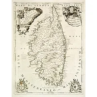 |
| 692 | CORONELLI, V.M. Isola di Corsica, Dedicata all' Em;mo e Rmo: Principe, il Sr. Cardinale Carpegna, Vicario di Sua Santita. Dal Cosmografo Coronelli. Venise, 1692. Noir et blanc. 600 x 450 mm. One of the most decorative maps of Corsica, with in the upper right, a draped fabric that bears the map's scales is dressed with two angels, one holding the cross, a coat of arms, and exquisite tassels and plumage. In the lower left, vines encircle a wreath containing the cross of the Genoa flag, and in the lower right, a similar design holds the silhouette that adorns the Corsican flag. The island is filled with mountains, rivers, towns, villages, ports, gulfs, bays, etc. |  |
| 692.0 | CORONELLI, V.M. Isola di Corsica, Dedicata all' Em;mo e Rmo: Principe, il Sr. Cardinale Carpegna, Vicario di Sua Santita. Dal Cosmografo Coronelli. Venise, 1692. 600 x 450 mm. Grande carte très décorative ornée de 4 cartouches dont un cartouche de titre, un d'échelle et un figurant la tête de Maure. Texte au verso en italien décrivant l'île de Corse. | 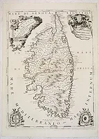 |
| 697.0 | CLUVER, Ph. Corsicae antiquae descriptio. / Sardiniae antiquae descriptio. Amsterdam, 1697. 265 x 110 mm. Carte de la Corse et de la Sardaigne. Nord en haut. | 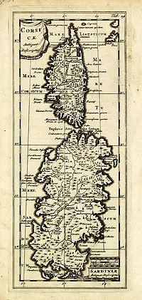 |
| 698.0 | ORTELIUS, A. Corsica. 1698. Limites en col. ancien. 80 x 11 mm. Avec la signature Q3. |  |
| 700.0 | SANSON, N. /MORTIER, P. Carte nouvelle de l'Isle et Royaume de Sardagne. Amsterdam, ca. 1700. 470 x 590 mm. Carte figurant la Sardaigne et le sud de la Corse. Ornée de bateaux, de combats navals et d'un cartouche d'échelle. | 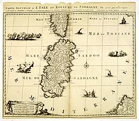 |
| 700 | ANONYME Les Costes depuis Ville Franche, jusques à. France, ca. 1700. 480 x 667 mm. Carte nautique manuscrite couvrant la côte depuis Villefranche jusqu'à Castillone et comprenant l'île d'Elbe, l'île de Montecristo et le nord de la Corse jusqu'à Calvi. Ornée d'une belle rose des vents, de rhumbs et d'un méridien passant par la Corse et séparant l'Est de l'Ouest du monde. Le cartouche de titre comprend également l'échelle : Echelle, de, lieues, Françoise, à, 20, par degré, Echelle, de, Milles, de provence, à, 75. par, degré.
Cette carte a vraisemblablement fait partie d'un ensemble de cartes nautiques, de fait, le titre incomplet, laisse supposer qu'une autre carte complétait celle-ci. | 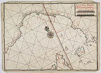 |
| 708.0 | CORONELLI, V.M. Ajazzo. Venise, ca. 1708. 130 x 183 mm. Plan d'Ajaccio publié dans "Regno di Corsica, in la Serenissima Republica di Genova e Regno suo di Corsica." | 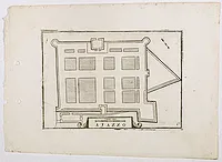 |
| 708.0 | CORONELLI, V.M. Calvi Nell Isola di Corsica della Republica di Genova. Venise, ca. 1708. 130 x 173 mm. Plan de Calvi publié dans "Regno di Corsica, in la Serenissima Republica di Genova e Regno suo di Corsica." | 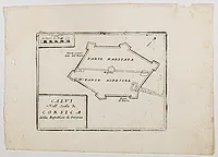 |
| 708.0 | KEULEN, J. VAN Nieuwe Pascaert van de Zee Kusten van Provence en Italiae.. Corsica.. (VII). Amsterdam, 1708. Beau col. 507 x 590 mm. Rare. Carte marine très décorative ornée de 2 cartouches figuratifs, représentant la Corse et le nord de la Sardaigne.
- This sea chart covers the Mediterranean coast between Toulon, in France, and the Elba island, off the coast of Tuscany. It shows Corsica as well as the northern part of Sardinia and the Asinara island on the bottom. Decorated with a vessel, a galley, a sea monster, rhumb lines, 2 compass roses and two decorative cartouches. From van Keulen's "De Nieuwe Groote Lichtende Zee-Fackel", part III.3.3. The atlas was published by Johannes van Keulen (1654-1715) and his son Gerard with the cooperation of the mathematician and surveyor, Claes Jansz. Voogt. The chart is an altered state with an scale with Italian miles added. Koeman calls the Van Keulen maps of paramount importance in the development of marine cartography. |  |
| 712.0 | MONTECALERIO, J. Pronvincia Insulae Corsicae. [avec page de titre]. Milan, 1712. 225 x 325 mm. Publiée dans l "Atlas des Capucins". | ![MONTECALERIO, J. - Pronvincia Insulae Corsicae. [avec page de titre].](../os/mapimg/62882-200x200.webp) |
| 712.0 | MONTECALERIO, J. Pronvincia Insulae Corsicae. Milan, 1712. 220 x 330 mm. Publiée dans l "Atlas des Capucins". | 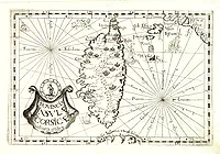 |
| 712.0 | MONTECALERIO, J. Pronvincia Insulae Corsicae. Milan, 1712. 216 x 329 mm. Publiée dans l'Atlas des Capucins, elle est accompagnée de son feuillet explicatif "Provinciae Corsicae continet". Ornée d'un cartouche, de roses des vents et de navires. |  |
| 713.0 | PORCACCHI, G. Corsica. Padoue, 1713. Col. 107 x 146 mm. Charmante carte miniature de la Corse. Publiée par Alphonsus Lasor a Varea (aka Raffaelo Savonarola), dans son "Universus terrarum orbis sriptorumcalamo delineatus..."édité à Padoue en 1713. Texte au verso faisant référence à d’autres publications (l’une datée 1674, voir verso, 1ère colonne, 2e ligne). Au verso, plan de la ville de Kroneburg au Danemark. |  |
| 713.0 | PORCACCHI / SAVONAROLA, R. Corsica. Padoue, Lasor A Varea, 1713. 105 x 140 mm. Carte de la Corse issue de "Universus Terrarum Orbis". Texte en latin sous la carte. Ornée d'une rose des vent en bas à droite, d'un cartouche de titre et de quelques monstres marins.  |  |
| 713.0 | 216 bis SAVONAROLA, Raffaelo. Corsica. Padoue, 1713. 110 x 150 mm. Publié dans "Universus Terrarum Orbis"... Studio et Labore Alphonsi Lasor A Varea.  |  |
| 719.0 | MICHELOT, Henri / BREMOND, Laurent. Nouvelle Carte de l'Isle Corce et partie de celle de Sardaigne. . . Marseille, 1719. Beau col. 470 x 680 mm. Carte de la Corse et d'une partie de la Sardaigne gravée par P. Starckman. L'échelle dans l'angle inf. gauche est ornée d'un Neptune et d'un triton combattant un monstre marin. La carte est en outre ornée d'un superbe cartouche de titre aquarellé, au centre de la carte, et de 6 roses des vents. Titre complet : Nouvelle carte de l' Isle de la Corce et partie de celle de la Sardaigne. Dédiée à Monseigneur le Chevalier d'Orléans Général des Galères de France. Par ses très humbles serviteurs Michelot Hydrographe et Pilote Real des Galeres du Roy et Brémond Hydrographe du Roy et de la Ville.
Map of the Island of Corsica and the tip of Sardaigna. Beautiful decorative title cartouche placed in the center of the map. With the address "Ce vend chez Laurent Brémond sur le Port à Marseille au coin de Reboul". Decorative scale on lower right corner of Neptune and a titron fighting a sea monster. Engraved by P. Starckman and published by Laurent Brémond who worked with Henri Michelot, hydrographer and pilot . This map is one of the first maps that was created based on direct on site observations. |  |
| 725 | AA, P. van der Insula Corsica, Novissime et Accuratissime… Pag. 120. Leiden, 1725. 303 x 377 mm. Carte de la Corse publiée dans "Thesaurus antiquitatum et historiarum Siciliae… Volumen Decimum Quintum. Scriptores qui Insularum… Corsicae, Lugduni Batavorum, excudit Petrus Van der AA… MDCCXXV". Scala di miglia quindici. Ornée d'un cartouche de titre figuratif. | 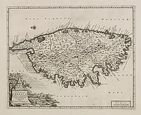 |
| 730.0 | MICHELOT, Henri & BREMOND, Laurent. Plan de Porto Vecchio, en l'Isle de Corse. Marseille, Laurens Brémond, ca.1730. 175 x 250 mm. Publié dans "Recüeil de Plusieurs Plans des Ports et Rades de la Mer Méditerranée". | 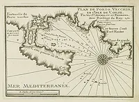 |
| 730.0 | BODENEHR, G. Insul und Konigreich Corsica. Augsbourg, ca.1730. Limites en col. d'époque. 168 x 295 mm. Carte de Corse d'après Coronelli. Flanquée de chaque côté d'un texte explicatif relatif aux différentes régions de Corse. Ornée de 2 cartouches de titre et du blason de Corse. | 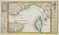 |
| 730.0 | BODENEHR, G. Insul und Konigreich Corsica. Augsbourg, ca.1730. Limites en col. d'époque. 168 x 298 mm. Carte de Corse d'après Coronelli. Flanquée de 2 tables contenant une liste de villes. 2 cartouches de titre et blason de Corse. | 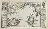 |
| 730.0 | OTTENS, R. & J. Nouvelle carte de l'Isle de Corse apartenante a la Republique de Genes. . . Amsterdam, 1730. Beau col. ancien. 510 x 580 mm. Carte de la Corse, sur laquelle figure le blason de l’Ile divisé en deux parties égales, la moitié droite est réservée au Roi Théodore 1er, avec les armoiries allemandes de sa famille (une chaîne à trois maillons), et la moitié gauche au peuple corse (symbolisé par la Tête de Maure). Quand Théodore de Neuhoff débarqua en Corse, il n'existait pas d'armée organisée. La révolte était composée de volontaires. Mais de combien d'hommes pouvait disposer Théodore pour combattre les génois "Et combien dans le Nebbiu". Sur le bas d'une carte de la Corse datée de 1737 dressée par le capitaine Vogt et ayant pour titre : "Nouvelle carte de l'Isle de Corse apartenante a la Republique de Genes. Presentement divisée et soulevée, sous les ordres du baron de Neuhoff, élu roy sous le nom de Theodore Premier : levé sur les lieux par le capitaine I. Vogt / donnée au jour par Renier et Iosué Ottens" une liste de chiffres est indiquée ou on apprend ainsi que Théodore pouvait compter sur 22390 hommes armés dont 1000 pour le Nebbiu. |  |
| 730 | OTTENS, R. & J. Nouvelle carte de l'Isle de Corse apartenante a la Republique de Genes. . . Amsterdam, 1730. Col. ancien. 05 x 580 mm. Carte de la Corse, sur laquelle figure le blason de l’Ile divisé en deux parties égales, la moitié droite est réservée au Roi Théodore 1er, avec les armoiries allemandes de sa famille (une chaîne à trois maillons), et la moitié gauche au peuple corse (symbolisé par la Tête de Maure). Quand Théodore de Neuhoff débarqua en Corse, il n'existait pas d'armée organisée. La révolte était composée de volontaires. Mais de combien d'hommes pouvait disposer Théodore pour combattre les génois "Et combien dans le Nebbiu". Sur le bas d'une carte de la Corse datée de 1737 dressée par le capitaine Vogt et ayant pour titre : "Nouvelle carte de l'Isle de Corse apartenante a la Republique de Genes. Presentement divisée et soulevée, sous les ordres du baron de Neuhoff, élu roy sous le nom de Theodore Premier : levé sur les lieux par le capitaine I. Vogt / donnée au jour par Renier et Iosué Ottens" une liste de chiffres est indiquée ou on apprend ainsi que Théodore pouvait compter sur 22390 hommes armés dont 1000 pour le Nebbiu. | 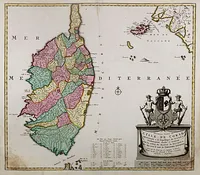 |
| 730.0 | MICHELOT, H. / BREMOND, L. Plan de Porto Vecchio, en l'Isle de Corse. Marseille, 1730. Noir et blanc. 180 x 250 mm. An attractive chart centered on Porto Vecchio. With scale and large compass-rose. Dated 1727, with the privilege of the King. From : Recueil des Plusieurs plans des ports et rades de la Mer Méditerranée.. Engraved by P.Starckman. The chart is exceptionally detailed and includes topographical details, soundings, anchorages, etc. Originally from Saint-Malo, Henri Michelot served from 1670 on sea as a pilot. He was also professor of hydrography in Marseille. He produced his first charts in the early years of the eighteenth century. Often associated with the brothers Laurent and Jean-Andre Bremond, also cartographers, he published with them in 1718 a chart of the Mediterranean in three leaves. |  |
| 730.0 | SEUTTER, M. Insula Corsica olim Regni Titulo insignis. . . Nüremberg, ca. 1730. Col. 570 x 490 mm. Ornée dans la partie sup. gauche d'un cartouche de titre décrivant une scène pittoresque corse, en haut à droite d'une description, en bas à gauche des armoiries de la Corse et à droite d'une échelle. | 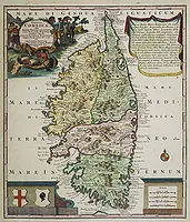 |
| 730.0 | SEUTTER, M. Insula Corsica olim Regni Titulo insignis. Augsbourg, 1730. Beau col. ancien. 575 x 495 mm. Fine and decorative map of the Island of Corsica published in the printing house by Matthaeus Seutter, ornated in the upper left corner with a decorative allegoric title-cartouche, in the other corners we find the coat of arms of Corsica. A milage scale and a description. |  |
| 730.0 | SEUTTER, M. Insula Corsica olim Regni Titulo insignis. Augsbourg 1730. Col. 560 x 490 mm. Fine and decorative map of the Island of Corsica published in the printing house by Matthaeus Seutter, ornated in the upper left corner with a decorative allegoric title-cartouche, in the other corners we find the coat of arms of Corsica. A milage scale and a description. |  |
| 730.0 | SEUTTER, M. Insula Corsica olim Regni Titulo insignis. . . Nüremberg, ca. 1730. Col. ancien. 570 x 490 mm. Ornée dans la partie sup. gauche d'un cartouche de titre décrivant une scène pittoresque corse, en haut à droite d'une description, en bas à gauche des armoiries de la Corse et à droite d'une échelle. | 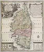 |
| 730.0 | SEUTTER, M. Insula Corsica olim Regni Titulo insignis. . . Nüremberg, ca. 1730. Col. 570 x 490 mm. Ornée dans la partie sup. gauche d'un cartouche de titre décrivant une scène pittoresque corse, en haut à droite d'une description, en bas à gauche des armoiries de la Corse et à droite d'une échelle. | 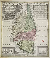 |
| 730.0 | SEUTTER, M. Insula Corsica olim Regni Titulo insignis. . . Nuremberg, ca. 1730. Col. ancien. 572 x 495 mm. Ornée dans la partie sup. gauche d'un cartouche de titre figuratif, en haut à droite d'une description en latin, en bas à gauche des armoiries de la Corse et à droite d'une échelle. | 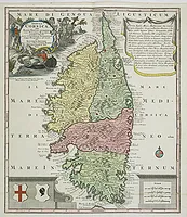 |
| 730.0 | SEUTTER, M. Insula Corsica olim Regni Titulo insignis. . . Nuremberg, ca. 1730. Col. ancien. 572 x 495 mm. Ornée dans la partie sup. gauche d'un cartouche de titre figuratif, en haut à droite d'une description en latin, en bas à gauche des armoiries de la Corse et à droite d'une échelle. | 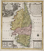 |
| 730.0 | SEUTTER, M. Insula Corsica olim Regni Titulo insignis. . . Nüremberg, ca. 1730. Beau col. ancien. 573 x 494 mm. Ornée dans la partie sup. gauche d'un cartouche de titre décrivant une scène pittoresque corse, en haut à droite d'une description, en bas à gauche des armoiries de la Corse et à droite d'une échelle. | 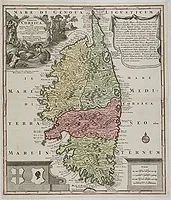 |
| 730.0 | SEUTTER, M. Insula Corsica olim Regni Titulo insignis. . . Nüremberg, ca. 1730. Col. d'époque. 573 x 490 mm. Ornée dans la partie sup. gauche d'un cartouche de titre décrivant une scène pittoresque corse, en haut à droite d'une description, en bas à gauche des armoiries de la Corse et à droite d'une échelle. | 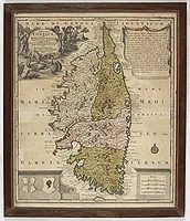 |
| 730.0 | BAECK, E. Die Insul und das Reich CORSICA. Zu finden bey Elias Baeck a. H. S. V.P. Augsbourg, 1730. Col. 150 x 210 mm. |  |
| 732.0 | HOMANN Héritiers. Insvlae Corsicae olim Cyrnvs dictae novisfima facies chorographice tradita. Nuremberg, 1732. Beau col. ancien. 520 x 435 mm. Deuxième édition avec l'ajout d'échelles et d'un plan de la ville de Bastia avec sa table de renvois : A-V. Ornée d'un cartouche de titre dans la partie sup. gauche décoré de monstres marins et de tritons arborant le drapeau corse, et de nombreux bateaux. | 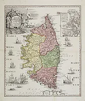 |
| 732.0 | HOMANN, Héritiers. Insulae Corsicae olim Cyrnus… Nuremberg, 1732. Beau col. ancien. 515 x 435 mm. En carton: Pianta della Bastia. |  |
| 732.0 | 218 bis HOMANN, Héritiers. Insulae Corsicae olim Cyrnus… Nuremberg, 1732. Beau col. ancien. 520 x 440 mm. En carton : Pianta della Bastia. Avec privilège. | 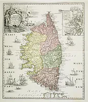 |
| 732.0 | HOMANN, Héritiers. Insulae Corsicae olim Cyrnus… Nuremberg, 1732. Beau col. ancien. 515 x 435 mm. En carton: Pianta della Bastia. Ornée de nombreux navires et d'un cartouche de titre décoré des attributs de la mer, de la pêche et de la chasse. | 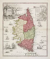 |
| 732.0 | HOMANN, Héritiers. Insulae Corsicae olim Cyrnus… Nuremberg, 1732. Beau col. ancien. 515 x 435 mm. En carton: Pianta della Bastia. | 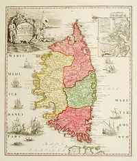 |
| 732.0 | HOMANN, Héritiers. Insulae Corsicae olim Cyrnus… Nuremberg, 1732. Beau col. ancien. 515 x 435 mm. En carton : Pianta della Bastia. Ornée de nombreux navires et d'un cartouche de titre décoré des attributs de la mer, de la pêche et de la chasse. | 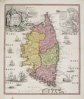 |
| 735.0 | HOMANN, Héritiers / VOGT, J. Insulae Corsicae accurata Chorographia tradita Per I. Vogt Capit… Nuremberg, 1735. Col. ancien. 550 x 485 mm. Première carte à faire mention de "I. Vogt Capit.", dont l'identité reste inconnue. Cartouche de titre emblématique de la mer et de la chasse. | 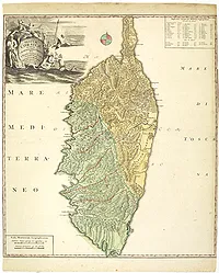 |
| 735.0 | HOMANN, Héritiers. / VOGT, J. Insulae Corsicae accurata Chorographia tradita Per I. Vogt Capit… Nuremberg, 1735. Col. ancien. 555 x 490 mm. Première carte à faire mention de "I. Vogt Capit.", dont l'identité reste inconnue. Cartouche décoratif. |  |
| 735.0 | HOMANN, Héritiers. / VOGT, J. Insulae Corsicae accurata Chorographia tradita Per I. Vogt Capit… Nuremberg, 1735. Col. ancien. 560 x 490 mm. Première carte à faire mention de "I. Vogt Capit.", dont l'identité reste inconnue. Cartouche de titre emblématique. | 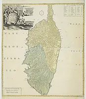 |
| 735.0 | HOMANN, HEIRS / VOGT, J. Insulae Corsicae Accurata Chorographia Tradita Per I. Vogt Capit. S. C. M. et excusa Studio Homannian. Heredum / Norib. MDCCXXXV Nuremberg, 1735. Beau col. ancien. 560 x 490 mm. Première carte à faire mention de "I. Vogt Capit.", dont l'identité reste inconnue. - Extremely well-detailed map of Corsica, published 1735 by Homann Heires. Divided into 38 districts. At upper right with a decorative title cartouche with allegorical depictions about the sea and its inhabitants. With a Royal privilege. Small compass rose near the Capo Corso. Very dark impression. |  |
| 735.0 | HOMANN, Héritiers / VOGT, J. Insulae Corsicae accurata Chorographia tradita Per I. Vogt Capit… Nuremberg, 1735. Col. ancien. 550 x 485 mm. Première carte à faire mention de "I. Vogt Capit.", dont l'identité reste inconnue. Cartouche de titre emblématique de la mer et de la chasse. | 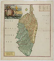 |
| 735.0 | HOMANN, Héritiers. Insulae Corsicae olim Cyrnus… Nuremberg, 1735. Beau col. 555 x 490 mm. En carton : Pianta della Bastia. Avec privilège. |  |
| 735.0 | HOMANN, Héritiers. Insulae Corsicae olim Cyrnus… Nuremberg, 1735. Beau col. 555 x 490 mm. Carte de la Corse ornée d'un plan de Bastia "Pianta della Bastia", d'un cartouche de titre décoré des attributs de la mer, de la pêche et de la chasse, et de nombreux navires. La carte est divisée en 4 régions : Banda di Fuori, Banda di quadalli Monte, Banda di Dentro, Banda di la dalli Monti. | 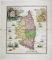 |
| 736 | MONATH, Peter Conrad. Corsica Insula et Regnum... Nuremberg, 1736. 390 x 295 mm. |  |
| 737.0 | OTTENS, R. & J. / VOGT, J. Nouvelle Carte de L'Isle de Corse Apartenante à la Republique de Genes. Amsterdam, ca. 1737. Beau col. ancien. 486 x 580 mm. Nouvelle Carte de L'Isle de Corse… Présentement divisée et soulevée sous les ordres du Baron de Neuhoff, élu Roy sous le nom de Théodore Premier, Levée sur les Lieux par le Capitaine I. Vogt. Le titre est surmonté de grandes armoiries représentant l'Odre de chevalerie de Théodore Premier, l'Ordre de la Délivrance. | 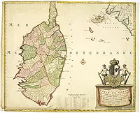 |
| 737.0 | OTTENS, R. & J. / VOGT, J. Nouvelle Carte de L'Isle de Corse Apartenante à la Republique de Genes. Amsterdam, ca. 1737. Col. d'époque. 510 x 590 mm. Nouvelle Carte de L'Isle de Corse… Présentement divisée et soulevée sous les ordres du Baron de Neuhoff, élu Roy sous le nom de Théodore Premier. Levé sur les Lieux par le Capitaine I. Vogt. Le titre est surmonté de grandes armoiries représentant l'Odre de chevalerie de Théodore Premier, l'Ordre de la Délivrance. | 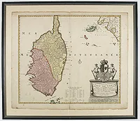 |
| 737.0 | COVENS, Jean & MORTIER, Corneille. Insula Corsica olim Regni Titulo insignis. . . Amsterdam, ca. 1737. Limites en col. d'époque. 560 x 480 mm. Publiée par Corneille Mortier, imprimeur et éditeur associé à Jean Covens à Amsterdam de 1774 à 1783. Ornée dans la partie sup. gauche d'un cartouche de titre figurant une scène pittoresque corse, en haut à droite d'une description, en bas à gauche des armoiries de la Corse et à droite d'une échelle. | 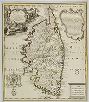 |
| 737.0 | COVENS, J. / MORTIER, P. Insula Corsica olim Regni Titulo insignis. Augsbourg, 1737. Beau col. ancien. 575 x 495 mm. |  |
| 737.0 | COVENS, J. / MORTIER, P. Insula Corsica olim Regni Titulo insignis. Augsbourg, 1737. Beau col. ancien. 575 x 495 mm. |  |
| 737.0 | OTTENS, R. & J. / VOGT, J. Nouvelle carte de l'Isle de Corse apartenante a la Republique de Genes. Amsterdam, ca.1737. Beau col. ancien. 510 x 585 mm. "Nouvelle carte de l'Isle de Corse apartenante a la Republique de Genes. Presentement divisée et soulevée, sous les ordres du baron de Neuhoff, élu Roy sous le nom de Theodore Premier : levé sur les lieux par le capitaine I. Vogt." Le blason figuré sur la carte est divisé en deux parties égales, la moitié droite est réservée au Roi Théodore 1er, avec les armoiries allemandes de sa famille (une chaîne à trois maillons), et la moitié gauche au peuple corse (symbolisé par la Tête de Maure). Quand Théodore de Neuhoff débarqua en Corse, il n'existait pas d'armée organisée. La révolte était composée de volontaires. Mais de combien d'hommes pouvait disposer Théodore pour combattre les Génois "Et combien dans le Nebbiu". En bas de la carte un dénombrement des hommes armés par district. | 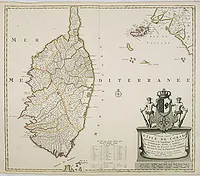 |
| 738.0 | JAILLOT, H. Carte Particuliere de L'Isle de Corse Divisée par ses Dix Provinces ou Juridictions et ses quatre Fiefs… Paris, 1738. Limites en col. d'époque. 497 x 790 mm. Première édition avec la dédicace au Marquis de Brignole Sale. Delahaye sculpsit. Cette carte avait été commandée par Gênes et réalisée d'après des sources manuscrites (Accinelli, 1731 etc…). | 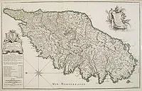 |
| 738.0 | JAILLOT, B.A. Carte Particulière de l'Isle de Corse. Divisée par ses dix Provinces ou Juridictions et ses quatre Fiefs. Paris, 1738. Limites en col. d'époque. 500 x 800 mm. Première édition avec la dédicace au Marquis de Brignole Sale. Delahaye sculpsit. Cette carte avait été commandée par Gênes et réalisée d'après des sources manuscrites. |  |
| 738.0 | JAILLOT, B.A. Carte Particulière de l'Isle de Corse. Divisée par ses dix Provinces ou Juridictions et ses quatre Fiefs. Levée sur les Lieux par les Ordres de la Rép Paris, 1738. Col. 500 x 800 mm. Première édition avec la dédicace au Marquis de Brignole Sale. Delahaye sculpsit. Cette carte avait été commandée par Gênes et réalisée d'après des sources manuscrites (Accinelli, 1731 etc…). |  |
| 738.0 | JAILLOT, B.A. Carte Particulière de l'Isle de Corse. Divisée par ses dix Provinces ou Juridictions et ses quatre Fiefs. Paris, 1738. Col. ancien. 500 x 800 mm. Première édition avec la dédicace au Marquis de Brignole Sale. Delahaye sculpsit. Cette carte avait été commandée par Gênes et réalisée d'après des sources manuscrites. | 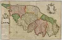 |
| 740.0 | HOMANN, Héritiers. Li Regni di Sicilia e Sardegna. Nuremberg, 1740. Col. ancien. 458 x 550 mm. Sicilia and Corsica. |  |
| 740 | OTTENS, R. / J. Nouvelle Carte de l'Etat de la République de Gênes. Dressé sur les mémoires les plus nouveaux. Amsterdam, ca. 1740. Col. ancien. 370 x 458 mm. Carte qui figure la Ligurie et le golfe de Gênes dans sa partie supérieure et au-dessous 3 cartons représentant Gênes, l'Isle de Corse et Le Destric de la Ville de Bastie. - Uncommon map of the Ligurian coast around Genoa in northern Italy with three insets below of the harbors of Genoa and Bastia and the island of Corsica. Joachim Ottens (1663 - 1719) and his sons Renier and Joshua were prominent Dutch booksellers and map publishers from about 1680 to 1790. Joachim, the founder of the firm, was initially employed as a copperplate engraver by Frederick de Wit. In 1711 Joachim founded his own firm. Though Joachim died only a few years later, his sons Renier and Joshua took over the firm and presided over its most prolific period. | 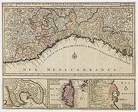 |
| 740.0 | LOTTER, T. C. L'isle de Corse avec les différents districts, appartenante à la République de gênes,… Augsbourg, ca. 1740. Col. 495 x 570 mm. Beau cartouche décoratif. Gravé par G. F. Lotter fils.
- T.C. Lotter married M. Seutter's daughter in 1740 and succeeded him in 1756. Lotter used the copperplate of Seutter; he only changed the name. |  |
| 740.0 | LOTTER, T. C. L'isle de Corse avec les différents districts, appartenante à la République de gênes,… Augsbourg, ca. 1740. Beau col. ancien. 500 x 570 mm. Beau cartouche décoratif. Gravé par G. F. Lotter fils.
T.C. Lotter married M. Seutter's daughter in 1740 and succeeded him in 1756. Lotter used the copperplate of Seutter; he only changed the name. |  |
| 740.0 | LOTTER, T. C. L'Isle de Corse avec les différents districts, appartenante à la République de Gênes… Augsbourg, ca. 1740. Beau col. ancien. 500 x 578 mm. Beau cartouche décoratif. Carte gravée par G. F. Lotter fils. T.C. Lotter épousa la fille de M. Seutter, il réutilisa les cuivres de son beau-père et remplaça le nom de Seutter par le sien. | 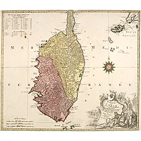 |
| 740.0 | SALMON, Th. Carta Geografica del Regno di Corsica. Venise, Girolamo Albrizzi, 1740. Col. 328 x 422 mm. Issu de "Lo stato presente di tutti i paesi, e popoli del Mondo", publié par Girolamo Albrizzi. - Taken from In Lo stato presente di tutti i paesi, e popoli del Mondo …Vol. XXIV, edited by Thomas Salmon. An Italian edition of this famous work, published in 26 volumes and published by Girolamo Albrizzi. |  |
| 745.0 | COVENS, J. / MORTIER, C. Insula Corsica, Olim Rehni Titulo Insignis . . . . Amsterdam, ca 1745. Limites en col. d'époque. 550 x 480 mm. Carte de Corse très décorative ornée d'un cartouche de titre composé de scènes relatives aux activités quotidiennes : pêche, récolte… , en bas à gauche des Armes de la Corse, en haut à droite d'un cartouche comprenant un descriptif en latin de la Corse et en bas à droite d'un cartouche d'échelle. - Large detailed map of Corsica. Splendid cartouche of picturesque scene of people at work engaged in their daily activities admist dogs and local fauna on the upper left corner. Beautiful Corsican coat of arms being upheld by two figures on the lower left and a scale cartouche on the bottom right corner. Short explanatory note cartouche on the upper right corner. |  |
| 745 | COVENS, J. / MORTIER, C. Insula Corsica, Olim Rehni Titulo Insignis . . . . Amsterdam, ca 1745. Limites en col. ancien. 550 x 480 mm. Carte de Corse très décorative ornée d'un cartouche de titre composé de scènes relatives aux activités quotidiennes : pêche, récolte… , en bas à gauche des Armes de la Corse, en haut à droite d'un cartouche comprenant un descriptif en latin de la Corse et en bas à droite d'un cartouche d'échelle.
Large detailed map of Corsica. Splendid cartouche of picturesque scene of people at work engaged in their daily activities admits dogs and local fauna on the upper left corner. Beautiful Corsican coat of arms being upheld by two figures on the lower left and a scale cartouche on the bottom right corner. Short explanatory note cartouche on the upper right corner. |  |
| 746.0 | AYROUARD, J. Plan du Port de Boniface en Corse. Marseille, 1732-1746. 292 x 456 mm. Publié dans : "Recueil de plusieurs plans des ports et rades et de quelques cartes particulières de la mer Méditerranée.." par Jacques Ayrouard pilote real et gravé par Louis Corne. |  |
| 746.0 | AYROUARD, J. [Profils de côtes de Corse et de Sardaigne] Marseille, 1732-1746. 298 x 455 mm. Publié dans : "Recueil de plusieurs plans des ports et rades et de quelques cartes particulières de la mer Méditerranée.." par Jacques Ayrouard pilote real et gravé par Louis Corne. | ![AYROUARD, J. - [Profils de côtes de Corse et de Sardaigne]](../os/mapimg/62202-200x200.webp) |
| 746.0 | AYROUARD, J. [Profils de côtes de Corse et de Sardaigne] Marseille, 1732-1746. 293 x 450 mm. Publié dans : "Recueil de plusieurs plans des ports et rades et de quelques cartes particulières de la mer Méditerranée.." par Jacques Ayrouard pilote real et gravé par Louis Corne. | ![AYROUARD, J. - [Profils de côtes de Corse et de Sardaigne]](../os/mapimg/62201-200x200.webp) |
| 746.0 | AYROUARD, J. Carte d'une partie de la côte de L'isle de Corse contenant de puis le Cap de Fen jusque au golfe de S.te Manza… Marseille 1732-1746. 460 x 600 mm. |  |
| 746.0 | AYROUARD, J. Carte d'une partie de la côte de L'isle de Corse contenant de puis le Cap de Fen jusque au golfe de S.te Manza… Marseille 1732-1746. 460 x 589 mm. Publié dans : "Recueil de plusieurs plans des ports et rades et de quelques cartes particulières de la mer Méditerranée.." par Jacques Ayrouard pilote real et gravé par Louis Corne. |  |
| 746.0 | AYROUARD, J. Plan du golfe de talane et de la Baye de campe moro en l'isle de Corse.. Marseille, 1732-1746. 290 x 423 mm. Publié dans : "Recueil de plusieurs plans des ports et rades et de quelques cartes particulières de la mer Méditerranée.." par Jacques Ayrouard pilote real et gravé par Louis Corne. |  |
| 746.0 | AYROUARD, J. Plan de La Baye et du Port de la Hiace en Corse. Marseille, 1732-1746. 295 x 453 mm. Publié dans : "Recueil de plusieurs plans des ports et rades et de quelques cartes particulières de la mer Méditerranée.." par Jacques Ayrouard pilote real et gravé par Louis Corne. |  |
| 746.0 | AYROUARD, J. Plan de La Baye de Calvi En Corse. Marseille, 1732-1746. 287 x 447 mm. Publié dans : "Recueil de plusieurs plans des ports et rades et de quelques cartes particulières de la mer Méditerranée.." par Jacques Ayrouard pilote real et gravé par Louis Corne. |  |
| 746.0 | AYROUARD, J. Plan de la Rade des canelles.. / Plan de l'Isle Plane.. / Plan du Port de St. Pierre de Campe.. / Plan de la rade de Ste. Marie Chapelle.. Marseille, 1732-1746. 287 x 448 mm. Une planche représentant quatre plans de côtes de la Corse et des îles italiennes Elba et Pianosa. Publié dans : "Recueil de plusieurs plans des ports et rades et de quelques cartes particulières de la mer Méditerranée.." par Jacques Ayrouard et gravé par Louis Corne. |  |
| 746.0 | AYROUARD, J. Plan du Golfe de St. Fiorenzo en Lisle de Corse. Marseille ,1732-1746. 297 x 456 mm. Publié dans : "Recueil de plusieurs plans des ports et rades et de quelques cartes particulières de la mer Méditerranée.." par Jacques Ayrouard pilote real et gravé par Louis Corne. |  |
| 746.0 | AYROUARD, J. Plan du Port de la Bastide en Lisle de Corse. Marseille, 1732-1746. 294 x 456 mm. Publié dans : "Recueil de plusieurs plans des ports et rades et de quelques cartes particulières de la mer Méditerranée…" par Jacques Ayrouard pilote real et gravé par Louis Corne. | 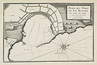 |
| 746.0 | AYROUARD, J. Plan du Golfe de St. Fiorenzo en Lisle de Corse. Marseille, 1732-1746. 298 x 453 mm. Publié dans : "Recueil de plusieurs plans des ports et rades et de quelques cartes particulières de la mer Méditerranée.." par Jacques Ayrouard pilote real et gravé par Louis Corne. | 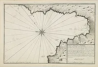 |
| 746.0 | AYROUARD, J. Plan de la Baye de Calui en Corse. Marseille, 1732-1746. 288 x 446 mm. Publié dans : "Recueil de plusieurs plans des ports et rades et de quelques cartes particulières de la mer Méditerranée.." par Jacques Ayrouard pilote real et gravé par Louis Corne. | 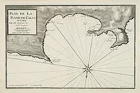 |
| 746.0 | AYROUARD, J. Plan du Port de Boniface en Corse. Marseille, 1732-1746. 292 x 456 mm. Publié dans : "Recueil de plusieurs plans des ports et rades et de quelques cartes particulières de la mer Méditerranée.." par Jacques Ayrouard pilote real et gravé par Louis Corne. | 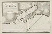 |
| 746.0 | AYROUARD, J. Plan du Port de La Bastide en Lisle de Corse.. Marseille, 1732-1746. 295 x 456 mm. Publié dans : "Recueil de plusieurs plans des ports et rades et de quelques cartes particulières de la mer Méditerranée.." par Jacques Ayrouard pilote real et gravé par Louis Corne. | 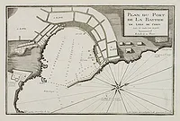 |
| 746.0 | AYROUARD, J. Carte d'une partie de la côte de l' îsle de Corse contenant de puis le Cap de fen. . . Marseille, 1732 - 1746. Noir et blanc. 460 x 595 mm. Carte nautique de la pointe sud de la Corse et des alentours de Bonifacio. Publiée dans : "Recueil de plusieurs Ports .. de la Mer Méditerranée". - Rare map depicting the southern tip of Corsica around Bonifacio. Oriented with East on top. From the rare chart book by Jacques Ayrouard: "Recueil de plusieurs Ports .. de la Mer Méditerranée". Little is known about Ayrouard, however, he states in his atlas that he visited the ports whilst as an navigator with the French Royal Navy, and whilst on other voyages undertaken by himself. The chart is beautiffully engraved by Louis Corne. His chats are adapted by numerous hydrographers, most notably William Heather, in 1802. |  |
| 746.0 | AYROUARD, J. [Sans titre]. [Différents profils des côtes de Corse et de Sardaigne]. Vue frontale de la côte Corse et de la Sardaigne. Marseille, 1732 - 1746. 297 x 455 mm. Belle gravure sur cuivre représentant des profils des deux îles situées autour du Détroit de Bonifacio. Publiée dans l'ouvrage de Jacques Ayrouard: Recueil de plusieurs Ports .. de la Mer Méditerranée. - Copper engraving presenting separate front views of the coastal relief of both islands around the Strait of Bonifacio, divided in varied sized strips. - Front views of the coastal relief of Corsica and Sardinia. From the rare chart book by Jacques Ayrouard: Recueil de plusieurs Ports .. de la Mer Méditerranée. | ![AYROUARD, J. - [Sans titre]. [Différents profils des côtes de Corse et de Sardaigne]. Vue frontale de la côte Corse et de la Sardaigne.](../os/mapimg/24833-200x200.webp) |
| 746.0 | AYROUARD, J. [Untitled] Front views of the coastal relief of Corsica and Tuscany. Marseille, 1732 - 1746. Noir et blanc. 297 x 453 mm. Copper engraving presenting separate front views of the coastal relief of northern Corsica and the facing Tuscan shores, divided in stripes. From the rare chart book by Jacques Ayrouard: Recueil de plusieurs Ports .. de la Mer Méditerranée. | ![AYROUARD, J. - [Untitled] Front views of the coastal relief of Corsica and Tuscany.](../os/mapimg/24834-200x200.webp) |
| 746.0 | AYROUARD, J. Plan de Porto Vecchio en L'isle de Corse. Marseille, 1732-1746. 29 x 45 mm. Plan de Porto Vecchio figurant la baie et les mouillages. Réalisé par l'hydrographe français Jacques Ayrouard (1730-1740) et gravé par Louis Corne. Publié dans: "Recueil de plusieurs plans des ports et rades et de quelques cartes particulières de la mer Méditerranée". | 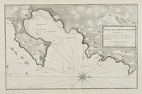 |
| 746.0 | AYROUARD, J. Plan de La Baye et du Port de la Hiace en Corse. . . Marseille, 1732-1746. 294 x 458 mm. Publié dans : "Recueil de plusieurs plans des ports et rades et de quelques cartes particulières de la mer Méditerranée.." par Jacques Ayrouard pilote real et gravé par Louis Corne. | 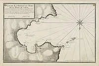 |
| 746.0 | AYROUARD, J. Plan du golfe de talane et de la Baye de campe moro en l'isle de Corse.. Marseille, 1732-1746. 290 x 423 mm. Publié dans : "Recueil de plusieurs plans des ports et rades et de quelques cartes particulières de la mer Méditerranée.." par Jacques Ayrouard pilote real et gravé par Louis Corne. |  |
| 748.0 | ROBERT DE VAUGONDY, G. Carte de l'Isle de Corse. Par le Sr. Robert de Vaugondy fils de Mr. Robert. Paris, après 1748. Limites en col. d'époque. 210 x 165 mm. Carte non datée, la date a été grattée. |  |
| 748.0 | ROBERT DE VAUGONDY, G. Carte de l'Isle de Corse. Par le Sr. Robert de Vaugondy fils de Mr. Robert. Paris, 1748. 212 x 162 mm. Carte de la Corse publiée dans l' "Atlas portatif, universel et militaire…" par Mr Robert, Paris, 1748. |  |
| 748.0 | VAUGONDY, R. de Carte de l'Isle de Corse. Paris, later than 1748. Limites en col. d'époque. 212 x 165 mm. Detailed small map of Corsica. From Atlas Portatif Universel, by Robert de Vaugondy. Page 57 outside border top right. Mary Sponberg Pedley does not mention a state without date. |  |
| 749.0 | SCHREIBER, J. Die Insul Corsica mit dessen Districten und Aemtern adgetheilet.. Leipzig, 1749. Beau col. ancien. 163 x 234 mm. Carte de Corse flanquée de 2 tables contenant quelques informations géographiques ainsi qu'une liste de villes. Publiée dans : "Atlas selectus…". |  |
| 749.0 | SCHREIBER, J. Die Insul Corsica mit dessen Districten und Aemtern adgetheilet. Leipzig, 1749. Beau col. ancien. 167 x 202 mm. Carte de Corse flanquée de 2 tables contenant quelques informations géographiques ainsi qu'une liste de villes. Publiée dans : "Atlas selectus von allen Königreichen und Ländern der Welt". |  |
| 749.0 | SCHREIBER, J. Die Insul Corsica mit dessen Districten und Aemtern adgetheilet. Leipzig, 1749. Beau col. ancien. 167 x 202 mm. La Corse est divisée en 2 districts, eux-mêmes divisés en pievi (la pieve est la plus ancienne division administrative de Corse). Elle est flanquée de 2 tables contenant quelques informations géographiques et recense notamment les pievi. Publiée dans : "Atlas selectus von allen Königreichen und Ländern der Welt". | 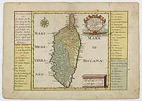 |
| 749.0 | SCHREIBER, J. Die Insul Corsica mit dessen Districten und Aemtern adgetheilet.. Leipzig, 1749. Beau col. ancien. 165 x 234 mm. Carte de Corse flanquée de 2 tables contenant quelques informations géographiques ainsi qu'une liste de villes. Publiée dans : "Atlas selectus…". | 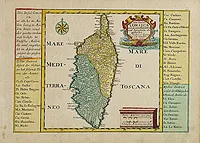 |
| 749.0 | FRANCOIS / LATTRE, Jean. Carte particulière de L'isle de Corse Divisée par ses Provinces ou Juridictions, et Fiefs. Levée sur les Lieux par les ordres de la République de Genes. Et corrigée par l'Auteur du Livre. 1749. 277 x 440 mm. Carte publiée dans "Histoire de l'Isle de Corse", A Nancy, chez Abel-Denis. Ornée d'un cartouche de titre. |  |
| 749.0 | BELLIN, J.N. Nouvelle carte de l'Isle de Corse. Paris, 1749. 410 x 268 mm. Issue de" Histoire des Révolutions de Gênes", Tome II. Page Ière. |  |
| 749.0 | SCHREIBERS, J. G. Die Insul CORSICA mit dessen Districten und Aemtern abgetheilet. Leipzig, 1749. Beau col. ancien. 192 x 260 mm. Carte détaillée de Corse. De part et d'autre, précisions sur les différentes divisions de Haute-Corse et de Corse-du-sud. |  |
| 750.0 | BELLIN, J.N. Nouvelle carte de l'Isle de Corse. Paris, ca. 1750. 317 x 167 mm. Tome XXXVI. Page 1. |  |
| 750.0 | BELLIN, J.N. Nouvelle Carte de L'Isle de Corse. Paris, ca. 1750. 317 x 167 mm. Tome XXXVI. Page 1. Nord en haut. | 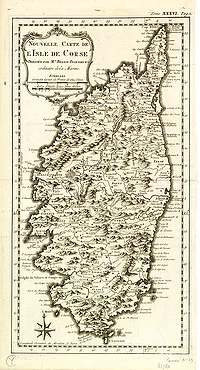 |
| 750.0 | ANONYME Carte Hydrographique de l'Isle de Corse (Livre XXVI, Planche II.). 1750. 290 x 364 mm. Rare carte marine ornée de 4 roses des vents. |  |
| 756.0 | ROBERT DE VAUGONDY, G. Carte Nouvelle de l'Isle de Corse... Par ordre de M. le Maréchal de Maillebois. Paris, 1756. Limites en col. ancien. 590 x 450 mm. Premier état. |  |
| 756.0 | NEW UNIVERSAL MAGAZINE. (Corse). Août 1756. 90 x 105 mm. Carte gravée et publiée en août 1756 pour "The New Universal Magazine". Gravé au-dessus sur la même planche, un plan du port de Toulon. Un texte descriptif de 3 pp.1/2 fait suite à la carte : "A geographical Description of Corsica with a map of the Island". Le volume (vol. IX et X.) en reliure moderne ne comprend pas le mois de juillet 1756, certaines pl. sont remontées, les feuillets sont jaunis et friables. Vendu en l'état. |  |
| 757.0 | KITCHIN ? The Gentleman's Magazine. /A Map of the Island of Corsica. Londres, 1757. 195 x 105 mm. Fascicule du mois d'octobre 1757 du "Gentleman's Magazine" comprenant 1 carte de Corse et 1 planche représentant des huîtres. |  |
| 757.0 | KITCHIN ? The Gentleman's Magazine and Historical Chronicle. Volume XXVII. For the Year 1757. Londres, 1757. 195 x 105 mm. Avec le mois d'octobre 1757 du "Gentleman's Magazine" comprenant 1 carte de Corse "A Map of the Island of Corsica" et 1 carte des îles de Ré et d'Oléron. |  |
| 757.0 | JEFFERYS, Th. A map of the Island of Corsica. 1757. Col. 195 x 105 mm. Petite carte détaillée de la Corse publiée dans le Gentleman's Magazine. | 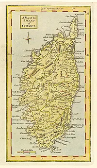 |
| 760 | LOTTER, T. C. L'isle de Corse avec les différents districts, appartenante à la République de gênes . . . Augsbourg, 1760. Col. d'époque. 500 x 578 mm. Carte de Corse gravée par G. F. Lotter fils. T.C. Lotter épousa la fille de M. Seutter, il réutilisa les cuivres de son beau-père et remplaça le nom de Seutter par le sien. Carte publiée lors du soulèvement du peuple corse contre la République de Gênes. Elle est ornée d'une rose des vents et d'un beau cartouche de titre orné d'un chasseur, d'un berger, d'un Neptune, et des armoiries de Corse. En haut à droite, on aperçoit la côte italienne avec la ville de Piombino, et les îles d'Elbe, Pianosa et Montecristo. En haut à gauche se trouve un tableau indiquant le nombre d'hommes armés pour le nord et le sud de l'île. Conrad Lotter, gendre et successeur de Matthaeus Seutter, est l'un des cartographes allemands les plus célèbres du XVIIIe siècle. | 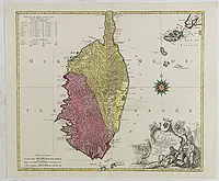 |
| 760 | ANONYME Il Baron di Niewhoff (portrait). Tom. XXIV. 1760. 156 x 101 mm. Portrait du Baron de Neuhoff élu roi de Corse, en 1736, sous le nom de Theodore Ier. Titre complet : "Il Baron di Niewhoff Riconosciuto Re dai Corsi sotto il nome di Teodoro I." | 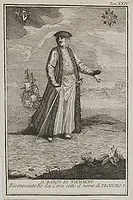 |
| 762.0 | SALMON. Carta geografica del Regno di Corsica. Venise, Albrizzi, 1762. Col. 330 x 425 mm. Publié dans "Lo stato presente di tutti i paesi, e popoli del Mondo…". Cartouche décoratif figurant la pêche et le ramassage des foins. | 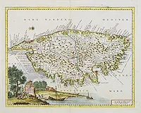 |
| 762.0 | SALMON. Carta geografica del Regno di Corsica. Venise, Albrizzi, 1762. Col. 330 x 430 mm. In "Lo stato presente di tutti i paesi, e popoli del Mondo…". | 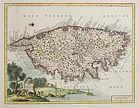 |
| 762.0 | SALMON. Carta geografica del Regno di Corsica. Venise, Albrizzi, 1762. 345 x 440 mm. Publié dans "Atlante novissimo”. Cartouche décoratif figurant la pêche et le ramassage des foins. | 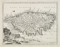 |
| 762.0 | SALMON, Th. Carta Geografica del Regno di Corsica. Venise, 1762. Col. 326 x 425 mm. In "Vol XXIV Compimento Dell’ Italia o sia descrizione Dell’ Isola Alla Medesima Aggiacenti Dell’ Isola e Regno di Sicilia, dell’ Isola di Malta, dell’ Isola e Regno di Sarde-gna, dell’ Isola e Regno di Corsica". |  |
| 762.0 | SALMON. Carta geografica del Regno di Corsica. Venise, Albrizzi, 1762. 330 x 430 mm. In "Lo stato presente di tutti i paesi, e popoli del Mondo...". | 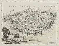 |
| 762.0 | SALMON. Carta geografica del Regno di Corsica. Venise, Albrizzi, 1762. 330 x 430 mm. In "Lo stato presente di tutti i paesi, e popoli del Mondo…".Carte détaillée de la Corse. Nord à droite. Belles illustrations en bas de la carte. | 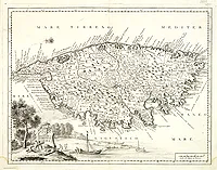 |
| 762.0 | SALMON. Carta geografica del Regno di Corsica. Venise, Albrizzi, 1762. Col. 330 x 425 mm. In "Lo stato presente di tutti i paesi, e popoli del Mondo…"Nord à droite. Cartouche allégorique en bas à gauche. | 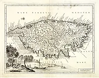 |
| 762.0 | SALMON. Carta geografica del Regno di Corsica. Venise, Albrizzi, 1762. Col. 330 x 423 mm. In "Lo stato presente di tutti i paesi, e popoli del Mondo…". Cartouche allégorique en bas à gauche. |  |
| 764 | BELLIN, J.N. Carte des Bouches de Boniface entre la Corse et la Sardaigne / Plan du Port et Ville de Boniface dans l'Isle de Corse. Paris, 1764. 220 x 170 mm. Deux plans de Bonifacio publiés dans le "Petit Atlas Maritime", Tome IV, N° 94 et N° 95. |  |
| 764.0 | BELLIN, J.N. Carte de l'Isle de Corse. Paris, 1764. 400 x 225 mm. Publié dans le "Petit Atlas Maritime", Tome IV, N° 89. |  |
| 764.0 | BELLIN, J.N. Carte de l'Isle de Corse. Paris, 1764. 400 x 225 mm. Publié dans le "Petit Atlas Maritime", Tome IV, N° 89. |  |
| 764.0 | BELLIN, J.N. Carte de l'Isle de Corse. Paris, 1764. 400 x 225 mm. Publié dans le "Petit Atlas Maritime", Tome IV, N° 89. | 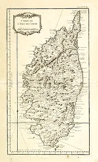 |
| 764.0 | BELLIN, J.N. Plan de la Baye de Calvi. Paris, 1764. 220 x 162 mm. Publié dans le "Petit Atlas Maritime", Tome IV, N° 90. |  |
| 764 | BELLIN, J.N. Plan de la Baye de Calvi. Paris, 1764. 220 x 162 mm. Publié dans le "Petit Atlas Maritime", Tome IV, N° 90. |  |
| 764 | BELLIN, J.N. Plan de la Baye de Calvi. Paris, 1764. 220 x 162 mm. Publié dans le "Petit Atlas Maritime", Tome IV, N° 90. |  |
| 764 | BELLIN, J.N. Plan de la Ville de Corte. Paris, 1764. 217 x 178 mm. Publié dans le "Petit Atlas Maritime", Tome IV, N° 91. |  |
| 764 | BELLIN, J.N. Plan de la Ville de Corte. Paris, 1764. 217 x 180 mm. Publié dans le "Petit Atlas Maritime", Tome IV, N° 91. |  |
| 764.0 | BELLIN, J.N. Plan de la Ville de Corte. Paris, 1764. 217 x 180 mm. Publié dans le "Petit Atlas Maritime", Tome IV, N° 91. |  |
| 764.0 | BELLIN, J.N. Golphe de Campo-Moro et Valinco. Paris, 1764. 215 x 176 mm. Publié dans le "Petit Atlas Maritime", Tome IV, N° 92. |  |
| 764 | BELLIN, J.N. Golphe de Campo-Moro et Valinco. Paris, 1764. 214 x 176 mm. Publié dans le "Petit Atlas Maritime", Tome IV, N° 92. |  |
| 764 | BELLIN, J.N. Golphe de Campo-Moro et Valinco. Paris, 1764. 214 x 176 mm. Publié dans le "Petit Atlas Maritime", Tome IV, N° 92. |  |
| 764 | BELLIN, J.N. Plan de Porto Vecchio. Paris, 1764. 217 x 175 mm. Publié dans le "Petit Atlas Maritime", Tome IV, N° 93. | 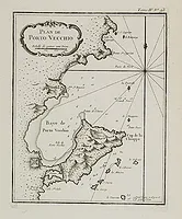 |
| 764 | BELLIN, J.N. Plan de Porto Vecchio. Paris, 1764. 217 x 175 mm. Publié dans le "Petit Atlas Maritime", Tome IV, N° 93. |  |
| 764.0 | BELLIN, J.N. Plan de Porto Vecchio. Paris, 1764. 215 x 178 mm. Publié dans le "Petit Atlas Maritime", Tome IV, N° 93. |  |
| 764.0 | BELLIN, J.N. Plan du Port et Ville de Boniface dans l'Isle de Corse. Paris, 1764. 215 x 178 mm. Publié dans le "Petit Atlas Maritime", Tome IV, N° 94. |  |
| 764.0 | BELLIN, J.N. Carte des Bouches de Boniface entre la Corse et la Sardaigne. Paris, 1764. 215 x 170 mm. Publié dans le "Petit Atlas Maritime", Tome IV, N° 95. |  |
| 764 | BELLIN, J.N. Carte des Bouches de Boniface entre la Corse et la Sardaigne. Paris, 1764. 212 x 167 mm. Publié dans le "Petit Atlas Maritime", Tome IV, N° 95. |  |
| 764.0 | BELLIN, J.N. Plan de la Baye de La Hiace. Paris, 1764. 210 x 173 mm. Publié dans le "Petit Atlas Maritime", Tome IV, N° 97. |  |
| 764 | BELLIN, J.N. Plan de la Baye de La Hiace. Paris, 1764. 210 x 173 mm. Publié dans le "Petit Atlas Maritime", Tome IV, N° 97. | 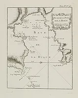 |
| 764.0 | ROUX, J. Porto Vecchio Corsica. [27 Corse]. Marseille 1764. Col. 125 x 200 mm. Charmante petite carte la baie de Porto Vecchio figurant le plan de la ville et du port, les mouillages, rochers, hauts-fonds, fortifications et phares. Joseph Roux (1725-1793) était un hydrographe marseillais qui a publié et également fabriqué et vendu des cartes, des instruments de navigation et du matériel nautique connexe. Vers le milieu du siècle, il reçut le droit d'être appelé "Hidrographe du Roy" et, en 1764, publia une série de 12 cartes de la Méditerranée, il publia simultanément cet atlas de plus petit format de 65 cartes marines. | ![ROUX, J. - Porto Vecchio Corsica. [27 Corse].](../os/mapimg/12247-200x200.webp) |
| 766.0 | DE FER, N. / BRION… L'Italie / Les Isles de Sardaigne et de Corse / L'Italie divisée… Paris, 1700-1766. Limites en col. d'époque. 222 x 325 mm. Lot de 3 cartes d'Italie incluant la Corse et la Sardaigne.

 |  |
| 766.0 | BRION / DESNOS. Les Isles de SARDAIGNE et de CORSE, Divisées par Provinces tant civiles qu'Ecclésiastiques... par le Sr Brion. Paris, 1766. Col. ancien. 265 x 295 mm. Carte de la Sardaigne et de la Corse. | 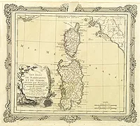 |
| 766.0 | BRION de la TOUR, Louis / DESNOS, Louis Charles. Les Isles de Sardaine et de Corse, Divisées par Provinces tant civiles qu'Ecclésiastiques… par le Sr Brion. Paris, 1766. Col. ancien. 265 x 300 mm. Carte de la Sardaigne et de la Corse, Divisées par Provinces tant civiles qu'Ecclésiastiques…, publiée dans "Atlas général, civil et écclésiastique… Dressé d'après les nouvelles observations astronomiques, faites par MM. Thirikow et De l'Isle, par M. Brion, Ingénieur Géographe… A Paris… 1766". Entourée d'une bordure décorative. | 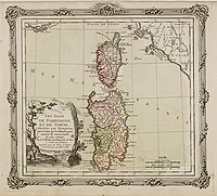 |
| 768.0 | PHINN, Thomas. A New and Accurate Map of the Island of CORSICA...To James Boswell Esq...Tho.s Phinn. Sculpt Edin. Londres, 1768. 270 x 440 mm. Carte réduite de la Jaillot. Publiée dans "An account of Corsica... The second edition. London : printed for Edward and Charles Dilly in the Poultry. MDCCLXVIII". |  |
| 768.0 | PHINN, Thomas. A New and Accurate Map of the Island of Corsica...To James Boswell Esq...Tho.s Phinn. Sculpt Edin. Londres, 1768. 270 x 440 mm. Carte réduite de la Jaillot. Publiée dans " An account of Corsica... The second edition. London : printed for Edward and Charles Dilly in the Poultry. MDCCLXVIII. |  |
| 768.0 | BOSWELL, James. An Account of Corsica the Journal of a Tour to that Island; and Memoirs of Pascal Paoli. Illustrated with a New and Accurate Map of Corsica. The Second Edition. London, Printed for Edward and Charles Dilly, 1768. x mm. Seconde édition publiée la même année que l'originale mais avec d'importantes modifications : Pottle: "It seems that someone in the Press may have taken upon themselves to remove all and any "Scottish peculiarities" present in the original text." La carte dépliante, datée 1768, est réalisée par Thomas Phinn. |  |
| 768.0 | PHINN, Thomas. A New and Accurate Map of the Island of Corsica...To James Boswell Esq...Tho.s Phinn. Sculpt Edin. Londres, 1768. 270 x 440 mm. Carte réduite de la Jaillot. Publiée dans " An account of Corsica... The second edition. London : printed for Edward and Charles Dilly in the Poultry. MDCCLXVIII. |  |
| 768.0 | BELLIN, J.N. Carte réduite du Golphe de Gênes. Paris, 1768. Col. 560 x 845 mm. Carte marine représentant le golfe de Gênes, le nord de la Corse avec les provinces de Calvi et Bastia et une partie de l'île d'Elbe. |  |
| 768 | St ANGELO / LATTRE / VEZOU. Carte de l'Isle de Corse divisée par Jurisdictions. Paris, 1768. Col. 605 x 460 mm. Map undated, carries the address of Lattré, rüe St. Jaques to the City of Bordeaux and Vezou, ruë St. Guill.e Faub. S. Germ. Long descriptive text on the right relating both the geography and the history of Corsica, until the intervention of the French troops and the victory of the Corsicans on the Genoese in 1767. Inset with the coasts of France and Italy with Corsica. | 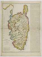 |
| 768.0 | ROBERT DE VAUGONDY, G. Carte Nouvelle de l'Isle de Corse... Par ordre de M. le Maréchal de Maillebois. Paris, 1768. Limites en col. d'époque. 640 x 490 mm. Carte de Corse dressée d'après la carte manuscrite levée sur les lieux par ordre de M. le Maréchal de Maillebois. Le nouveau cartouche est l'œuvre de Arrivet., présence en haut à droite hors filet d'encadrement de l'île Capraia (Capraia est l'une des sept îles de l'Archipel Toscan, sur la route entre le Cap Corse et l'Ile d'Elbe).
. | 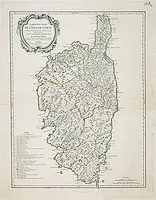 |
| 768.0 | St ANGELO / LATTRE / VEZOU. Carte de l'Isle de Corse divisée par Jurisdictions. Paris, 1768. Limites en col. ancien. 650 x 460 mm. Carte non datée, porte l'adresse de Lattré, rüe St. Jaques à la Ville de Bordeaux et de Vezou, ruë St. Guill.e Faub. S. Germ. Texte descriptif à droite, en carton : côtes de France et d'Italie avec la Corse. |  |
| 768.0 | St ANGELO / LATTRE / VEZOU. Carte de l'Isle de Corse divisée par Jurisdictions. Paris, 1768. Limites en col. d'époque. 600 x 455 mm. Carte non datée, porte l'adresse de Lattré, rüe St. Jaques à la Ville de Bordeaux et de Vezou, ruë St. Guill.e Faub. S. Germ. Long texte descriptif à droite relatant à la fois la géographie et l'histoire de la Corse, jusqu'à l'intervention des troupes françaises et la victoire des Corses sur les Génois en 1767. En carton : côtes de France et d'Italie avec la Corse. | 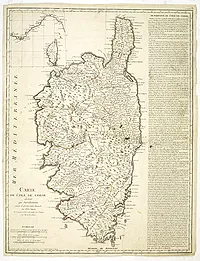 |
| 768 | ANONYME L'Isola di Corsica. Ricavatta dall'esatta carta del Signor Ruberto Vaugondy, Geografo dell' Accademia Reale delle Scienze, e Belle Lettere di Nancy. 1768. Limites en col. d'époque. 580 x 445 mm. Belle et rare carte de Corse comprenant, en bas à gauche, un carton représentant Bastia et ornée d'un cartouche de titre figuratif. La carte figure les différentes juridictions délimitées par des contours coloriés. | 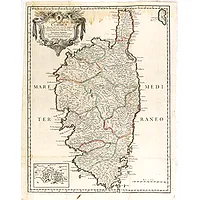 |
| 768.0 | BELLIN, J.N. Carte de l'isle de Corse pour servir aux vaisseaux du roi. Paris, 1768. 585 x 860 mm. Grande carte marine gravée par Croisey, orientée avec le nord à gauche (Nord du Monde et Nord de la Boussole). Echelle en Milles communes d'Italie et de Provence, en Lieues Marines de France et d'Angleterre et en Milles de Corse. | 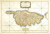 |
| 768.0 | BELLIN, J.N. Carte de l'isle de Corse pour servir aux vaisseaux du roi. Paris, 1768. 588 x 860 mm. Grande carte marine gravée par Croisey, orientée avec le nord à gauche (Nord du Monde et Nord de la Boussole). Echelle en Milles communes d'Italie et de Provence, en Lieues Marines de France et d'Angleterre et en Milles de Corse. | 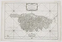 |
| 769.0 | MONDHARE, L. Nouvelle carte de l'isle de Corse divisée en ses fiefs et juridictions… Paris, 1769. Limites en col. ancien. 460 x 640 mm. Tirage sans la date. |  |
| 769.0 | BOSWELL, James. Etat de la Corse, suivi d'un journal de voyage dans l'isle, et des mémoires de Pascal Paoli. Londres [Lausanne], 1769. x mm. Tome I seul de la première édition française, traduite de l'anglais et de l'italien par Gabriel Seigneux de Correvon. Elle est illustrée d'une grande carte gravée dépliante de la Corse par Robert de Vaugondy, aux contours coloriés à l'époque. Ecrivain et avocat écossais, James Boswell entreprit, en 1768, un voyage en Europe. Il rencontra notamment Jean-Jacques Rousseau qui lui parla de la Corse qui avait proclamé son indépendance et s'était donnée une constitution. Boswell se rendit sur l'île, se lia d'amitié avec Pascal Paoli, général de la nation corse, et publia dès son retour en Angleterre le récit de son voyage. Traduit en de nombreuses langues, cet ouvrage rendit célèbre cette première tentative en Europe de former un état démocratique. | 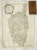 |
| 769.0 | ROBERT DE VAUGONDY, G. Carte Nouvelle de l'Isle de Corse... Par ordre de M. le Maréchal de Maillebois. Lausanne, François Grasset & Compagnie, 1769. Limites en col. ancien. 570 x 440 mm. Rare édition publiée à Lausanne par F. Grasset en 1769. Annotations manuscrites anciennes sous la carte : "Par le dénombrement de 1769 Il y a en Corce 57 Pieves, 10 Juridictions, 26,336 Feux 32,322 hommes en etat de porter les Armes et 130,680 Ames". | 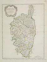 |
| 769 | Pruvost / Dezauche / Daumont. Carte particulière de l’Isle de Corse. Paris, chès Daumont, ca. 1769. Limites en col. d'époque. 500 x 685 mm. Rare carte de la Corse divisée en provinces avec les différents Pieves, gravée par Dezauche. Ornée, en haut à droite d'un cartouche de titre figuratif et en bas à gauche d'un cartouche comprenant une description de l'Isle de Corse. | 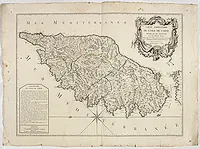 |
| 769.0 | POLICARDI, Domenico. Carta dell'Isola di Corsica. Dedicata a sua Eccelenza il Signor Giuseppe Rocco Boyer de Fonscolombe Commendatore, e gran croce dell'Ordine di San Michele di Baviera, governatore della citta d'Hieres in Provenza. Gênes, 1769. 780 x 1640 mm. Rarissime. Dessinée par D. Policardi, gravée par Inocenzo Chiesa. Orientée Nord à droite. Ornée d'un magnifique cartouche de titre surmonté d'armoiries. - POLICARDI Domenico : Géographe génois. En 1768, à Bastia, parution, chez le libraire Pagani, de sa carte de la Corse qui donne des informations sur la démographie de l’Ile: On y compte 57 pièves, 10 juridictions, 26336 feux, 32332 hommes en état de porter les armes (de 17 à 60 ans), et 130680 habitants. |  |
| 769.0 | POLICARDI, Domenico. Carta dell'Isola di Corsica. Dedicata a sua Eccelenza il Signor Giuseppe Rocco Boyer de Fonscolombe Commendatore, e gran croce dell'Ordine di San Michele di Baviera, governatore della citta d'Hieres in Provenza. Gênes, 1769. 780 x 1640 mm. Rarissime. Dessinée par D. Policardi, gravée par Inocenzo Chiesa. Orientée Nord à droite. Ornée d'un magnifique cartouche de titre surmonté d'armoiries. - POLICARDI Domenico : Géographe génois. En 1768, à Bastia, parution, chez le libraire Pagani, de sa carte de la Corse qui donne des informations sur la démographie de l’Ile: On y compte 57 pièves, 10 juridictions, 26336 feux, 32332 hommes en état de porter les armes (de 17 à 60 ans), et 130680 habitants. |  |
| 769.0 | BOASSO, V. Carta dell'isola di Corsica divisa nelle sue Provincie. Turin, 1769. Col. ancien. 376 x 663 mm. Rare carte de la Corse réalisée et publiée à Turin par Vittorio Boasso. Elle est divisée en Provinces et orientée avec le nord à droite. Ornée de 2 cartouches et de nombreux bateaux. Un tableau explicatif indique les différents couvents réguliers par des lettres qui sont reportées sur la carte : PC pour Capucins, PD pour Dominicains… | 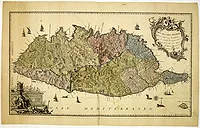 |
| 769.0 | BOSWELL, J. Giornale del viaggio fatto nell' Isola di Corsica da Giacomo Bosvvell, con alcune memorie del Generale, Pasquale Paoli, che serve di tomo II. alla Relazione della Corsica. Londres, 1769. x mm. Vol. 2 de la" Relazione della Corsica". | 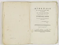 |
| 769.0 | PHINN, Thomas; A New and Accurate Map of the Island of CORSICA...To James Boswell Esq...Tho.s Phinn. Sculpt Edin. Londres, 1769. x mm. Carte réduite de la Jaillot. London, Printed for Edward and Charles Dilly, 1769., 1769. 1 volume in-8 (21 x 13 cm) de 1 portrait de Pascal Paoli, General of the corsicans (peint par Henry Benlridge et gravé par J. Lodge), 400 pages y compris le faux-titre, le titre et la préface, chiffrés en romains de (I) à XXX. La table qui précède le texte n'est pas chiffrée mais est comprise dans la pagination. The journal of a tour to Corsica and memoirs of Pascal Paoli commence à la page (285) et se termine à la page 400 et dernière. TROISIÈME EDITION. The book is divided in two parts, the first giving a detailed description and history of Corsica, and the second containing a journal of Boswell's voyage to the island. It was especially this latter part which excited the public, being a lively account of Boswell's quixotic adventures in Corsica and his association with General Paoli. Pascal Paoli was a Corsican patriot, who in 1755 succeeded in liberating the island from Genoese oppression and was chosen president under a republican constitution. In 1769, however, his troops were defeated by the French, and he had to flee to England. Boswell brought Paoli to London, introduced him to the circle of Samuel Johnson, and succeeded in getting official British support for the island's struggle to become an independent nation. With the help of Admiral Hood, the French were defeated in 1794, but after only two years of British reign the French took over again, with Corsica coming under jurisdiction of Napoleon Bonaparte. Boswell enjoyed his role as promoter of Corsica's interests so much that he appeared in Corsican costume at Garrick's anniversary party in honour of Shakespeare in Stratford-on-Avon in 1769. Johnson said about Boswell's book: "Your History is like other histories, but your Journal is in a very high degree curious and delightful". The large folding map, newly made for Boswell's account by his servant Thomas Phinn and dated 1768, is one of the rare maps solely devoted to the island. Édition publiée un an après la première édition de Glasgow. Elle est illustrée du portrait de Pascal Paoli, et d'une carte gravée dépliante de la Corse par Thomas Phinn. Écrivain et avocat écossais, James Boswell entreprit, en 1768, un voyage en Europe. Il rencontra notamment Jean-Jacques Rousseau qui lui parla de la Corse qui avait proclamé son indépendance et s'était donnée une constitution. Boswell s'y rendit, se lia d'amitié avec le général Pascal Paoli, et publia dès son retour en Angleterre le récit de son voyage, précédé d'un Compte Rendu de la Corse qui donne une vue d'ensemble de l'histoire, de l'économie, et des mœurs. Traduit en de nombreuses langues, cet ouvrage rendit célèbre cette première tentative en Europe de former un état démocratique. Références : Cox I, pp. 138-9; Lowndes, The Bibliogr. Manual of Engl. Lit. I, p. 242 (first ed.); Pottle 24; Rotschild 442; Gaskell 473. |  |
| 769 | BOSWELL, James. Relation de l'isle de Corse, journal d'un voyage dans cette isle, et mémoires de Pascal Paoli. La Haye, Frederic Staatman, 1769. 234 x 155 mm. Ouvrage illustré d'une carte gravée dépliante de la Corse par Abraham Isaac Polak.  | 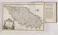 |
| 769 | SYSANG, Johanna Dorothea. Neue und Accurate Carte von der Insel Corsica. Leipzig, 1769. 270 x 430 mm. Parue dans la seconde édition allemande de Boswell, Esq. Historisch-geographische Beschreibung von Corsica. | 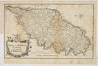 |
| 769.0 | LAPIS, Giovanni. Isola di Corsica. Londres, 1769. Noir et blanc. 230 x 165 mm. Rare carte de Corse publiée dans la " Relazione della Corsica ", traduction italienne de l'ouvrage de Boswell " An Account of Corsica", publié l'année précédente, en 1768, à Glasgow. | 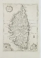 |
| 769.0 | BELLIN, J.N. Description géographique et historique de l'Isle de Corse, pour joindre aux Cartes & Plans de cette Isle. Relié avec : Atlas de l'Isle de Corse. Paris, Didot, 1769. x mm. La Description est reliée avec l'Atlas. L'atlas est illustré d'une carte générale et de 30 cartes (sur 32). Il manque quelques feuillets au début de la Description. |  |
| 770.0 | DESNOS, Louis Charles. Royaume de Corse. Paris, 1770. Col. ancien. 95 x 95 mm. Charmante petite carte de Corse publiée dans "Almanach géographique", à Paris, chez Desnos. |  |
| 774 | MASSON, M. Abrégé élémentaire de géographie universelle de la France. Tome second. Paris, Moutard, 1774. 174 x 105 mm. Tome second illustré d'une carte de Corse (134 x 82 mm) gravée sur cuivre. La carte ne porte pas de titre mais "Isle de Corse" inscrit à l'intérieur de la carte, comprend une "Echelle de 10 lieues de 20 au D.é".  | 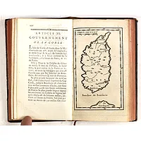 |
| 779.0 | KITCHIN ? A Map of the Island of Corsica. Londres, 1779. 195 x 105 mm. Publiée dans le "Gentleman's Magazine" en 1779. |  |
| 779.0 | DA RABATTA / DE BAILLOU / LAMBERTI, A. Isole di Corsica anticamente Cyrnus ab Herculis Filio de' Franci. . . Florence, 1779. Col. ancien. 96 x 55 mm. Carte à jouer représentant la Corse, la Sardaigne et une partie de la côte toscane. Réalisée par D. Agostino da Rabatta Barone et Giov. de Baillou, gravée par Aniello Lamberti. Version florentine du Tarot, le "Minchiate", ce jeu fut publié dans l'atlas “Nuovo Atlante Generale Metodico, ed Elementare Tascabile” de Aniello Lamberti. - Playing card with map of Corsica and Sardinia with part of the coastline of Tuscany (45x55mm.) . Prepared by D. Agostino da Rabatta Barone and Giov. de Baillou, engraved by Aniello Lamberti. Intended to play the Florentine version of the tarot play, the “Minchiate”. Published in “Nuovo Atlante Generale Metodico, ed Elementare Tascabile” by Aniello Lamberti. | 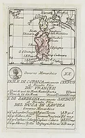 |
| 780.0 | JAILLOT, H. / SANTINI. Carte Particuliere de l'Isle de Corse. Divisée par ses Dix Provinces ou Juridictions et ses quatre Fiefs.. Venise, 1780. Limites en col. ancien. 477 x 658 mm. Carte de Corse, orientée Nord à gauche. En carton: Pointe de Capo Corso et une table de renvois. Cartouche de titre et rose des vents. | 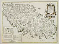 |
| 780.0 | JAILLOT, H. / SANTINI. Carte Particulière de l'Isle de Corse. Divisée par ses Dix Provinces ou Juridictions et ses quatre Fiefs.. Venise, 1780. Col. 477 x 658 mm. Carte de Corse, orientée Nord à gauche. En carton: Pointe de Capo Corso et une table de renvois. Cartouche de titre et rose des vents. | 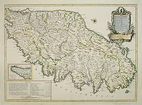 |
| 780.0 | JAILLOT, H. / SANTINI. Carte Particulière de l'Isle de Corse. Divisée par ses Dix Provinces ou Juridictions et ses quatre Fiefs. Venise, 1780. Limites en col. d'époque. 475 x 655 mm. Carte de Corse, orientée Nord à gauche. En carton: Pointe de Capo Corso et une table de renvois. Cartouche de titre et rose des vents. | 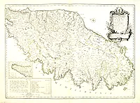 |
| 780.0 | JAILLOT, H. / SANTINI. Carte Particuliere de l'Isle de Corse. Divisée par ses Dix Provinces ou Juridictions et ses quatre Fiefs.. Venise, 1780. Limites en col. ancien. 477 x 658 mm. Carte de Corse, orientée Nord à gauche. En carton: Pointe de Capo Corso et une table de renvois. Cartouche de titre et rose des vents. | 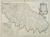 |
| 780.0 | JAILLOT, H. / SANTINI. Carte Particulière de l'Isle de Corse. Divisée par ses dix Provinces ou Juridictions et ses quatre Fiefs. Venise, 1780. Beau col. 480 x 660 mm. En carton: Pointe de Capo Corso et une table de renvois. |  |
| 780.0 | JAILLOT, H. / SANTINI. Carte Particulière de l'Isle de Corse. Divisée par ses Dix Provinces ou Juridictions et ses quatre Fiefs. Venise, 1780. Limites en col. d'époque. 476 x 655 mm. Carte de Corse, orientée Nord à gauche. En carton : Pointe de Capo Corso et une table de renvois. Cartouche de titre et rose des vents. | 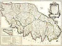 |
| 780.0 | JAILLOT, H. / SANTINI. Carte Particulière de l'Isle de Corse. Divisée par ses Dix Provinces ou Juridictions et ses quatre Fiefs.. Venise, 1780. Limites en col. d'époque. 476 x 655 mm. Carte de Corse, orientée Nord à gauche. En carton: Pointe de Capo Corso et une table de renvois. Cartouche de titre et rose des vents. |  |
| 780.0 | FADEN, W. / ELLIS, J. Carte de l'Isle de Corse tirée sur les lieux. . . Mr le Maréchal de Maillebois. Londres, ca. 1780. Limites en col. d'époque. 417 x 206 mm. Carte de la Corse gravée par J. Ellis, figurant les différentes juridictions. Echelle en "Lieues de 2739 pas géométriques et Milles de Corse de 833 toises 2 Pieds chacun". | 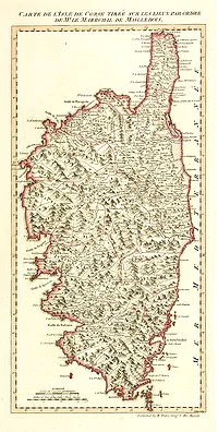 |
| 780.0 | JAILLOT / MORTIER / VAUGONDY / D'ANVILLE / BONNE; Lot de 12 cartes d'Italie ou de ses régions (10 avec la Corse). Paris/Amsterdam, c.1750-1780. 456 x 648 mm. Ensemble de 12 cartes du 18e s. dont 10 comprennent la Corse et la Sardaigne. 


 | 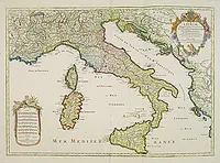 |
| 782.0 | ZATTA, A. L'Isola di Corsica Divisa nelle sue Provincie Di nuova Projezione. Venise, 1782. Beau col. ancien. 415 x 325 mm. Carte gravée par G. Zuliani et écrite par G. Pitteri, publiée dans “Atlante novissimo”. | 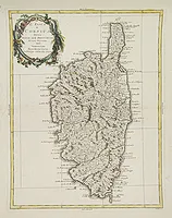 |
| 782.0 | ZATTA, A. L'Isola di Corsica Divisa nelle sue Provincie Di nuova Projezione. Venise, 1782. Col. ancien. 400 x 310 mm. Carte gravée par G. Zuliani et écrite par G. Pitteri. | 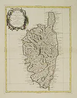 |
| 782.0 | ZATTA, A. L'Isola di Corsica Divisa nelle sue Provincie Di nuova Projezione. Venise, 1782. 400 x 310 mm. Carte gravée par G. Zuliani et écrite par G. Pitteri. | 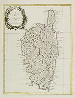 |
| 782.0 | ZATTA, A. L'Isola di Corsica Divisa nelle sue Provincie Di nuova Projezione. Venise, 1782. Col. ancien. 400 x 310 mm. Carte gravée par G. Zuliani et écrite par G. Pitteri. | 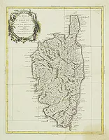 |
| 783.0 | LATTRÉ, J. L'Isle de Corse divisée par Juridictions Extraite de plusieurs Cartes Nationales. Paris, 1783. Col. 435 x 300 mm. Carte de la Corse divisée en Jurictions. | 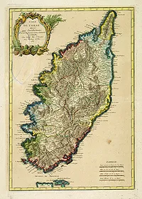 |
| 783.0 | LATTRÉ, J. L'Isle de Corse divisée par Juridictions Extraite de plusieurs Cartes Nationales. Paris, 1783. Col. 435 x 300 mm. Carte de la Corse divisée en Juridictions. Echelle en : Lieues communes de France - Milles de Corse de 68. au degré - Milles d'Italie de 60 au degré - Lieues Marines de 20. au Degré. | 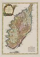 |
| 783.0 | JAILLOT, H. Carte Particulière de l'Isle de Corse. Divisée par ses Dix Provinces ou Juridictions et ses quatre Fiefs. Paris, Dezauche, 1783. Limites en col. d'époque. 500 x 795 mm. Réimpression de la carte de Jaillot de 1738. Carte gravée par Delahaye, ornée de 2 cartouches dont 1 pour la dédicace au Marquis de Brignole Sale. | 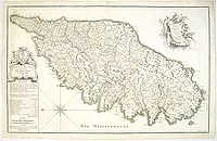 |
| 784.0 | SANTINI, P. / REMONDINI, M. Carte Particuliere de l'Isle de Corse. Venise, 1784. Limites en col. d'époque. 478 x 660 mm. Carte de Corse, orientée Nord à gauche. En carton: Pointe de Capo Corso et une table de renvois. Cartouche de titre et rose des vents. Tirage portant la pagination P. II. 27, et l'adresse de Remondini. Edition vénitienne de la carte de Jaillot. | 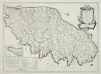 |
| 784.0 | SANTINI, P. / REMONDINI, M. Carte Particuliere de l'Isle de Corse. Venise, 1784. Limites en col. ancien. 478 x 660 mm. Carte de Corse, orientée Nord à gauche. En carton: Pointe de Capo Corso et une table de renvois. Cartouche de titre et rose des vents. Tirage portant la pagination P. II. 27, et l'adresse de Remondini. Edition vénitienne de la carte de Jaillot. | 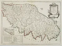 |
| 784.0 | JAILLOT/ SANTINI/ REMONDINI. Carte Particulière de l'Isle de Corse. Divisée par ses dix Provinces ou Juridictions et ses quatre Fiefs. Venise, 1784. Limites en col. d'époque. 485 x 670 mm. | 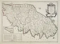 |
| 784.0 | SANTINI, P. / REMONDINI, M. Carte Particuliere de l'Isle de Corse. Venise, 1784. Limites en col. ancien. 478 x 660 mm. Carte de Corse, orientée Nord à gauche. En carton: Pointe de Capo Corso et une table de renvois. Cartouche de titre et rose des vents. Tirage portant la pagination P. II. 27, et l'adresse de Remondini.
- Finely and crisply engraved map of Corsica, with remarkable topographical detail. Oriented with East on top. Venetian edition of Jaillot's map, from "Atlas Universel" printed in 1776-84. Decorated with a large title cartouche and a compass rose in the upper right corner. Inset map of the island's northernmost tip in the lower left together with some administrative and demographic information. The map was prepared by the Venetian cartographer and publisher François (Père) Santini and first published in Santini's 'Atlas Universel dressé sur les meuilleures cartes modernes 1776.' Santini collaborated with Janvier and gives credit to him on most of his maps. The atlas is effectively an Italian copy of the Robert de Vaugondy "Atlas Universel". In 1784 Santini sold the plates to M. Remondini, whose name appears on this particular example - indicating that this is the second state of the map. |  |
| 787.0 | BONNE, R. Isles DE CORSE ET DE SARDAIGNE. Hérisson del. André sculp. Paris, 1787. 345 x 230 mm. Corse et Sardaigne. Carte montrant les reliefs. Nord en haut. Sous passe-partout. | 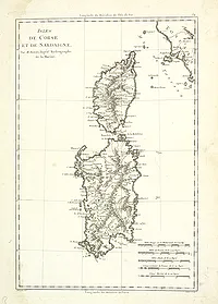 |
| 787.0 | BONNE, R. Isles de Corse et de Sardaigne. Paris, 1787. 340 x 227 mm. Corse et Sardaigne. Hérisson del. André sculp. 2 exemplaires. | 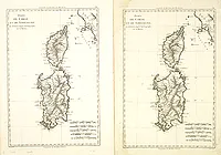 |
| 790.0 | ANONYME (Corse et Sardaigne). Ca. 1790. Limites en col. d'époque. 750 x 430 mm. Cette carte est la partie ouest d'une plus grande carte des Postes d'Italie, elle figure une partie de l'Italie, la Corse et la Sardaigne. Un cartouche à gauche comprend l'échelle et donne des indications sur les Postes d'Italie. | 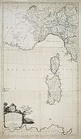 |
| 790.0 | BRION DE LA TOUR, Louis. Les Isles de Sardaigne et de Corse.. Paris 1790. Col. ancien. 280 x 315 mm. Attractive copper engraved map of Corsica and Sardinia with Rome at extreme left. Good detail throughout including villages, rivers, and coastlines. Decorated with a nice title cartouche and enclosed in a rococo-style border. |  |
| 790.0 | BRION / DESNOS. Les Isles de Sardaigne et de Corse, Divisées par Provinces tant Civiles qu'Ecclésiastiques. Paris, 1790. Col. ancien. 362 x 510 mm. Carte figurant la Sardaigne et la Corse, encadrée d'un texte donnant des explications relatives à l'histoire et à la géographie des 2 îles, le tout entouré d'une bordure décorative. | 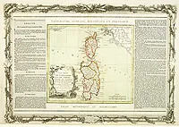 |
| 790.0 | CHANLAIRE, P. G. Département de l'isle de Corse. . . Paris, ca. 1790. Col. ancien. 230 x 180 mm. Carte du département de la Corse divisé en 9 districts et 68 cantons. | 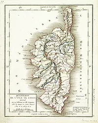 |
| 791.0 | REILLY, F.J.J. von. Das Koenigsreichs Corsica . Nro 458. Vienne, 1791. Limites en col. d'époque. 250 x 305 mm. Carte de la Corse publiée dans: "Schauwplatz der fünf Theile der Welt… herausgegeben von F.J.J. von Reilly. Dritter Theil… Wien, 1791". La pointe du Cap Corse figure dans un carton en haut à droite. | 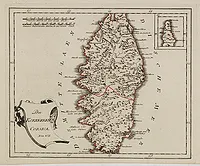 |
| 791.0 | REILLY, F.J.J. von. Des Koenigsreichs Corsica Noerdlicher Theil. / Mittlerer Theil. / Südlicher Theil. Vienne, 1791. Limites en col. ancien. x mm. |  |
| 791 | COVENS, J. & FILS. Carte du département de l'Isle de Corse. Amsterdam, 1791. Limites en col. d'époque. 97 x 112 mm. Carte de Corse découpée de la "Carte de France divisée en 83 departements, suivant les decrets de l' Assemblée Nationale". | 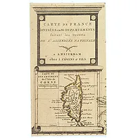 |
| 792.0 | CASSINI, G. M. L'isola di Corsica Divisa Nelle sue Provincie, o Giurisdizioni e parte dell' isola di Sardegna. Rome, 1792. 470 x 330 mm. Publiée dans : "Nuovo Atlante geografico universale…". |  |
| 792.0 | CASSINI, G. M. L'isola di Corsica Divisa Nelle sue Provincie, o Giurisdizioni e parte dell' isola di Sardegna. Rome, 1792. Limites en col. d'époque. 470 x 330 mm. Carte peu commune publiée dans : "Nuovo Atlante geografico universale…". Ornée d'un cartouche de titre figuratif. Echelle en milles italiennes, romaines et en lieues de France. | 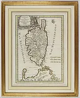 |
| 794.0 | ZATTA, A. L'Isola di Corsica Divisa nelle sue Provincie Di nuova Projezione. Venise, 1794. Col. ancien. 404 x 310 mm. Carte gravée par G. Zuliani et écrite par G. Pitteri. | 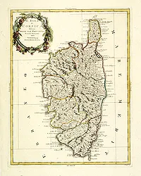 |
| 794.0 | JEFFERYS, Thomas. A New Map of the Island and Kingdom of Corsica, by Thomas Jefferys… Londres, 1794. Col. ancien. 615 x 475 mm. Descriptif géographique et démographique en anglais. L'auteur se réfère au Capitaine Vogt, à Boswell et à Necker. | 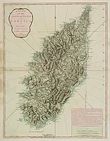 |
| 794.0 | JEFFERYS, Thomas. A New Map of the Island and Kingdom of Corsica. Londres, 1794. Limites en col. d'époque. 633 x 483 mm. En carton : descriptif géographique et démographique en anglais. L'auteur se réfère au Capitaine Vogt, à Boswell et à Necker. | 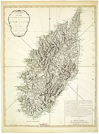 |
| 794.0 | JEFFERYS, Thomas. A New Map of the Island and Kingdom of Corsica, by Thomas Jefferys… Londres, 1794. Col. 630 x 485 mm. En carton : descriptif géographique et démographique en anglais. L'auteur se réfère au Capitaine Vogt, à Boswell et à Necker. | 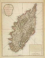 |
| 794.0 | JEFFERYS, Thomas. A New Map of the Island and Kingdom of Corsica, by Thomas Jefferys… Londres, 1794. Limites en col. ancien. 630 x 485 mm. En carton : descriptif géographique et démographique en anglais. L'auteur se réfère au Capitaine Vogt, à Boswell et à Necker. | 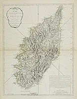 |
| 794.0 | JEFFERYS, Thomas. A New Map of the Island and Kingdom of Corsica. Londres, 1794. Limites en col. d'époque. 633 x 483 mm. En carton : descriptif géographique et démographique en anglais. L'auteur se réfère au Capitaine Vogt, à Boswell et à Necker. | 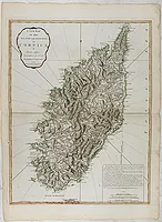 |
| 794 | WALLIS, J. Map of the Isle of Corsica, Divided into 9 Districts & 68 Cantons. Londres, 1794. Col. ancien. 219 x 172 mm. Carte de Corse divisée en 9 districts et 68 cantons. | 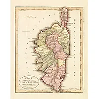 |
| 794.0 | CHANLAIRE, P. G. Département de l'Isle de Corse. Paris, 1794. Col. ancien. 640 x 500 mm. Département de l'île de Corse publié dans "Atlas national de France". | 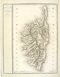 |
| 794 | CARLI, P. La Corsica. Siena, 1794. Beau col. ancien. 310 x 230 mm. Carte de P. Carli gravée par Agostino Costi. In "Atlante geografico", 1788-1800. Ornée d'un cartouche figuratif et de la tête de Maure. | 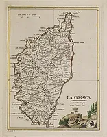 |
| 794.0 | JEFFERYS, Thomas. A New Map of the Island and Kingdom of Corsica, by Thomas Jefferys… Londres, 1794. Limites en col. ancien. 630 x 485 mm. En carton : descriptif géographique et démographique en anglais. L'auteur se réfère au Capitaine Vogt, à Boswell et à Necker. | 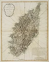 |
| 795 | ENGELMANN, J. W. Kriegs Atlas zum Gebrauch für Zeitungsleser. Vienne, 1795. Beau col. ancien. 205 x 325 mm. Rare atlas publié à Vienne en Autriche comprenant 16 cartes dont une de la Corse non répertoriée par Cervoni. Les cartes ont été gravées par Johann Wenzel Engelmann. Les cartes représentent les différents théâtres de la guerre lors de la "Première Coalition" contre les Français. | 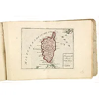 |
| 796.0 | BUSCHING. Karte von der Insel Korsika. Vienne, 1796. Col. ancien. 380 x 270 mm. | 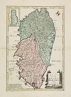 |
| 798.0 | BACLER D'ALBE. CARTE GÉNÉRALE Du Théâtre de la Guerre en Italie et Dans les Alpes (partie avec la Corse, la Provence et le magnifique cartouche). Par Bacler Dalbe. C A Milan 1798. 1060 x 1330 mm. Rare carte de la Corse que l'on trouve difficilement séparément, accompagnée du spectaculaire cartouche représentant Bonaparte en libérateur de l'Italie. |  |
| 798.0 | BACLER D'ALBE. (Corse). Feuille N°XXII et XXVII. Milan, l'auteur, An 6 [1798. 1020 x 650 mm. Carte de la Corse faisant, à l'origine, partie de la grande carte d'Italie commandée par Napoléon à l'occasion de la Campagne d'Italie : "Carte générale du Théâtre de la guerre en Italie et dans les Alpes". Ornée, en bas à gauche, d'une grande rose des vents avec le nord indiqué par une flèche empennée, et d'une partie de cartouche. La carte a été gravée par les frères Bordiga. "Bacler D'Albe suit Bonaparte en Italie et devient chef de son bureau topographique. Il est Général en 1812, puis directeur du Dépôt de la Guerre (futur Service Géographique de l'Armée)". |  |
| 798.0 | BACLER D'ALBE. (Corse). Feuille N°XXII. Milan, 1798. Beau col. 1020 x 650 mm. Fait partie de la grande carte d'Italie commandée par Napoléon à l'occasion de la Campagne d'Italie : "Carte générale du Théatre de la guerre en Italie et dans les Alpes". | 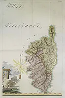 |
| 799.0 | FEYDEL, G. Mœurs et coutumes des Corses. Paris, Garnery, an VII, 1799. x mm. |  |
| 799.0 | BRION DE LA TOUR, Louis. Département du Golo, partie de l'isle de Corse/ Département du Liamone, partie de l'isle de Corse. Paris, 1799. Col. ancien. 160 x 215 mm. Publié dans "Voyage dans les départemens de la France", à Paris chez Brion, An VIII de la République française. | 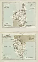 |
| 800 | ALLEZARD, Jean Joseph Plan de la Baye de Calvi Sur l'Isle de Corse [Pl. 71]. Marseille, 1800. 125 x 190 mm. Publié dans "Nouveau Recueil… Nouvelle édition corrigée et augmentée… par Jean Joseph Allezard Capitaine de Navire. Publié l'an 1800. A Marseille, chez Poize Graveur et Imprimeur en taille-douce". | ![ALLEZARD, Jean Joseph - Plan de la Baye de Calvi Sur l'Isle de Corse [Pl. 71].](../os/mapimg/62870-200x200.webp) |
| 800 | ALLEZARD, Jean Joseph Golfe er Rade de Ajaccio [Pl. 123]. Marseille, 1800. 125 x 185 mm. Publié dans "Nouveau Recueil… Nouvelle édition corrigée et augmentée… par Jean Joseph Allezard Capitaine de Navire. Publié l'an 1800. A Marseille, chez Poize Graveur et Imprimeur en taille-douce". | ![ALLEZARD, Jean Joseph - Golfe er Rade de Ajaccio [Pl. 123].](../os/mapimg/62871-200x200.webp) |
| 800.0 | BARTHELEMY, J-J. Carte des Isles de Sardaigne et de Corse / (Corse et Sardaigne). Ca. 1800. 305 x 325 mm. Lot de 2 cartes comprenant une partie de l'Italie centrale avec les îles de Corse et de Sardaigne, l'une légèrement coloriée. La première a été publiée dans l'Histoire universelle", la seconde dans le "Voyage en Italie". |  |
| 800 | CHANLAIRE, P-G. N°24. I. de Corse Gènes et Florence. Paris, chez l'Auteur au Dépôt de Géographie, ca.1800. Beau col. ancien. 395 x 560 mm. Carte N°24 faisant partie de la "Carte générale de l'Italie et de la côte orientale de la mer Adriatique". A gauche dans un carton, figure une carte de Corse avec sa propre échelle, cette représentation de la Corse n'est pas présente dans toutes les éditions. L'inscription "N°24. I. de Corse Gènes et Florence" est manuscrite. | 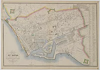 |
| 800 | CHANLAIRE, P-G. N°24. I. de Corse Gènes et Florence. Paris, chez l'Auteur au Dépôt de Géographie, ca.1800. Limites en col. d'époque. 395 x 560 mm. Carte N°24 faisant partie de la "Carte générale de l'Italie et de la côte orientale de la mer Adriatique". A gauche dans un carton, figure une carte de Corse avec sa propre échelle, cette représentation de la Corse n'est pas présente dans toutes les éditions. La Corse est divisée en départements du Golo et du Liamone. D'autre part, le nord de l'Italie jusqu'à Corte, est également représenté sur la carte elle-même. | 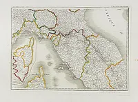 |
| 801.0 | SERRES, J-T./ LUFFMAN. Corsica / Porto Vecchio / Ajaccio / Gibraltar. Londres, 1801. Col. ancien. 123 x 160 mm. 4 cartes dont 1 carte générale de Corse, 1 plan du port d'Ajaccio, 1 de Porto Vecchio et 1 de Gibraltar. 
  |  |
| 801.0 | REMONDINI, G. A. (L'Isle de Corse). Venise, 1801. Limites en col. d'époque. 130 x 110 mm. Rare carte de Corse publiée dans « Atlas géographique dressé sur les meilleures cartes de ces derniers terms… ». |  |
| 802.0 | HEATHER, W. / STEPHENSON, J. The Gulf of Fiorenzo / The road of Fiorenzo / Calvi / Ajaccio. 1802. Col. 138 x 180 mm. 4 plans de baies et golfes de la Corse, dont 3 coloriés : 2 du golfe de Fiorenzo (St Florent), golfe d'Ajaccio et baie de Calvi. 

 |  |
| 802.0 | BACLER D'ALBE. (Corse). Feuille N°XXII et XXVII. Paris, 1802. 1020 x 650 mm. Fait partie de la grande carte d'Italie commandée par Napoléon à l'occasion de la Campagne d'Italie : "Carte générale du Théâtre de la guerre en Italie et dans les Alpes". Publiée dans la seconde partie en 24 feuilles concernant le Royaume de Naples, la Sicile, la Sardaigne et Malte, intitulée : "Carte Générale des Royaumes de Naples, Sicile et Sardaigne aussi que les Iles de Malte et de Goze formant la seconde partie de la Carte G.le du Théâtre de la Guerre en Italie et dans les Alpes".
Ornée d'un cartouche en bas à droite. |  |
| 803.0 | DE BOUGE, J. B. Carte Géographi-diplomatique suivant les Derniers Traités de Paix Dédiée au Général Beurnonville ambassadeur de la République Française. Bruxelles, 1803. Limites en col. ancien. 490 x 690 mm. Représente la Corse avec les départements du Golo et du Liamone et une partie de la Sardaigne. |  |
| 803.0 | GÖTZE, F. Charte Insel Corsica / Charte von Sardinien. Weimar, 1801-1803. Col. ancien. 450 x 610 mm. Deux cartes sur 1 planche. La Corse avec la Sardaigne. Publiée à Weimar," im Verlag des IndustrieComptoirs. Revidirt im September 1803". L'adresse et la date sont différentes de celles données par Cervoni. | 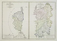 |
| 803.0 | SOCIETA CALCOGRAFICA. L'Isle de Corse Divisée en ses departemens. P.II. 27. Venise, 1803. Col. ancien. 478 x 660 mm. Rare carte de Corse non répertoriée par Cervoni, ornée d'un beau cartouche de titre. En carton: "Pointe de Capo Corso". La carte est divisée en 2 départements : le Golo et le Liamone. A la fin du 18e siècle Antonio Zatta et Giuseppe Antonio Remondini s'associèrent afin de publier un nouvel atlas. Les cartes devaient être imprimées à partir de cuivres existants en la possession de Zatta ou de Remondini, ce dernier, lui-même en possession des planches de Paolo et Francesco Santini. Le projet n'aboutit jamais et les cartes furent vendues séparément ou dans des atlas composites. Les cartes de Santini, d'après celles de Gilles Robert, furent modernisées par l'ajout de nouveaux cartouches. Ces cartouches furent gravés sur des planches séparées par Pasquali, Zuliani et Pitteri et imprimés à la place des anciens cartouches préalablement effacés. Cette carte dérive de celle de Santini à laquelle a été ajouté un nouveau cartouche gravé séparément. - At the end of the 18th century Antonio Zatta and Giuseppe Antonio Remondini formed a partnership (the “Società Calcografica”) to promote a new atlas project. The maps were to be printed from existing plates, either in the possession of Zatta or Remondini, the last one being in the possession of the plates of Paolo and Francesco Santini. The project never resulted in the publication of an atlas. Only a small quantity of maps were printed and sold separately or as composite collections. The Santini maps, which originate in the maps from Gilles Robert, were modernised by inserting new cartouches. For this purpose new small cartouche-plates were engraved by collaborators as Pasquali, Zuliani and Pitteri. From these plates the new cartouches were printed into the maps the old ones having been erased. This map of Corsica has its origin in a Santini plate. The entirely new cartouche is printed from a separate new plate. | 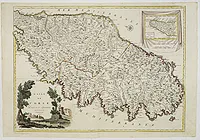 |
| 805.0 | ANONYME ISLE de CORSE. Paris, c.1805. 195 x 370 mm. Volney, Précis de l'état de la Corse. Tome VI. |  |
| 805 | ZATTA, A. L'Isle de CORSE Divisée en ses departemens. Venise,1805. Limites en col. ancien. 475 x 655 mm. Nice map of Corsica, with a decorative cartouche in the left low corner. Small inset map of Sicily in the upper right corner: "Pointe de Capo Corso". This is the very rare larger edition published by Zatta in 1805. The title cartouche printed from a separate copper plate. | 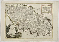 |
| 806.0 | DELAPORTE,L'Abbé. Départemens de l'Isle de Corse, Golo et Liamone. Paris, Prudhomme, Levrault, Debray, 1806. Limites en col. ancien. 180 x 105 mm. Carte de l'ïle de Beauté, avec une petite légende dans le coin inférieur gauche.@ | 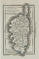 |
| 810.0 | ANONYME Corsica. Allemagne, ca. 1810. Limites en col. d'époque. 215 x 160 mm. Carte de Corse et du nord de la Sardaigne extraite d'un atlas allemand. Echelle en "Teutsche Meilen" et "Französische Meilen". | 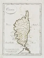 |
| 813.0 | LUFFMAN / GOLD, J. Corsica. Londres, 1800-1813. 160 x 115 mm. 3 cartes représentant la Corse avec le nord en haut, 1 par Luffman et 2 par J. Gold. 
 | 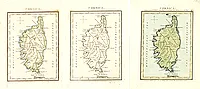 |
| 819.0 | BORGHI, B. La Corsica. Florence, 1819. Limites en col. d'époque. 225 x 245 mm. | 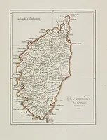 |
| 819.0 | ANONYME Corse N°86 / Dép.t de la Corse. N°86. Paris, ca. 1819. Col. ancien. 125 x 75 mm. Rare. 2 cartes de Corse issues d'un jeu géographique des 86 départements de la France (peut-être "Analyse géographique sur les départemens de la France", Paris, Bourrut-Lemeri, 1819). | 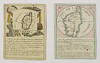 |
| 820.0 | ANONYME Corsica. Ca. 1820. 236 x 160 mm. Carte de la Corse avec un plan de Bastia en bas à gauche et une description en anglais en bas à droite. | 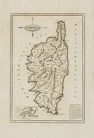 |
| 821 | JOLY de la VAUBIGNON, Adrien. (Voyage pittoresque en Corse). Paris, chez l'auteur et chez Engelmann, (1821. Noir et blanc. 543 x 410 mm. Rare et important ouvrage sur la Corse paru en 10 livraisons. Notre exemplaire est illustré de 38 planches, il manque le titre et les planches n° 12, 28, 32, 36, 40 et les dernières planches parues (44 à 48). Il comprend 38 remarquables lithographies représentant les plus beaux sites et monuments de l' " Ile de Beauté", accompagnées d'un texte explicatif pour chacune d'elles, imprimé à l'aide de caractères de cuivre donnant un grand relief à ce texte ; les lithos sont d'une remarquable qualité de dessin, composition et tirage datant des débuts de la lithographie en France, les dernières exécutées en 1820. Brunet, III, col. 561, dit que l'ouvrage n'a pas été terminé et comprend 44 pl., mais J. Adhémar dans la bibliographie de son ouvrage sur "Les Lithographies de Paysage en France à l'époque romantique" (Colin, 1937, N°49), décrivant le livre d'après l'ex. de la Bibliothèque Nationale, annonce bien 10 livraisons et 48 planches. Adrien Joly de la Vaubignon, peintre, dessinateur et lithographe, exposa au Salon de Paris, de 1822 à 1846, des vues et paysages de Fontainebleau, de Suisse et du Dauphiné ; dans la planche de la plaine de Fiu-Morbo l'artiste s'est représenté dessinant devant son chevalet, entouré de Corses coiffés de chapeaux pointus. | 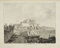 |
| 823 | CHARLE. 17me. Division militaire. Paris, Dandalle, 1823. Limites en col. d'époque. 530 x 525 mm. Carte de la Corse publiée dans "Atlas communal de la France par divisions militaires". Paris, Dandalle, 1823. Dessiné et confectionné par Charle, la topographie gravée par Thierry. Représente la Corse, divisée en arrondissements. Un tableau de part et d'autre de la carte indique les noms des arrondissemens, cantons et chef lieux de la Corse ainsi que les noms des établissemens, civils, militaires et religieux de la Corse. | 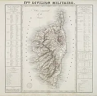 |
| 823.0 | DÉPÔT DE LA MARINE. Carte des Bouches de Bonifacio. Paris, 1823. Noir et blanc. 880 x 600 mm. Carte des Bouches de Bonifacio. Levé et Dressée en 1821 et 1822 par M. de Hell, Capitaine de Frégate, secondé par M. M. T. Deloffre et A. Mathieu. . .A. T. Allegro et E. Lapierre. Timbre du Dépôt des Cartes Plans de la Marine. | 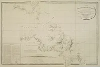 |
| 824.0 | JACOTIN, Pierre. Carte topographique de l'Ile de Corse / dressée par ordre du roi, d'après les opérations géodésiques et les levés du cadastre executés de 1770 a 1791 et dirigés par feu MM.. Testevuide et Bedigis... Paris, Département de la guerre, 1824. 2050 x 1190 mm. Carte topographique de l'Ile de Corse / dressée par ordre du roi, d'après les opérations géodésiques et les levés du cadastre executés de 1770 a 1791 et dirigés par feu MM. Testevuide et Bedigis ; gravée au Depôt-général de la guerre ... terminée sous la direction de M. le comte Guilleminot... Cette Carte a été dressée par Mr Jacotin... . - En carton : Carte des Triangles de la Corse, 1 : 1. 000. 000, par Tranchot ; carte générale servant à donner la position de l'Ile de Corse... 1 : 2. 500. 000 ; Tableau alphabétique des points trigonométriques de la Corse... ; Tableau des Arrondissemens, Cantons, Communes ou Mairies du Département de la Corse avec leur Population 1821, Superficie...
"La « Carte topographique de l’Île de Corse » permet aussi d’afficher les informations communales sur un fonds historique. Dressée selon les levés réalisés sous les ordres du colonel Tranchot de 1774 à 1790, elle est d’une échelle proche de celle de Cassini (1/100.000e), et est constituée de sept feuilles."
Carte des triangles de la Corse observée de 1773 à 1790 ... par Tranchot, scala 1:1000000, Carte génerale servant à donner la position de l'Ile de Corse.. |  |
| 825.0 | VOLNEY, C. F. Leçons d'histoire. Vol. 7. Paris, 1825. 200 x 140 mm. l'"Etat physique de la Corse" comprend le plan du "Port et Territoire d'Ajaccio", 190 x 240 mm. Le "Précis de l'état de la Corse" comprend la carte "Isle de Corse" gravée par Tardieu l'Ainé, 95 x 370 mm. | 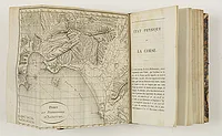 |
| 825.0 | HELL. Plan des Moines ou Monachi et de la partie adjacente de la Côte S.O. de l'Ile de Corse… Paris, Dépôt Général de la Marine, 1825. 455 x 595 mm. Pl. N° 104. Plan levé et dressé par M. Hell Capitaine de Frégate, dessiné par A.é Mathieu . | 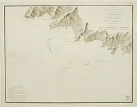 |
| 825.0 | BENSON, R. Sketches of Corsica. Londres, 1825. x mm. Première édition. Illustrée de 5 aquatintes dont 3 en sépia et une planche de costumes en couleurs "Corsican Mountaineers". L'ouvrage est dédié à Lord Arundell of Wardour. | 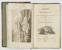 |
| 825.0 | VOLNEY, C. F. Leçons d'histoire. Histoire de Samuel. Etat physique de la Corse. Paris, 1825. 200 x 140 mm. Illustré de 2 cartes dépliantes : "Port et Territoire d'Ajaccio" et "Isle de Corse" gravée par Tardieu l'Ainé. | 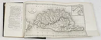 |
| 825.0 | VOLNEY, C. F. Leçons d'histoire. Vol. 7. Paris, 1825. 200 x 140 mm. Illustré de 2 cartes dépliantes : "Port et Territoire d'Ajaccio" et "Isle de Corse" gravée par Tardieu l'Ainé. | 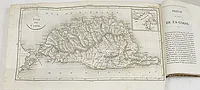 |
| 825.0 | HELL. Plan du mouillage de Propriano. - de Porto-Polo - de Campo-Moro. Paris, Dépôt Général de la Marine, 1825. 465 x 600 mm. Pl. n° 241. Plan levé et dressé par M. Hell Capitaine de Frégate, dessiné par A.é Mathieu. Publié dans "Pilote de l'Ile de Corse". Au Dépôt-Général de la Marine. 1831. Edition corrigée vers 1873. | 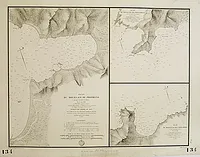 |
| 826.0 | HELL. Plan des Iles Sanguinaires. Paris, Dépôt Général de la Marine, 1826. 465 x 600 mm. Pl. n° 243. Levé en 1821 et 1822 par M. Hell Capitaine de Frégate. Dessiné par A.é Mathieu. Gravé par A. Tardieu. Ecrit par Besançon. Publié dans "Pilote de l'Ile de Corse". | 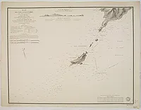 |
| 827.0 | HELL. Plan des Iles Cerbicale et du canal qui les sépare. Paris, Dépôt Général de la Marine, 1827. 600 x 465 mm. Pl. n° 261. Levé en 1820, par M. Hell Capitaine de Vaisseau. Gravé par A. Tardieu. Ecrit par Besançon. Publié dans "Pilote de l'Ile de Corse". | 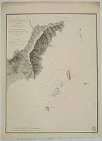 |
| 828.0 | ERSCH, Johann Samuel / GRUBER, Johann Gottfried. Corsica. Leipzig, 1828. 223 x 165 mm. Lithographié par Hertz et publié dans : " Zur Allgem. Encyclopaedie der Künste u. Wissensch. v. Ersch u. Gruber gehörig. Neue Geographie". L'encyclopédie fut publiée à Leipzig entre 1818 et 1889. | 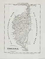 |
| 828.0 | HELL. Plan du golfe de Pinarello - du port de Favone - de Porto Nuovo. Paris, Dépôt Général de la Marine, 1828. 465 x 600 mm. Pl. n° 259. Plan levé et dressé par M. Hell Capitaine de Frégate, dessiné par A.é Mathieu. Gravé par A. Tardieu. Publié dans "Pilote de l'Ile de Corse". Au Dépôt-Général de la Marine. 1831. Edition corrigée vers 1873. | 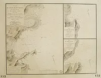 |
| 828.0 | HELL. Plan des mouillages situés à la côte septentrionale de l'Ile de Corse. Paris, Dépôt Général de la Marine, 1828. 455 x 590 mm. Pl. n° 254. Plan levé et dressé par M. Hell Capitaine de Frégate, dessiné par A.é Mathieu. Gravé par Boclet. Ecrit par Besançon. Publié dans "Pilote de l'Ile de Corse". Au Dépôt-Général de la Marine. 1831. Edition corrigée vers 1873. | 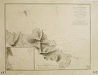 |
| 828.0 | HELL. Plan du golfe de St. Florent. Paris, Dépôt Général de la Marine, 1828. 460 x 600 mm. Pl. n° 253. Levé et dressé en 1822 et 1824 par M. Hell Capitaine de Vaisseau. Gravé par Chassant. Ecrit par Besançon. Publié dans "Pilote de l'Ile de Corse". | 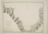 |
| 829.0 | HELL. Plan du danger de l'Algajola - du port de Malfalco - du port et de la côte de Centuri. Paris, Dépôt Général de la Marine, 1829. 450 x 595 mm. Pl. n° 250. Plan levé et dressé par M. Hell Capitaine de Frégate, dessiné par A.é Mathieu. Gravé par Chassant. Ecrit par Besançon. Publié dans "Pilote de l'Ile de Corse". Au Dépôt-Général de la Marine. 1831. Edition corrigée vers 1873. | 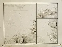 |
| 829.0 | HELL. Carte de la côte N.O. de l'île de Corse. Paris, Dépôt Général de la Marine, 1829. 450 x 550 mm. Pl. n° 248. Plan levé et dressé par M. Hell Capitaine de Frégate, dessiné par A.é Mathieu. Gravé par Chassant. Ecrit par Besançon. Publié dans "Pilote de l'Ile de Corse". Au Dépôt-Général de la Marine. 1831. Edition corrigée vers 1873. | 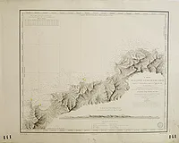 |
| 829.0 | HELL. Plan du mouillage de l'Ile Rousse. Paris, Dépôt Général de la Marine, 1829. 460 x 590 mm. Pl. n° 251. Plan levé et dressé par M. Hell Capitaine de Frégate, dessiné par A.é Mathieu. Gravé par Hennequin. Ecrit par Besançon. Publié dans "Pilote de l'Ile de Corse". Au Dépôt-Général de la Marine. 1831. Edition corrigée vers 1873. | 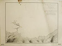 |
| 829.0 | HELL. Plan des golfes de Calvi et de Revellata. Paris, Dépôt Général de la Marine, 1829. 470 x 620 mm. Pl. n° 249. Plan levé et dressé par M. Hell Capitaine de Frégate, dessiné par A.é Mathieu. Gravé par Michel. Ecrit par Besançon. Publié dans "Pilote de l'Ile de Corse". Au Dépôt-Général de la Marine. 1831. Edition corrigée vers 1873. | 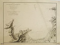 |
| 829.0 | HELL. Plan du golfe et du port de Galéria. Paris, Dépôt Général de la Marine, 1829. 590 x 460 mm. Pl. n° 247. Plan levé et dressé par M. Hell Capitaine de Frégate, dessiné par A.é Mathieu. Gravé par Barrière jeune. Ecrit par Hacq. Publié dans "Pilote de l'Ile de Corse". Au Dépôt-Général de la Marine. 1831. Edition corrigée vers 1873. | 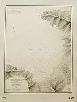 |
| 829.0 | HELL. Plan du mouillage de Sagone. Paris, Dépôt Général de la Marine, 1829. 465 x 600 mm. Pl. n° 245. Plan levé et dressé par M. Hell Capitaine de Frégate, dessiné par A.é Mathieu. Gravé par Chassant. Ecrit par Hacq. Publié dans "Pilote de l'Ile de Corse". Au Dépôt-Général de la Marine. 1831. Edition corrigée vers 1873. | 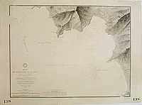 |
| 830.0 | DUFOUR. Département de la Corse. Paris, Basset, 1830. Limites en col. ancien. 755 x 530 mm. Carte dressée par A. H. Dufour, accompagnée d'une notice statistique par A. Guibert, gravée par Lallemand. Publiée dans l"Atlas départemental de la France". |  |
| 830.0 | HELL. Plan du golfe de Lava - Plan du golfe et du port de Girolata. Paris, Dépôt Général de la Marine, 1830. 610 x 470 mm. Pl. n° 246. Plan levé et dressé par M. Hell Capitaine de Frégate, dessiné par A.é Mathieu. Gravé par Lecoq. Ecrit par Hacq. Publié dans "Pilote de l'Ile de Corse". Au Dépôt-Général de la Marine. 1831. Edition corrigée vers 1873. | 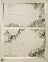 |
| 831.0 | HELL. Carte générale de l'île de la Corse. Paris, 1831. 600 x 920 mm. Carte générale de l'île de Corse représentant également la partie septentrionale de la Sardaigne. Dressée... pour la Partie Hydrographique d'après les travaux exécutés en 1820, 1821, 1822 et 1824 sous les Ordres de Mr. Hell, Capitaine de Vaisseau. | 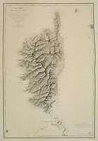 |
| 831.0 | HELL. Carte des Bouches de Bonifacio. Paris, 1823-1831. 650 x 940 mm. Carte des Bouches de Bonifacio. Levée et dressée en 1821 et 1822 par Mr. de Hell, Capitaine de Frégate. Carte avec ajouts de lignes à l'encre rouge. | 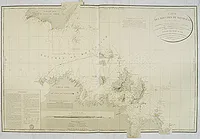 |
| 831.0 | HELL. Plan des Moines ou Monachi et de la partie adjacente de la Côte S.O. de l'Ile de Corse… Paris, Dépôt Général de la Marine, 1825-1831. 465 x 605 mm. Pl. n° 240. Plan levé et dressé par M. Hell Capitaine de Frégate, dessiné par A.é Mathieu. Publié dans "Pilote de l'Ile de Corse". Au Dépôt-Général de la Marine. 1831. Annotations manuscrites près du titre et tracés au crayon sur la carte. Il s'agit d'un rapport (ordre de mission 221) qui indique les écueils. | 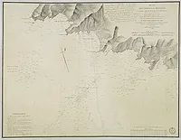 |
| 831.0 | HELL. (Pilote de l'Ile de Corse). Ensemble de 18 cartes. Paris, Dépôt Général de la Marine, 1831. 665 x 530 mm. Série de 18 cartes issues du "Pilote de l'Ile de Corse", levées et dressées par M. Hell Capitaine de Frégate, dessinées par A.é Mathieu et gravées par Ambroise Tardieu, Chocarne, Michel, Boclet, Chassant, Hennequin. | 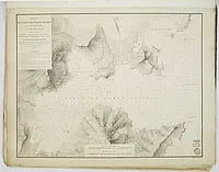 |
| 831.0 | HELL. Vue de la côte de Corse depuis la pte de Latoniccia jusques au Cap Pertusato… (3 profils). Paris, Dépôt Général de la Marine, 1831. 600 x 460 mm. Pl. n° 262. Plan levé et dressé par M. Hell Capitaine de Frégate, dessiné par A.é Mathieu. Gravé par Michel. Publié dans "Pilote de l'Ile de Corse". Au Dépôt-Général de la Marine. 1831. Edition corrigée vers 1873. | 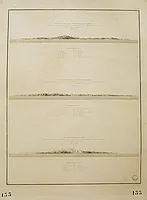 |
| 831.0 | HELL. 1ère vue servant de reconnaissance aux Bouches de Bonifacio en venant de l'O.S.O. (4 profils). Paris, Dépôt Général de la Marine, 1831. 605 x 460 mm. Pl. n° 263. Plan levé et dressé par M. Hell Capitaine de Frégate, dessiné par A.é Mathieu. Gravé par Michel. Publié dans "Pilote de l'Ile de Corse". Au Dépôt-Général de la Marine. 1831. Edition corrigée vers 1873. |  |
| 834 | ALMANACH. Le Vrai double Matthieu Laensberg ou le bon astrologue pour 1834. Lille, Castiaux, 1834. 101 x 62 mm. Le Vrai double Matthieu Laensberg ou le bon astrologue pour 1834, contenant les prophéties relatives aux saisons, des prédictions générales et particulières pour 1834, des recettes utiles, des anecdotes littéraires, curieuses et scientifiques, des conseils pour conserver la santé, des notes instructives, etc. Illustré d'une planche dépliante figurant 5 départements : la Manche, la Corse, le Finistère, le Loiret et la Saône-et-Loire. 


 | 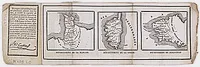 |
| 835.0 | MONIN, P. Corse. Paris, 1835. 200 x 130 mm. Publiée dans la "France pittoresque". Gravé par Laguillermie et Ramboz. Ornée d'une vignette représentant la Citadelle de Corte. | 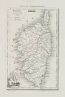 |
| 835.0 | MONIN, Ch. V. Corse. N°19. Paris, 1835. 238 x 188 mm. Carte N°19 du Petit atlas national. | 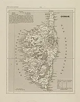 |
| 838.0 | HELL / ADMIRALTY CHART. The Island of Corsica surveyed by M. Hell, Capitaine de Vaisseau. 1831, Hydrographical Office, 1838. 470 x 615 mm. Carte de Corse dressée par Hell publiée en anglais par le "Hydrographical Office"en 1838. Carte générale de Corse avec indication des fonds marins, accompagnée de 11 cartons figurant les baies et golfes de Corse : Calvi, Santo Fiorenzo, Porto Vecchio, Ajaccio, Bastia... | 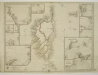 |
| 840.0 | SOCIETE DE GENS DE LETTRES, DE GEOGRAPHES ET D'ARTISTES. Panorama pittoresque de la France. Département de la Corse. Paris, ca. 1840. 230 x 145 mm. Livraison illustrée de 16 vues de Corse, 3 gravures de Napoléon et 1 carte gravées sur acier. |  |
| 840.0 | MONIN. Corse. Paris, 1840. Col. ancien. 240 x 191 mm. Carte N°19 publiée dans le "Petit Atlas National" par Blaisot. Gravé sur acier par Ales. 
 |  |
| 841.0 | DONNET, A. / FREMIN, A. R. / LEVASSEUR. Département de la Corse. Region sud est N°19. Paris, 1841. Limites en col. d'époque. 715 x 505 mm. Carte ornée en haut à gauche d'une vue d'Ajaccio, en bas à gauche d'un carton donnant la position de la Corse à l'égard des Côtes de France, d'Italie et d'Espagne. Accompagnée d'une explication des signes, d'un texte de statistique et d'un tableau des Cantons. |  |
| 841 | DONNET and MONIN. Département de la Corse. Paris, M. B. Dusillon, ca. 1841. Limites en col. ancien. 675 x 480 mm. Carte du département de la Corse publiée dans "Atlas Général de France", divisé par départements par Donnet et Monin, ingénieurs géographes, avec Armes et Vues de Chapuy, gravées sur cuivre et sur acier par Artus, Malo, Bénard, Traversier. Paris, chez M.B. Dusillon [1841]. Chaque carte est ornée d’une vue du chef-lieu du département et d’un texte statistique relatif à l’administration, l’agriculture, l’industrie, le commerce ainsi qu’aux monuments et personnages célèbres. Alexis Donnet : Géographe attaché au Cadastre, il est à l'origine d'une abondante oeuvre cartographique souvent rééditée. A ses cartes de France et des environs de Paris s'ajoutent des cartes d'Italie et de la péninsule ibérique, et des cartes concernant les nouvelles lignes de chemins de fer. |  |
| 844.0 | MAINA, G / STANGHI, V. Carta antica dell'isola di Corsica. Florence, ca.1844. Limites en col. ancien. 535 x 350 mm. |  |
| 844.0 | MAINA, G / STANGHI, V. Carta moderna dell'isola di Corsica. Florence, ca.1844. Limites en col. ancien. 530 x 350 mm. Carte de la Corse publiée dans "Atlante Geografico dell Italia" | 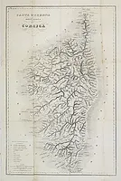 |
| 844.0 | MAINA, G / STANGHI, V. Carta moderna dell'isola di Corsica. Florence, ca.1844. Limites en col. ancien. 530 x 350 mm. |  |
| 844.0 | MAINA, G. Carta antica dell'isola di Corsica. Florence, ca.1844. Limites en col. ancien. 540 x 355 mm. Carte de la Corse antique publiée dans "Atlante Geografico dell Italia" | 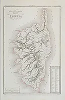 |
| 844.0 | MAINA, G. / STANGHI, V. Carta moderna dell' isola di Corsica. Florence, ca.1844. Limites en col. ancien. 535 x 350 mm. Carte de la Corse publiée dans "Atlante Geografico dell Italia" | 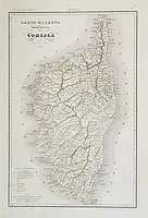 |
| 845.0 | ANONYME La Corse. 1845. Col. 172 x 103 mm. | 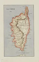 |
| 845 | PARETO, Lorenzo (Marquis). Cenni geognostici sulla Corsica. Milan, Luigi di Giacomo Pirola, 1845. Col. ancien. 298 x 222 mm. Etude consacrée à la Corse, publiée dans la revue scientifique "Atti della Sesta Riunione degli scienziati italiani tenuta in Milano nel settembre del 1844". Illustrée d'une carte géologique dépliante "Schizzo di Carta Geologica della Corsica" (Tavola III) et d'une planche de coupes géologiques dépliante (Tavola IV) lithographiée et coloriée au pochoir. Lorenzo Nicolò Pareto né à Gênes, le 6 décembre 1800, mort le 19 juin 1865 à Gênes, est un géologue, homme politique et ministre des Affaires étrangères du Royaume de Sardaigne sous le règne de Charles-Albert de Sardaigne. Il est considéré comme l'un des pères de la géologie moderne.  | 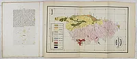 |
| 848.0 | COWEN, William . Six weeks in Corsica. Londres, T. C. Newby, 1848. x mm. "Le plus rare de tous les récits de voyageurs anglais au XIXe siècle, surtout dans la reliure de l'éditeur". Le même ouvrage a été catalogué dans la vente de la bibliothèque corse de François Flori. - Illustrated with fourteen highly finished etchings. - Dedicated by permission to the right honorable the earl Fitzwilliam. |  |
| 850.0 | ANONYME Carta moderna dell'isola di Corsica. Ca. 1850. Col. ancien. 540 x 355 mm. | 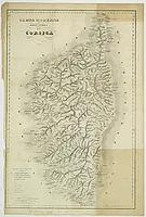 |
| 850.0 | NAYMILLER. Corsica. Milan, Franceso Pagnoni, ca. 1850. Limites en col. ancien. 420 x 320 mm. Carte gravée par Allodi comprenant un cartouche représentant l'Ile de Malte. | 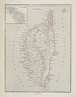 |
| 850 | MANTERO. De Paoli. Ca. 1850. 220 x 142 mm. Portrait de Pasquale Paoli. "Il s'agit du buste de Paoli gravé par l'un des membres de la famille Mantero, originaire de Gênes, connue essentiellement grâce aux sculpteurs Bernardino et son fils Sebastiano. C'est la gravure de Bonneville qui a servi de modèle." (Musée de la Corse). | 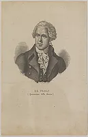 |
| 852.0 | LEVASSEUR, V. Dépt. De La Corse. N°19. Paris, A. Combette, 1852. Col. 410 x 285 mm. Carte du département de la Corse. Jeune ingénieur géographe du milieu du XIXe siècle, Victor Levasseur est surtout connu pour son Atlas National Illustré des 86 Départements et des Possessions de La France, où sont représentés les départements français ainsi que les colonies françaises d'Amérique, d'Afrique, d'Asie. Son travail de cartographie est apprécié pour les décorations caractéristiques entourant les cartes plutôt que pour le détail des cartes elle-mêmes. Son fils, l'illustre Pierre Émile Levasseur, devint économiste et géographe. Précieux témoignage du XIXe siècle, les cartes coloriées à la main sont entourées de gravures indiquant statistiques, notes historiques et illustrations caractéristique des départements. Sur ces cartes sont représentées les routes, voies ferrées et voies d'eaux. Par ailleurs, les départements sont divisés en arrondissements, cantons et communes. Ce travail fut réalisé d'après les Travaux du Cadastre du Dépôt de la Guerre et des Ponts et Chaussées. Cet ouvrage était autrefois essentiellement utilisé dans les mairies. Imprimé à plusieurs reprise entre 1838 et 1870. | 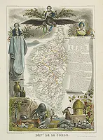 |
| 852.0 | LEVASSEUR, V. Dépt. De La Corse. N°19. Paris, A. Combette, 1852. Limites en col. ancien. 410 x 285 mm. Carte du département de la Corse. Jeune ingénieur géographe du milieu du XIXe siècle, Victor Levasseur est surtout connu pour son Atlas National Illustré des 86 Départements et des Possessions de La France, où sont représentés les départements français ainsi que les colonies françaises d'Amérique, d'Afrique, d'Asie. Son travail de cartographie est apprécié pour les décorations caractéristiques entourant les cartes plutôt que pour le détail des cartes elle-mêmes. Son fils, l'illustre Pierre Émile Levasseur, devint économiste et géographe. Précieux témoignage du XIXe siècle, les cartes coloriées à la main sont entourées de gravures indiquant statistiques, notes historiques et illustrations caractéristique des départements. Sur ces cartes sont représentés les routes, voies ferrées et voies d'eaux. Par ailleurs, les départements sont divisés en arrondissements, cantons et communes. Ce travail fut réalisé d'après les Travaux du Cadastre du Dépôt de la Guerre et des Ponts et Chaussées. Cet ouvrage était autrefois essentiellement utilisé dans les mairies. Imprimé à plusieurs reprise entre 1838 et 1870. | 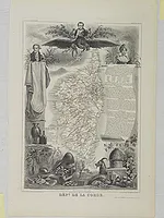 |
| 852.0 | LEVASSEUR, V. Dépt. De La Corse. N°19. Paris, A. Combette, 1852. Limites en col. d'époque. 413 x 291 mm. Carte du département de la Corse. Jeune ingénieur géographe du milieu du XIXe siècle, Victor Levasseur est surtout connu pour son Atlas National Illustré des 86 Départements et des Possessions de La France, où sont représentés les départements français ainsi que les colonies françaises d'Amérique, d'Afrique, d'Asie. Son travail de cartographie est apprécié pour les décorations caractéristiques entourant les cartes plutôt que pour le détail des cartes elles-mêmes. Son fils, l'illustre Pierre Émile Levasseur, devint économiste et géographe. Précieux témoignage du XIXe siècle, les cartes coloriées à la main sont entourées de gravures indiquant statistiques, notes historiques et illustrations caractéristique des départements. Sur ces cartes sont représentés les routes, voies ferrées et voies d'eaux. Par ailleurs, les départements sont divisés en arrondissements, cantons et communes. Ce travail fut réalisé d'après les Travaux du Cadastre du Dépôt de la Guerre et des Ponts et Chaussées. Cet ouvrage était autrefois essentiellement utilisé dans les mairies. Imprimé à plusieurs reprise entre 1838 et 1870. | 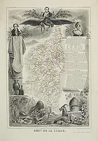 |
| 852.0 | LEVASSEUR, V. Dépt. De La Corse. N°19. Paris, A. Combette, 1852. Limites en col. d'époque. 410 x 285 mm. Carte du département de la Corse. Jeune ingénieur géographe du milieu du XIXe siècle, Victor Levasseur est surtout connu pour son Atlas National Illustré des 86 Départements et des Possessions de La France, où sont représentés les départements français ainsi que les colonies françaises d'Amérique, d'Afrique, d'Asie. Son travail de cartographie est apprécié pour les décorations caractéristiques entourant les cartes plutôt que pour le détail des cartes elle-mêmes. Son fils, l'illustre Pierre Émile Levasseur, devint économiste et géographe. Précieux témoignage du XIXe siècle, les cartes coloriées à la main sont entourées de gravures indiquant statistiques, notes historiques et illustrations caractéristique des départements. Sur ces cartes sont représentées les routes, voies ferrées et voies d'eaux. Par ailleurs, les départements sont divisés en arrondissements, cantons et communes. Ce travail fut réalisé d'après les Travaux du Cadastre du Dépôt de la Guerre et des Ponts et Chaussées. Cet ouvrage était autrefois essentiellement utilisé dans les mairies. Imprimé à plusieurs reprise entre 1838 et 1870. | 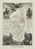 |
| 852 | LEVASSEUR, V. Dépt. De La Corse. N°19. Paris, A. Combette, 1852. Limites en col. ancien. 410 x 285 mm. Map of the Corsica island. Lovely map from one of the last decorative atlases of the nineteenth century. The rather simple map is framed by elaborate border showing regional costume, produce and local historical figures - dominated here by Napoleon. Victor Levasseur's "Atlas National Illustré" and "Atlas Universel Illustré" are among the last great decorative atlases published. This map comes from the Atlas National Illustré. | 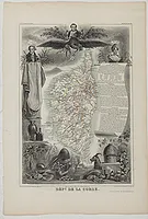 |
| 853.0 | INDUSTRIE MINERALE 11ème Année. Forges de Toga (Corse). 1853. 245 x 365 mm. Intéressante carte géologique de Corse représentant également l'usine de Toga. | 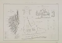 |
| 857.0 | LA ROCCA, Jean de. La Corse et son avenir. Paris, 1857. x mm. Ouvrage dédié à M. Lonneau premier médecin de sa Majesté l'Empereur. Avec une carte dépliante du Département de la Corse dressée par A. H Dufour et corrigée par V. Clérot. |  |
| 858 | FORESTER, Thomas. Rambles in the islands of Corsica and Sardinia. Londres, Longman, 1858. x mm. Première édition. Les lithographies par M. & N. Hanhart d'après des dessins du Lt.-Col. M.A. Biddulph. Elles représentent Ajaccio, Ersa, Capo Corso, Corte, Vivario, Bonifaccio, Valley of the Liscia/Sardinia, the Himbara, from Tempio (dépliante) et the Plain of Ozieri. | 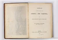 |
| 860.0 | Atlas de la France. Corse. 19. Paris, ca. 1860. 335 x 233 mm. Carte de Corse dans un médaillon central surmonté d'un portrait de Napoléon, elle est entourée d'explications et de remarques concernant l'économie, la géographie et l'histoire de la Corse. | 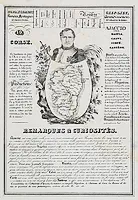 |
| 860 | HELL. Carta esférica de las bocas de Bonifacio. Madrid, 1860. Noir et blanc. 605 x 930 mm. Carte figurant les Bouches de Bonifacio gravée par I. Tubau, publiée sous la "Direccion de Hidrografia". | 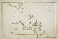 |
| 861 | LAMBERTI, Luigi. Piano del Golfo di Calvi / S. Fiorenzo / Bastia / Porto Vecchio / Bonifazio / Valinco / Ajaccio. Pise, 1861. 160 x 213 mm. Rare ensemble de 7 plans nautiques de ports et de rades de la Corse publiés dans "Nuova Edizione dell'opera Raccolta dei più interessanti Piani dei Porti e delle Rade dei Mari Mediterraneo, Adriatico, Arcipelago; Mar Nero e Mar d'Azof. Compilata da Luigi Lamberti, professore di Nautica, sulle più recenti osservazioni delle Marine Francese e Inglese, con le debite correzioni intorno la variazione della bussola". Tomaso Santoni inc. In Pisa 1861. | 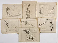 |
| 863 | IMRAY, J. Western portion of the Mediterranean sea compiled from the most recent surveys. Londres, James Imray and Son,1863. 1020 x 1910 mm. Monumentale carte marine figurant la partie occidentale de la Méditerranée avec la Corse, la Sicile, la Sardaigne, les Baléares et Malte. Illustrée de 16 cartons représentant le détroit de Messine, le détroit de Bonifacio, le détroit de Gibraltar ainsi que les ports de Marseille, Barcelone, Carthagène et Malaga. |  |
| 869.0 | HELL. Plan des Iles Cerbicale et du canal qui les sépare… Paris, Dépôt Général de la Marine, 1827-1869. 600 x 465 mm. Pl. n° 261. Plan levé et dressé par M. Hell Capitaine de Frégate, dessiné par A.é Mathieu. Gravé par A. Tardieu. Ecrit par Besançon. Publié dans "Pilote de l'Ile de Corse". Au Dépôt-Général de la Marine. 1831. Edition corrigée vers 1873. | 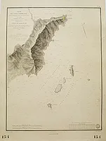 |
| 870.0 | PERRONE, G. Corsica. Turin, 1870. Col. ancien. 509 x 305 mm. Carte de la Corse figurant les reliefs et les sondes. Nord en haut. | 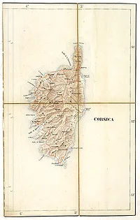 |
| 870 | LEAR, Edward. Journal of a Landscape Painter in Corsica.1868. Robert John Bush, Londres, 1870. x mm. Première édition. Illustrée de 40 planches gravées sur bois dont une carte de la Corse à pleine page. Les gravures sur bois furent réalisées sous le contrôle d'Edward Lear. Le Journal d’Edward Lear lors de son voyage en Corse en 1868 est un guide qui décrit toutes les beautés de la Corse. Joint : traduction française par Véronique Emmanuelli.  | 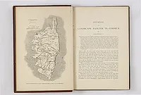 |
| 871 | COUCHE, Louis-François / HACQ, J.M. Tableau Géographique et Statistique du département de la Corse. (N°19). Paris, Baudouin Frères, 1871. Limites en col. d'époque. 232 x 180 mm. Carte de Corse encadrée d'un texte descriptif relatif à la géographie, l'administration, la statistique, l'industrie…de la Corse. Publiée dans " Atlas géographique et statistique des départements de la France". |  |
| 872.0 | DÉPÔT GÉNÉRAL DE LA MARINE. Carte de la partie de la Méditerranée comprise entre la côte d'Italie, du canal de Piombino au golfe de Naples, la Corse et la Sardaigne. Paris, 1864-1872. 620 x 960 mm. Dressée d'après les levés faits de 1846 à 1857 sous la direction successive de feu Mr. Le Bourguignon-Duperré... Publiée par ordre de l'Empereur, sous le Ministère de S.E.Mr. le C.te de Chasseloup-Laubat... 1864. Carte amendée en 1872 avec ajouts de lignes concentriques gravées en bistre indiquant la portée des feux et de lignes au crayon et à l'encre rouge. |  |
| 873.0 | HELL. Plan des Iles Sanguinaires. Paris, Dépôt Général de la Marine, 1826-1873. 465 x 600 mm. Pl. n° 243. Plan levé et dressé par M. Hell Capitaine de Frégate, dessiné par A.é Mathieu. Gravé par A. Tardieu. Ecrit par Besançon. Publié dans "Pilote de l'Ile de Corse". Au Dépôt-Général de la Marine. 1831. Etiquette du libraire qui vend les cartes du "Dépôt des cartes de la marine" collée en bas à droite: "J. Trabaud, Libraire Quai de Rive-Neuve, 4 (avant le Pont), Marseille." |  |
| 873.0 | HELL. Plan des Iles Sanguinaires. Paris, Dépôt Général de la Marine, 1826-1873. 465 x 600 mm. Pl. n° 243. Plan levé et dressé par M. Hell Capitaine de Frégate, dessiné par A.é Mathieu. Gravé par A. Tardieu. Ecrit par Besançon. Publié dans "Pilote de l'Ile de Corse". Au Dépôt-Général de la Marine. 1831. Edition corrigée vers 1873. | 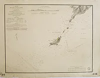 |
| 873.0 | HELL. Plan du golfe de Porto Vecchio. Paris, Dépôt Général de la Marine, 1828-1873. 455 x 590 mm. Pl. n° 260. Plan levé et dressé par M. Hell Capitaine de Frégate, dessiné par A.é Mathieu. Gravé par Chocarne. Ecrit par Besançon. Publié dans "Pilote de l'Ile de Corse". Au Dépôt-Général de la Marine. 1831. Edition corrigée vers 1873. | 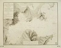 |
| 873.0 | HELL. Plan du golfe de Porto Vecchio. Paris, Dépôt Général de la Marine, 1828-1873. 455 x 590 mm. Plan levé et dressé par M. Hell Capitaine de Frégate, dessiné par A.é Mathieu. Gravé par Chocarne. Ecrit par Besançon. Publié dans "Pilote de l'Ile de Corse". Au Dépôt Général de la Marine. 1831. Edition corrigée vers 1873. | 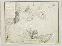 |
| 873.0 | HELL. Plan de la côte de Bastia et du mouillage de la pointe d'Arco. Paris, Dépôt Général de la Marine, 1830-1873. 460 x 620 mm. Pl. n° 255. Plan levé et dressé par M. Hell Capitaine de Frégate, dessiné par A.é Mathieu. Gravé par Chocarne. Ecrit par Besançon et Hacq. Accompagné d'un profil de la côte. Publié dans "Pilote de l'Ile de Corse". Au Dépôt-Général de la Marine. 1831. Edition corrigée vers 1873. | 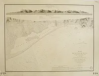 |
| 873.0 | HELL. Plan du golfe de St. Florent. Paris, Dépôt Général de la Marine, 1828-1873. 460 x 600 mm. Pl. n° 253. Plan levé et dressé par M. Hell Capitaine de Frégate, dessiné par A.é Mathieu. Gravé par Chassant. Ecrit par Besançon. Publié dans "Pilote de l'Ile de Corse". Au Dépôt-Général de la Marine. 1831. Edition corrigée vers 1873. | 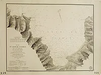 |
| 874.0 | HELL. Plan des mouillages situés au fond du golfe d'Ajaccio. Paris, Dépôt Général de la Marine, 1825-1874. 465 x 600 mm. Pl. n° 242. Plan levé et dressé par M. Hell Capitaine de Frégate, dessiné par A.é Mathieu. Gravé par A. Tardieu. Ecrit par Besançon. Publié dans "Pilote de l'Ile de Corse". Au Dépôt-Général de la Marine. 1831. Edition corrigée vers 1873. | 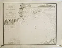 |
| 874.0 | HELL. Plan des mouillages situés au fond du golfe d'Ajaccio. Paris, Dépôt Général de la Marine, 1825-1874. 465 x 600 mm. Plan levé et dressé par M. Hell Capitaine de Frégate, dessiné par A.é Mathieu. Gravé par A. Tardieu. Ecrit par Besançon. Publié dans "Pilote de l'Ile de Corse". Au Dépôt Général de la Marine. 1831. Edition corrigée vers 1873. | 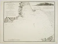 |
| 874.0 | HELL. Plan des mouillages situés au fond du golfe d'Ajaccio. Paris, Dépôt Général de la Marine, 1825-1874. 465 x 600 mm. Pl. n° 242. Plan levé et dressé par M. Hell Capitaine de Frégate, dessiné par A.é Mathieu. Gravé par A. Tardieu. Ecrit par Besançon. Publié dans "Pilote de l'Ile de Corse". Au Dépôt-Général de la Marine. 1831. Edition de 1859. | 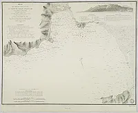 |
| 874.0 | ROBIQUET. Carte de la Côte d'Italie comprise entre Nice et Civita-Vecchia Golfe de Gênes... Paris, 1874. 670 x 1000 mm. Carte dressée d'après les travaux de M.M. Le Bourguignon-Duperré, Begat, de Hell, Albini &. Par Robiquet hydrographe.
Entourée de plans de villes : Civita-Vecchia, Livourne, Gènes et Nice. Carte avec ajouts de lignes concentriques gravées indiquant la portée des feux et de lignes au crayon et à l'encre rouge. Figure le nord de l'île de Corse jusquà la pointe Capigtiolo. | 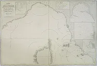 |
| 874.0 | HELL. Plan des Moines ou Monachi et de la partie adjacente de la Côte S.O. de l'Ile de Corse… Paris, Dépôt Général de la Marine, 1825-1874. 465 x 605 mm. Pl. n° 240. Plan levé et dressé par M. Hell Capitaine de Frégate, dessiné par A.é Mathieu. Publié dans "Pilote de l'Ile de Corse". Au Dépôt-Général de la Marine. 1831. Edition corrigée vers 1873. | 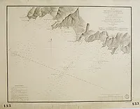 |
| 875.0 | HELL. Carte générale de l'île de la Corse. Paris, 1831-1875. 610 x 920 mm. Carte générale de l'île de Corse représentant également la partie septentrionale de la Sardaigne. Dressée... pour la Partie Hydrographique d'après les travaux exécutés en 1820, 1821, 1822 et 1824 sous les Ordres de Mr. Hell, Capitaine de Vaisseau. Carte amendée en 1875 avec ajouts de lignes concentriques gravées en bistre indiquant la portée des feux. | 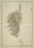 |
| 875.0 | HELL. Carte générale de l'île de la Corse. Paris, 1831-1875. 610 x 920 mm. Carte générale de l'île de Corse représentant également la partie septentrionale de la Sardaigne. Dressée... pour la Partie Hydrographique d'après les travaux exécutés en 1820, 1821, 1822 et 1824 sous les Ordres de Mr. Hell, Capitaine de Vaisseau. Carte amendée en 1875 avec ajouts de lignes concentriques gravées en bistre indiquant la portée des feux. | 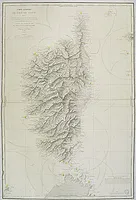 |
| 879.0 | SCHEDA, J. (Corse). XVI. Vienne, Expeditions-Bureau, 1879. Limites en col. d'époque. 495 x 555 mm. Carte figurant la Corse jusqu'au golfe de Valinco avec la côte italienne et l'île d'Elbe. Ornée d'une bordure d'encadrement. | 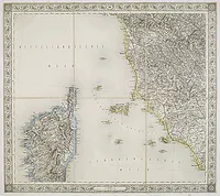 |
| 880.0 | ANONYME Corse. Paris, ca. 1880. Col. 80 x 110 mm. Jolie petite carte de Corse en couleurs illustrée de 8 vignettes représentant les villes et sites importants de Corse. Extrait de la Géographie de la Corse, par Ad. Joanne. Au verso : "Département de la Corse" avec un texte descriptif. |  |
| 883.0 | DÉPOT DE LA MARINE. Carte de la Partie de la Méditerranée comprise entre la côte d'Italie, du canal de Piombino au golfe de Naples, la Corse et la Sardaigne.. N° 2122 Paris, [1864] corrigé en 1883. 610 x 900 mm. Représente la côte orientale de la Corse et de la Sardaigne. Titre complet: "Carte de la partie de la Méditerranée comprise entre la côte d’Italie, du Canal de Piombino au Golfe de Naples. La Corse et la Sardaigne Dressée d’après les levés faits de 1846 à 1857 sous la direction successive de feu Mr. Le Bourgignon-Duperré, Ingénieur hydrographe de 4e classe de la légion d’honneur, Mr. Bégat, alors ing. Hyd. de 4e classe… Publiée par ordre de l’Empereur, sous le Ministère de S. E. Mr Comte de Chasse-Loup-Laubat… au Dépôt des cartes et Plans de la Marine en 1884". Gravée par E. Collin, la lettre par V. Carré. Corrigé en 1883. |  |
| 883.0 | DÉPÔT DE LA MARINE. Carte de la Partie de la Méditerranée comprise entre la côte d'Italie, du canal de Piombino au golfe de Naples, la Corse et la Sardaigne. . . N° 2122. Paris, 1864 corrigé en juin 1883. 642 x 987 mm. Carte marine figurant la côte italienne depuis Piombino jusqu'à Naples, l'île d'Elbe, la côte est de la Corse et nord-est de la Sardaigne. Titre complet: "Carte de la partie de la Méditerranée comprise entre la côte d’Italie, du Canal de Piombino au Golfe de Naple la Corse et la Sardaigne Dressée d’après les levés faits de 1846 à 1857 sous la direction successive de feu Mr. Le Bourgignon-Duperré, Ingénieur hydrographe de 4e classe de la légion d’honneur, Mr. Bégat, alors ing. Hyd. De 4e classe… Publiée par ordre de l’Empereur, sous le Ministère de S. E. Mr Comte de Chasse-Loup-Laubat… au Dépôt de la Marine et des colonies au Dépôt de la Marine en 1864". Gravée par E. Collin, la lettre par V. Carré.
- A detailed chart of Corsica and of Sardinia. With latitude and longitude scales, soundings, rocks, shoals, safe harbours indicated in orange ink. Engraved by E. Collin, letter engraved by V. Carré. Corrections made in 1935. |  |
| 889.0 | DEPOT DE LA GUERRRE. Corse. Paris, 1889. x mm. Une carte générale, 17 cartes régionales et 2 petites cartes manuscrites "Carte d'Etat-major de la Corse". Les cartes sont levées par les Officiers du Corps d'Etat-major. Gravées : le trait par Rouillard, la lettre par Carré, le figuré du terrain par Labelle, les eaux par Beaupré. Contenu : carte générale, Corte en 4 ff. (complet), Bastelica en 4 ff. (complet), Sartène en 4 ff. (complet), Ajaccio en 2 ff., Vico en 2 ff., Porto Pollo en 1 f. et 2 petites cartes d'Etat-major au 1/80 000. |  |
| 890.0 | ANONYME Allineamento per la delimitazione della pesca nelle Bocche di Bonifacio. Italie, ca. 1890. 344 x 470 mm. Carte qui figure la délimitation de la pêche dans les Bouches de Bonifacio. | 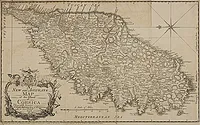 |
| 891.0 | PRINCE ROLAND BONAPARTE. Une Excursion en Corse. Paris, Imprimé pour l'auteur, 1891
1891Imprimé pour l'auteur
1891. x mm. llustré de 6 héliogravures hors texte. | 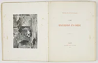 |
| 891.0 | BONAPARTE, Prince Roland / BERGERAT, Emile. Une excursion en corse. / La chasse au mouflon en Corse, ou petit voyage philosophique. Paris, l'auteur & Delagrave, 1891. x mm. Deux narrations d'un même voyage : BONAPARTE : Une intéressante bibliographie d'ouvrages relatifs à la Corse occupe les pp.141 à 273. BERGERAT : La chasse ne tient qu'une place secondaire et assez fantaisiste dans cet amusant voyage. |  |
| 892 | ANDREI, A. Les Étapes d'un touristes en France. A travers la Corse. Paris, A. Hennuyer, 1892. 182 x 120 mm. Première édition. Illustrée de gravures sur bois et d'une carte dépliante de la Corse par E. Morieu. |  |
| 893.0 | ADMIRALTY CHART Bonifacio Strait from an Italian Government Survey, 1879. The South Coast of Corsica with the adjacent islands and rocks from a French Government Survey 1884. . . Londres, 1879 -1893. 645 x 970 mm. Carte marine figurant le détroit de Bonifacio avec le sud de la Corse et le nord de la Sardaigne. Carte dressée d'après des relevés établis par le gouvernement italien en 1879 puis par le gouvernement français en 1884 et amendée en 1885 et 1893 pour l'Amirauté. Elle représente les fonds marins, les bancs de sable et les variations de la boussole. Une étiquette rose publicitaire collée au-dessu du titre précise le nom du marchand qui vend ce type de cartes : I. Bianchetti Opticien 2 rue de la République, Marseille. Cartes de Navigation Anglaises et Françaises.
Detailed chart of the southern Corsican coast with adjacent islands and rocks. Map is taken from an Italian Government Survey dated 1879. Published at the Admiralty 5th May 1883 under the superintendence of Captain Sir Frederick J. Evans, Hydrographer. Large corrections made on January 1885 and February 1893. Above the title a pink illustrated label : I. Bianchetti Opticien 2 rue de la République, Marseille Carte de Navigation anglaises et françaises. |  |
| 895.0 | ADMIRALTY CHART Mediterranean Ports and Anchorages in Corsica Soundings in Fathoms. Londres, 1895. 630 x 485 mm. Figure le golfe de St. Florent ; seule la moitié inf. de la carte est gravée. Published at the Admiralty, 6th Aug.t 1895, under the Superintendence of Rear Admiral W.J.L. Wharton, C.B., F.R.S Hydrographer. Engraved by Davies & Company. | 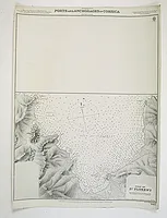 |
| 896.0 | SERVICE HYDROGRAPHIQUE DE LA MARINE. Mer Méditerranée. Côte est de Corse. Bastia. Paris, 1887 / 1896. 640 x 475 mm. Plan levé en 1884 sous la direction de M. Germain, Ing. Hydr.phe par M.M. Favé et Garnier, Sous-Ingénieurs. Edition d'Avril 1896. Gravé par Grenier, Ecrit par Vialard. | 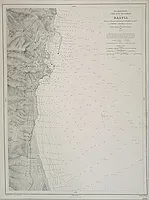 |
| 897.0 | Service Hydrographique de la Marine. Ile de Corse. Carte Générale levée de 1884 à 1891. 1897. 965 x 660 mm. "Gravé : le trait par Huguet, la topographie par E. Delaune, la lettre par Er. Dumas Vorzet. |  |
| 901.0 | ADMIRALTY CHART Mediterranean Ports and Anchorages in Corsica from the latest French charts. Londres, 1901. 605 x 910 mm. Carte illustrée de 15 cartons dont 14 figurent des ports et mouillages de Corse. Drawn by R. C. Carrington Hyd. Off. Published at the Admiralty 20th. Nov. 1874 under the Superintendence of Captain F.J. Evans, R.N.: C.B.: F.R.S. Hydrographer. Large Corrections, Feb.y 1887... 1901. | 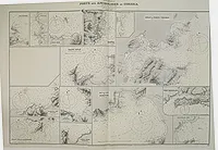 |
| 913 | DORANGE, J. La France Inconnue, Tome V. L'Ile parfumée. Paris, Société d'Editions artistiques et littéraires de tourisme et de sport, [1913. 322 x 2500 mm. Edition originale imprimée sur papier glacé. Bien complet de sa grande carte rempliée. Importante iconographie consacrée à la Corse. |  |
| 913.0 | ANONYME Allineamento per la delimitazione della pesca nelle Bocche di Bonifacio. Rome, 1913. 344 x 470 mm. Carte qui figure la délimitation de la pêche dans les Bouches de Bonifacio. Accompagnée du texte de loi en italien du 25 août 1913 qui approuve la convention italo-française sur la délimitation de la zone de pêche entre la Sardaigne et la Corse. | 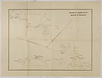 |
| 920 | TARIDE. Nouvelle Carte de la Corse, a l'usage des automobilistes, cyclistes, touristes, etc. 1:200,000e. Paris, A. Taride, ca. 1920. Col. ancien. 944 x 725 mm. Nouvelle Carte de la Corse, a l'usage des automobilistes, cyclistes, touristes, etc. 1:200,000e. En carton, en haut à gauche : "Lignes de navigation reliant la France et l'Italie à la Corse". En bas à gauche : Titre et légende. Exemplaire ayant appartenu à l'écrivain britannique Allan Sillitoe, auteur de la nouvelle "La Solitude du coureur de fond". 
 | 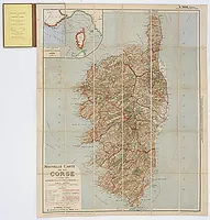 |
| 926.0 | BLANCHARD, R. La Corse. Grenoble, Rey, 1926. x mm. Ouvrage orné de 190 héliogravures. |  |
| 926 | TOUCHAGUES. Le Rire. N°378. Paris, 1er Mai 1926. 310 x 232 mm. Numéro 378 du 1er mai 1926 de la revue satirique "Le Rire", avec en couverture une illustration d'après un dessin de Touchagues, figurant la Méditerranée entre Nice et la Tunisie avec la Corse au centre. L'illustration est ainsi légendée : "Tandis que les Italiens reçoivent le souffle de la Méditerranée, les Français ne respirent que les miasmes de la mare de Locarno." |  |
| 929.0 | SERVICE GEOGRAPHIQUE DE L'ARMEE. La Corse. Paris, 1929. Col. ancien. 930 x 575 mm. Carte routière de Corse multi-publicitaire offerte par la compagnie Shell et éditée par "France-Tourisme". Carte dressée, gravée et publiée par le Service Géographique de l'Armée. Au verso, 16 annonces publicitaires pour Shell, la Société Générale, Dunlop, le Touring Club de France...
 |  |
| 935.0 | DÉPÔT DES CARTES ET PLANS DE LA MARINE. Mer Méditerranée - Bouches de Bonifacio. . . N° 3937. Paris, 1884 corrigé en 1935. . 620 x 930 mm. Carte marine détaillée de la côte de Bonifacio représentant la pointe sud de la Corse ainsi que la pointe nord de la Sardaigne. Titre complet: "Mer Méditerranée - Bouches de Bonifacio d’après le levé exécuté sous la direction du commandant Magnaghi, de la Marine Royale Italienne. Dépôt des Cartes Plans de la Marine 1885. . .levé exécuté en 1884".
- A detailed chart of the Strait of Bonifacio Showing the southern tip of Corsica and the northern tip of Sardinia. With latitude and longitude scales, soundings, rocks, shoals, safe harbours indicated in red ink. Engraved by Raynaud, F. Vavasseur, A. Bizet and Aug. Biscay after the original drawing prepared under the supervision of Major Magnaghi, officer of the Italian Royal Navy. Paris 1884, corrections to 1935. - Good margins. Label mark in the lower left corner. Small label pasted on the right side. Overall good condition. |  |
| 942 | MÉRIMÉE, Prosper. Colomba. Paris, La Tradition, 1942. x mm. Édition enrichie de 24 eaux fortes originales par Jean Traynier. Les cuivres en taille douce ont été tirés sur les presses à bras de J. Dumoulin. |  |
| 943.0 | JYLBERT. Corse. France, 1943. 345 x 242 mm. L'illustrateur n'est connu que par son pseudonyme "Jylbert". |  |
| 976 | GERMANES, Abbé de. Histoire des révolutions de Corse depuis ses premiers habitans jusqu'à nos jours. Marseille, Lafitte Reprints, 1976. 223 x 155 mm. Réimpression de l'édition de Paris, 1771-1776, tirée à 250 exemplaires. |  |
| 099 | ANONYME [Corse-Napoléon]. . 203 x 105 mm. Collage-puzzle arcimboldesque figurant un portrait de profil de Napoléon sous la forme d'une carte de la Corse. En outre, ce portrait, est composé de 3 petits profils qui se distinguent particulièrement. | ![ANONYME - [Corse-Napoléon].](../os/mapimg/64902-200x200.webp) |
| 32. | TOMASI, Xavier. Les chansons de Cyrnos. Marseille, F. Detaille, [1932.. x mm. Illustré de 40 dessins in-texte et 4 planches hors-texte de Marcel Poggidi. Un des 500 exemplaires sur vélin. Couverture illustrée en 2 tons. Anthologie des chansons populaires de la Corse recueillies, notées avec la traduction du "dialecte", une introduction, des notes sur la langue, les vocératrices, les danses et les instruments de musique. Contient les paroles des 55 chansons avec la musique notée, berceuses, filastroche, jeux et rondes, sénénades, paghielle, barcarolles, chansons de pêcheur, chants de mariage, de cérémonies, de travail, chansons satiriques pour les élections, tercets amoureux, proverbes, chants patriotiques, complaintes, lamenti, voceri. |  |
| 746.0 | AYROUARD, J. Carte d'une partie de la côte de L'isle de Corse contenant de puis le Cap de Fen jusque au golfe de S.te Manza… Marseille 1732-1746. 454 x 585 mm. Publié dans : "Recueil de plusieurs plans des ports et rades et de quelques cartes particulières de la mer Méditerranée.." par Jacques Ayrouard pilote real et gravé par Louis Corne. | 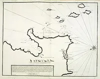 |
| 746.0 | AYROUARD, J. Carte d'une partie de la côte de L'isle de Corse contenant de puis le Cap de Fen jusque au golfe de S.te Manza… Marseille 1732-1746. Col. 460 x 590 mm. Publié dans : "Recueil de plusieurs plans des ports et rades et de quelques cartes particulières de la mer Méditerranée.." par Jacques Ayrouard pilote real et gravé par Louis Corne. | 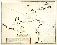 |
| 763.0 | ANONYME Plan della citta di Bastia, E Delle sue Adiacenze sino à Furiani. Bastia, 1763. Col. ancien. 425 x 605 mm. Plan manuscrit de Bastia figurant le siège de Furiani de 1763. La table de renvois numérotée de 1 à 9 indique les positions des redoutes, batteries de canons et troupes. Comprend une échelle : "Scala di Palmi 4000" et dans un carton, un profil du relief depuis Furiani jusqu'à S. Domenico. Un texte en "génois" donne une description du siège de Furiani pour le 6 juin et indique principalement le nombre de morts par catégorie : officiers, soldats, déserteurs et paysans corses. Le siège de Furiani par les Génois : Les troupes de Pascal Paoli occupent et verrouillent Furiani depuis 1755, en 1759 les Génois essayent de faire sauter ce verrou mais leur tentative échoue, à nouveau en 1763, ils décident de mener une attaque contre Furiani qui se solde par un échec et par la victoire de Pascal Paoli. "Le siège de Furiani (du 5 juin au 19 juillet 1763) est la dernière opération militaire menée en Corse par la République. Il dura 45 jours. Ce petit village était très important au point de vue stratégique, car il ouvrait les portes du Nebbio." |  |
| 764 | BELLIN, J.N. Plan de la Baye de Calvi. Paris, 1764. 220 x 162 mm. Publié dans le "Petit Atlas Maritime", Tome IV, N° 90. |  |
| 764 | BELLIN, J.N. Plan de la Ville de Corte. Paris, 1764. 215 x 175 mm. Publié dans le "Petit Atlas Maritime", Tome IV, N° 91. |  |
| 764 | BELLIN, J.N. Golphe de Campo-Moro et Valinco. Paris, 1764. 217 x 170 mm. Publié dans le "Petit Atlas Maritime", Tome IV, N° 92. | 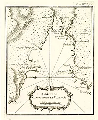 |
| 775 | LA BLAQUIERE, de. Elévation sur la Ligne A.B. Calvi, le 23 O.bre 1775. 285 x 324 mm. Plan manuscrit figurant une maison en élévation à Calvi (?), signé "de La Blaquiere" et visé par "Rozieres" (?). |  |
| 776.0 | Ozanne, P.N. Le port de Bastia vu du coté de l'est. . . Paris, 1776. Col. 105 x 160 mm. Réduit de la collection des Ports de France dessinés pour le Roi en 1776, Pierre-Nicolas Ozanne, gravure d'Yves Le Gouaz. |  |
| 787 | D'AUBIGNY. Vue de la ville de Bastia / Vue de l'intérieur du port de Bastia. Paris, 1787. 210 x 330 mm. Deux planches gravées d'après d'Aubigny par Fessard et Née, issues du voyage de Jean-Benjamin de Laborde "Description générale et particulière de la France… [Voyage pittoresque de la France, avec la description des toutes ses provinces…]. Paris, Imprimerie de Pierres, Lamy, 1781-1800." |  |
| 787 | D'AUBIGNY. Vue de la ville et du fort de St Florent. Paris, 1787. 205 x 330 mm. Planche gravée d'après d'Aubigny par Née, issue du voyage de Jean-Benjamin de Laborde "Description générale et particulière de la France… [Voyage pittoresque de la France, avec la description des toutes ses provinces…]. Paris, Imprimerie de Pierres, Lamy, 1781-1800." |  |
| 787 | LABORDE / D' AUBIGNY. Voyage pittoresque de la France. Isle de Corse. Paris, 1787. 210 x 335 mm. Partie complète de l'Isle de Corse tirée du voyage de Jean-Benjamin de Laborde "Description générale et particulière de la France… [Voyage pittoresque de la France, avec la description des toutes ses provinces…]. Paris, Imprimerie de Pierres, Lamy, 1781-1800." Comprend 4 pp. de texte de description de la Corse et d'explication des planches et 9 vues sur 6 planches gravées. - N°1 Vue de la ville de Bastia. - N°2 Vue de l'intérieur du port de Bastia. -N°3 Vue de la citadelle de Bastia. - N°4 Vue de la citadelle et de la Cathédrale. N°5 Vue de la fontaine de Ficayola. N°6 Couvent des Capucins de Bastia. - N°7 Ruines de la villa Justiniani. - N°8 Vue de la tour de Senèque. N° 9 Vue de la ville et du fort de St Florent. |  |
| 787 | D'AUBIGNY. Vue de la citadelle de Bastia / Vue de la citadelle et de la cathédrale. Paris, 1787. 150 x 220 mm. Deux planches gravées d'après d'Aubigny par Née, issues du voyage de Jean-Benjamin de Laborde "Description générale et particulière de la France… [Voyage pittoresque de la France, avec la description des toutes ses provinces…]. Paris, Imprimerie de Pierres, Lamy, 1781-1800." |  |
| 793 | FADEN, W / FOOT, Th. Road of Figarone and St Mary / Bay and road of St. Fiorentino / Bay and port of Calvi / Harbour and road of Ajaccio / Gulfs of Talana or Valinco and of Campo-Moro. Londres, 1793. Col. 215 x 320 mm. 5 plans sur une planche. Route de Figarone et St Mary. Baie et route de St Fiorentino. Baie et port de Calvi. Port et route d'Ajaccio. Golfe de Talana ou Valinco et Campo-Moro. | 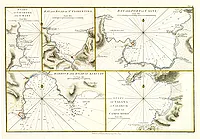 |
| 794 | ANONYME Plan de la ville et la Baye de la Bastia en corce.. mediterrannée. Ca. 1794. Beau col. ancien. 359 x 490 mm. Carte manuscrite à l'encre et à l'aquarelle, non signée et non datée. Titre et notes en français. Elle est ornée d'une rose des vents et de deux navires, dont l'un battant pavillon anglais. L'échelle est indiquée en toises, ce qui permet de dater la carte avant 1795, date à laquelle la toise fut remplacée par le mètre. Le cartographe a indiqué les magasins à poudre et la tour de garde. On peut supposer que la carte fut dessinée en 1794. C'est en effet à cette date que le port de Bastia fut assiégé par les Anglais. Cette thèse est renforcée par le pavillon anglais de l'un des deux navires mouillant dans la baie. Le gouvernement anglais pris possession de la ville jusqu'en 1794. (voir reproduction 3 de couverture)
- Manuscript plan of Bastia in Corsica, emphasized with watercolour and embellished with a compass rose and 2 vessels. Some notations in French are written in the upper right corner, without presenting any date nor a signature. However it is possible to date the map around 1794. This may be inferred thanks to the British flag on one of the ships berthing in the bay, since the English besieged the town in 1794. Moreover the scale in toises indicates that the map was made before 1795, when this unit of measure was definitely dropped and replaced by the meter. |  |
| 796 | FRASER, Percy, Capt.
JUKES,F. St Fiorenzo in the Island of Corsica. Londres, 1796. 228 x 368 mm. Vue de Saint Florent dessinée par le Capitaine Percy Fraser en 1794 et gravée à l'aquatinte par F. Jukes. Légende avec renvois représentés par des mouettes. |  |
| 798 | MANNSKIRSCH, I. F. A Ruin near Bastia in Corsica. Londres, R. Ackermanns Gallery, July 16, 1798. 302 x 242 mm. "Franz Joseph Manskirsch [1770 - 1827] was a German landscape painter working in England who undertook several commissions for Ackermann". |  |
| 800 | ALLEZARD, Jean Joseph. Isle de Corse. Golfe de Valincou [Pl.152] / St Amansa [Pl 122]./ Porto Vecchio Corsica / Golfe et Rade de Ajacio [Pl. 123]. Marseille, 1800. 125 x 180 mm. 4 plans publiés dans "Nouveau Recueil… Nouvelle édition corrigée et augmentée… par Jean Joseph Allezard Capitaine de Navire. Publié l'an 1800. A Marseille, chez Poize Graveur et Imprimeur en taille-douce". 

 | ![ALLEZARD, Jean Joseph. - Isle de Corse. Golfe de Valincou [Pl.152] / St Amansa [Pl 122]./ Porto Vecchio Corsica / Golfe et Rade de Ajacio [Pl. 123].](../os/mapimg/63743-200x200.webp) |
| 809 | LEE, L. T. Mortella Tower, St. Fiorenza Bay, Corsica. Londres, Joyce Gold, 1809. 140 x 132 mm. Publié dans : "The Naval Chronicle, published in 40 volumes between 1799 and 1818, is a key source for British maritime and military history, and is also sought after by those researching family histories... It was issued in regular instalments (sometimes reprinted with corrections) by Bunney and Gold, later Joyce Gold, in London". |  |
| 810 | ANONYME View in Corsica. Ca. 1810. Col. ancien. 183 x 240 mm. Composition romantique qui figure un village en bord de mer. |  |
| 820 | DUPLESSI-BERTAUX, J. Délivrance de la Corse, le 29 Vendémiaire An 5. Paris, ca 1820. 232 x 345 mm. Scène de bataille gravée à l'eau forte d'après Carle Vernet. Elle célèbre la chute de l'éphémère royaume anglo-corse (1794-1796). Le 20 octobre 1796, les troupes du Directoire avec Bonaparte débarquent en Corse et contraignent Nelson à rembarquer à Bastia les troupes anglaises et quelques milliers de corses anglophiles. |  |
| 820 | VERNET, Carle. Délivrance de la Corse, le 29 Vendémiaire An 5. Paris, 1820. 235 x 345 mm. Dessinée par Carle Vernet, gravé à l'eau-forte par Duplessis-Bertaux, terminé par Niquet et Pillement. Publié dans "Gloires, Victoires et Conquêtes de la République Française". |  |
| 821 | JOLY de la VAUBIGNON, Adrien. Vue du pont d'Ucciani et du Monte d'Oro (+ 7 autres lithographies). Paris, chez l'auteur et chez Engelmann, (1821. 280 x 365 mm. Belles lithographies de Godefroy Engelmann issues du "Voyage pittoresque en Corse", rare ouvrage sur la Corse paru en 10 livraisons.
Joint : Vue de la tour de Toga près de Bastia / Vue d'un petit aqueduc près de Laporta (col.) / La tour de Senèque dans le cap Corse (2 ex. dont 1 col.) / Vue du petit Fort d'Aleria / Vue du pont de Vivario / Vue de la Forêt de Vizzavona (col.).


 |  |
| 821 | JOLY de la VAUBIGNON, Adrien. Vue du fort de Bonifaccio en regardant le couchant. Paris, chez l'auteur et chez Engelmann, (1821. 280 x 370 mm. Belle lithographie de Godefroy Engelmann issue du "Voyage pittoresque en Corse", rare ouvrage sur la Corse paru en 10 livraisons. |  |
| 821 | JOLY de la VAUBIGNON, Adrien. Vue de Calvi. Paris, chez l'auteur et chez Engelmann, (1821. 275 x 370 mm. Belle lithographie de Godefroy Engelmann issue du "Voyage pittoresque en Corse", rare ouvrage sur la Corse paru en 10 livraisons. |  |
| 821 | JOLY de la VAUBIGNON, Adrien. Vue de la maison ou est né le Gal. Paoli. Paris, chez l'auteur et chez Engelmann, (1821. 275 x 370 mm. Belle lithographie de Godefroy Engelmann issue du "Voyage pittoresque en Corse", rare ouvrage sur la Corse paru en 10 livraisons. |  |
| 830 | GARNERAY, L. Vue de Calvi prise à l'est de la baye. Paris, ca. 1830. 188 x 294 mm. Vue de Calvi et de la Citadelle. Ambroise Louis Garneray est né à Paris le 9 février 1783. Il est le fils aîné de Jean-François Garneray (1755-1837), peintre du roi, qui fut élève de Jacques-Louis David. A l’âge de treize ans, il s’engage dans la marine comme pilotin à l'incitation de son cousin, Beaulieu-Leloup, capitaine de la frégate La Forte et embarque à Rochefort pour donner corps à ses rêves d’aventures et de gloire. Il part pour l’océan Indien avec la division de frégates Sercey à laquelle appartient La Forte.
Employé par le duc d’Angoulême, alors grand amiral de France, il devient par concours son peintre attitré en 1817. Il est de ce fait le premier peintre officiel de la Marine... En 1833, il est nommé directeur du musée de Rouen. Il développe dans les années 1830 un nouveau procédé de peinture, l'aquatinte ainsi qu'une importante activité de gravure. |  |
| 830 | GARNERAY, L. Vue d'Ajaccio prise de la chapelle des grecs. Paris, ca. 1830. 185 x 300 mm. Vue d'Ajaccio animée de nombreux bateaux. Ambroise Louis Garneray est né à Paris le 9 février 1783. Il est le fils aîné de Jean-François Garneray (1755-1837), peintre du roi, qui fut élève de Jacques-Louis David. A l’âge de treize ans, il s’engage dans la marine comme pilotin à l'incitation de son cousin, Beaulieu-Leloup, capitaine de la frégate La Forte et embarque à Rochefort pour donner corps à ses rêves d’aventures et de gloire. Il part pour l’océan Indien avec la division de frégates Sercey à laquelle appartient La Forte. Employé par le duc d’Angoulême, alors grand amiral de France, il devient par concours son peintre attitré en 1817. Il est de ce fait le premier peintre officiel de la Marine... En 1833, il est nommé directeur du musée de Rouen. Il développe dans les années 1830 un nouveau procédé de peinture, l'aquatinte ainsi qu'une importante activité de gravure. |  |
| 830 | GARNERAY, L. Bastia. Paris, ca. 1830. 187 x 295 mm. Vue de Bastia avec au premier plan des bateaux voguant sur une mer agitée. Ambroise Louis Garneray est né à Paris le 9 février 1783. Il est le fils aîné de Jean-François Garneray (1755-1837), peintre du roi, qui fut élève de Jacques-Louis David. A l’âge de treize ans, il s’engage dans la marine comme pilotin à l'incitation de son cousin, Beaulieu-Leloup, capitaine de la frégate La Forte et embarque à Rochefort pour donner corps à ses rêves d’aventures et de gloire. Il part pour l’océan Indien avec la division de frégates Sercey à laquelle appartient La Forte. Employé par le duc d’Angoulême, alors grand amiral de France, il devient par concours son peintre attitré en 1817. Il est de ce fait le premier peintre officiel de la Marine... En 1833, il est nommé directeur du musée de Rouen. Il développe dans les années 1830 un nouveau procédé de peinture, l'aquatinte ainsi qu'une importante activité de gravure. |  |
| 830 | GARNERAY, L. Bastia. Paris, ca. 1830. Col. 187 x 295 mm. Vue de Bastia avec au premier plan des bateaux voguant sur une mer agitée. Ambroise Louis Garneray est né à Paris le 9 février 1783. Il est le fils aîné de Jean-François Garneray (1755-1837), peintre du roi, qui fut élève de Jacques-Louis David. A l’âge de treize ans, il s’engage dans la marine comme pilotin à l'incitation de son cousin, Beaulieu-Leloup, capitaine de la frégate La Forte et embarque à Rochefort pour donner corps à ses rêves d’aventures et de gloire. Il part pour l’océan Indien avec la division de frégates Sercey à laquelle appartient La Forte. Employé par le duc d’Angoulême, alors grand amiral de France, il devient par concours son peintre attitré en 1817. Il est de ce fait le premier peintre officiel de la Marine… En 1833, il est nommé directeur du musée de Rouen. Il développe dans les années 1830 un nouveau procédé de peinture, l'aquatinte ainsi qu'une importante activité de gravure. |  |
| 840 | DE MERCEY, F. / CICERI, Eug. Bastia. Paris, Imp. Lemercier, ca; 1840. 235 x 372 mm. Vue de Bastia prise depuis la plage. |  |
| 850 | BAUDOY, F. Ajaccio, (Corse) Vue prise du milieu du golfe, vis-à-vis le quai. Paris, ca. 1850. Col. 330 x 463 mm. Rare vue d'Ajaccio dessinée d'après nature par F.ois Baudoy, lithographiée par Deroy et publiée par V.e Turgis pour la série des "Ports de mer d'Europe. France." |  |
| 853 | MERCEY, Frédéric Bourgeois de. St. Bonziano. Val di China / Couvent près de Bastia. Paris, 1853. 355 x 246 mm. 2 vues sur une même planche des environs de Bastia lithographiées par Eugène Cicéri d'après F. de Mercey. |  |
| 891 | BETTEX, F. Bastia. Bastia, 28 Aôut 1891. Col. ancien. 170 x 440 mm. Joli dessin représentant la rade de Bastia avec au premier plan des pins maritimes. |  |
| 944 | BOSCH, Lodewijk Johannes. Bastia (Corse). Bastia, ca. 1944. 235 x 290 mm. Eau-forte par L. Bosch, épreuve sur simili-japon signée au crayon à droite. Initiales et date gravées dans la planche : LB 1944. Lodewijk Bosch (1894-1980) est né à Amsterdam, il travailla ensuite en France, à Berlin puis en Espagne. Il a également préfacé un livre sur l'histoire de la gravure aux Pays-Bas : " Nederlandsche Prentkunst sedert 1900. Etsen en gravures verzameld en ingeleid door Lodewijk Bosch". |  |
| 944 | BOSCH, Lodewijk Johannes. Bastia (Corse). Bastia, ca. 1944. 235 x 290 mm. Eau-forte par L. Bosch, épreuve sur simili-japon signée au crayon à droite. Initiales et date gravées dans la planche : LB 28.
Lodewijk Bosch (1894-1980) est né à Amsterdam, il travailla ensuite en France, à Berlin puis en Espagne. Il a également préfacé un livre sur l'histoire de la gravure aux Pays-Bas : " Nederlandsche Prentkunst sedert 1900. Etsen en gravures verzameld en ingeleid door Lodewijk Bosch". |  |
| 954 | ROSE, Francis. [Bastia, Le Vieux port / Eglise St Charles]. Ca. 1954. 370 x 270 mm. Deux lithographies originales signées de Sir Francis Rose (1909-1979) représentant Bastia, Le Vieux port, numérotée 14/100 et Bastia, Eglise St Charles numérotée 16/100. Reproduites dans « En Corse avec Francis Rose ». Dorothy Carrington. Ed Piazzola. 1995. Francis Rose a travaillé dans l’atelier de Picabia et de Fernand Léger à Antibes, dessiné, en 1929, les décors et les costumes pour les ballets russes de Diaghilev et exposé en 1930 à Paris, avec Salvador Dali, dans la galerie de Marie Cuttoli. Francis Rose (1909-1985). La plupart des dessins réalisés, relatifs à la Corse, l'ont été sans doute pour un projet de livre de Dorothy Carrington son épouse, Granite island, La Corse l'ïle de granite, mais semblent n'avoir pas été retenus. | ![ROSE, Francis. - [Bastia, Le Vieux port / Eglise St Charles].](../os/mapimg/64780-200x200.webp) |
| 634.0 | TASSIN, N. Seigneurie de Gênes, Comté de Nice et Partie de l'isle de Corse. Paris, 1634. Beau col. ancien. 370 x 515 mm. Rare en coloris d'époque. Première édition.
Very detailed map showing south of France and northern Corsica. Embellished with several sailing ships, a sea monster, a wind rose and a title cartouche surmounted by an eagle. Nicolas Tassin, who was active from 1633 till 1655, was appointed "royal cartographer" at Dijon before setting up as an engraver in Paris where he issued various collections of small maps and plans of France, Switzerland, Germany and Spain. Maps by Tassin in original colours are rare. |  |
| 634.0 | BEREY,N. / TASSIN,C. Seigneurie de Genes Comte de Nice Parti de Corse. Paris, 1634. Beau col. ancien. 352 x 517 mm. A rare map centred on the province of Genova. On the lower left-hand corner, an eagle holding the titlle cartouche is depicted. The sea is also decorated by several ships and a sea monster. Showing northern part of Corsica. The title is printed from a different copper plate. From "Cartes générales de toutes le provinces de France", including maps prepared by C.Tassin and published by Nicolas Bery. Interestingly the name of Tassin was not engraved in the plates. |  |
| 647.0 | DUDLEY. Carta Particolare del Mare Mediterraneo che Comincia con il Capo Melle nella Riviera di Genova e Finisce con Civita Vecchia nelo Stato del Papa … Florence, 1646-1647. 480 x 745 mm. Première édition. L'atlas de Dudley "Arcano del Mare", est le premier atlas maritime anglais couvrant le monde. Les cartes sont gravées par Lucini. La carte présente, couvre la côte italienne de San Remo jusqu'à Civita Vechia et le nord de la Corse.
- Robert Dudley (1574-1649). English geographer. His rare atlas 'Arcano del Mare' was the first English sea-atlas, the first with charts - all in Mercator-projection- of the whole world. Famous for its engraving by Lucini. 1st. ed. 1646-7, 2nd. ed.1661. |  |
| 647.0 | DUDLEY. Carta Particolare della Isolla di Sardinia e parte della Corsica. Florence, 1646-1647. 480 x 340 mm. Première édition. L'atlas de Dudley "Arcano del Mare", est le premier atlas maritime anglais couvrant le monde. Les cartes sont gravées par Lucini. La carte présente, couvre la Sardaigne et le sud de la Corse.
- Robert Dudley (1574-1649). English geographer. His rare atlas 'Arcano del Mare' was the first English sea-atlas, the first with charts - all in Mercator-projection- of the whole world. Famous for its engraving by Lucini. 1st. ed. 1646-7, 2nd. ed.1661. |  |
| 760.0 | CONSTANTINUS. Pascal Paoli, General of the Corsicans ; Born 6th April 1726, Elected 16 July 1755. Corte, ca. 1760. 325 x 250 mm. Done from an Original Printed at Corte, by Constantinus. R. Purcel fecit. Rare portrait de Pascal Paoli avec en arrière-plan une scène de bataille. |  |
| 764 | BELLIN, J.N. Plan de la Baye de Calvi. Paris, 1764. 220 x 162 mm. Publié dans le "Petit Atlas Maritime", Tome IV, N° 90. |  |
| 769 | BELLIN, J.N. Plan de la province de Balagna. Paris, 1769. 222 x 312 mm. Publié dans l'atlas qui accompagne la "Description géographique et historique de l'Isle de Corse, pour joindre aux Cartes & Plans de cette Isle". |  |
| 769 | BELLIN, J.N. Carte de la Province de Calvi. Paris, 1769. 353 x 405 mm. Publiée dans l'atlas qui accompagne la "Description géographique et historique de l'Isle de Corse, pour joindre aux Cartes & Plans de cette Isle". |  |
| 769 | BELLIN, J.N. Partie de la Province de Sartene. XXIII. Paris, 1769. 212 x 315 mm. Publiée dans l'atlas qui accompagne la "Description géographique et historique de l'Isle de Corse, pour joindre aux Cartes & Plans de cette Isle". |  |
| 769 | BELLIN, J.N. Partie de la Province de Sartene. XXII. Paris, 1769. 215 x 285 mm. Publiée dans l'atlas qui accompagne la "Description géographique et historique de l'Isle de Corse, pour joindre aux Cartes & Plans de cette Isle". |  |
| 769 | BELLIN, J.N. Partie de la province de Sagone ou de Vico. Paris, 1769. 220 x 295 mm. Publiée dans l'atlas qui accompagne la "Description géographique et historique de l'Isle de Corse, pour joindre aux Cartes & Plans de cette Isle". | 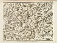 |
| 769 | BELLIN, J.N. Partie de la province de Bastia. Pl. V et VI. Paris, 1769. 225 x 320 mm. Publiée dans l'atlas qui accompagne la "Description géographique et historique de l'Isle de Corse, pour joindre aux Cartes & Plans de cette Isle".  |  |
| 769 | BELLIN, J.N. Carte de la Province de Nebio. Paris, 1769. 213 x 332 mm. Publiée dans l'atlas qui accompagne la "Description géographique et historique de l'Isle de Corse, pour joindre aux Cartes & Plans de cette Isle". |  |
| 769 | BELLIN, J.N. Carte de la Province d'Ajaccio et fief d'Istria. Première /Seconde /Troisième /Quatrième feuille. Paris, 1769. 240 x 305 mm. Carte en 4 feuilles de la province d'Ajaccio publiée dans l'atlas qui accompagne la "Description géographique et historique de l'Isle de Corse, pour joindre aux Cartes & Plans de cette Isle". |  |
| 964 | SERVICE HYDROGRAPHIQUE DE LA MARINE. Mer Méditerranée - Corse - Presqu'île du Cap Corse - partie nord de la pointe de Canelle au cap Sagro. Paris, 1896-1964. 970 x 675 mm. Dernières corrections en 1964. - Joint : Bassin ouest de la Méditerranée…. Corse et Sardaigne. Pli central marqué, taches brunes. |  |