Menu
Shop
Catalog
New
World maps - Celestials
World
0
Celestial charts
0
Poles
0
France
West regions
0
Anjou - Maine
0
Anjou - Maine towns
0
Aunis - Saintonge
0
Towns Aunis - Saintonge
0
Brittany
0
Brittany towns
0
Guyenne - Gascogne - Béarn
0
Guyenne-Gascogne towns
0
Normandy
0
Normandy towns
0
Poitou
0
Poitou towns
0
Vendée
0
Vendée towns
0
Central France
0
Berry
0
Limousin
0
Limousin towns
0
Nivernais
0
Orléanais
0
Orléanais towns
0
Touraine
0
Touraine towns
0
East regions
0
Alsace
0
Alsace towns
0
Auvergne
0
Auvergne towns
0
Bourgogne
0
Champagne - Ardennes
0
Champagne towns
0
Dauphiné
0
Dauphiné towns
0
Franche-Comté
0
Franche-Comté towns
0
Lorraine
0
Lorraine towns
0
Lyonnais
0
Lyonnais towns
0
Savoy
0
Savoy towns
0
South regions
0
Languedoc
0
Languedoc towns
0
Monaco
0
Provence
0
Provence towns
0
Roussillon
0
Corsica
0
Paris & Île-de-France
0
Île-de-France towns
0
Paris
0
Île-de-France
0
North regions
0
North
0
North towns
0
Picardy
0
Picardie towns
0
Nord
0
Nord towns
0
Europe
British Isles
0
England
0
Ireland
0
Scotland
0
Wales
0
Channel Islands
0
Gibraltar
0
Europe continent
0
Southern Europe
0
Greece
0
Portugal
0
Spain
0
Italy
0
Switzerland - Austria
0
Austria
0
Switzerland
0
Scandinavia
0
Scandinavia general
0
Denmark
0
Finland
0
Iceland
0
Norway
0
Sweden
0
BeNeLux
0
Belgium
0
Leo Belgicus maps
0
Luxemburg
0
Netherlands
0
Germany
0
Germany general
0
Germany provinces
0
Germany towns
0
Central & Eastern Europe
0
Balkans
0
Baltic Countries
0
Black Sea - Ukraine
0
Bulgaria
0
Czech Republic - Slovakia
0
Hungary
0
Lithuania
0
Poland
0
Romania
0
Russia
0
Mediterranean Sea
0
Balearic Islands
0
Cyprus
0
Malta
0
Minorca - Majorca
0
Sardinia
0
Sicily
0
Africa
Africa continent
0
North Africa
0
Algeria
0
Egypt
0
Libya
0
Morocco
0
Tunisia
0
West Africa
0
Central Africa
0
East Africa
0
East Africa general
0
Madagascar - Mauritius - La Réunion
0
South Africa
0
America
America continent
0
North America
0
North America general
0
Canada
0
Alaska
0
California
0
Florida
0
Great Lakes - Philadelphia
0
Indiana - Ohio - Kentuky
0
Mexico
0
Mississippi - Louisiana
0
New England
0
New England States
0
Virginia - Maryland - Carolina
0
Western America - Texas
0
Central America
0
Costa Rica
0
Guatemala
0
Honduras
0
Panama
0
Porto Rico
0
South America
0
Peru
0
South America general
0
Strait of Magellan - Tierra del Fuego
0
Venezuela
0
South America general
0
Argentina
0
Bolivia
0
Brazil
0
Chili
0
Colombia
0
French Guiana - Suriname
0
Paraguay
0
West Indies
0
Jamaica
0
Martinique
0
Trinidad and Tobago
0
West Indies general
0
Bermuda
0
Cuba
0
Curaçao
0
Guadeloupe
0
Haïti - Domenican Republique
0
Atlantic Ocean
0
Pacific
0
Asia
Asia continent
0
Central Asia
0
Silk Road
0
Usbekistan - Kazakhstan
0
Far East
0
China
0
China provinces
0
China towns
0
Hong Kong
0
Japan
0
Korea
0
Taiwan
0
Tartary - Mongolia
0
Tibet
0
Near and Middle East
0
Near & Middle East general
0
Arabian Peninsular
0
Holy Land
0
Libyan
0
Pakistan - Afghanistan
0
Persia/Iran
0
Syria
0
Turkey
0
India
0
Ceylon
0
Pakistan
0
South East Asia
0
Cambodia - Laos - Thailand - Vietnam
0
Indonesia
0
Malaysia - Singapore
0
Philippines
0
Oceania
Australia
0
French Polynesia
0
New Caledonia
0
New Zealand
0
Old Books - Atlases
Atlases
0
Cosmography
0
Local French history
0
Modern illustrated
0
Travel
0
Asian travel books
0
Travel America
0
Travel Americana
0
Travel Asia - Oceania
0
Travel Europe
0
Travel Africa
0
Various subjects
0
Architecture
0
Bibliography
0
Children books
0
Economy
0
Fashion & costume
0
Gastronomy
0
History
0
Judaica
0
Literature
0
Medicine
0
Military
0
Natural history
0
Science & technology
0
Sports
0
Typography
0
Various subjects
0
Prints
Architectural prints
0
Botanical Prints
0
Fashion prints
0
Japanese prints
0
Maritime
0
Natural history prints
0
Nuremberg Chronicle
0
Old Master
0
Optical prints
0
Other subject
0
Zoological prints
0
16th - 18th century prints
0
Wood block prints
0
19th century prints
0
20th century prints
0
Portraits
0
Various
Cartographic Curiosities
0
Carte-à-figures maps
0
Folding maps
0
Geological maps
0
Sea Charts
0
Title pages
0
Drawings
0
Erotica
0
Globes & Instruments
0
La Belle Époque
0
Medieval manuscript leaves
0
Photography
0
Posters & Publicity
0
Les Maitres de l'Affiche
0
Posters
0
Publicity
0
Prints
0
Architectural prints
0
Botanical Prints
0
Fashion prints
0
Japanese prints
0
Maritime
0
Natural history prints
0
Nuremberg Chronicle
0
Old Master
0
Optical prints
0
Other subject
0
Zoological prints
0
16th - 18th century prints
0
Wood block prints
0
19th century prints
0
20th century prints
0
Portraits
0
Valuation
Contact
Menu
Filter
Clear
Your Cart
Librairie Loeb-Larocque - Paris
Facebook
Instagram
Printerest
English
Français
English
€
Euro
EUR
€
Euro
EUR
£
Pound Sterling
GBP
$
US Dollar
USD
Search here...
Account
Login / Register
Login
Register
Wishlist
Edit Your Wishlist
0
Compare
Product Comparison
0
0 item(s) - 0€
0
Your shopping cart is empty!
Menu
Maps France
General France
North regions
North
Picardy
Paris & Île-de-France
Île-de-France
Île-de-France towns
Paris
West regions
Anjou - Maine
Aunis - Saintonge
Brittany
Guyenne - Gascogne - Béarn
Normandy
Poitou
Vendée
Central regions
Berry
Limousin
Nivernais
Orléanais
Touraine
East regions
Alsace
Auvergne
Bourgogne
Champagne - Ardennes
Dauphiné
Franche-Comté
Lorraine
Lyonnais
Savoy
South regions
Languedoc
Monaco
Provence
Roussillon
Corsica
Monaco
Maps all parts
World - Celestials - Poles
World
Celestial
Poles
Europe
Continent
British Isles
England
0
Ireland
0
Scotland
0
Wales
0
Channel Islands
0
Gibraltar
0
Switzerland - Austria
Austria
0
Switzerland
0
BeNeLux
Belgium
0
Leo Belgicus maps
0
Luxemburg
0
Netherlands
0
Germany
Germany general
0
Germany provinces
0
Germany towns
0
Central & Eastern Europe
Balkans
0
Baltic Countries
0
Black Sea - Ukraine
0
Bulgaria
0
Czech Republic - Slovakia
0
Hungary
0
Lithuania
0
Poland
0
Romania
0
Russia
0
Southern Europe
Greece
0
Portugal
0
Spain
0
Italy
0
Mediterranean
Balearic Islands
0
Cyprus
0
Malta
0
Minorca - Majorca
0
Sardinia
0
Sicily
0
Scandinavia
Scandinavia general
0
Denmark
0
Finland
0
Iceland
0
Norway
0
Sweden
0
Travel
Africa
African continent
North Africa
Algeria
0
Egypt
0
Libya
0
Morocco
0
Tunisia
0
Central Africa
West Africa
East Africa
East Africa general
0
Madagascar - Mauritius - La Réunion
0
South Africa
America
America continent
0
North America
0
North America general
0
Canada
0
Alaska
0
California
0
Florida
0
Great Lakes - Philadelphia
0
Indiana - Ohio - Kentuky
0
Mexico
0
Mississippi - Louisiana
0
New England
0
New England States
0
Virginia - Maryland - Carolina
0
Western America - Texas
0
Central America
0
Costa Rica
0
Guatemala
0
Honduras
0
Panama
0
Porto Rico
0
South America
0
Peru
0
South America general
0
Strait of Magellan - Tierra del Fuego
0
Venezuela
0
South America general
0
Argentina
0
Bolivia
0
Brazil
0
Chili
0
Colombia
0
French Guiana - Suriname
0
Paraguay
0
West Indies
0
Jamaica
0
Martinique
0
Trinidad and Tobago
0
West Indies general
0
Bermuda
0
Cuba
0
Curaçao
0
Guadeloupe
0
Haïti - Domenican Republique
0
Atlantic Ocean
0
Pacific
0
Asia
Asia continent
Near & Middle East
Near & Middle East general
0
Arabian Peninsular
0
Holy Land
0
Libyan
0
Pakistan - Afghanistan
0
Persia/Iran
0
Syria
0
Turkey
0
South East Asia
Cambodia - Laos - Thailand - Vietnam
0
Indonesia
0
Malaysia - Singapore
0
Philippines
0
India
Ceylon
0
Pakistan
0
Far East
China
0
China provinces
0
China towns
0
Hong Kong
0
Japan
0
Korea
0
Taiwan
0
Tartary - Mongolia
0
Tibet
0
Travel Asia & Oceania
Central Asia
Silk Road
0
Usbekistan - Kazakhstan
0
Oceania
Australia
New Zealand
Pacific
French Polynesia
Cartographic curiosities
Curiosities
Title pages
Globes
Carte-à-figures maps
Sea charts
Sea charts
Books
Atlases
Travel
Asie - Oceania
Travel America
Travel Europe
Travel Africa
Local French
Books Old & Rare
Fashion
Literature
Natural history
Modern illustrated
Reference books
Various
Fashion & costumes
Literature
Natural history
Various subjects
Varia
Posters / Les Maitres de l'Affiche
Posters
Les Maitres de l'Affiche
Prints
16th - 18th century
19th century
20th century
Architecture
Erotica
Fashion
Japanese prints
Natural history
Maritime
Portraits
Optical prints
Wood block prints
Zoological prints
Other subjects
Drawings
Posters & Publicity
Les Maitres de l'Affiche
0
Posters
0
Publicity
0
Cartographic curiosities
Carte-à-figures maps
Globes & Instruments
Leo Belgicus
Title Pages
Globes & instruments
Books of Hours & leaves
Erotica
Photography
The shop
About
Catalog
We Buy
Terms
Mapmakers
Schedel
Dating maps
Corsica Illustrata
News Letter
Contact
The Silk Road
Valuation
Next Auction
Next Auction
Results
Valuation
Estimation form
Contact
Valuation
Estimate your book
We buy
Valuation
Contact
Valuation form
Auction results
Contact
Contact
News Letter
Login
0
home
France
West regions
Brittany
Brittany
Brittany towns
39
Product Compare
0
Sort By:
Default
Name (A - Z)
Name (Z - A)
Price (Low > High)
Price (High > Low)
Show:
24
25
50
75
100
Location:
1594
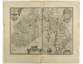
ORTELIUS, A. - Cenomanorum... La Mans. / Neustria. Britanniae, et Normandiae Typus.
Published
: Antwerp, 1594
Size
: 375 x 505mm.
Color
: Uncolored
Condition
: 2 cartes sur 1 planche. Bel exemplaire.
Planche double comprenant deux cartes qui englobent le nord-ouest de la France, le nord étant orienté vers la gauche. La cart..
150€
ORTELIUS, A. - Cenomanorum... La Mans. / Neustria. Britanniae, et Normandiae Typus.
Add to Cart
Add to Wish List
Compare this Product
Ask Question
Ask Question
Location:
1598
ORTELIUS, A. - Cenomanorum... La Mans. / Neustria. Britanniae, et Normandiae Typus.
Published
: Antwerp, 1598
Size
: 375 x 505mm.
Color
: In attactive colours.
Condition
: 2 cartes sur 1 planche. Bel exemplaire.
Double-page sheet containing two maps that encompass northwest France, with north oriented to the left. The map on the left c..
200€
ORTELIUS, A. - Cenomanorum... La Mans. / Neustria. Britanniae, et Normandiae Typus.
Add to Cart
Add to Wish List
Compare this Product
Ask Question
Ask Question
Location:
1598
ORTELIUS, A. - Cenomanorum... La Mans. / Neustria. Britanniae, et Normandi.
Published
: Anvers, 1598
Size
: 375 x 505 mm.
Color
: Uncoloured.
Condition
: French text on the verso. Wide margins and a strong and dark impression. In fine condition.
ORTELIUS, A. - Cenomanorum... La Mans. / Neustria. Britanniae, et Normandi. - 40943 - Brittany - ORTELIUS, A. - Cenomanorum...
400€
ORTELIUS, A. - Cenomanorum... La Mans. / Neustria. Britanniae, et Normandi.
Add to Cart
Add to Wish List
Compare this Product
Ask Question
Ask Question
Location:
1619
BOUGUEREAU, M. / LECLERC, J. - Description du pays Armorique a pres[ent] Bretaigne.
Published
: Paris, ca. 1619
Size
: 357 x 470mm.
Color
: Uncoloured.
Condition
: Good condition.
Ornée d'armoiries et de 3 roses des vents. Sans texte au verso. Le "Theatre geographique de France" de Leclerc est le prolong..
1,000€
BOUGUEREAU, M. / LECLERC, J. - Description du pays Armorique a pres[ent] Bretaigne.
Add to Cart
Add to Wish List
Compare this Product
Ask Question
Ask Question
Location:
1630
MERCATOR, G. / CLOPPENBURG. - Bretania et Normandia. . .
Published
: Amsterdam, ca 1630
Size
: 185 x 250mm.
Color
: Uncoloured.
Condition
: Some marginal staining. Some spotting on engraved area. Else in good condition. A good dark impression, full margins as published.
Map of Brittany and Normandy. Published in the rare Cloppenburgh edition of Gerhard Mercator's "Atlas Minor", verso latin te..
150€
MERCATOR, G. / CLOPPENBURG. - Bretania et Normandia. . .
Add to Cart
Add to Wish List
Compare this Product
Ask Question
Ask Question
Location:
1641
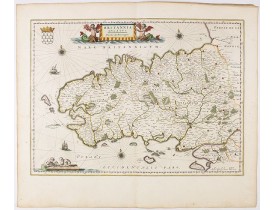
BLAEU, G. - Britannia Ducatus / Duché de Bretaigne.
Published
: Amsterdam, 1641
Size
: 380 x 520mm.
Color
: Out line color
Condition
: Bel exemplaire. Petite restauration en bas du pli central.
Bel exemplaire de la carte de Bretagne issue du "Theatrum Orbis Terrarum". Elle figure en haut à droite le Mont St. Michel, à..
200€
BLAEU, G. - Britannia Ducatus / Duché de Bretaigne.
Add to Cart
Add to Wish List
Compare this Product
Ask Question
Ask Question
Location:
1644
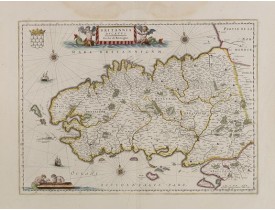
BLAEU, W. - Britannia Ducatus. Duché de Bretaigne.
Published
: Amsterdam, 1644
Size
: 380 x 520mm.
Color
: In original colours.
Condition
: Some light creasing along center fold. Very good and dark impression. French text on verso.
Map of Bretagne in France. From early on Willem Jansz. Blaeu aimed of publishing an atlas to compete with the Hondius-Jansso..
600€
BLAEU, W. - Britannia Ducatus. Duché de Bretaigne.
Add to Cart
Add to Wish List
Compare this Product
Ask Question
Ask Question
Location:
1648
BLAEU, W. - Britannia Ducatus / Duché de Bretaigne.
Published
: Amsterdam, 1648
Size
: 380 x 520mm.
Color
: In attactive original colours.
Condition
: Bel exemplaire aquarellé à l’époque. Légères mouillures dans la partie marginale supérieure centrale. Bonne condition générale.
Mont-Saint-Michel appears near the top right of this map of Brittany. Includes many decorative elements such as three windros..
700€
BLAEU, W. - Britannia Ducatus / Duché de Bretaigne.
Add to Cart
Add to Wish List
Compare this Product
Ask Question
Ask Question
Location:
1655
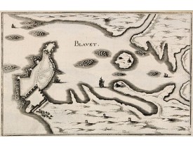
MERIAN, C. - Blavet.
Published
: Francfort/Main, 1655
Size
: 180 x 280mm.
Color
: Uncoloured.
Condition
: Belle impression.
Planche figurant l'embouchure du Blavet avec la citadelle de Port-Louis, publiée dans la "Topographia Galliae"de Merian. De 1..
80€
MERIAN, C. - Blavet.
Add to Cart
Add to Wish List
Compare this Product
Ask Question
Ask Question
Location:
1676
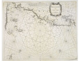
DONCKER, H. - Bretaigne van C. de Hague tot Heyssant.
Published
: Amsterdam, 1676
Size
: 420 x 530mm.
Color
: Uncoloured.
Condition
: Pâles mouillures.
Carte marine figurant la côte bretonne avec les îles anglo-normandes, Saint-Malo, St-Pol-de-Léon, Brest et l'île d'Ouessant...
600€
DONCKER, H. - Bretaigne van C. de Hague tot Heyssant.
Add to Cart
Add to Wish List
Compare this Product
Ask Question
Ask Question
Location:
1680
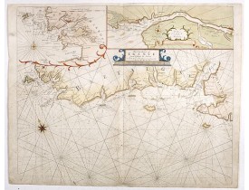
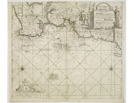
MOUNT, R. / PAGE, T. - The Sea Coasts of France from Ushent to Olone.
Published
: Londres, ca. 1680
Size
: 440 x 532mm.
Color
: Coloured
Condition
: Bel exemplaire.
Detailed chart of the Coast of Brittany between Ouessant and Olonne-sur-Mer. The chart is oriented with north-east at the top..
450€
MOUNT, R. / PAGE, T. - The Sea Coasts of France from Ushent to Olone.
Add to Cart
Add to Wish List
Compare this Product
Ask Question
Ask Question
Location:
1683
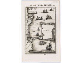
MANNESSON MALLET, A. - Plan de St. Malo / Platte Grond van St. Malo.
Published
: Paris, 1683
Size
: 143 x 95mm.
Color
: Uncoloured.
Condition
: Bon exemplaire.
Plan de St. Malo publié en 1684-85 dans l'ouvrage de science militaire "Les Travaux de Mars, ou l'Art de la guerre.". Allain ..
50€
MANNESSON MALLET, A. - Plan de St. Malo / Platte Grond van St. Malo.
Add to Cart
Add to Wish List
Compare this Product
Ask Question
Ask Question
Location:
1690
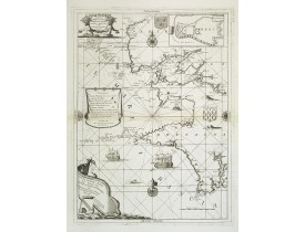
CORONELLI, V.M. - Citta, porto, e rada di Brest, e . . . Nella Bretagna . . .
Published
: Venise, 1690
Size
: 603 x 450mm.
Color
: Uncoloured.
Condition
: Belle impression. Papier un peu jauni le long du pli central.
Belle carte de Bretagne par Vincenzo Coronelli ornée de 3 cartouches, de bateaux et roses des vents. En carton : plan de Bres..
750€
CORONELLI, V.M. - Citta, porto, e rada di Brest, e . . . Nella Bretagna . . .
Add to Cart
Add to Wish List
Compare this Product
Ask Question
Ask Question
Location:
1693
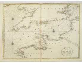
JAILLOT, H. / MORTIER, P. - Carte de la Manche.
Published
: Amsterdam, Pierre Mortier, 1693
Size
: 578 x 785mm.
Color
: In original o/l colours.
Condition
: Printed on two joined sheets. Paper along the centerfold slightly age-toned. Very good condition. In original o/l colours.
Chart showing the Channel, with the coastline of France from La Baie de Douarnenez to Dunkerque, and the coastline of England..
750€
JAILLOT, H. / MORTIER, P. - Carte de la Manche.
Add to Cart
Add to Wish List
Compare this Product
Ask Question
Ask Question
Location:
1705
DE FER, N. - Plan d'un marais salant . . .
Published
: Paris, 1705
Size
: 160 x 195mm.
Color
: Uncoloured.
Condition
: Mint condition. Dark impression. <br />Together with an engraved text sheet.
Aerial view of a salt marsh, with depiction of working scenes and a nice cartouche, from Nicolas de Fer's "L'Atlas curieux ou..
30€
DE FER, N. - Plan d'un marais salant . . .
Add to Cart
Add to Wish List
Compare this Product
Ask Question
Ask Question
Location:
1709
VAN KEULEN, J. - Nieuwe pascaart van een Gedeelte Van Bretagne… / Carte Marine Pour une Partie des Costes de Bretagne depuis L'isle de Groa Jusqu'a Le Roches de Penmarcke…
Published
: Amsterdam, 1709
Size
: 505 x 575mm.
Color
: Uncoloured.
Condition
: Petites taches brunes ; coupé en haut, à l'intérieur du filet d'encadrement.
Carte marine publiée dans "De Groote Nieuwe Vermeerderde Zee-Atlas ofte Water-Waereld. Vertoonende in zig alle de Zee-Kusten ..
600€
VAN KEULEN, J. - Nieuwe pascaart van een Gedeelte Van Bretagne… / Carte Marine Pour une Partie des Costes de Bretagne depuis L'isle de Groa Jusqu'a Le Roches de Penmarcke…
Add to Cart
Add to Wish List
Compare this Product
Ask Question
Ask Question
Location:
1720
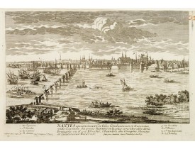
AVELINE, P. / CREPY. - Nantes, ancienement Corbilo, Condiuineum et Namnetes, ville Capitale du pays Nantois et la plus considérable de la Bretagne..
Published
: Paris, 1690-1720
Size
: 210 x 310mm.
Color
: Uncoloured.
Condition
: Restoration of a worm hole on top, 14 mm into the image. Minor part of upper right border frame cut off.
Bird's eye-view of the French town of Nantes, including a key list at the bottom. Engraved by Pierre Aveline (Paris, c.1656 -..
250€
AVELINE, P. / CREPY. - Nantes, ancienement Corbilo, Condiuineum et Namnetes, ville Capitale du pays Nantois et la plus considérable de la Bretagne..
Add to Cart
Add to Wish List
Compare this Product
Ask Question
Ask Question
Location:
1720
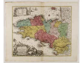
HOMANN, J.- B. - Tabula Ducatus Britanniae Gallis le Gouvernemt. General de Bretagne.
Published
: Nuremberg, ca. 1720
Size
: 482 x 574mm.
Color
: In attactive original colours.
Condition
: Mouillures angulaires dans la partie supérieure.
Troisième état, non datée et sans privilège. Ornée d'un cartouche de titre et d'un plan de la ville de Brest...
300€
HOMANN, J.- B. - Tabula Ducatus Britanniae Gallis le Gouvernemt. General de Bretagne.
Add to Cart
Add to Wish List
Compare this Product
Ask Question
Ask Question
Location:
1729
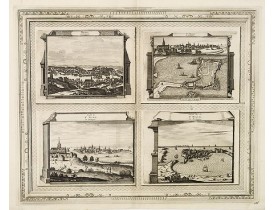
AA, P. van der - Brest, Profil de St. Malo, Autre vue de St. Malo en Bretagne.
Published
: Leide, 1729
Size
: 336 x 412mm.
Color
: Uncoloured.
Condition
: Belle impression.
Quatre vues sur une planche figurant Brest et St. Malo (sous 3 angles différents). Planche figurant dans la "Galerie Agréable..
450€
AA, P. van der - Brest, Profil de St. Malo, Autre vue de St. Malo en Bretagne.
Add to Cart
Add to Wish List
Compare this Product
Ask Question
Ask Question
Location:
1730
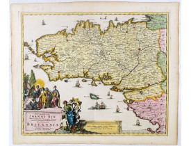
PERSOY, P. - Nobm° Prudm°qs Vìro Joanni Six ... hanc novissimam Britanniae, olim Armoricae, tabulam summa veneratione d.d.d. Petrus Persoy.
Published
: Amsterdam, 1730
Size
: 465 x 556mm.
Color
: In attractive strong original colours.
Condition
: In mint condition. Very attractive original colours.
This rare map of Britany made by the Amsterdam publisher and Pieter Persoy (1675-1695). This among fourteen other maps are s..
700€
PERSOY, P. - Nobm° Prudm°qs Vìro Joanni Six ... hanc novissimam Britanniae, olim Armoricae, tabulam summa veneratione d.d.d. Petrus Persoy.
Add to Cart
Add to Wish List
Compare this Product
Ask Question
Ask Question
Location:
1753
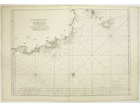
LE NEPTUNE FRANCOIS. - 6.me Carte Particuliere des Costes de Bretagne depuis la Baye d' Hodierne jusqu' a l' Isle de Groa, Contenant les Isles de Glenan.
Published
: Paris, 1753
Size
: 585 x 805mm.
Color
: In original colours.
Condition
: Parfait état. Sur papier fort.
Le "Neptune François" fut une entreprise officielle à laquelle collaborèrent, à l'initiative du ministre Colbert, les mathéma..
450€
LE NEPTUNE FRANCOIS. - 6.me Carte Particuliere des Costes de Bretagne depuis la Baye d' Hodierne jusqu' a l' Isle de Groa, Contenant les Isles de Glenan.
Add to Cart
Add to Wish List
Compare this Product
Ask Question
Ask Question
Location:
1753
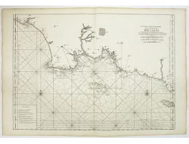
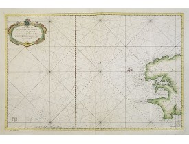
LE NEPTUNE FRANCOIS. - 4me Carte Particulière des Costes de Bretagne Depuis l'Anse de Goulven jusqu'à l'Isle d'Ouessant.
Published
: Paris, 1753
Size
: 585 x 805mm.
Color
: In original colours.
Condition
: Parfait état. Sur papier fort.
Le "Neptune François" fut une entreprise officielle à laquelle collaborèrent, à l'initiative du ministre Colbert, les mathéma..
450€
LE NEPTUNE FRANCOIS. - 4me Carte Particulière des Costes de Bretagne Depuis l'Anse de Goulven jusqu'à l'Isle d'Ouessant.
Add to Cart
Add to Wish List
Compare this Product
Ask Question
Ask Question
Location:
1757
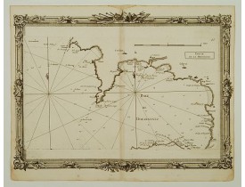
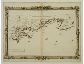
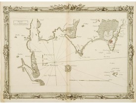
BRION DE LA TOUR, Louis. - Partie de la Bretagne. (27).
Published
: Paris, Desnos, 1757
Size
: 275 x 363mm.
Color
: Uncoloured.
Condition
: Mouillures en marge inf., pli central jauni.
Couvre la région de Lambaban à la Baye de Forest en englobant les Roches de Penmark et l'Isle aux Moutons. Tiré du "Recueil d..
300€
BRION DE LA TOUR, Louis. - Partie de la Bretagne. (27).
Add to Cart
Add to Wish List
Compare this Product
Ask Question
Ask Question
Location:
1757
BRION DE LA TOUR, Louis. - Partie de la Bretagne. (21).
Published
: Paris, Desnos, 1757
Size
: 275 x 363mm.
Color
: Uncoloured.
Condition
: Pâles mouillures en bordure de carte, pli central un peu jauni. Villes coloriées en rouge à l'époque.
Couvre le littoral de l'Isle Vierge à l'Anse de Goulven. Tiré du "Recueil des Côtes Maritimes de France" édité chez Desnos. B..
200€
BRION DE LA TOUR, Louis. - Partie de la Bretagne. (21).
Add to Cart
Add to Wish List
Compare this Product
Ask Question
Ask Question
1
2
3
4
>
>|
Showing 1 to 24 of 95 (4 Pages)
Filter Products