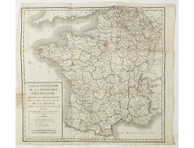
France general
Location: 1799
Published: Paris, 1799
Size: 503 x 530mm.
Color: In original o/l colours.
Condition: Very crisp and fine image. Various folds and margins rather short, as issued. Repair of 2 tears in the lower left side, 1,7 and 6 cm into the engraved image; 2,5 cm in the upper right.
Folding map of France, extending northeastwards to include Belgium and part of Germany.From Atlas Portatif Universel, by Robe..
50€
Location: 1814
Published: Paris,1811-1814
Size: 1055 x 915mm.
Color: In original o/l colours.
Condition: Carte repliée montée sur toile. Large texte descriptif à gauche et en partie supérieure gauche. Quelques annotations complémentaires manuscrites. Cachet rouge circulaire (illisible) près du titre. Quelques galeries de vers affectant la carte et traces de pliures.
Carte monumentale quadrillée de la France figurant la navigation intérieure de l'Empire français. La Corse est figurée dans u..
750€
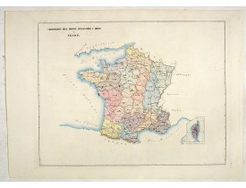
Location: 1840
Published: Venice, 1840
Size: 315 x 440mm.
Color: In attractive original colours.
Condition: Printed on heavy paper. Mint condition.
Two rare page maps of France on one page. According to the title, prepared by A de La Sage for l'Atlante Storico, Letterario,..
50€
Location: 1841
Published: Paris, M. B. Dusillon, ca. 1841
Size: 480 x 675mm.
Color: In original o/l colors.
Condition: Paper slightly age toned but generally in very good condition. The maps on strong paper. Size of the sheet 560mm x 740mm.
Detailed map of France, from "Atlas général de France divisée en départements par Donnet et Monin ; avec armes et vues de Cha..
80€
Location: 1844
Published: Paris, 1844
Size: 786 x 1016mm.
Color: In attactive original colours.
Condition: Carte dépliante divisée en 32 sections montées sur toile. Infimes rousseurs. - Folding map dissected in 32 sections, canvas mounted. In original colours. Paper very slightly age toned. Generally fine condition.
Road map of France, Corsica and Northern Italy. In lower left corner inset map of the region around Paris.Prepared by Lapie a..
200€
Location: 1858
Published: Rome, 1858
Size: 480 x 610mm.
Color: In attractive original wash colours.
Condition: With original full hand colour, on fine wove paper watermarked ‘Pietro Miliani Fabriano’, size of the sheet 570 x 800 mm.
PETRI Girolamo - Circscrizione delle province ecclesiastiche e diocesi in Francia (Tav LIII) - 44089 - France general - PET..
250€
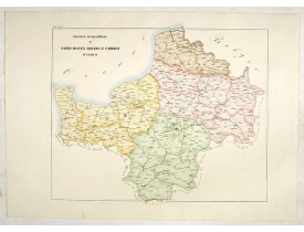
Location: 1858
Published: Rome, 1858
Size: 485 x 585mm.
Color: In attractive original wash colours.
Condition: With original full hand colour, on fine wove paper watermarked ‘Pietro Miliani Fabriano’, size of the sheet 570 x 800 mm.
PETRI Girolamo - Province ecclesiastiche di Parigi, Rouen, Rheims, E Cambray in Francia (Tav LIV) - 44090 - France general ..
250€
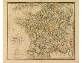
Location: 1864
Published: Londres, 1855 / 1864
Size: 523 x 617mm.
Color: In original colours.
Condition: Printed on heavy paper. Repair of split lower part centerfold, else good.
Very detailed map of France. Indicated are railways, but also the projected and the ones in progress. Lower right, inset map ..
90€
Location: 1874
Published: Paris, 1874
Size: 270 x 370mm.
Color: Original colours.
Condition: Steel engraving in mint condition.
A decorative map of France's topography from Géographie Universelle, Atlas Migeon. published by J. Migeon.From one of the las..
20€
Location: 1875
Published: Paris, ca. 1875
Size: 900 x 656mm.
Color: In attactive original colours.
Condition: Bel exemplaire sur papier fort.
Grande carte de France figurant les voies navigables par A. Vuillemin, dressée d'après les cartes hydrographiques de la Marin..
250€
Location: 1875
Published: Paris, ca.1875
Size: 616 x 846mm.
Color: In attactive original colours.
Condition: Bel exemplaire.
Carte figurant les chemins de fer de la France et de l'Allemagne flanquée d'un "Tableau indiquant les réseaux des chemins de ..
250€
Location: 1876
Published: Paris, 1876
Size: 654 x 880mm.
Color: In attactive original colours.
Condition: Petites déchirures en marge supérieure.
Carte de France dressée par Frémin d'après les cartes de la Marine, celles des Ponts-et-Chaussées et des Postes. Indique les ..
250€
Location: 1876
Published: Paris, 1876
Size: 654 x 810mm.
Color: In attactive original colours.
Condition: Bel exemplaire.
Carte de France dressée par A. Vuillemin indiquant les routes, les chemins de fer, les rivières navigables et les canaux ; ai..
250€
Location: 1900
Published: Paris, circa 1900
Size: 405 x 304mm.
Color: Colour printed.
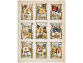
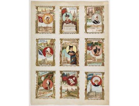
Condition: Nine small chromolithographies pasted on one sheet. Each card is 113mm x 81mm. In very good condition.
Nine small chromolithographed trade cards for "A la Ville de Saint Denis", each illustrating French regions and cities, with ..
60€
Location: 1900
Published: Paris, circa 1900
Size: 405 x 304mm.
Color: Colour printed.
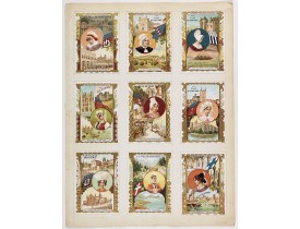
Condition: Nine small chromolithography's pasted on one sheet. Each trade card is 113mm x 81mm. In very good condition.
Nine small chromolithographed trade cards for "A la Ville de Saint Denis", each illustrating French regions and cities, with ..
60€

