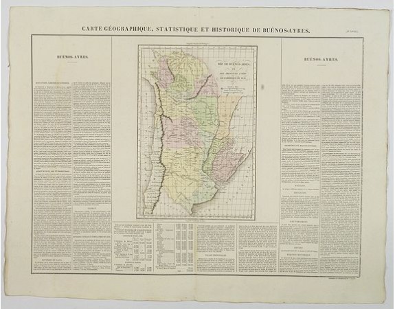
BUCHON, J. A. - Carte Geographique, Statistique et Historique de Buenos-Ayres.
 Click on image to zoom

BUCHON, J. A. - Carte Geographique, Statistique et Historique de Buenos-Ayres.
Published: Paris, 1825
Size: 445 x 610 mm.
Color: In original colours.
Condition: In mint condition. Lightly age toned. Wide margins etc.
Description
A nice detailed map of what is today northern Argentina (Rep. of Buenos Ayres or the United Provinces of South America) from Buchon's Atlas Gégraphique Statistique, historique et chronologique des deux Ameriques et des isles adjacentes; traduit de l'atlas exécuté en Amerique d'aprés Lesage, avec des nombreuses corrections et augmentations, Paris 1825. An elegant Parisian publication of the Carey & Lea atlas of the Americas, first published in 1822 in Philadelphia.
Map is surrounded by letterpress explanatory text (in French), which includes details of its limits and extent, aspects of the country and its soil, produce, rivers, lakes, climate, division of population, major settlements, manufacturing and commerce, religion, education, income, government, and historical notes. Mileage scales.
This is a fine map and is a great example of a superior 19th century engraving technique.
100€
- Reference N°: 44075
