


Geological maps
The weird, enchanting beauty of geology maps
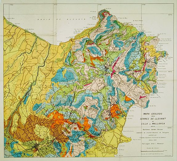
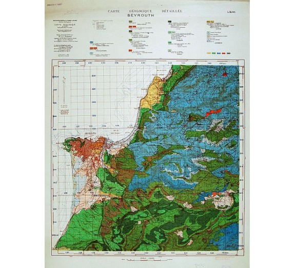
There is something about geological maps from the early twentieth century! Their colors seem more vivid than those of modern maps. Even their legends are more interesting: geological maps are special-purpose maps made to show geological features. Rock units or geologic strata are shown by color or symbols to indicate where they are exposed at the surface.
Bedding planes and structural features such as faults, folds, foliations, and lineations are shown with strike and dip or trend and plunge symbols, giving these features three-dimensional orientations.
Stratigraphic contour lines may be used to illustrate the surface of a selected stratum, illustrating the subsurface topographic trends of the strata. They offer a glimpse of the transportation infrastructure (steam and electric railroads, trails, ferry landings), landscape features that may not be visible today (salt marshes, swamps, tidal flats, escarpments, rock outcrops), and geology (stony and gravelly areas, quarries).
There are colors for different ages of rocks, patterns for different kinds of rock, and lines for faults, elevation and boundaries between rock layers. Each colored area on the map also has a letter symbol, which you can see in the explanation boxes.
Among the various branches of science, the earth sciences, especially geology, are most dependent on maps. Geology was the exciting new science of the nineteenth century, much like space exploration or biotechnology in the twentieth. New concepts appeared of unimaginably vast periods, of strange extinct creatures, of systematic ways of exploring for economic minerals.