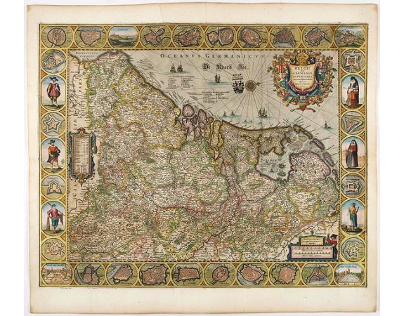
HONDIUS, H. - Belgii sive Germaniae Inferioris accuratissima tabula.

Out Of Stock
HONDIUS, H. - Belgii sive Germaniae Inferioris accuratissima tabula.
Published: Amsterdam, 1631
Size: 480 x 605mm.
Color: Colored
Condition: Verso blank. Paper slightly water stained and some light brown spotting. Lower and side parts folded as issued. Split of 5 cm in the middle of lower fold and small tears at the intersection of folds, a few tears along margins into engraved area.
Description
Very rare and very decorative map with in the right and left borders costumed figures and town plans alternately. In top and bottom border town plans and views.
Separate publication. State (a) with blank verso.
Title in a shield, surrounded by the coat-of-arms of the XVII Provinces, in upper corner. In lower right corner imprint and bar scales.
Along the left border a cartouche with legend of symbols and number of towns and villages per province.
Decorative borders on top and bottom with city plans and views i.a. Leuven, Luxemburg, Ghent, Arras, Middelburg, Zutphen, Antwerp, Mechelen, Deventer, etc.
Each side border shows 4 town plans in circular frames with 3 costumed figures in upright oval frames.
0€
- See other items by this publisher: HONDIUS, H.
- Reference N°: 45528
2218 views
 Click on image to zoom
