All Products
Click on image to zoom
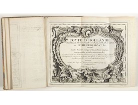
Location: 1730
Published: Augsbourg, ca. 1730
Size: 390 x 240mm.
Color: Uncoloured.
Condition: In-folio de 157 planches ; plein vélin, dos à 5 nerfs, tranche mouchetée, titre au dos inscrit à la plume en italien (reliure postérieure). Coins frottés. Ex-libris armorié avec la devise : "Bene vivere et laetari" (bien vivre et se réjouir).
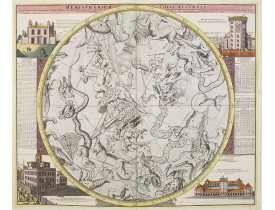
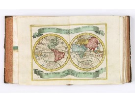
Rare recueil composite d'estampes publiées à Augsbourg par les célèbres éditeurs Martin Engelbrecht, Ioh. Georg Hertel et les..
9,500€
Location: 1730
Published: Amsterdam, 1730
Size: 465 x 556mm.
Color: In attractive strong original colours.
Condition: In mint condition. Very attractive original colours.
This rare map of Britany made by the Amsterdam publisher and Pieter Persoy (1675-1695). This among fourteen other maps are s..
700€
Location: 1730
Published: Paris, 1730
Size: 212 x 305mm.
Color: Uncoloured.
Condition: Coupé au filet d'encadrement et collé anciennement sur papier fort.
View of the Arcenal in Paris. Published in Paris at N. Langlois rüe St. Jacques a la Victoire. N. Langlois, son-in-law of the..
120€
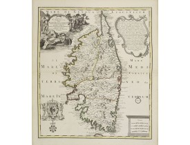
Location: 1730
Published: Nüremberg, ca. 1730
Size: 570 x 490mm.
Color: In attactive original colours.
Condition: Belle impression sur papier fort. Fortes mouillures dans les angles inf. gauche.
Ornée dans la partie sup. gauche d'un cartouche de titre décrivant une scène pittoresque corse, en haut à droite d'une descri..
950€
Location: 1730
Published: Augsbourg, ca. 1730
Size: 385 x 1035mm.
Color: Uncoloured.
Condition: Imprimé en 2 feuilles, jointes. Bel exemplaire en parfait état. - Printed from two plates, joined. Fine condition.
A large-scale panoramic town-view of Lisbon, with legends in Latin and German, numbered from 1-72, along the bottom of the pr..
4,500€
Location: 1730
Published: Amsterdam, 1730
Size: 490 x 573 mm.
Color: Original o/l colour.
Condition: In mint condition.
COVENS, J./ MORTIER, C. - Carte du Canada ou de la Nouvelle France. - 00675 - Canada - COVENS, J./ MORTIER, C. - Carte du Ca..
1,000€
Location: 1732
Published: Leipzig, Gledisch, 1732
Size: 200 x 300mm.
Color: Uncoloured.
Condition: Paper slightly age-toned. Dark impression.
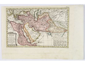
Uncommon map of Persia, Armenia, Arabian Peninsular and part of India. Prepared by Christoph Cellarius (1638-1707). From Geo..
80€
Location: 1734
Published: Venice, 1734
Size: 200 x 130 mm.
Color: Uncoloured.
Condition: 8vo. Contemp. vellum. 512pp. Illustrated with 4 plates including one with Japanese people. 1 folding view of Deshima and two folding maps of Japan and the Philippines with Italian text after I. Tirion.
This most uncommon work provides an interesting focus on the dissemination of the outline of Japan provided by Kaempfer. Besi..
1,000€
Location: 1734
Published: London, William Mount & Thomas Page, 1734
Size: 518 x 865mm.
Color: Coloured.
Condition: In very good condition.
A very fine sea chart of China's Zhejiang Province, from the celebrated Third Book of 'The English Pilot'This elegant and lar..
2,500€
Location: 1735
Published: Paris, P.G. Le Mercier, 1735
Size: 371 x 435mm.
Color: Uncoloured.
Condition: A very good and dark impression. Wide margins.
Important map of Yun-nan 云南 [Yunnan] province. With a quite elaborately pictorial cartouche featuring a rococo chinoiserie or..
100€
Location: 1735
Published: Paris, P.G. Le Mercier, 1735
Size: 258 x 302mm.
Color: Coloured.
Condition: A very good and dark impression. Wide margins.
Important map of Koei-tcheou 贵州 [Guizhou]. With a quite elaborately pictorial cartouche featuring a rococo chinoiserie orname..
80€
Location: 1735
Published: Amsterdam, c.1735
Size: 1591 x 1355mm.
Color: Original outline colours.
Condition: Wall map in 4 panels of 3 sheets each not joined, mounted on canvas. Water staining and some moisture stains more visible on the canvas. Dark impression. Cardboard case covered with marbled paper, label with the 2 title in manuscript.
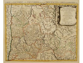
Rare wall map of the Savoie/Piémont and Dauphiné/Provence region. Decorated with 2 title-cartouches, one at upper right part ..
2,500€
Location: 1735
Published: Nuremberg, 1735
Size: 966 x 585mm.
Color: In original colours.
Condition: Two sheet map in full original body colour, if assembled 966 x 585mm.
Large 2-sheet map of an area of Lithuania and Eastern Prussia (Russian province of Kaliningrad) stretching from Klaipeda (Mem..
1,350€
Location: 1736
Published: The Hague, H. Scheurleer, 1736
Size: 560 x 410mm.
Color: Uncoloured.
Condition: 4 volumes, 4to (257 x 196mm.), titles printed in red and black with engraved vignettes, 11 engraved vignette illustrations and 51 plates (of 53), a number folding, contemporary half calf, spines gilt with morocco labels, [Löwendahl 398], without the separately published atlas, lacking 2 plates in vol.2 (Obseques at p.149 and Gin seng at p.180), one plate torn without loss (vol.1, p.230), d4 vol.1 with short tear and slight stain, bindings slightly rubbed and slightly worn.
These volumes accompany Bourguignon d'Anville's Nouvel atlas de la Chine, de la Tartarie chinoise et du Thibet. of 1737. Firs..
5,000€
Location: 1736
Published: Nuremberg, 1736
Size: 508 x 1660mm.
Color: In original colours.
Condition: A three sheet plan. Some light water staining's, discolouration along joints, a few printer's creases. Lower margin cut to neat line. Overall in good condition for such a large view.
Detailed plan of London, extending from Grosvenor Square in the west to Mile End to the east. To the right inset views of St..
4,000€
Location: 1737
Published: Amsterdam, 1737
Size: 120 x 265mm.
Color: Uncoloured.
Condition: Dark impression. Printed on heavy paper.
View of Niagara Falls, taken from the six sheet Dutch edition of Popple's monumental map the "British Empire in America"...
240€
Location: 1737
Published: Augsburg, 1737
Size: 505 x 580mm.
Color: In original colours.
Condition: Very good and dark impression.
A striking image of this fortified Russian outpost on the Black Sea at Otzakoff, northeast of Odessa...
1,000€
Location: 1737
Published: Nurnberg, 1737
Size: 482 x 562mm.
Color: In original colours.
Condition: Repair of a very small marginal tear in lower margin. Paper slightly age toned. In good condition.
Johann Baptist Homann's well-engraved map of the Turkish Empire shows the journey from Tunis to Arabia, including Greece, Ara..
900€
Location: 1737
Published: The Hague, 1737
Size: 470 x 685mm.
Color: In original colours.
Condition: Paper broken on centerfold and other places due to oxidation of green ink. Good and dark impression.
It has a quite elaborate pictorial cartouche engraved by G. Kondet. It is a very detailed map of China, Tibet, and Korea.In t..
2,500€
Location: 1737
Published: Paris, 1737
Size: 500 x 700mm.
Color: In original o/l colours.
Condition: Bel exemplaire.
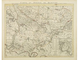
Comprend les villes d'Abbeville, Amiens, Cambrai, Beauvais, Compiègne et Soissons. Etienne-Louis Crépy. Graveur de géographi..
200€
Location: 1737
Published: Nurnberg, 1737
Size: 485 x 563mm.
Color: Original colours.
Condition: A good and dark impression. Some very light age toning of paper.
Johann Baptist Homann's well-engraved map of the Ottoman Empire centered on Cyprus. With good detail in the Arabian Peninsula..
475€
Location: 1738
Published: Paris, 1705-1738
Size: 480 x 600mm.
Color: Coloured.
Condition: Very fine condition. Dark impression.
Fifth map of the city of Paris. Its growth and its fourth enclosure, begun under Charles V in the year 1367 and completed und..
400€