Menu
Menu
Your Cart

All Products

Click on image to zoom

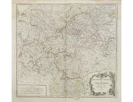
Location: 1745
Published: Amsterdam c. 1745
Size: 470 x 590 mm.
Color: In original colors.
Condition: Printed on heavy paper, slightly age-toned. Minor water staining on lower margin centerfold, not attaining the engraved area. Good margins. Excellent condition.
COVENS, J. / MORTIER, C. - Carte du Diocese de Narbonne Dressée.. - 21508 - Languedoc - COVENS, J. / MORTIER, C. - Carte du ..
350€
Add to Cart
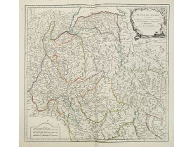
Location: 1745
Published: Amsterdam c. 1745
Size: 470 x 575 mm.
Color: In original colors.
Condition: Original color in outline and highlights on stout paper, slightly age-toned. Minor water staining on lower margin centerfold, not attaining the engraved area. Good margins. Excellent condition.
COVENS, J. / MORTIER, C. - Carte du Diocese de Beziers Dressée. . . - 21509 - Languedoc - COVENS, J. / MORTIER, C. - Carte d..
300€
Add to Cart
Location: 1745
Published: Amsterdam, ca. 1745
Size: 470 x 585mm.
Color: In original o/l colours.
Condition: Imprimé sur papier fort. - Printed on heavy paper, slightly age-toned. Very good condition.
Highly detailed regional map, with an inset town plan of Beauvais. Shows illustrated topography with towns, roads, rivers, la..
250€
Add to Cart
Location: 1745
Published: Amsterdam c. 1745
Size: 485 x 275mm.
Color: Uncoloured.
Condition: Paper slightly age toned. Printed on heavy paper. Dark impression.
Title page of the homonymous atlas by Jean Covens and Corneille Mortier. Blank verso. Soldiers, savages and other individuals..
250€
Add to Cart
Location: 1745
Published: Amsterdam c. 1745
Size: 485 x 570 mm.
Color: Original o/l colour.
Condition: Printed on heavy paper slightly age-toned as usual. Very good impression.
COVENS, J. / MORTIER, C. - Carte du Paraguay, du Chili, du Detroit de Magellan &c. - 43300 - Argentina - COVENS, J. / MORTIE..
400€
Add to Cart
Location: 1745
Published: Amsterdam c. 1745
Size: 610 x 614 mm.
Color: In original o/l colours.
Condition: Original outline hand colouring on heavy paper, slightly age-toned. Minor water stain lower margin centre fold. Short margins as issued. Very good condition.
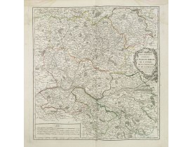
COVENS, J. / MORTIER, C. - Carte de la Beauce du Gatinois de la Sologne et Pays Voisins.. - 21517 - Orléanais - COVENS, J. / ..
250€
Add to Cart
Location: 1746
Published: Paris, 1746
Size: 204 x 274mm.
Color: In original o/l colours.
Condition: Very good condition.
Interesting map of South America...
100€
Add to Cart
Location: 1746
Published: Marseille, 1732 - 1746
Size: 460 x 595mm.
Color: Uncoloured.
Condition: Bonne condition générale. Très belle impression. Marge sup. gauche un peu courte. Pliures d'origine.
Rare map depicting the southern tip of Corsica around Bonifacio. Oriented with East on top. From the rare chart book by Jacqu..
500€
Add to Cart
Location: 1746
Published: Marseille, 1732-1746
Size: 293 x 455mm.
Color: Uncoloured.
Condition: Belle impression sur papier fort. Bonne condition générale.
Publié dans : "Recueil de plusieurs plans des ports et rades et de quelques cartes particulières de la mer Méditerranée..." ..
400€
Add to Cart
Location: 1746
Published: Paris, 1746
Size: 540 x 400mm.
Color: Uncoloured
Condition: Paris, Chez l'Auteur Sur le Quay de l'Horloge du Palais à l'Enseigne de LA PLACE DES VICTOIRES a la descente du Pont-Neuf. Avec Privilege du ROI. 1746.<br>Folio. Book block 540x40mm. With a frontispiece, 123 mostly double page maps in original outline colour and a 4 pages manuscript list of contents. 18th century brown calf, gilt spine with raised bands (binding carefully restored). Maps in very good condition despite some small restoration work, the paper is very slightly age-toned as is usual, with a few brown spots. Generally in very fine condition.<br>The frontispiece in this example has like in the other known examples the engraved date 170[.], for this example the manuscript addition changing the date into 1746. Bound at the end we find a 4 page manuscript table of contents, according to this list the title page and 3 maps are wanting (36, 91 and 101).
The present example of the Théâtre du monde is the reissue of 1746 by Jean-Baptiste Nolin II. This scarce atlas is illustrate..
115,000€
Add to Cart
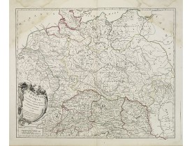
Location: 1746
Published: Venice, 1746
Size: 390 x 460mm.
Color: Uncoloured.
Condition: Margins cut short. Some light spotting. Some white tape on verso. A very good and dark impression.
Rare map of eastern part of Germany. West to the top. Showing the river Weser. Prepared by Johann Michael Gigas (1582-1637)...
200€
Add to Cart
Location: 1746
Published: Marseille 1732-1746
Size: 300 x 455mm.
Color: Uncolored
Condition: Belle impression.
Publié dans: "Recueil de plusieurs plans des ports et rades et de quelques cartes particulières de la mer Méditerranée..." pa..
250€
Add to Cart
Location: 1746
Published: Nuremberg, 1746
Size: 170 x 265mm.
Color: Coloured.
Condition: In very good condition, additional, wider margins added in contemporary paper. Nice impression.
An attractive map of the areas of control under the ancient Egyptian King Sesostris. These comprised Egypt and Ethiopia, Asia..
100€
Add to Cart
Location: 1747
Published: Nuremberg, 1747
Size: 490 x 585mm.
Color: In original colours.
Condition: Very good condition. Dark impression. Repair of tear lower part center fold 8mm. into the printed area. Very good condition.
Magnificent celestial chart drawn by the famous scientist Johann Gabriel Doppelmayr.Large circular charts of the southern hem..
2,200€
Add to Cart
Location: 1748
Published: Paris, later than 1748
Size: 159 x 208mm.
Color: In original o/l colours.
Condition: Very crisp and fine image. Good margins. Very good condition.
Attractive small map centered on the delta of the River Ijssel, where it discharges into the Zuiderzee.From Atlas Portatif Un..
60€
Add to Cart
Location: 1748
Published: Paris, later than 1748
Size: 158 x 180mm.
Color: In original o/l colours.
Condition: Very crisp and fine image. Good margins. Very good condition.
Attractive small map covering the northwestern part of Gelderland. In the center "'t Loo". From Atlas Portatif Universel, by ..
80€
Add to Cart
Location: 1748
Published: Augsbourg, 1748
Size: 205 x 170mm.
Color: In attractive original colours.
Condition: Contemp. half calf spine with gilt label. Fronti, title page,pp. 12,9,cxixi; 368;3,30 double page maps414,7,140, table 19pp. illustrated with 17 folding maps, 556,10pp.
A rare manual and containing geographical descriptions of all continents. Illustrated with 30 very finely engraved and colour..
6,000€
Add to Cart
Location: 1748
Published: Paris, Dheulland et Jullien,1748
Size: 265 x 390mm.
Color: In attactive original colours.
Condition: In-4 oblong. Titre (numéroté 23) et 2 feuillets de table gravés, une carte générale et 23 cartes régionales coloriées aux limites. Plats de carton recouverts de papier marbré (reliure d'attente). Plats et dos usagés, coins émoussés. Très frais intérieurement.
Première édition. Atlas illustré d'une carte générale de l'Italie et de 23 cartes régionales coloriées aux limites.- Illustra..
1,000€
Add to Cart
Location: 1748
Published: Paris, 1748
Size: 246 x 349mm.
Color: Coloured.
Condition: A good and dark impression.
A good engraved map of Cape of Good Hope. The geographical features are typical with somewhat exaggerated bays, inlets and pr..
200€
Add to Cart
Location: 1748
Published: Paris, Crépy, ca. 1748
Size: 240 x 138mm.
Color: Uncoloured.
Condition: In-8 oblong de (1) f. de titre et 35 cartes repliées ; 1/2 basane fauve, dos à nerfs orné (reliure de l'époque). Dos frotté, galerie de ver à côté de l'étiquette, galerie de ver affectant le contreplat, le feuillet blanc, la première carte et le titre. Ex-libris : J. A. Dezauche.
Atlas illustré d'un titre gravé replié, d'une carte générale et de 34 cartes particulières repliées. Les cartes réunies (y co..
2,200€
Add to Cart
Location: 1749
Published: Leipzig, 1749
Size: 167 x 202mm.
Color: In attactive original colours.
Condition: Papier légèrement bruni, infimes rousseurs.
La Corse est divisée en 2 districts, eux-mêmes divisés en pievi (la pieve est la plus ancienne division administrative de Cor..
300€
Add to Cart
Location: 1749
Published: Paris, 1749
Size: 470 x 560mm.
Color: In original o/l colours.
Condition: Larges mouillures dans les angles supérieurs.
Carte détaillée de la partie méridionale de la Franche-Comté figurant les villes de Dôle, St Claude et le lac de Genève...
50€
Add to Cart
Location: 1749
Published: Paris, 1749
Size: 465 x 560mm.
Color: In original o/l colours.
Condition: Larges mouillures dans les angles supérieurs.
Carte détaillée de la Franche-Comté figurant les villes de Vesoul, Besançon, Auxonne, Gray, et Belfort...
40€
Add to Cart
Location: 1750
Published: London, ca 1750
Size: 177 x 256 mm.
Color: Uncoloured.
Condition: In good condition, some light water staining and assorted marks etc to the margins and elsewhere. Dark impression, wide margins.
MOLL, H. - Arabia. According to the Newest and Most Exact Observations. - 43083 - Arabian Peninsular - MOLL, H. - Arabia. Ac..
350€
Add to Cart
Showing 1081 to 1104 of 2411 (101 Pages)