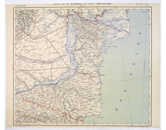
SERVICE GEOGRAPHIQUE DE L'ARMEE. - Carte de la Roumanie et Pays limitrophes. Odessa. GALATZ.
 Click on image to zoom

Out Of Stock
SERVICE GEOGRAPHIQUE DE L'ARMEE. - Carte de la Roumanie et Pays limitrophes. Odessa. GALATZ.
Published: Paris, 1908
Size: 515 x 598mm.
Color: Uncoloured.
Condition: Helio engraving in colours. Upper margin cut short, shaving the title. Very good condition.
Description
Very detailed (1:750.000) map centered on Constanta, with the river Danube in Romania. Made after an Austrian map.
The French Service géographique des armées was founded in 1887 and provided the French military and administrative forces with maps, their publications usually do not appear on the market. In 1940 the division became L'Institut géographique national (IGN).
The helio engraving was initially cited by J. N. Niépce (1829) to describe his photo-etching process (1826), which used a pewter plate coated with a bitumen resist that hardened on prolonged exposure to light.
0€
- Reference N°: 33636
