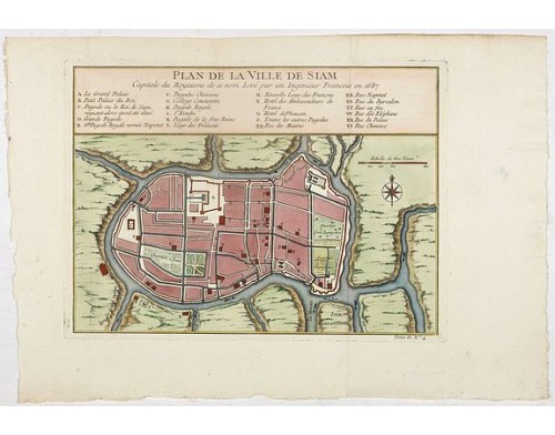
BELLIN, J.N. - Plan de la ville de Siam.
 Click on image to zoom

BELLIN, J.N. - Plan de la ville de Siam.
Published: Paris, 1750
Size: 192 x 263mm.
Color: Coloured
Condition: In very good condition.
Description
Early plan of Siam, Thailand. Across the top is an extensive list of 22 important sites and locations keyed to the plan with tiny letters and numbers.
Jacques Nicolaas Bellin (1703-1772) was one of the most important and proficient French cartographers of the mid-eighteenth century. He was appointed the first Ingenieur Hydrographe de la Marine, and also Official Hydrographer to the French King.
In smaller format, he issued the Petit Atlas Maritime (1764), which contained 580 charts, as well as maps to illustrate l Abbe Prevost's Histoire Générale des Voyages (1746-1757). Bellin also produced a substantial number of important separately issued maps, particularly reflecting continuing discoveries and political events in the Americas.
His maps and charts were finely engraved and produced, and set a high standard of accuracy.
350€
- Reference N°: 37973
