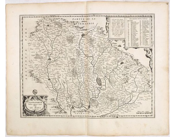
BLAEU, W. - Cenomanrum Galliae regionis typus: vulgo Le Mans.

New
BLAEU, W. - Cenomanrum Galliae regionis typus: vulgo Le Mans.
Published: Amsterdam, 1634
Size: 380 x 495mm.
Color: Uncoloured.
Condition: In good condition, printed on strong paper, a good dark impression. German text on verso.
Description
FIRST EDITION, FIRST ISSUE OF THIS MAP. From the 1634 edition of Blaeu's Atlas Novus, the first edition of this work.
Early map centered on Le Mans by the seventeenth century master Dutch publisher W. Blaeu. The regions rivers, tributaries, towns, cities hills and woodlands are all finely engraved and beautifully presented.
The map is well served with decorative embellishments like that of a title cartouche to the lower left corner, a table explaining all the religious symbols pertaining to the map. The major and most significant towns of the region are highlighted.
From an incomplete example of the 1634 German text edition of Blaeu's "Novus Atlas", previously owned by Johann Christoph Gesen (1639), Johann Rudolph von Metzradt (1651), Friedrich August II, King of Saxony (1797-1854).
P. van der Krogt mentions two variants for the German 1634 text edition and only two examples containing proof states (Bad Münstereifel and Gotha).
80€
- See other items by this publisher: BLAEU, W.
- Reference N°: 36040
4 views
 Click on image to zoom
