Languedoc
Location: 1784
Published: Venice, 1776 - 1784
Size: 587 x 458mm.
Color: In original o/l colours.
Condition: Bel exemplaire sur papier fort.
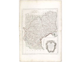
Attractive map of part of France, covering the western part of the Gulf of Lyon with its hinterland. Decorated with a rococo ..
100€
Location: 1784
Published: Venice, 1776 - 1784
Size: 587 x 458mm.
Color: In original o/l colours.
Condition: Minor marginal staining. A good and dark impression. Very good condition.
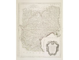
Attractive map of part of France, covering the western part of the Gulf of Lyon with its hinterland. Decorated with a rococo ..
250€
Location: 1806
Published: Paris, Prudhomme, Levrault, Debray, 1806
Size: 96 x 150mm.
Color: In original o/l colours.
Condition: Belle impression. Marge supérieure courte. Annotations manuscrites à l'encre rouge en haut à droite.
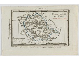
Carte du Tarn centrée sur la ville d' Albi, ici Alby, avec une petite légende dans le coin inférieur gauche. Toulouse est pré..
25€
Location: 1806
Published: Paris, Prudhomme, Levrault, Debray, 1806
Size: 150 x 96mm.
Color: In original o/l colours.
Condition: Belle impression.
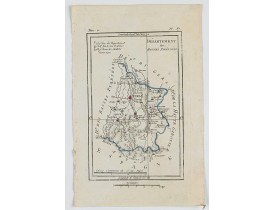
Carte centrée sur la ville de Bagnères, avec une petite légende dans le coin supérieur gauche...
15€
Location: 1806
Published: Paris, Prudhomme, Levrault, Debray, 1806
Size: 96 x 150 mm.
Color: In original o/l colours.
Condition: Belle impression.
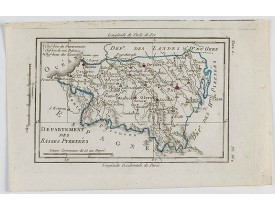
DELAPORTE,L'Abbé. - Département des Basses Pyrénées. - 62224 - Languedoc - DELAPORTE,L'Abbé. - Département des Basses Pyréné..
15€
Location: 1806
Published: Paris, Prudhomme, Levrault, Debray, 1806
Size: 115 x 157 mm.
Color: In original o/l colours.
Condition: Belle impression. Marge supérieure courte.
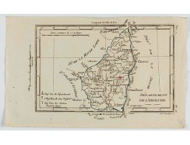
DELAPORTE, L'Abbé. - Département de l'Ardeche. - 62286 - Languedoc - DELAPORTE, L'Abbé. - Département de l'Ardeche. - 62286 ..
20€
Location: 1806
Published: Paris, Prudhomme, Levrault, Debray, 1806
Size: 101 x 158 mm.
Color: In original o/l colours.
Condition: Belle impression. Marge supérieure courte avec une infime mouillure.
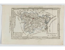
DELAPORTE, L'Abbé. - Département de l'Aude. - 62269 - Languedoc - DELAPORTE, L'Abbé. - Département de l'Aude. - 62269 - Lang..
20€
Location: 1806
Published: Paris, Prudhomme, Levrault, Debray, 1806
Size: 100 x 150 mm.
Color: In original o/l colours.
Condition: Belle impression. Marge supérieure courte.
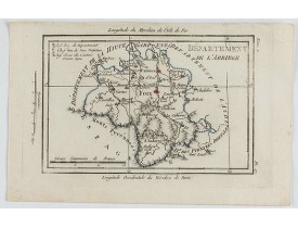
DELAPORTE, L'Abbé. - Département de l'Arriege. - 62267 - Languedoc - DELAPORTE, L'Abbé. - Département de l'Arriege. - 62267 ..
20€
Location: 1806
Published: Paris, Prudhomme, Levrault, Debray, 1806
Size: 100 x 157 mm.
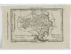
Color: In original o/l colours.
Condition: Belle impression. Marge supérieure courte.
DELAPORTE, L'Abbé. - Département du Gard. - 62258 - Languedoc - DELAPORTE, L'Abbé. - Département du Gard. - 62258 - Languedo..
30€
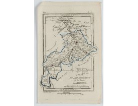
Location: 1806
Published: Paris, Prudhomme, Levrault, Debray, 1806
Size: 155 x 120 mm.
Color: In original o/l colours.
Condition: Belle impression. Marge gauche courte.
DELAPORTE, L'Abbé. - Carte du Département de la Haute Garonne. - 62257 - Languedoc - DELAPORTE, L'Abbé. - Carte du Départeme..
20€
Location: 1806
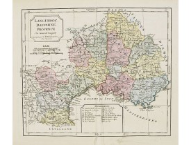
Published: Paris, 1794 – 1806
Size: 240 x 280mm.
Color: Original colours
Condition: Good and strong impression. Some minor marginal spotting. Repair of small marginal split, lower part center fold. Else very good condition.
Map of Languedoc, Dauphiné, Provence. By C. F. Delamarche, successor of Robert de Vaugondy, Geographer. Inset lower center ma..
80€
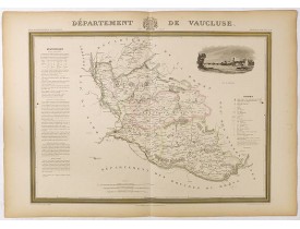
Location: 1841
Published: Paris, M. B. Dusillon, ca. 1841
Size: 480 x 675mm.
Color: In original o/l colors.
Condition: Paper slightly age toned but generally in very good condition. The maps on strong paper. Size of the sheet 560mm x 740mm.
Map of the department of Vaucluse published in "Atlas Général de France", divided by departments by Donnet and Monin, geograp..
250€
Location: 1841
Published: Paris, M. B. Dusillon, ca. 1841
Size: 480 x 675mm.
Color: In original o/l colors.
Condition: Paper slightly age toned but generally in very good condition. The maps on strong paper. Size of the sheet 560mm x 740mm.
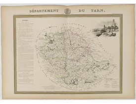
Map of the Tarn department published in "Atlas Général de France", divided into departments by Donnet and Monin, geographers,..
180€
Location: 1841
Published: Paris, M. B. Dusillon, ca. 1841
Size: 480 x 675mm.
Color: In original o/l colors.
Condition: Paper slightly age toned but generally in very good condition. The maps on strong paper. Size of the sheet 560mm x 740mm.
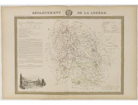
Detailed map of Lozère, from "Atlas général de France divisée en départements par Donnet et Monin ; avec armes et vues de Cha..
180€
Location: 1841
Published: Paris, M. B. Dusillon, ca. 1841
Size: 480 x 675mm.
Color: In original o/l colors.
Condition: Paper slightly age toned but generally in very good condition. The maps on strong paper. Size of the sheet 560mm x 740mm.
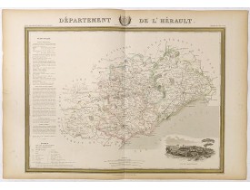
Detailed map of Hérault, from "Atlas général de France divisée en départements par Donnet et Monin ; avec armes et vues de Ch..
180€
Location: 1841
Published: Paris, M. B. Dusillon, ca. 1841
Size: 480 x 675mm.
Color: In original o/l colors.
Condition: Paper slightly age toned but generally in very good condition. The maps on strong paper. Size of the sheet 560mm x 740mm.
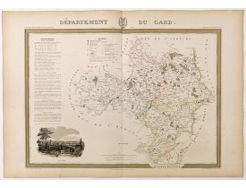
Detailed map of Guard, from "Atlas général de France divisée en départements par Donnet et Monin ; avec armes et vues de Chap..
180€
Location: 1841
Published: Paris, M. B. Dusillon, ca. 1841
Size: 675 x 480mm.
Color: In original o/l colors.
Condition: Paper slightly age toned but generally in very good condition. The maps on strong paper. Size of the sheet 560mm x 740mm.
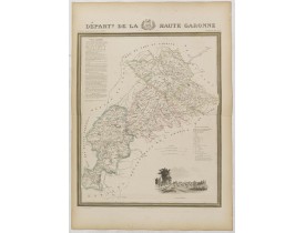
Detailed map of Haute Garonne, from "Atlas général de France divisée en départements par Donnet et Monin ; avec armes et vues..
180€
Location: 1841
Published: Paris, M. B. Dusillon, ca. 1841
Size: 480 x 675mm.
Color: In original o/l colors.
Condition: Paper slightly age toned but generally in very good condition. The maps on strong paper. Size of the sheet 560mm x 740mm.
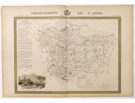
Detailed map of Aude, from "Atlas général de France divisée en départements par Donnet et Monin ; avec armes et vues de Chapu..
180€
Location: 1841
Published: Paris, M. B. Dusillon, ca. 1841
Size: 675 x 480mm.
Color: In original o/l colors.
Condition: Paper slightly age toned but generally in very good condition. The maps on strong paper. Size of the sheet 560mm x 740mm.
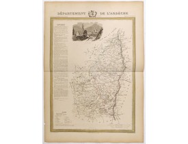
Detailed map of Ardèche, from "Atlas général de France divisée en départements par Donnet et Monin ; avec armes et vues de Ch..
180€
Location: 1841
Published: Paris, M. B. Dusillon, ca. 1841
Size: 480 x 675mm.
Color: In original o/l colors.
Condition: Paper slightly age toned but generally in very good condition. The maps on strong paper. Size of the sheet 560mm x 740mm.
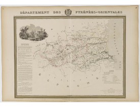
Map of the Pyrénées Orientales department published in "Atlas Général de France", divided into departments by Donnet and Moni..
180€
Location: 1841
Published: Paris, M. B. Dusillon, ca. 1841
Size: 480 x 675mm.
Color: In original o/l colors.
Condition: Paper slightly age toned but generally in very good condition. The maps on strong paper. Size of the sheet 560mm x 740mm.
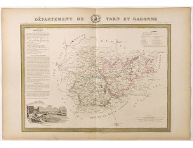
Detailed map of Tarn et Garonne, from "Atlas général de France divisée en départements par Donnet et Monin ; avec armes et vu..
180€
Location: 1852
Published: Paris, A. Combette, 1852
Size: 285 x 415mm.
Color: In original o/l colours.
Condition: Tres bon état. Gravure sur acier avec limites en coloris d'époque, les éléments décoratifs ne sont pas coloriés.
Carte du département de l'Ariège. Jeune ingénieur géographe du milieu du XIXe siècle, Victor Levasseur est surtout connu pour..
30€
Location: 1852
Published: Paris, A. Combette, 1852
Size: 290 x 420mm.
Color: In original o/l colours.
Condition: Tres bon état. Gravure sur acier avec limites en coloris d'époquer, les éléments décoratifs ne sont pas coloriés.
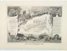
Carte du département des Pyrénées Orientales. Jeune ingénieur géographe du milieu du XIXe siècle, Victor Levasseur est surtou..
50€
Location: 1852
Published: Paris, A. Combette, 1852
Size: 280 x 425mm.
Color: In original o/l colours.
Condition: Tres bon état. Gravure sur acier avec limites en coloris d'époquer, les éléments décoratifs ne sont pas coloriés.
Carte du département du Hautes. Pyrénées. Jeune ingénieur géographe du milieu du XIXe siècle, Victor Levasseur est surtout co..
50€


![LEVASSEUR, V. - Dépt. De L'Ariège. N°8. [ Foix ] LEVASSEUR, V. - Dépt. De L'Ariège. N°8. [ Foix ]](https://www.loeb-larocque.com/eshop/image/cache/catalog/image/new_upload/27087-275x210w.jpg)
![LEVASSEUR, V. - Dépt. Des Htes. Pyrénées. N°64. [ Lourdes ] LEVASSEUR, V. - Dépt. Des Htes. Pyrénées. N°64. [ Lourdes ]](https://www.loeb-larocque.com/eshop/image/cache/catalog/image/new_upload/27143-275x210w.jpg)