Menu
Menu
Your Cart

All Products

Click on image to zoom

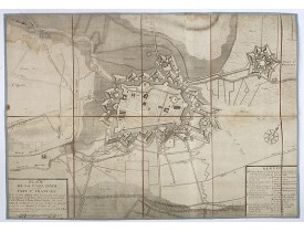
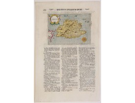
Location: 1705
Published: Paris, 1705
Size: 242 x 340mm.
Color: Uncoloured.
Condition: Mint condition. Dark impression.
Plan of the castle and city of Chantilly, from Nicolas de Fer's "L'Atlas curieux ou le Monde réprésente dans des cartes. "The..
50€
Add to Cart
Location: 1705
Published: Paris, 1705
Size: 265 x 380mm.
Color: Uncoloured.
Condition: Lower margin cut into engraved area. Dark impression.
Plan of the castle and park of Saint Cloud, from Nicolas de Fer's "L'Atlas curieux ou le Monde réprésente dans des cartes. "T..
50€
Add to Cart
Location: 1705
Published: Paris, 1705
Size: 230 x 335mm.
Color: Uncoloured.
Condition: Mint condition. Dark impression.
City plan of St Germain en Laye, from Nicolas de Fer's "L'Atlas curieux ou le Monde réprésente dans des cartes. "The "Atlas C..
50€
Add to Cart
Location: 1705
Published: Paris, 1705
Size: 243 x 355mm.
Color: Uncoloured.
Condition: Mint condition. Dark impression. <br />Together with an engraved text sheet.
Map of the Picardie region, from Nicolas de Fer's "L'Atlas curieux ou le Monde réprésente dans des cartes. "The "Atlas Curieu..
50€
Add to Cart
Location: 1705
Published: Paris, 1705
Size: 227 x 343mm.
Color: Uncoloured.
Condition: Mint condition. Dark impression. <br />Together with an engraved text sheet.
Map of the Dauphiné region, from Nicolas de Fer's "L'Atlas curieux ou le Monde réprésente dans des cartes. "The "Atlas Curieu..
50€
Add to Cart
Location: 1705
Published: Paris, 1705
Size: 243 x 345mm.
Color: Uncoloured.
Condition: Mint condition. Dark impression. <br />Together with an engraved text sheet.
Plan of the castle and city of Caen, from Nicolas de Fer's "L'Atlas curieux ou le Monde réprésente dans des cartes. "The "Atl..
50€
Add to Cart
Location: 1705
Published: Paris, 1705
Size: 233 x 353mm.
Color: Uncoloured.
Condition: Mint condition. Dark impression. <br />Together with an engraved text sheet.
Map of central France with Clermont-Ferrand and Lyon to the right, from Nicolas de Fer's "L'Atlas curieux ou le Monde réprése..
50€
Add to Cart
Location: 1705
Published: Paris, 1705
Size: 237 x 340mm.
Color: Uncoloured.
Condition: Mint condition. Dark impression. <br />Together with an engraved text sheet.
Map of the Neuchatel region, from Nicolas de Fer's "L'Atlas curieux ou le Monde réprésente dans des cartes. "The "Atlas Curie..
50€
Add to Cart
Location: 1705
Published: Paris, 1705
Size: 160 x 195mm.
Color: Uncoloured.
Condition: Mint condition. Dark impression. <br />Together with an engraved text sheet.
Aerial view of a salt marsh, with depiction of working scenes and a nice cartouche, from Nicolas de Fer's "L'Atlas curieux ou..
30€
Add to Cart
Location: 1705
Published: Paris, 1705
Size: 243 x 337mm.
Color: Uncoloured.
Condition: Mint condition. Dark impression. <br />Together with an engraved text sheet.
Map centered on Loire region, with Blois, Saumur, Sancerre and Orleans, from Nicolas de Fer's "L'Atlas curieux ou le Monde ré..
50€
Add to Cart
Location: 1705
Published: Paris, 1705
Size: 247 x 360mm.
Color: Uncoloured.
Condition: Mint condition. Dark impression. <br />Together with an engraved text sheet.
Map of the Isle de France and Champagne regions, from Nicolas de Fer's "L'Atlas curieux ou le Monde réprésente dans des carte..
50€
Add to Cart
Location: 1705
Published: Paris, 1705
Size: 277 x 373mm.
Color: Uncoloured.
Condition: Mint condition. Dark impression.
Map of the Messin region, from Nicolas de Fer's "L'Atlas curieux ou le Monde réprésente dans des cartes. "The "Atlas Curieux"..
60€
Add to Cart
Location: 1705
Published: Paris, 1705
Size: 640 x 640mm.
Color: In original o/l colours.
Condition: Good impression. A two-sheet map, when joined together 640 x 640mm.
Map of Brabant with the address : Chez l’Auteur sur le Quai de l’Horloge (address erased after Horloge). Avec privilege du Ro..
300€
Add to Cart
BLAEU, J. / MORTIER, P. -  Hortus et Palatum Atestinorum Tyburi.
New
Location: 1705
Published: Amsterdam, 1705
Size: 455 x 569mm.
Color: Coloured.
Condition: A nice and attractive impression.
Showing in great detail the hortus and gardens of Villa Tivoli. Joan Blaeu published during his life three town-books of Ital..
900€
Add to Cart
Location: 1705
Published: Paris, 1705
Size: 235 x 342mm.
Color: Uncoloured.
Condition: Mint condition. Dark impression. <br />Together with an engraved text sheet.
Map of the Languedoc region, from Nicolas de Fer's "L'Atlas curieux ou le Monde réprésente dans des cartes. "The "Atlas Curie..
75€
Add to Cart
Location: 1705
Published: Amsterdam, circa 1705
Size: 480 x 570mm.
Color: In attractive strong original colours.
Condition: A good and dark impression. Repair of a very small tear lower part center fold.
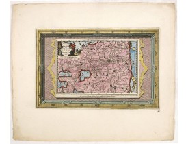
Petrus Schenk's map of the Ottoman Empire, based upon an earlier map by Sanson. Showing from Italy to the Caspian Sea and the..
900€
Add to Cart
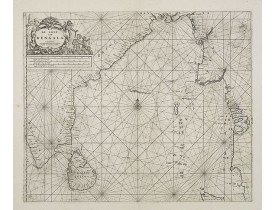
Location: 1705
Published: Leyde, 1705
Size: 152 x 228mm.
Color: Coloured.
Condition: Wide margins, in very good condition.
A map of the Arabian Peninsula, India, and Ceylon. The map was intended to illustrate the Dutch Translation of Nuno Da Cunha'..
400€
Add to Cart
Location: 1705
Published: Paris, 1705
Size: 217 x 282mm.
Color: In original o/l colours.
Condition: Paper slightly age toned and browned, a dark impression. Repair of a split in lower part center fold. <br />Accompanied by a double page engraved text sheet with a description of the region.
An interesting small map of the British islands by Nicolas de Fer. From his rare "Petit et Nouveau Atlas". The first edition ..
75€
Add to Cart
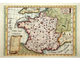
Location: 1705
Published: Paris, 1705
Size: 210 x 245mm.
Color: In original o/l colours.
Condition: Paper slightly age toned and browned, a dark impression. Repair of a split in lower part center fold. <br />Accompanied by a double page engraved text sheet with a description of the region.
DE FER, N. - La France avec ses acquisitions jusqu'à l'année 1705. - 37709 - France - DE FER, N. - La France avec ses acquis..
75€
Add to Cart
Location: 1705
Published: Paris, 1705
Size: 226 x 338mm.
Color: In original o/l colours.
Condition: Wide margins. Good and dark impression.
Uncommon world map in Mercator's projection, which first appeared in De Fer's Atlas Curieux.Showing California as an island. ..
800€
Add to Cart
Location: 1705
Published: Paris, de Fer, 1705
Size: 890 x 1170mm.
Color: Coloured
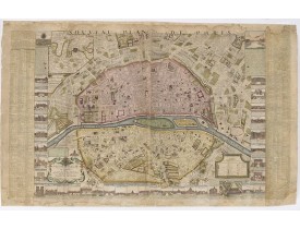
Condition: Plan in 4 joined sheets, colored and framed. Dimensions of the frame: 107 x 136 cm. The plan is probably glued to its support (not examined outside the frame) and cut a little short at the bottom left.
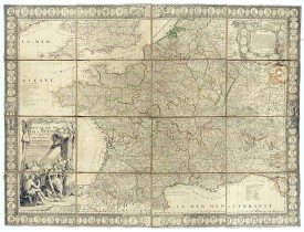
Published "Ichez le S[ieur]r de Fer. Dans l'Isle du Palais sur le Quay de l'Orloge à la Sphère Royale. Avec Privilege du Roy ..
7,000€
Add to Cart
Location: 1705
Published: Paris, 1705
Size: 480 x 710mm.
Color: In original o/l colours.
Condition:
Fine map of Lorraine region.Alexis-Hubert Jaillot (1632-1712), was a French cartographer. Map from "Atlas géographique Conten..
100€
Add to Cart
Location: 1705
Published: Paris, 1705
Size: 240 x 323mm.
Color: Uncoloured.
Condition: Mint condition. Dark impression. Together with an engraved text page.
Two engraved views of Le Louvre with an engraved text page, from Nicolas de Fer's "L'Atlas curieux ou le Monde réprésente da..
100€
Add to Cart
Location: 1705
Published: Paris, 1705
Size: 240 x 338mm.
Color: Uncoloured.
Condition: Mint condition. Dark impression. Together with an engraved text page.
Engraved view of the Observatoire de Paris, with a plan of the differents floors of the building, together with an engraved t..
100€
Add to Cart
Showing 841 to 864 of 2410 (101 Pages)