Menu
Menu
Your Cart

All Products

Click on image to zoom

Location: 1720
Published: Paris, 1690-1720
Size: 205 x 312mm.
Color: Uncoloured.
Condition: Good impression. Short upper margin. Repair of minor worm hole on top of image. Good condition.
Bird's eye-view of the French town of Dieppe, including a key list at the bottom. Engraved by Pierre Aveline (Paris, c.1656 -..
200€
Add to Cart
Location: 1720
Published: Amsterdam, 1720
Size: 315 x 360 mm.
Color: Uncoloured.
Condition: In good condition. Good margins.
A true picture of the wind trade of the rue Quinquempoix, Paris, in 1720, taken from Het groote tafereel der dwaasheid : ve..
250€
Add to Cart
Location: 1720
Published: Amsterdam, ca. 1720
Size: 220 x 260mm.
Color: Uncoloured.
Condition: Few spotting in the margins. Wide margins. Good and dark impression. In good condition.
Finely designed map of Hyeres island and the Briançon fort. In top inset views of Aix, St. Tropez, Gulf of St. Tropez, Nice ..
500€
Add to Cart
Location: 1721
Published: London, 1721
Size: 476 x 547mm.
Color: Original outline colors.
Condition: A good and dark impression. Repair of split right hand part of the map.
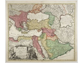
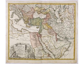
FIRST EDITION - Fine Turkish Empire map centered on Saudi Arabia, Cyprus and the Mediterranean Sea. Dated 1711, "Sold by John..
1,500€
Add to Cart
Location: 1722
Published: Amsterdam, 1722
Size: 468 x 600 mm.
Color: In original o/l colours.
Condition: A good and dark impression. Printed on heavy paper. Mint.
This is a Dutch edition of De L'Isle's map. It was the first printed map to accurately portray the course and mouth of the Mi..
1,200€
Add to Cart
Location: 1723
Published: Paris, 1723
Size: 155 x 288mm.
Color: In attractive full colour.
Condition: Paper very minor age toned.
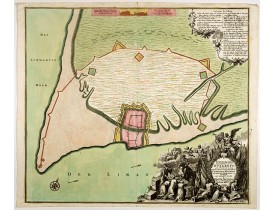
Detailed plan of Valetta. In upper right corner a key to the principal places in town. Prepared by N.de Fer and re-issued by..
2,200€
Add to Cart
Location: 1723
Published: Paris, 1723
Size: 620 x 419mm.
Color: Original o/l colour.
Condition: Printed on heavy paper, slightly age-toned as usual. Good impression. Excellent condition.
The map shows the area east of the Caspian Sea, including parts of Kazakhstan, Turkmenistan, Uzbekistan, and northern Iran. T..
600€
Add to Cart
Location: 1723
Published: Paris, Danet, 1723
Size: 440 x 585mm.
Color: In original o/l colours.
Condition: Belle impression sur papier fort. Contours aquarellés à l’époque de rose, vert et jaune. Infimes taches brunes dans les marges.
Carte marine très attrayante décrivant l'île de St. Domingue et les îles Caïques. Orné de deux cartouches représentant les ac..
800€
Add to Cart
Location: 1724
Published: Bruges, 1669 - 1724
Size: 880 x 880mm.
Color: Original colours
Condition: Huile sur toile. Diamètre : 88 cm.- Oil on canvas round. Diameter : 88 cm (34,60 in.).
Two putty studying a terrestrial globe, one of them holding a pair of dividers. The information on the globe is clearly imagi..
8,500€
Add to Cart
Location: 1724
Published: Paris, ca. 1724
Size: 445 x 594mm.
Color: Original o/l colour.
Condition: Good margins. Old repair of small split lower part center fold. Paper very slightly browned, good and dark impression.
Scarce map of Caribbean. A visually stunning map with a large title cartouche. This large one-sheet map was produced by the V..
1,200€
Add to Cart
Location: 1724
Published: Amsterdam, 1724
Size: 445 x 560mm.
Color: Uncoloured.
Condition: Lower part of right hand margin cut till plate mark, as issued. Several folding's, as issued. Else in very condition.
The earliest printed map of Taiwan or Formosa. Oriented to the east, with north at the left, covering the entire island and ..
3,750€
Add to Cart
Location: 1725
Published: Rouen, Pierre Le Boucher, 1725
Size: 305 x 425 mm.
Color: Uncoloured.
Condition: Very good condition. Folds as issued. Paper very slightly age toned. Dark impression. ans. Two plates detached from Volumes I and II, wax spots (?) p. 176 of Vol. IV, hole deleting two-word letters from pp. 225-226 of volume IV, small paper scarf in the lower margin of the board opposite p. Volume IX. Clear rednesses. Restorations with some caps and bit, small trace of worm to a box on the back of the volume.
Important richely illustrated compendium of the first Dutch voyages to East India, of great interest for the history and esta..
5,000€
Add to Cart
Location: 1725
Published: Nuremberg, 1725
Size: 308 x 374mm.
Color: In original colours.
Condition: A good impression. centerfold underlaid for protective reason. Upper left and righthand corner of margin re-inforced.
A very striking map of the ancient Arabian Peninsular, embellished with an coloured pictorial title cartouche...
500€
Add to Cart
Location: 1725
Published: Paris, ca. 1725
Size: 398 x 264mm.
Color: Uncoloured.
Condition: De L'Isle maps were almost always issued with outline colour, and it is very unusual to find them in wash colour. Two sheets if joined together
Detailed of the Caspian Sea, prepared by Karl van Verden in 1722. Van Verden was a Russian sailor and the Czar's Special Comm..
200€
Add to Cart
Location: 1726
Published: Amsterdam, 1726
Size: 273 x 360mm.
Color: Uncoloured.
Condition: Folds as issued. Dark impression. In very good condition.
Fine map depicting the southern part of India and the northern tip of Ceylon. Much detail is given along the coastlines, sett..
675€
Add to Cart
Location: 1726
Published: Marseille, 1715-1726
Size: 470 x 690mm.
Color: Uncoloured.
Condition: Staining. A few small worm tracing in lower part chart. A dark impression.
The chart covers Cadiz and the Strait of Gibraltar. Includes San Lucar de Barameda, Rota, Cape Trafalgar, Ceuta, Tangiers, Ta..
750€
Add to Cart
Location: 1728
Published: Amsterdam, 1728
Size: 335 x 436 mm.
Color: Uncoloured.
Condition: A good and dark impression.
CHATELAIN, H. - Carte du Gouvernement Civil et Politique de l'Espagne . . . - 38858 - Spain - CHATELAIN, H. - Carte du Gouve..
120€
Add to Cart
Location: 1728
Published: Amsterdam 1728
Size: 265 x 380mm.
Color: Uncoloured.
Condition: Good and dark impression. Upper margin cut till neat line.
This splendid map of the southern United States was based on Delisle's influential Carte du Mexique de la Floride.. of 1703. ..
900€
Add to Cart
Location: 1728
Published: Amsterdam, 1728
Size: 265 x 380mm.
Color: Uncoloured.
Condition: Good and dark impression. Upper margin cut till neatline.
With decorative title cartouche upper left corner. This example is unusual in having the additional separately engraved decor..
250€
Add to Cart
Location: 1728
Published: Amsterdam, 1728
Size: 333 x 440 mm.
Color: In original o/l colours.
Condition: Very good impression. Hard to find in original colours.
CHATELAIN, H. - Carte historique et géographique de l'ancienne Grece . . . - 38983 - Greece - CHATELAIN, H. - Carte historiq..
100€
Add to Cart
HOMANN HEIRS. -  Tabula Americae Specialis Geographica Regni Peru, Brasiliae, Terra Firmae & Reg: Amazonum; Secundum relationes de Herrera, de Laet & PP d Acuña & M. Rodriguez . . .
New
Location: 1728
Published: Nuremberg, 1728
Size: 480 x 560mm.
Color: Original colours.
Condition: A good and dark impression. Worm trace in lower margin, close to center fold. Repair of tear lower part center fold. Some age toning of paper. Good condition.
A good and clean copy of Homann's map of the northern part of South America. The map is on the Valley of the Amazon and delin..
350€
Add to Cart
Location: 1729
Published: Augsburg, 1729
Size: 340 x 1055mm.
Color: Uncolored
Condition: Printed on two joined sheets. Paper slightly age toned and light marginal water staining. Left and right margin reinforced on verso with strip of paper.
A spectacular panoramic view of Ingolstadt in Bavaria, with legends numbered from A-P and 1-6 in German. With the title in a ..
1,500€
Add to Cart
Location: 1729
Published: Augsburg, 1729
Size: 360 x 1020mm.
Color: Uncolored
Condition: Printed on two joined sheets. Paper slightly age toned and light marginal water staining and some fraying of paper in lower right bottom.
A spectacular panoramic view of Hamburg, with legends numbered 1-19 and A-Z in German. With the title in a banderol.After a ..
2,000€
Add to Cart
Location: 1729
Published: Leiden, 1729
Size: 227 x 285mm.
Color: Uncoloured.
Condition:
Plan of the town and fortress of Nice, "Town taken by the French from the Duke of Savoy in 1692". Plan after N. de Fer publis..
100€
Add to Cart
Showing 961 to 984 of 2410 (101 Pages)