All Products
Click on image to zoom
Location: 1763
Published: Amsterdam, Leipzig, 1763
Size: 242 x 283 mm.
Color: Uncoloured
Condition: (2pp), title page with engraved vignette, table of contents, 630pp, (2pp), 9 fold-out maps (cpl.), contemporary full calf leather binding with ribbed spine with floral motif, and a mention of title and volume, red edges.<br />Paper very slightly browned,
Volume 21 of this informative publication with a description of the discoveries, conquests, and settlements by the Portuguese..
1,100€
Location: 1763
Published: Paris, 1763
Size: 880 x 560mm.
Color: Uncoloured.
Condition: Carte sur papier fort repliée, légèrement jaunie le long des plis. - Folding map slightly age-toned along folds.
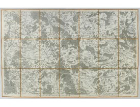
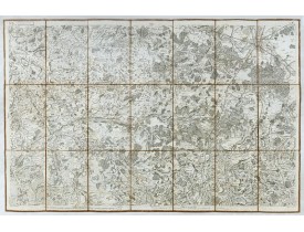
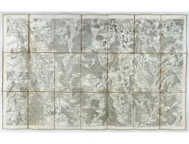
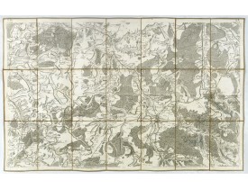
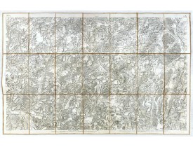
Carte établie sous la direction de César-François Cassini de Thury et gravée par Foin. Carte 141 bis. [Luxembourg], N°175. Fl..
200€
Location: 1763
Published: Paris, Savoye, Despilly, Duchesne, Dessaint et Saillant, Guillyn, Grange et Dufour, et l'Auteur, 1763
Size: 275 x 215mm.
Color: Uncoloured.
Condition: In-4 de VIII-XXXIV-122 pp., (1) f. et XII pp. ; titre gravé, une planche à double page et 25 cartes aquarellées à double-page ; veau marbré, dos à cinq nerfs orné, étiquette rouge, tranches marbrées (reliure de l'époque). Pâle mouillure en tête en début d'ouvrage, infimes rousseurs éparses, coiffes usées, coins émoussés, infime trou de ver en bas du dos, infimes éraflures sur les plats.
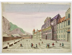
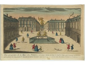
Illustré d'un titre gravé à double-page, d'une planche gravée à double-page (Statue Equestre de Louis le bien Aimé) et de 25 ..
1,500€
Location: 1763
Published: Paris, 1763
Size: 236 x 285mm.
Color: Coloured.
Condition: In good condition.
This well-known map of Taiwan is based on Jesuit information. The text along the island's east-coast claims: "Of this coast l..
600€
Location: 1763
Published: Paris 1763
Size: 408 x 872mm.
Color: Coloured.
Condition: Printed on heavy paper. Overall in very good condition.
Carte de la Guyane françoise et l'isle de Cayenne Cette carte de la Guyane française et l'île de Cayenne est due à Jacques Be..
500€
Location: 1764
Published: Marseille 1764
Size: 125 x 200mm.
Color: Coloured.
Condition: Sea chart on heavy paper with sharp impression.
Charming chart of Corsica. Showing town and harbor plan, with soundings, anchorages, rocks, shoals, fortifications, lighthous..
100€
Location: 1764
Published: Paris, 1764
Size: 568 x 870mm.
Color: Coloured.
Condition: Belle impression sur papier fort. Infimes taches grises en marge.
Très belle carte marine du Finistère finement aquarellée, dressée par Jacques Nicolas Bellin, le père, nommé "hydrographe du ..
450€
Location: 1764
Published: Paris, 1764
Size: 480 x 590mm.
Color: Coloured.
Condition: Some paper thinness along centerfold. Minor marginal re-inforcement lower part centerfold.
Map printed in two colours, black for the stars, red for the constellation figures. Uncommon large-scale celestial chart of t..
1,000€
Location: 1765
Published: Paris, 1765
Size: 250 x 387mm.
Color: In original o/l colours.
Condition: Pen and ink on paper. In very good condition.
An early manuscript map of Gingy shortly after The Seven Years War, when the French took possession of large part of India.Wi..
1,400€
Location: 1765
Published: Paris, 1765
Size: 140 x 175mm.
Color: Coloured.
Condition: In good condition
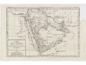
Uncommon map of Arabian Peninsular with a title inland "Arabie Heureuse. . ."...
125€
Location: 1766
Published: Paris, 1766
Size: 567 x 495mm.
Color: Uncoloured.
Condition: En 15 sections montées sur toile et plié, formant un plan de 567 x 495 mm. Marge supérieure coupée. Papier légèrement bruni. La Loire a été aquarellée à l’époque.
Rare plan de Nantes, figurant les travaux d’agrandissement et d’embellissement de la ville réalisés entre 1757 et 1766 : l’îl..
750€
Location: 1766
Published: Napels, 1766
Size: 390 x 543mm.
Color: Coloured.
Condition: A good and dark impression. Very good, with large margins.
Rare map of North America drawn directly from the work of Nicholas De Fer and N. Sanson's famous map of 1650. The map is engr..
1,750€
Location: 1766
Published: Paris, 1766
Size: 255 x 295mm.
Color: In original colours.
Condition: Some slight age-toning and light water staining in the upper part of the map. Good and dark impression.
Charming small map depicting the area around Nogent-sur-Seine. Surrounded by a decorative frame embellished with floral patte..
80€
Location: 1766
Published: Paris, 1766
Size: 254 x 293mm.
Color: In attactive original colours.
Condition: Beau col. ancien.
Charming small map depicting the area around Compiègne. Surrounded by a decorative frame embellished with floral patterns.Fro..
80€
Location: 1767
Published: Paris, 1767
Size: 559 x 872mm.
Color: In original colours.
Condition: Printed on heavy paper. Overall in very good condition.
A well engraved and highly detailed chart, corrected to 1767. Elaborate hand-coloured cartouche, rhumb lines.Shows northern p..
750€
Location: 1768
Published: Paris, 1768
Size: 605 x 460mm.
Color: Coloured.
Condition: Good impression.
Map undated, carries the address of Lattré, rüe St. Jaques to the City of Bordeaux and Vezou, ruë St. Guill.e Faub. S. Germ. ..
750€
Location: 1768
Published: Paris, 1768
Size: 567 x 860mm.
Color: Coloured.
Condition: A few mainly marginal wormholes filled in. In very good condition.
Detailed map publishedd by the French Marine and prepared by N.Sanson. Covering the coasts of the French and Italian Riviera'..
750€
Location: 1768
Published: Paris, 1768
Size: 475 x 620mm.
Color: In original o/l colours.
Condition: Good and dark impression.
From the Atlas Universel , a detailed map extending the length of the east coast from Penobscot Bay to Cape Fear and, in an i..
750€
Location: 1769
Published: Paris, 1769
Size: 250 x 382mm.
Color: In original o/l colours.
Condition: Pen and ink on paper. In very good condition.
An early manuscript map of Thiagar. With an extensive unfinished key to the left. The map was drawn shortly after the end of ..
700€
Location: 1769
Published: Amsterdam, 1769
Size: 360 x 450 mm.
Color: In attractive strong original colours.
Condition: In very fine condition. Short margin as issued.
TIRION, I. - Nieuwe Kaart van de Grootbrittannische Volkplantingen in Noord America waar in Tevens de Fransche Bezittingen e..
900€
Location: 1769
Published: Paris, Lattré, 1769
Size: 1110 x 1410 mm.
Color: Uncoloured.
Condition: Wall map in two sheets accompanied by borders in 7 boards engraved separately. The plan if joined, without the borders is 820 x 1140 mm.
Rare plan mural de Reims gravé par Jean Lattré. Cartouche central inclus
dans la bordure inférieure (sans le médaillon), co..
2,500€
Location: 1769
Published: Rome 1769
Size: 569 x 845mm.
Color: Coloured.
Condition: Some light browning in places. Marginal water staining on a few places affecting engraved area, can easily be removed. Good and dark impression.
Fine chart of the entrance of the river Thames up to London. To the north Ipswich and to the south Dover. A highly accomplish..
700€
Location: 1770
Published: Nurnberg, 1770
Size: 214 x 355mm.
Color: In original colours.
Condition: A few minor rust spots. Else very good.
Plan of the city of Quebec, with an inset view of the town in the lower right corner. In the upper right a recapitulation of ..
350€
Location: 1770
Published: France, ca. 1770
Size: 275 x 280 mm.
Color: In original colours.
Condition: Folding fan. Ivory frame with gold decoration with double sheets of paper with gouache painting. Some usual wear and small restorations.
ANONYMOUS - A folding fan showing a nautical festival, ca. 1770. - 46662 - Various - ANONYMOUS - A folding fan showing a na..
1,250€