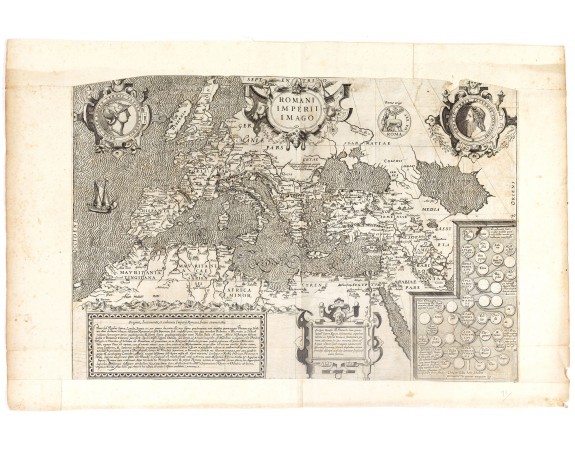
JOLLAIN, G. - Romani Imperii Imago.
 Click on image to zoom

JOLLAIN, G. - Romani Imperii Imago.
Published: Paris, 1680
Size: 325 x 480mm.
Color: Uncoloured.
Condition: Cut on the neat line and in lower part into longitude scale, with extended margins to fit in composite atlas. Part in upper left and right corner cut off. Dark impression.
Description
Copied after a map by Ortelius, but much rarer. The medallion portraits are of Romulus and Remus - the genealogical 'tree' describes the lineage of the Roman emperors, while the strapwork bordered panels explain the history of the Empire.
The coasts of North Africa, England, and Ireland are outlined in orange.
Appears to be a proof state or earlier edition, as the name of "Jollain", which normally occurs in his map, is not present. A very dark, so early impression of this rare map.
The coasts of North Africa, England, and Ireland are outlined in orange.
Appears to be a proof state or earlier edition, as the name of "Jollain", which normally occurs in his map, is not present. A very dark, so early impression of this rare map.
2,500€
- See other items by this publisher: JOLLAIN, G.
- Reference N°: 36652
