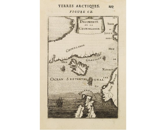
MALLET, A.M. - Decouverte de la Groenlande.
 Click on image to zoom

MALLET, A.M. - Decouverte de la Groenlande.
Published: Paris, 1683
Size: 150 x 103mm.
Color: Uncoloured.
Condition: Some age-toning of paper. Minor water staining along upper and right margin. Hardly noticeable brown spots in the center of the map. Else very good condition and dark imprint.
Description
An interesting miniature map centred on Iceland and outlining most part of Greenland. Northwest on top. It includes Norway and great part of the British Isles.
The sea is fully engraved and 4 ships are shown heading northwards to the Greenlandic Shores.
From the French text edition of Description d'Univers... By Allain Manneson Mallet (1630-1706), a well travelled military engineer and geographer who worked in 17th century France under King Louis XIV.
The sea is fully engraved and 4 ships are shown heading northwards to the Greenlandic Shores.
From the French text edition of Description d'Univers... By Allain Manneson Mallet (1630-1706), a well travelled military engineer and geographer who worked in 17th century France under King Louis XIV.
120€
- See other items by this publisher: MALLET, A.M.
- Reference N°: 22569


