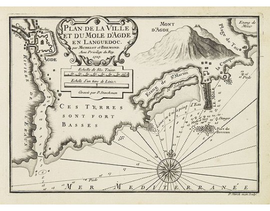
MICHELOT, H. / BREMOND, L. - Plan de la Ville et du Mole d'Agde en Languedoc.
 Click on image to zoom

Out Of Stock
MICHELOT, H. / BREMOND, L. - Plan de la Ville et du Mole d'Agde en Languedoc.
Published: Marseille, 1730
Size: 180 x 250mm.
Color: Uncoloured.
Condition: In very good condition. On thick paper, paper very slightly age-toned.
Description
An attractive chart centered on Agde and Sète, with Etang de Thau and Mount Agde. With scale and large compass-rose. Dated 1727, with the privilege of the King. From : Recueil des Plusieurs plans des ports et rades de la Mer Mediterranée.. Engraved by P.Starckman.
The chart is exceptionally detailed and includes topographical details, soundings, anchorages, etc.
Originally from Saint-Malo, Henri Michelot served from 1670 on the sea as a pilot. He was also a professor of hydrography in Marseille. He produced his first charts in the early years of the eighteenth century. Often associated with the brothers Laurent and Jean-Andre Bremond, also cartographers, he published with them in 1718 a chart of the Mediterranean in three leaves.
0€
- See other items by this publisher: MICHELOT, H. / BREMOND, L.
- Reference N°: 30149
