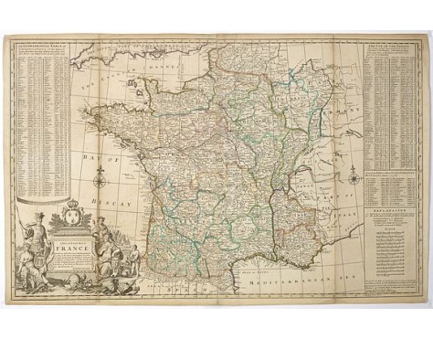
MOLL,H. - A New and Exact Map of France Dividid into all its Provinces and Acquisitions, according to the Newest Observations. . .
 Click on image to zoom

MOLL,H. - A New and Exact Map of France Dividid into all its Provinces and Acquisitions, according to the Newest Observations. . .
Published: London, P. Overton, T. Bowles, John King, ca. 1740
Size: 610 x 974mm.
Color: In original o/l colours.
Condition: Small repairs of vertical fold and some discolouration for the rest an attractive item. Printed on two joined sheets.
Description
A decorative wall size map of France. In the lower left bottom is a large and very decorative cartouche. The map was first published 1710–1714 and reissued by J. Bowles, P. Overton, T. Bowles, John King, London c. 1740.
To the left side "An Alphabetical Table of the Principal Towns of France", and to the right "The Use of the Tables".
To the left side "An Alphabetical Table of the Principal Towns of France", and to the right "The Use of the Tables".
700€
- Reference N°: 39111
2,500€


