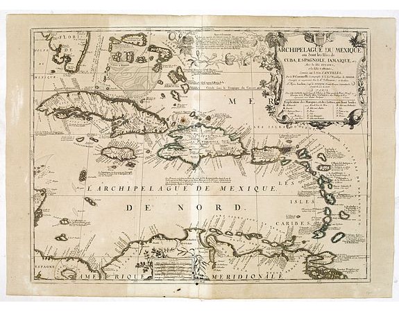
NOLIN, J.B. / CORONELLI, P. - Archipelague Du Mexique. ou Sont les Isles de Cuba, Espagnole, Iamaique, etc. Avec les Isles Lucayes, et les Isles Caribes, Connues sous les nom d'Antilles . . . 1742

NOLIN, J.B. / CORONELLI, P. - Archipelague Du Mexique. ou Sont les Isles de Cuba, Espagnole, Iamaique, etc. Avec les Isles Lucayes, et les Isles Caribes, Connues sous les nom d'Antilles . . . 1742
Published: Paris, ca. 1724
Size: 445 x 594mm.
Color: Original o/l colour.
Condition: Good margins. Old repair of small split lower part center fold. Paper very slightly browned, good and dark impression.
Description
Scarce map of Caribbean. A visually stunning map with a large title cartouche. This large one-sheet map was produced by the Venetian cosmographer Vincenzo Coronelli when he was working in Paris in the 1680's. Tillemon, who corrected and amended the map was, Coronelli's collaborator in Paris and J.B.Nolin was their publisher.
Nolin must have published this map separately on several occasions as it is not regularly found in atlas form.
Florida's southern coastline is curiously shaped and the Bahamas are shown as a series of oversized islands.
The final edition with the date of 1742 and the publisher's address to rue Saint Jacques. ¤
1,200€
- See other items by this publisher: NOLIN, J.B. / CORONELLI, P.
- Reference N°: 34065
2422 views
 Click on image to zoom
