Menu
Menu
Your Cart

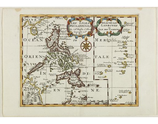
SANSON, N. - Les Isles Philippines Molucques et de la Sonde.

SANSON, N. -  Les Isles Philippines Molucques et de la Sonde.
SANSON, N. - Les Isles Philippines Molucques et de la Sonde.
Published: Paris, 1654
Size: 396 x 555 mm.
Color: Coloured.
Condition: Dark impression. Very good.

Description

Sanson's important mid-seventeenth century map of the East Indies, covering modern Indonesia, the Philippines, Malaysia and parts of Southeast Asia and New Guinea. At a scale of about 1:10,000,000, it shows the cities and smaller settlements, rivers, mountain chains, and even forests.
It was engraved by J. Somer for the elder Nicolas Sanson with a privilege for twenty years, and appeared in Sanson's 1658 Cartes générales de toutes les parties du monde and in later editions. Pastoureau's 1650 date appears to be an error for 1654. In spite of later developments in the cartography of the East Indies the map remained unchanged, with the original date and Pierre Mariette's name as publisher, for nearly a century. It therefore reflects the historical situation and the state of cartographic knowledge in the middle of the seventeenth century.
1,200€
  • See other items by this publisher: SANSON, N.
  • Reference N°: 42023
780 views