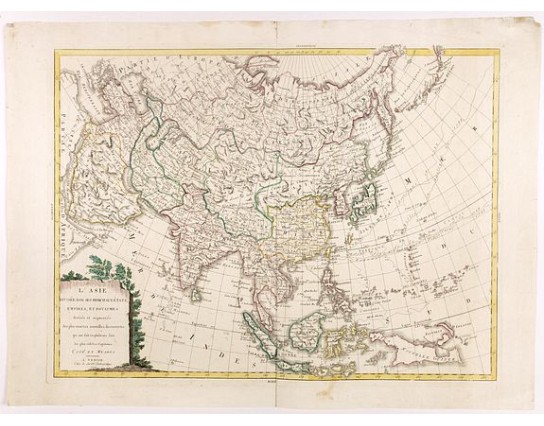
SOCIETE CHALCOGRAFIQUE - L'Asie divisée dan ses principaux états, empires, et royaumes dréssée et augmentée des plus exactes nouvelles découvertes qui ont fait en plusieurs fois les plus celebres capitaines.
 Click on image to zoom

New
SOCIETE CHALCOGRAFIQUE - L'Asie divisée dan ses principaux états, empires, et royaumes dréssée et augmentée des plus exactes nouvelles découvertes qui ont fait en plusieurs fois les plus celebres capitaines.
Published: Venise, 1799
Size: 460 x 620mm.
Color: In attractive strong original colours.
Condition: In very good condition.
Description
A very scarce map of Asia, in the style of Antonio Zatta with a scenic title cartouche, but folio-sized. It comes from a never-finished atlas by the ‘Società Calcografia’, a partnership of the two main Venetian publishers of the period, Zatta and Giuseppe Antonio Remondini, which probably ended with Zatta’s death in 1804.
The map shows the track of the voyage made in 1788/1789 by Meares.
John Meares (1756-1809) was an English trader and sea-captain who was engaged in the fur trade between British Columbia and China. He made voyages from China to America in 1788 and 1789.
His vessels were seized at Nootka Sound by the Spaniards, who claimed all that coast as Spanish. War nearly broke out between England and Spain over the question, and the latter had to give way." (Lande, A Bibliography of Canadiana, No.1346).
2,000€
- Reference N°: 40544
