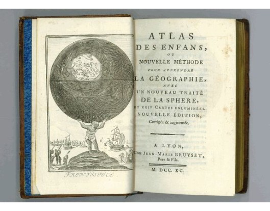
ANONYME. - Atlas des Enfans ou nouvelle méthode pour apprendre la géographie…
 Click on image to zoom

ANONYME. - Atlas des Enfans ou nouvelle méthode pour apprendre la géographie…
Published: Lyon, Bruyset Père & Fils, 1790
Size: 130 x 170mm.
Color: In original colours.
Condition: Small 8vo. Contemporary brown calf.
Description
Atlas for the children with 24 maps of the World and continents and maps of European countries. Size of the maps: 13x17cm size of the binding: 17x11x3cm.
With fine engraved allegorical frontispiece, and 24 folding engraved "blind" maps, all finely coloured by hand, in the main part, and two folding engraved plates, of an armillary globe and eclipses in the added part. Illustrated with 24 numbered hand-coloured engraved "blind" maps, that is maps with the geographical names left out for the children to "find blindly". The explanatory text to all maps is in the form of questions and answers, like a catechism, for the children to learn by heart. Gumuchian records this Pirate edition published at Lyons in 1790. The work was pirated not only in France, but also in Germany, no doubt because of the "blind" maps, which represented quite a new method of teaching geography to children.
With fine engraved allegorical frontispiece, and 24 folding engraved "blind" maps, all finely coloured by hand, in the main part, and two folding engraved plates, of an armillary globe and eclipses in the added part. Illustrated with 24 numbered hand-coloured engraved "blind" maps, that is maps with the geographical names left out for the children to "find blindly". The explanatory text to all maps is in the form of questions and answers, like a catechism, for the children to learn by heart. Gumuchian records this Pirate edition published at Lyons in 1790. The work was pirated not only in France, but also in Germany, no doubt because of the "blind" maps, which represented quite a new method of teaching geography to children.
700€
- See other items by this publisher: ANONYME.
- Reference N°: 25091
