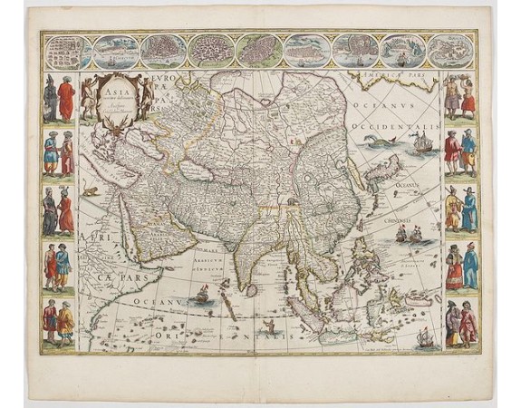
BLAEU, W. - Asia noviter delineata. . .

BLAEU, W. - Asia noviter delineata. . .
Published: Amsterdam, 1644
Size: 411 x 555mm.
Color: In attractive original colours
Condition: Good margins. General in very fine condition. French text on verso.
Description
From 1633 the members of the Blaeu family were official cartographers to the United East India Company and, as such, had access to the most up-to-date cartographic information concerning this area. Indeed, Dutch explorers and merchants returning from the East with new information were obliged to turn their maps and charts over to the Blaeu workshop so that alterations could be made or new plates engraved. However, this map contains many errors, showing how old plates continued to be used long after the information on them had proved to be wrong. With columns of figures on either side depicting the native manners of dress, and nine city plans and views at the top.
Japan is shown accurately unusually with Korea as an enlonged island.
From early on Willem Jansz. Blaeu aimed of publishing an atlas to compete with the Hondius-Jansson Atlas. By 1630, he had published at least 17 folio size maps.
Blaeu was able to realize his plan soon after he had acquired the copper plates of the atlas maps by Jodocus Hondius. The "Appendix followed in 1630.
In 1635 he finally realized a "international edition" of a world atlas, the "Theatrum Orbis Terrarum".
3,300€
- See other items by this publisher: BLAEU, W.
- Reference N°: 45150
1877 views
 Click on image to zoom
