Menu
Menu
Your Cart

Description geographique, historique, chronologique, politique, et physique de l'empire de la Chine et de la Tartarie chinoise.
Description geographique, historique, chronologique, politique, et physique de l'empire de la Chine et de la Tartarie chinoise.
Published: Paris, P. G. Le Mercier, 1735
Size: 430 x 280mm.
Color: Uncolored
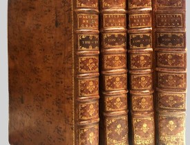
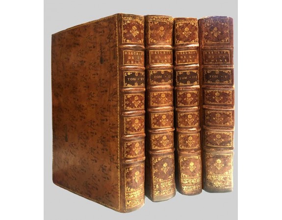
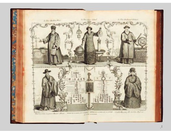
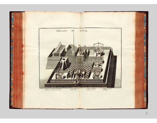
Condition: 4 volumes folio ; (2) leaves, viij-lij-iv-592 pp. — (2) leaves, iv-725 pp. — (2) leaves, iv-564-(2) pp. — (2) leaves, ij-520 pp. Contemporary calf, spines divided in compartments by six raised bands, contrasting red morocco labels in two, others richly gilt with floral tools, leaf sprays, etc., sides ruled in gilt with three-line fillet, marbled endpapers, red edges. With 65 maps and plates (all but one double-page or folding); titles in red and black incorporating engraved pictorial vignette by Baquoy after Humblot; with all half-titles; woodcut head- and tailpieces, typographic ornaments, historiated and decorative initials.

Description

First edition of this cornerstone of any collection of books on China, which is also among the rarest and most desirable of important Americana, included in Rare Americana: A Selection of One Hundred and One Books, Maps and Prints not in the John Carter Library.
This, "the first definitive European work on the Chinese empire" (Hill), was compiled by Du Halde, Jesuit former confessor to the duc d'Orléans, from the accounts, published and unpublished, prepared by 27 Jesuit missionaries during their travels.


This encyclopaedic work not only provided valuable information on Chinese political institutions, education, language, medicine, science, customs and artefacts - importantly it is one of the earliest European sources on Chinese ceramics - but also marked the first appearance of 43 maps by Jean Baptiste Bourguignon d'Anville, internationally recognized as "the finest cartographer of his time" (Moreland & Bannister).

Drawn from recent surveys commissioned by the Emperor Kang-hi from the Jesuits, these maps represented an immense improvement on existing knowledge and are considered by Tooley to be "the principal cartographic authority on China during the 18th century". For certain remote parts of northern China, Mongolia and Tibet, this work was the only adequate reference until the technological revolution in surveying in the 20th century.
The work also contains the first separate map of Korea, together with a previously unpublished account of that country by Jean-Baptiste Régis. The book is also of considerable interest in terms of the exploration of America. Printed here for the first time is the eponymous Vitus Bering's account of his 1728 traverse of the Strait, "Relation succinte du voyage du capitaine Beering dans la Siberie."

Of comparable importance is the map "Carte des pays traversees par le Capne. Beering depuis la ville de Tobolsk jusqu'a Kamtschatka" bound between pp. 452–3, based on Bering's manuscript map, and containing the first representation of any part of Alaska, St. Lawrence Island. The manuscripts followed a circuitous route to Du Halde. Bering, a Dane who had risen in the ranks of the Russian navy, was sponsored on his expedition by Peter the Great, and when he finally returned to St. Petersburg in 1730, five years after Peter's death, his account was sent as a gift to the King of Poland, who in turn "gave them to Du Halde with permission to do with them 'as he saw fit'" (Hill).

An excellent example of this fine work of 18th-century encyclopaedism, here in the superbly printed and engraved first French folio edition, considered by Lada-Mocarski to be "the most desirable and significant."

References Cordier, Sinica 46–47; Cox I, p. 335; Hill 498; Howes 546; Lada-Mocarski, Books on Alaska II, pp. 20-22; Lust 12; Moreland & Bannister Antique Maps; Sommervogel iv 35.11; Tooley Maps and Mapmakers, p.107; Wagner p. 156; Wroth: Early Cartography of the Pacific, 91.

30,000€
  • Reference N°: 48162

Some of the most asked FAQ by our clients

Librairie Loeb-Larocque specializes in maps, atlases, and travel books from the 16th to 19th centuries.
The Librairie was founded in 1958 by Louis Loeb-Larocque. Originally, he arrived in France from Germany shortly after World War II. He started an antiquarian map and book shop in Paris, specializing in early maps, atlases, travel books, and prints. The shop was located at Rue Le Peletier until 1996, and was frequently visited by collectors and fellow dealers from all parts of the world.
At present, the office is located at 31 rue de Tolbiac in Paris in the lively 13th district, a 5-minute walk from the Bibliothéque Nationale de France (Metro Line 14).
We welcome visitors to our shop by appointment, Monday through Friday.

MORE ABOUT LOEB-LAROCQUE
Librairie Loeb-Larocque sells authentic maps, prints, atlases, and rare books. We guarantee the authenticity and condition of each lot listed in our catalogs.
Browse the catalog now >>>
We supply a certificate for each item sold. Librairie Loeb-Larocque fully guarantees the authenticity and condition of each lot described in our catalogs. The warranty is unlimited in time. Defects in lots offered for sale have been carefully noted.
The term "color" means that the color is applied by hand.
- "Original colors / col. ancien-d' époque" means that the item was colored at or about the time of publication.
- "Colored/color" means that the map has recently been hand-colored within the last 50 years.

Measurements are given in centimeters; height is given first, excluding margins. Size is mentioned of the plate mark; height is given first. When there is no plate mark, we take the sizes of the illustration. In some instances, we additionally mention the size of the sheet in the condition field.

The date and place mentioned in our catalog is the date when the item was made and published. Where the publishing date is approximate, then c. (circa) is used.
We do not sell reproductions!

Browse the catalog now >>>
The value of a rare book, atlas, globe, print, or map depends on rarity, condition, binding, provenance, and the significance of any inscriptions it may contain. Béatrice Loeb-Larcque, an expert and member of the Syndicat Français des Experts Professionnels en Œuvres d'Art et Objets de Collection, provides a free appraisal if you are considering selling. We provide auction estimates from photographs sent via the Internet. These estimates are not for valuation purposes and are subject to revision upon inspection of the object. It is impossible to provide verbal estimates over the phone, nor can we respond to requests without a photo.

DO A VALUATION >>>
There is no easy answer to this question. Some books or maps have, without question, appreciated considerably in value over the years.
Others have remained steadily desirable without seeing a significant rise in price, and still others can be purchased for little money but give great personal satisfaction.
Librairie Loeb-Larocque, with 60 years of experience in the rare map and book trade, can help you decide what kind of collection you would like to build.
We buy antiquarian books in our areas of specialization: Atlases, old maps, travel books, and illustrated books.
If you want to sell books and maps, contact us for a free estimate. Send us photos by email, or make an appointment for a physical examination of the object. We will then make a purchase offer.

DO A FREE APPRAISAL >>>
Following the European Consumer Rights Directive, a buyer habitually residing in the European Union has the right to cancel the contract for the purchase of an item, without giving any reason.
The cancellation period will expire 14 calendar days from the day after the date on which you or a third party (other than the carrier and indicated by you) acquires physical possession of the lot.
To exercise the right to cancel, you must inform Joppen et Loeb Associates SARL, which is offering to sell the lot either as an agent for the seller or as the owner of the lot, of your decision to cancel this contract by a clear statement (e.g. a letter sent by post, 31 rue de Tolbiac, 75013 Paris France or e-mail (info @ loeb-larocque.com).


Browse the catalog now >>>
Parcels are shipped by DHL or registered mail and must be signed for. Insurance is included.
- We charge a flat shipping fee of 15 euros for shipments within France for shipments up to one kg.
- For parcels shipped within Europe, a flat 25,00 euros is charged.
-For shipments outside of Europe, the postal fee is 25.00 euros for the USA and Asia
- 45.00 euros for Africa and Australia for parcels up to one kg. Heavier parcels are shipped at a nominal postal fee.

Items are fully insured and usually shipped the day following payment. We ship maps and prints in sturdy tubes or strong packaging if necessary.

The items are shipped when your payment is received.
Browse the catalog now >>>
Visitors are welcome to our shop by appointment, Monday through Friday from 9 AM to 7 PM. We participate in fairs in Amsterdam, London, Venice, and often travel to find interesting items. Registered users receive monthly email updates. Follow us on Instagram or Facebook.
CONTACT US