All Products
Click on image to zoom
Location: 1647
Published: Amsterdam, 1647
Size: 385 x 493mm.
Color: In original colours.
Condition: Slight marginal discolouration but in seneral very fine. Wide margins. Latin text on verso.
Striking old colour example of Blaeu's second map of Brazil prepared by Krystof Arciszewski, a Polish general who worked for ..
700€
Location: 1647
Published: Amsterdam, 1647
Size: 464 x 550mm.
Color: In original colours.
Condition: Some minor shinetrue of text. Paper very slightly age-toned. Repair of split lower part center fold, 2cm. into engraved area. In very good condition.
Showing California as an island, and above, the north west of the continent left blank except for two legends explaining the ..
3,000€
Location: 1648
Published: Paris, 1648
Size: 410 x 584mm.
Color: In original o/l colours.
Condition: Good and dark impression. Left and right hand border cut into scale border.
Fine map of southern part of Italy. This edition carries the date 1648, engraved by AB. De la plaets. With manuscript number ..
230€
Location: 1648
Published: Paris, c. 1648
Size: 375 x 495 mm.
Color: In original o/l colours.
Condition: Cut close to the scale border. Printed without title cartouche. Slightly browning along border scale.
SANSON, N. - [Les Deux Bourgognes, Duché et Comté, la Bresse & la Souveraineté de Dombes, le Nivernois, &c.].? - 44009 - Bou..
200€
Location: 1648
Published: Amsterdam, 1648
Size: 380 x 520mm.
Color: In attactive original colours.
Condition: Bel exemplaire aquarellé à l’époque. Légères mouillures dans la partie marginale supérieure centrale. Bonne condition générale.
Mont-Saint-Michel appears near the top right of this map of Brittany. Includes many decorative elements such as three windros..
700€
Location: 1649
Published: Turin, 1649
Size: 215 x 323mm.
Color: Uncoloured.
Condition: Good and dark impression. Small hole in lower right margin filled in. Very light spotting of paper.
Map of France from the rare atlas of the Capucin order: "Chorographica descriptio provinciarum, et conventum fratrum minorum ..
150€
Location: 1650
Published: Amsterdam, 1650
Size: 492 x 383mm.
Color: In original colours.
Condition: Paper slightly age-toned. A good and dark impression
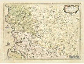
Decorative map centered on the Loire valley. Fine title cartouche in upper right corner...
700€
Location: 1650
Published: Amsterdam, 1650
Size: 395 x 522mm.
Color: Uncoloured.
Condition: Margins cut close. Repair of split centerfold and a few more splits filled in. Laid down on tissue paper. Dark impression.
Extremely rare panoramic view of Istanbul published by Rombout van den Hoeye. With a numbered key (1-29) to principal places ..
3,500€
Location: 1650
Published: Paris, 1650
Size: 390 x 522mm.
Color: Original o/l colours
Condition: Paper slightly age-toned. A good and dark impression.
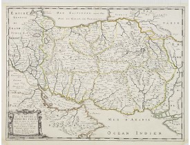
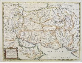
The map of the Empire of Persia is shown to extend from Baghdad almost to the present-day borders of India. Including part of..
250€
Location: 1650
Published: Frankfurt 1650
Size: 205 x 325mm.
Color: Uncoloured.
Condition: Dark impression.
Detailed bird's-eye view of the town of Marseille. From Merian's Theatrum Europaeum. To the bottom a lettered key to the prin..
100€
Location: 1650
Published: Amsterdam, 1650
Size: 380 x 490mm.
Color: In original colours.
Condition: Good condition. French text on verso.
Covers the area of the modern Uppsala land in the vicinity of Stockholm, and includes most of Aland. With a Swedish coat of a..
350€
Location: 1650
Published: Paris, 1650
Size: 393 x 524mm.
Color: In original o/l colours.
Condition: Paper contemporarily cut till plate mark and laid down on a larger sheet of paper. Good and dark impression.
Fine map of central part of France. This edition carries the date 1650 and the cartouche presents the address of Pierre Marie..
100€
Location: 1650
Published: Paris, 1650
Size: 398 x 515mm.
Color: In original o/l colours.
Condition: Paper contemporarily cut till plate mark and laid down on a larger sheet of paper. Good and dark impression.
Fine map of the Near East with Turkey, Palestine and the Crim area. Nicolas Sanson was to bring about the rise of French cart..
400€
Location: 1650
Published: Amsterdam, 1650
Size: 415 x 545mm.
Color: In attactive original colours.
Condition: Paper slightly age-toned. Repair of split along centerfold.
Very decorative chart of Mediterranean. Decorative title cartouche on the upper right corner...
2,400€
Location: 1650
Published: Amsterdam, 1650
Size: 385 x 519mm.
Color: Original body colours.
Condition: Fine. With wide margins. Paper slightly browned, as usual. Several town spots heightened in gold.
¤..
750€
Location: 1650
Published: Amsterdam, 1650
Size: 360 x 503mm.
Color: In attractive strong original colours.
Condition: On strong, thick double ply paper, centerfold separated and has been repaired, together with complete lower margin. Assorted marginal marks, stains etc. Condition good overall.<br /> Latin text on verso.
A striking map of the Mediterranean Sea and its surrounding areas. It depicts the travels of the Apostle St. Paul.The pair of..
700€
Location: 1650
Published: Francfort, ca. 1650
Size: 200 x 300 mm.
Color: Uncoloured.
Condition: Good and dark impression. Left margin cut close. Two vertical folds hardly visible.
Rare view of Paris engraved by M. Merian. Published in a horse riding book. The view of Paris is represented in the backgroun..
250€
Location: 1650
Published: Amsterdam, 1650
Size: 640 x 970mm.
Color: Uncoloured.
Condition: Because of its dimensions the map is printed from two plates. Underlaying on folds, lower margin cut to lower neat line and contemporarily added margin.
Prepared by Petrus Bertius in 1616. Very large historical map (four sheets joined) depicting the empire of Charles the Great...
350€
Location: 1650
Published: Francfort, ca. 1650
Size: 190 x 288mm.
Color: Uncoloured.
Condition: Pâles rousseurs.
Plan de St-Tropez et de ses fortifications...
120€
Location: 1650
Published: Paris, ca. 1650
Size: 375 x 520mm.
Color: Uncoloured.
Condition: Papier légèrement jauni, large mouillure en partie supérieure, manque angulaire en bas à gauche, angles et pli central renforcés.
Carte du Poitou comprenant les îles de Noirmoutier, Dieu, Ré et Oléron. A Peyrounin fecit...
100€
Location: 1650
Published: Paris, ca. 1650
Size: 314 x 495mm.
Color: Uncoloured.
Condition: Bel exemplaire.
Rarissime vue de Rouen publiée par Balthazar Moncornet, peintre, graveur et éditeur, né à Rouen vers 1600. Ornée de 2 blasons..
1,500€
Location: 1650
Published: Amsterdam, 1650
Size: 411 x 557mm.
Color: In attactive original colors
Condition: Mint condition. Dutch text on verso.
From 1633 the members of the Blaeu family were official cartographers to the United East India Company and, as such, had acce..
3,250€
Location: 1650
Published: Amsterdam, 1650
Size: 385 x 538mm.
Color: In attactive original colours.
Condition: Très bel exemplaire. - In very good condition.
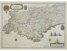
A very decorative map, several cartouches, prepared by Pierre Jean Bompar.In this region over half of the rosé wines produced..
800€
Location: 1650
Published: Amsterdam, 1650
Size: 380 x 519mm.
Color: Original body colours.
Condition: Fine. With wide margins. Paper slightly browned, as usual. Several town spots heightened in gold.
Centered on St. Paul, Hesdin, with the coast of Northern France, including Boulogne-sur-Mer...
350€