Menu
Menu
Your Cart

All Products

Click on image to zoom

Location: 1666
Published: Paris, P.Mariette, 1666
Size: 435 x 575mm.
Color: In original colours.
Condition: Short upper margin, as issued. Some very light staining. Good condition.
Map of the Northern part of Gulf of Bothnia, today's border area between Sweden and Finland. The map derive from the work of ..
400€
Add to Cart
Location: 1666
Published: Paris, Iacques Iollain, 1666
Size: 353 x 465mm.
Color: Uncoloured.
Condition: Trace de pli dans la partie gauche. Pâles taches brunes au centre. Petits dessins à la plume en marge.
Rare carte du Béarn par le Sieur Sollon la Fitte Bearnois, M. D. S. E; publiée chez Iacques Iollain sur le quay de la Megisse..
500€
Add to Cart
Location: 1666
Published: Amsterdam, 1666
Size: 430 x 540mm.
Color: Colored.
Condition: In good condition.
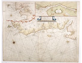
Detailed sea chart of Norway, Finland, Iceland, Spitsbegen and part of Scotland published by Hendrik Donker. The Greenwich me..
1,250€
Add to Cart
Location: 1666
Published: Amsterdam, 1666
Size: 422 x 518mm.
Color: Coloured.
Condition: On double-ply paper as issued. Paper very mildly age-toned, as usual. A good and dark impression.
An eye-catching chart of the north western coast of Africa. Including Canary Islands, Cape Verde Islands and Azores. Pieter G..
600€
Add to Cart
Location: 1667
Published: Paris, 1667
Size: 525 x 395mm.
Color: In original o/l colours.
Condition: In good condition. Good and dark impression. Some light marginal foxing, slightly affecting upper right hand part of the map.
Rare map of the islands of Malta, Gozo, Comino and Cominotto with fine title cartouche lower left. Inset plan of Valetta (110..
1,500€
Add to Cart
Location: 1667
Published: Paris, 1667
Size: 405 x 515mm.
Color: In original o/l colours.
Condition: Very light water stain in upper part of the map with very light foxing of paper. Good and dark impression.
Detailed map centered on Bar-le-Duc in the province Le Barrois. Fine title cartouche with coat of arms lower left.Engraved by..
200€
Add to Cart
Location: 1667
Published: Paris, 1667
Size: 130 x 170mm.
Color: Uncoloured.
Condition: Some light marginal brown spotting. Short lower margin, shaving engraved scale border.
Rare map of the Turkish empire, published by Jollain in 1667. Published in "Trésor Des Cartes Geographiques Des Principaux Es..
300€
Add to Cart
Location: 1667
Published: Amsterdam, 1667
Size: 410 x 517mm.
Color: In attractive original colours.
Condition: Good margins. Paper very slightly age toned as usual. Else very good condition.
An impressive and attractive map with a particularly fine cartouche showing the Turkish Sultan on his throne and allegorical ..
1,000€
Add to Cart
Location: 1667
Published: Paris, P. Mariette, 1667
Size: 200 x 275mm.
Color: In original o/l colours.
Condition: Paper slightly age toned. Some very light marginal water staining spotting.
Map of South America prepared by N.Sanson and published by Pierre Mariette.Published in an early edition of the small Sanson..
300€
Add to Cart
Location: 1667
Published: Paris, P. Mariette, 1667
Size: 175 x 285mm.
Color: In original o/l colours.
Condition: Paper slightly age toned. Some light marginal water staining and spotting.
Map of Morocco prepared by N.Sanson and published by Pierre Mariette. The cartouche is obviously re-engraved as it is much d..
100€
Add to Cart
Location: 1667
Published: Paris, P. Mariette, 1667
Size: 165 x 305mm.
Color: In original o/l colours.
Condition: Paper age toned. Dark impression.
Map of Guinea and Africa's Gold coast prepared by N.Sanson and published by Pierre Mariette.Published in an early edition of..
100€
Add to Cart
Location: 1667
Published: Paris, P. Mariette, 1667
Size: 205 x 277mm.
Color: In original o/l colours.
Condition: Paper slightly age toned. Some marginal water staining and spotting.
Map depicting Colombia and Venezuela prepared by N.Sanson and published by Pierre Mariette.Published in an early edition of ..
200€
Add to Cart
Location: 1667
Published: Paris, P. Mariette, 1667
Size: 190 x 250mm.
Color: In original o/l colours.
Condition: Paper slightly age toned. Some very light water staining and spotting.
Two maps together on one sheet : to the left a map of Thailand and to the right the Malaysian peninsula prepared by N.Sanson..
400€
Add to Cart
Location: 1668
Published: Paris, P.Mariette, 1668
Size: 415 x 533mm.
Color: In original o/l colours.
Condition: Short left and right margins. Some very light staining. Good condition.
Map of the Lapland and Norway and more particularly of the government of Wardhus. all around the north sea...
400€
Add to Cart
Location: 1668
Published: Paris, 1668
Size: 380 x 522mm.
Color: In original o/l colours.
Condition: Very light water stain in lower right hand part of the map with very light foxing of paper. Good and dark impression.
Detailed map of Franche- Comté with fine title cartouche lower right. Centered on Besançon...
300€
Add to Cart
Location: 1669
Published: Nuremberg, c. 1669
Size: 457 x 550mm.
Color: 1
Condition: Cut on upper and lower neat line and remargined. Dark impression. In very good condition.
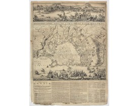
An earlier and smaller version of De Wit's map of Candia. Richly engraved work, one of the most beautiful ever produced of Cr..
2,250€
Add to Cart
Location: 1669
Published: Paris, l'Auteur, s.d., ca.1669
Size: 210 x 290mm.
Color: Uncolored
Condition: In-8 oblong ; veau brun (reliure de l'époque restaurée).Traces de mouillures sur le contreplat. Exemplaire frais intérieurement malgré d'infimes trous de vers marginaux n'affectant pas les cartes. - 3 parts in one. 8vo oblong, contemp. Brown calf. Binding used. Small marginal wormholes not affecting the maps, otherwise maps in very good condition. The general title "Diverses cartes et tables… is lacking.
A rare atlas in three parts. Including a fine map of China, Taiwan and Korea "Carte du voyage des Ambassadeurs de la Compagni..
7,000€
Add to Cart
Location: 1670
Published: Paris, 1670
Size: 520 x 740 mm.
Color: Uncoloured.
Condition: Marge supérieure coupée à l'intérieur du filet d’encadrement. 2 trous de ver dans les angles des marges inférieures.
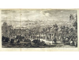
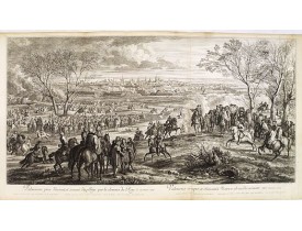
Planche de la série « Courses de Testes et de Bagues Faittes par le Roy et par Les Princes et Seigneurs de sa cour En l'ann..
500€
Add to Cart
Location: 1670
Published: Paris, 1670
Size: 530 x 750 mm.
Color: Uncoloured.
Condition: Marge supérieure coupée au-dessus du filet d’encadrement. 2 trous de ver dans les angles des marges inférieures.
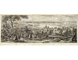
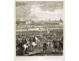
SYLVESTRE, I. - Comparse des Cinq Quadrilles dans l'Amphitheatre. - 36511 - Paris - SYLVESTRE, I. - Comparse des Cinq Quadri..
500€
Add to Cart
Location: 1671
Published: Amsterdam, 1671
Size: 269 x 355mm.
Color: Uncoloured.
Condition: Good and dark imprint. Paper slightly browned. Some foxing. Else good.
View of the port of St. Augustine, the oldest city in the United States and the northernmost bastion of the Spanish empire in..
450€
Add to Cart
Location: 1671
Published: Amsterdam, Jacob Meurs, 1671
Size: 330 x 220mm.
Color: Uncoloured.
Condition: Folio. Engraved allegorical title (short tear repaired), letterpress title in black and red with vignette. Folding engraved general map of America (short tears along fold), 47 double-page engraved plates (2 folding, including 15 maps, the remaining 32 mostly comprising town views), 7 portraits and 69 text engravings.
FIRST EDITION. "This is a classic book on America and is much sought after by collectors of Americana as it contains, on p. 1..
20,000€
Add to Cart
Location: 1672
Published: Paris, 1672
Size: 100 x 120mm.
Color: Uncoloured.
Condition: Very good and dark impression.
Uncommon miniature map of California as a island, from Pierre Duval's La Geographie Universeille dated 1676. The map is deriv..
800€
Add to Cart
Location: 1672
Published: Paris, P. Duval, ca. 1667-1672
Size: 142 x 90mm.
Color: Uncoloured.
Condition: Contemp. brown calf with gilt raised spine. 4 parts in 1 vol. Paris: P. Duval around 1667-72. 13.5 x 8.3 cm. With additional 5 double page engraved titles, 43 maps and 28 double engraved text sheets. Partly slight marginal tears, minor signs of wear and a little age-spotted in the 4th volume are missing the panels of the province of Artois and Franche comté.
Compilation of Duval's Pocket Atlas, with an archbishoprics and dioceses description of the world, here right at the beginnin..
3,000€
Add to Cart
Location: 1673
Published: Antwerpen, Michiel Cnobbaert, 1673
Size: 185 x 125mm.
Color: Uncoloured.
Condition: Good and dark impression. Letter press with copper engraving.
Taken from a very rare travel book by Anthonius Gonsales, "Hierusalemsche Reyse". The book describes his pilgrimage from Antw..
50€
Add to Cart
Showing 625 to 648 of 2411 (101 Pages)