All Products
Click on image to zoom
Location: 1710
Published: Amsterdam, ca. 1710
Size: 510 x 883 mm.
Color: In original colours.
Condition: Good and dark impression. Some very light browning. Generally in very fine condition. On two joined sheets.
VAN KEULEN, G. - Nieuwe en Nette Afteekening van het Eyland Corsica en het Eyland Elba vertoonende alle desselfs Havenen, St..
3,800€
Location: 1710
Published: Paris, c. 1710
Size: 475 x 620 mm.
Color: In original o/l colours.
Condition: Slightly water staining at lower part of the map.
DE L'ISLE, G. - Carte de la souveraineté de Neuchatel et Vallangin. - 41947 - Switzerland - DE L'ISLE, G. - Carte de la souv..
200€
Location: 1711
Published: Amsterdam, 1711
Size: 550 x 550mm.
Color: Colored
Condition: A very rare 18 inch (46cm.) diameter celestial globe in very good condition. made up of two sets of twelve finely engraved and hand-colored gores and two polar calottes (70°) laid to the ecliptic poles of a papier-maché and plaster sphere, the axis through the celestial poles, the equatorial graduated in individual degrees and labelled every 10°, the ecliptic graduated in individual days of the houses of the Zodiac, with sigils and labelled every ten days.
RARE FIRST STATE OF THIS CELESTIAL TABLE GLOBE, 46 cm in diameter, produced by Gerard and Leonard Valk at the beginning of th..
95,000€
Location: 1711
Published: Paris, 1711
Size: 469 x 704mm.
Color: In original o/l colours.
Condition: In good condition.
Showing Poitou, Pays d'Aunis, Saintonge, Limousin, Medoc, Perigord, etc. Embellished with a big title cartouche surrounded by..
200€
Location: 1711
Published:
Size: 430 x 605mm.
Color: Uncoloured.
Condition:
Plan de la citadelle d’Aire-sur-la-Lys et du fort Saint-François (renommé Fort Gassion en 1872), dressé par le capitaine et i..
75€
Location: 1712
Published: Amsterdam, after 1669-1712
Size: 434 x 520mm.
Color: Uncoloured.
Condition: Paper slightly age-toned. With some plate scratching and ink toning.
Rare chart of the Indian Ocean, with compass roses and system of rhumb lines, soundings and anchorage's. Many place names. T..
1,900€
Location: 1712
Published: Milan, 1712
Size: 222 x 318mm.
Color: In attactive colours.
Condition: Trous de ver marginaux.
In "Atlas des Capucins"...
300€
Location: 1713
Published: Amsterdam, 1713
Size: 215 x 335mm.
Color: Coloured.
Condition: Map has two small holes that affect the engraved surface, one is a rust hole light creasing and the margins have very minor nicks and small tears, else in good condition.
This attractive map of Tartary shows the ancient Silk Road region. The map shows the track of William of Rubruck (Willem van ..
500€
Location: 1713
Published: Amsterdam 1713
Size: 495 x 653mm.
Color: Uncoloured.
Condition: In very good condition. Dark impression.
Although not renowned for the originality of his work, Pieter van der Aa is highly thought of for the design and quality of h..
1,500€
Location: 1713
Published: Amsterdam 1713
Size: 490 x 653mm.
Color: Uncoloured.
Condition: In very good condition. Dark impression.
Although not renowned for the originality of his work, Pieter van der Aa is highly thought of for the design and quality of h..
2,000€
Location: 1713
Published: Padoue, 1713
Size: 107 x 146mm.
Color: Coloured.
Condition: Very good condition.
Fine miniature map of Corsica. Printed by Alphonsus Lasor a Varea (aka Raffaelo Savonarola), in his "Universus terrarum orbis..
300€
Location: 1715
Published: Paris, 1715
Size: 236 x 345mm.
Color: Coloured.
Condition: Paper slightly browned. Minor marginal water staining. Lighter foxing.
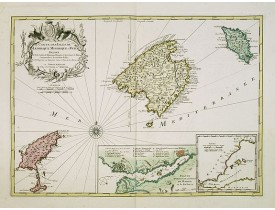
Bird's eye-view of Palma de Majorca. Wind rose in the lower left corner...
300€
Location: 1715
Published: Paris, Jaillot, 1715
Size: 675 x 530mm.
Color: Uncoloured.
Condition: Carte monumentale en 6 feuilles non jointes : 67,5 x 53 cm chaque, soit une carte mesurant au total 135 x 159 cm. Plis centraux et 1 carte un peu jaunis. Bel exemplaire sur papier fort.
Carte particulière du Diocèse de Rouen dressée sur les lieux / par Mr Fremont de Dieppe ; sous les yeux et par les Ordres de ..
2,000€
Location: 1715
Published: Paris, à présent rue St. Jacques au-dessus de la rue des Mathurins à l'enseigne de la Place des Victoires et du Lion d'Argent, c. 1715
Size: 1009 x 1440mm.
Color: Original outline colors.
Condition: Large folding map dissecte in 6 sheets + decorative border, mounted on linen. Paper slightly age-toned. A hole of 4 cm at upper right part in "Franconie", missing a few location names and water staining. A few worm holes affecting the right border and the lower part of the map.
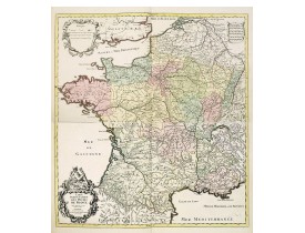
Impressive wall map of France decorated with a large figurative title cartouche, a dedication cartouche to the glory of the K..
2,500€
Location: 1717
Published: Paris, 1717
Size: 820 x 690 mm.
Color: In original o/l colours.
Condition: Two brown stains at center left and right, just affecting the printed area. Paper very slightly age toned.<br />Each map ca. 413 x 690mm.
JAILLOT, A. H. - EVESCHÉ DE MEAUX dédié A Monseigneur Jacques Benigne Bossuet, Evescque de Meaux. . . - 36770 - Île-de-Franc..
100€
Location: 1718
Published: Amsterdam, 1718
Size: 356 x 520mm.
Color: In attactive colours.
Condition: In very good condition.
Very decorative map of the area north of Dokkum from the "Uitbeelding der Heerlijkheit Friesland" prepared by Schotanus. With..
300€
Location: 1718
Published: Amsterdam, 1718
Size: 363 x 425mm.
Color: Uncoloured.
Condition: A good and dark impression.
Historical map of the present-day Low Countries prepared by the Menso Alting (1637-1713). He was burgomaster of Groningen and..
250€
Location: 1718
Published: Amsterdam, 1718
Size: 388 x 472mm.
Color: Uncoloured.
Condition: A good and dark impression.
Historical map of the present-day Low Countries prepared by the Menso Alting (1637-1713). He was burgomaster of Groningen and..
250€
Location: 1718
Published: Amsterdam, 1718
Size: 445 x 440mm.
Color: Uncoloured.
Condition: A good and dark impression.
Historical map of the present-day Low Countries prepared by the Menso Alting (1637-1713). He was burgomaster of Groningen and..
150€
Location: 1718
Published: Paris, 1718
Size: 770 x 1285mm.
Color: Colored.
Condition: Plan en 4 feuilles assemblées : 2 feuilles pour le plan et 2 feuilles pour le texte (Table alphabétique). Large déchirure en bas à droite et fentes le long du pli central restaurées, 2 manques avec lacune en bas à droite comblés et redessinés, petites consolidations en divers endroits, manques en haut à droite avec atteinte à la vue de Paris et à la table alphabétique, marges abîmées restaurées.
A four-sheet wall map originally published by Claude Roussel in 1716 here in an unrecorded publishing date of 1718. Still bea..
3,500€
Location: 1718
Published: Amsterdam, 1718
Size: 295 x 415mm.
Color: Uncoloured.
Condition: A good and dark impression.
Historical map of the present-day Low Countries prepared by the Menso Alting (1637-1713). He was burgomaster of Groningen and..
150€
Location: 1718
Published: Amsterdam, 1718
Size: 472 x 353mm.
Color: Uncoloured.
Condition: A good and dark impression.
Historical map of the present-day Low Countries prepared by the Menso Alting (1637-1713). He was burgomaster of Groningen and..
250€
Location: 1718
Published: Amsterdam, 1718
Size: 372 x 375mm.
Color: Uncoloured.
Condition: A good and dark impression.
Historical map of the present-day Low Countries prepared by the Menso Alting (1637-1713). He was burgomaster of Groningen and..
200€