All Products
Click on image to zoom
Location: 1784
Published: Paris, 1784
Size: 518 x 635mm.
Color: Uncoloured.
Condition: Mounted on linen, dissected in 15 parts, lined with green silk. Some age toning of paper.
Very rare and beautiful plan of the city and bay of Saint-Jean-de-Luz, detailing the projects of expansion of the port undert..
2,000€
Location: 1784
Published: Venice, 1776 - 1784
Size: 476 x 606mm.
Color: In original o/l colours.
Condition: Slight marginal spotting. Lower margin short, as issued. Else very good condition.
Finely and crisply engraved map of the Persian Empire during the 18th century. It shows the Caspian Sea in the north to the P..
350€
Location: 1784
Published: Venice, 1776 - 1784
Size: 468 x 647mm.
Color: In original o/l colours.
Condition: In very good condition.
A finely and crisply engraved map of Asia is decorated with an ornamental title cartouche in the lower-left corner.There are ..
1,000€
Location: 1785
Published: Spain, 1785
Size: 325 x 210mm.
Color: Uncoloured.
Condition: 4pp. 4pp. With copper engraved share on front page, other pages are blank. Small tear in lower margin, Page 4 stained. Size of sheet 355 x 260mm.
A scarce Real Compañia de Filipinas 250 Pesos deed issued in 1785. Share nº 27324, hand signed by several company officials...
1,650€
Location: 1785
Published: Paris, Ph.-D. Pierres, Clousier [- Moutard], 1785
Size: 515 x 805mm.
Color: Uncoloured.
Condition: A very good and dark impression. Folded as issued. Printed on thick paper.
This is a very detailed map of the region from Japan to the Gobi Desert, centered on Mongolia and Korea, from D'Anville's Atl..
1,500€
Location: 1785
Published: Paris, 1785
Size: 475 x 624mm.
Color: In original o/l colours.
Condition: Some staining, especially in the margin. Center fold very marked. Repair in the left margin.
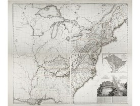
A map of the eastern United States from editions of Atlas universel. Copies also found with "Supplément à l'atlas de M Rober..
1,750€
Location: 1785
Published: Paris, 1785
Size: 268 x 388mm.
Color: Uncolored
Condition: Foldings as issued. Overall very good condition.
BERNARD, J.F. / COOK, Capt. - Carte de l'Entrée de Norton, et du Detroit de Bhering ou Von vou le Cap le plus oriental de l'..
250€
Location: 1785
Published: Paris, ca. 1785
Size: 260 x 152mm.
Color: Uncoloured.
Condition: In very good condition.
Detailed of the Caspian Sea, prepared by Jean Antoine Guldenstaedt (1745-1781), who was a Russian naturalist and physician, b..
180€
Location: 1785
Published: London 1781-1785
Size: 241 x 184mm.
Color: In attractive original colours.
Condition: Some age toning of the paper. Overall good condition.
Hand coloured copper engraving representing a Hackled Partridge from General Synopsis of Birds by John A. Latham (1740–1837)..
125€
Location: 1785
Published: London, 1781-1785
Size: 240 x 184mm.
Color: In attractive original colours.
Condition: Some age toning of the paper. Overall good condition.
Hand coloured copper engraving representing a Red Flamingo from General Synopsis of Birds by John A. Latham (1740–1837) who ..
150€
Location: 1785
Published: Paris, Aliamet, ca. 1785
Size: 510 x 660 mm.
Color: Uncoloured
Condition: Very fine condition and imprint.
Dédié à Monseigneur Anne Robert Jacques Turgot Ministre d'Etat,
Controlleur Général des Finances. Gravé par J. Aliamet d'ap..
600€
Location: 1786
Published:
Size: 249 x 384mm.
Color: Uncoloured.
Condition:
Très rare plan de la ville de Bourg-en-Bresse, publié par l’astronome Joseph-Jérôme Le François de Lalande, membre de l’Acadé..
350€
Location: 1786
Published: Paris, 1732- 1786
Size: 580 x 375mm.
Color: In original o/l colours.
Condition: Atlas in elephant folio (book block measuring 580x375 mm.), bound in modern. half calf with gilted label on spine "ATLAS DE D'ANVILLE", 59 pages multisheet maps, actual map sheet count is 42. Maps dated 1743-1786. This set is accompanied by a 4 pages printed broadsheet "Mémoire instructif. . . En Mars MDCCXXXII D'Anville, Geographe ordinaire du Roy. Permis d'imprimer ce 21 Mars 1732, Herault" and 4 pages manuscript text in pen and brown ink "Mémoire instructif pour faire la carte (de d'Anville)…"<br>Very good condition inside the book block, the two sheet map of Africa has slight overall browning, the others printed on fine white thick paper and coloured in outline.
Jean Baptiste Bourguignon d'Anville was perhaps the most important and prolific cartographer of the 18th century.He engraved ..
19,000€
Location: 1786
Published: Paris, Robert de Vaugondy/Delamarche, 1786
Size: 985 x 1150mm.
Color: Original outline colors.
Condition: Large map dissected in 20 sheets and mounted on linen. Slightly water staining.
Large world map showing the sea tracks of Captain Cook in his three Pacific voyages published by C. F. Delamarche.Rare state ..
3,500€
Location: 1787
Published: London, 1787
Size: 1030 x 1195mm.
Color: In original o/l colours.
Condition: Three joined sheets. Repair of 2 marginal tears just runniing into engraved area. Some paper thinness reinforced.
An attractive and rare, separately issued map, of Asia with figured side borders. With large decorative title cartouche. By T..
5,500€
Location: 1787
Published: Paris, Mondhare, 1787
Size: 960 x 1221mm.
Color: Original outline colors.
Condition: Printed on four sheets. Joined and mounted on canvas. The paper is slightly browned. Some minor localized staining and foxing. Some minor folds and minor wrinkles. Two small losses of paper at the lower right and left part. Good impression. Some pinholes due to ancient display.
Spectaculaire carte murale entourée d'une superbe bordure dans le style Rococo, constituée de 20 scènes à sujets historiques ..
6,000€
Location: 1787
Published: Paris, Le Gouaz, 1787
Size: 145 x 230mm.
Color:
Condition: Dimensions du cuivre : 23 x 32 cm.
Dessiné par N. Ozanne, gravé par Y. le Gouaz. "De 1777 à 1779, N. Ozanne faisait paraître chez Le Gouaz graveur une série de ..
200€
Location: 1787
Published: Paris, 1787
Size: 440 x 525mm.
Color: In original o/l colours.
Condition: Very good to mint condition. Good margins.
Map of France during the regime of Henri IV. With a colour key in lower left. Prepared by J.A. Dezauche, who was a publisher,..
50€
Location: 1788
Published: Potzdam, Strasbourg, Paris, 1788
Size: 590 x 640 mm.
Color: In original o/l colours.
Condition: 4to. 92pp. with large folding map. Contemp. mottled calf, with raised spine in 6 compartments. Richly gilted with coats of arms of Ducs of Luynes, and title on red morocco label.
MULLER, L. - Tableau des guerres de Frédéric le Grand: ou plans figurés de vingt-six batailles rangées, ou combats essentiel..
4,500€
Location: 1788
Published: Leipzig, 1788
Size: 410 x 470mm.
Color: In original o/l colours.
Condition: Paper slightly age toned and good and dark impression. Printed on heavy paper.
Very rare separately published map showing the Russian War seat including Finland, Lithuania, Denmark and parts of Poland, No..
2,000€
Location: 1788
Published: Paris, 1788
Size: 440 x 650mm.
Color: In original colours.
Condition: Good condition.
Very rare map of the Crimea area published Jean-Claude Dezauche, who was active in Paris 1770-1824. The map includes borders ..
750€
Location: 1788
Published: Rome, 1788
Size: 330 x 465mm.
Color: In original o/l colours.
Condition: Good and dark impression, some light marginal foxing, generally in good condition.
First edition on laid paper. Cassini’s splendid map depicts Asia at the end of the eighteenth century. Good details are provi..
750€
Location: 1788
Published: Paris, Mondhare, 1788
Size: 965 x 1230mm.
Color: Original outline colours.
Condition: Printed on four sheets. Joined and mounted on canvas. Paper slightly browned. Some minor localized staining and foxing. There are some pin holes due to ancient mounting on a frame. The outlines color is slightly oxidized.
Carte murale entourée d'une superbe bordure dans le style Rococo, constituée de 20 scènes historiques décrivant l’avènement d..
3,800€