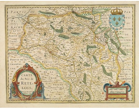
JANSSONIUS, J. - Carte du pais de Retelois.

JANSSONIUS, J. - Carte du pais de Retelois.
Published: Amsterdam, 1645
Size: 380 x 500mm.
Color: In attractive strong original colours.
Condition: Paper slightly age toned. In good condition.
Description
Beautiful and detailed map of Pais de Retelois in the north east of France. Showing the city of Retel, Moncornet en Tirache, Beaumont, Charleville. The cartographer was Jean Jubrien Châlonnais (1569-1641).
In the lower left-hand side a large title cartouche and a scale cartouche in lower right.
No text on verso. With the signature of Henricus Hondius and the co-address "Et se vendent à Paris chez Melchior Tavernier". From a French composite atlas.
In the lower left-hand side a large title cartouche and a scale cartouche in lower right.
No text on verso. With the signature of Henricus Hondius and the co-address "Et se vendent à Paris chez Melchior Tavernier". From a French composite atlas.
100€
- See other items by this publisher: JANSSONIUS, J.
- Reference N°: 32365
1490 views
 Click on image to zoom
