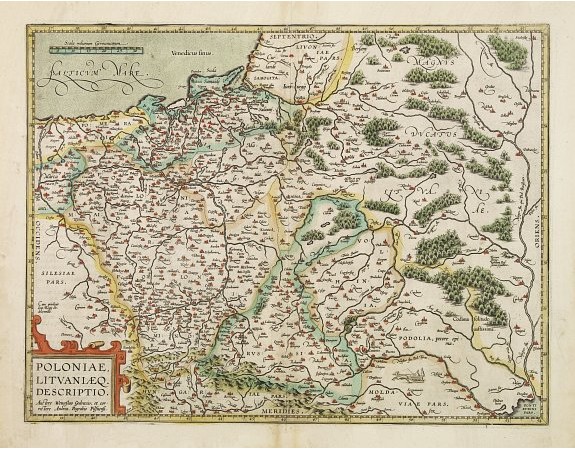
ORTELIUS, A. - Poloniae, Lituaniaeq descriptio.

ORTELIUS, A. - Poloniae, Lituaniaeq descriptio.
Published: Anvers, 1612
Size: 369 x 481mm.
Color: In attractive original colours.
Condition: Good and dark impression. Some very minor age-toning along centre fold and in margins. Paper frayed in very outer lower left corner.
Description
Fine general map of Poland, the second plate appearing in post -1595 edition of the Theatrum. Based on the now lost map of Waclaw Grodecki. Shows the Polish kingdom near its greatest territorial limits, stretching south to the borders of the Black Sea and well into present-day Moldova and Ukraine. The line of the Dneiper River at the extreme right of the map.
1,500€
- See other items by this publisher: ORTELIUS, A.
- Reference N°: 04521
1657 views
 Click on image to zoom
