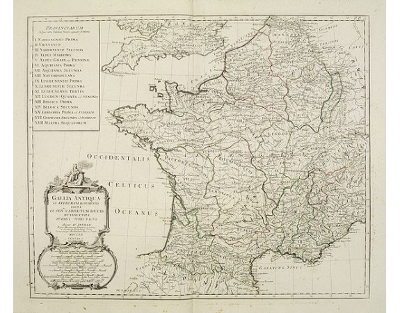
SANTINI, P. /REMONDINI, M. - Gallia Antiqua ex Aevi Romani monumentis eruta..
 Click on image to zoom

SANTINI, P. /REMONDINI, M. - Gallia Antiqua ex Aevi Romani monumentis eruta..
Published: Venice, 1776 - 1784
Size: 470 x 570mm.
Color: In original o/l colours.
Condition: Minor marginal foxing, affecting the lower right corner. Elsewhere very good condition.
Description
Historical map of France depicted in Roman times showing ancient divisions. With numbered key in the upper left corner listing the Roman provinces.
Venetian edition of d'Anville's map, from "Atlas Universel" printed in 1776-84.
Ornamental title cartouche and scale cartouche in the lower left.
Venetian edition of d'Anville's map, from "Atlas Universel" printed in 1776-84.
Ornamental title cartouche and scale cartouche in the lower left.
100€
- Reference N°: 24930


