Menu
Shop
Catalog
New
World maps - Celestials
World
0
Celestial charts
0
Poles
0
France
West regions
0
Anjou - Maine
0
Anjou - Maine towns
0
Aunis - Saintonge
0
Towns Aunis - Saintonge
0
Brittany
0
Brittany towns
0
Guyenne - Gascogne - Béarn
0
Guyenne-Gascogne towns
0
Normandy
0
Normandy towns
0
Poitou
0
Poitou towns
0
Vendée
0
Vendée towns
0
Central France
0
Berry
0
Limousin
0
Limousin towns
0
Nivernais
0
Orléanais
0
Orléanais towns
0
Touraine
0
Touraine towns
0
East regions
0
Alsace
0
Alsace towns
0
Auvergne
0
Auvergne towns
0
Bourgogne
0
Champagne - Ardennes
0
Champagne towns
0
Dauphiné
0
Dauphiné towns
0
Franche-Comté
0
Franche-Comté towns
0
Lorraine
0
Lorraine towns
0
Lyonnais
0
Lyonnais towns
0
Savoy
0
Savoy towns
0
South regions
0
Languedoc
0
Languedoc towns
0
Monaco
0
Provence
0
Provence towns
0
Roussillon
0
Corsica
0
Paris & Île-de-France
0
Île-de-France towns
0
Paris
0
Île-de-France
0
North regions
0
North
0
North towns
0
Picardy
0
Picardie towns
0
Nord
0
Nord towns
0
Europe
British Isles
0
England
0
Ireland
0
Scotland
0
Wales
0
Channel Islands
0
Gibraltar
0
Europe continent
0
Southern Europe
0
Greece
0
Portugal
0
Spain
0
Italy
0
Switzerland - Austria
0
Austria
0
Switzerland
0
Scandinavia
0
Scandinavia general
0
Denmark
0
Finland
0
Iceland
0
Norway
0
Sweden
0
BeNeLux
0
Belgium
0
Leo Belgicus maps
0
Luxemburg
0
Netherlands
0
Germany
0
Germany general
0
Germany provinces
0
Germany towns
0
Central & Eastern Europe
0
Balkans
0
Baltic Countries
0
Black Sea - Ukraine
0
Bulgaria
0
Czech Republic - Slovakia
0
Hungary
0
Lithuania
0
Poland
0
Romania
0
Russia
0
Mediterranean Sea
0
Balearic Islands
0
Cyprus
0
Malta
0
Minorca - Majorca
0
Sardinia
0
Sicily
0
Africa
Africa continent
0
North Africa
0
Algeria
0
Egypt
0
Libya
0
Morocco
0
Tunisia
0
West Africa
0
Central Africa
0
East Africa
0
East Africa general
0
Madagascar - Mauritius - La Réunion
0
South Africa
0
America
America continent
0
North America
0
North America general
0
Canada
0
Alaska
0
California
0
Florida
0
Great Lakes - Philadelphia
0
Indiana - Ohio - Kentuky
0
Mexico
0
Mississippi - Louisiana
0
New England
0
New England States
0
Virginia - Maryland - Carolina
0
Western America - Texas
0
Central America
0
Costa Rica
0
Guatemala
0
Honduras
0
Panama
0
Porto Rico
0
South America
0
Peru
0
South America general
0
Strait of Magellan - Tierra del Fuego
0
Venezuela
0
South America general
0
Argentina
0
Bolivia
0
Brazil
0
Chili
0
Colombia
0
French Guiana - Suriname
0
Paraguay
0
West Indies
0
Jamaica
0
Martinique
0
Trinidad and Tobago
0
West Indies general
0
Bermuda
0
Cuba
0
Curaçao
0
Guadeloupe
0
Haïti - Domenican Republique
0
Atlantic Ocean
0
Pacific
0
Asia
Asia continent
0
Far East
0
China
0
China provinces
0
China towns
0
Hong Kong
0
Japan
0
Korea
0
Taiwan
0
Tartary - Mongolia
0
Tibet
0
Near and Middle East
0
Near & Middle East general
0
Arabian Peninsular
0
Holy Land
0
Libyan
0
Pakistan - Afghanistan
0
Persia
0
Syria
0
Turkey
0
India
0
Ceylon
0
Pakistan
0
South East Asia
0
Cambodia - Laos - Thailand - Vietnam
0
Indonesia
0
Malaysia - Singapore
0
Philippines
0
Oceania
Australia
0
French Polynesia
0
New Caledonia
0
New Zealand
0
Old Books - Atlases
Atlases
0
Cosmography
0
Local French history
0
Modern illustrated
0
Travel
0
Asian travel books
0
Travel America
0
Travel Americana
0
Travel Asia - Oceania
0
Travel Europe
0
Travel Africa
0
Various subjects
0
Architecture
0
Bibliography
0
Children books
0
Economy
0
Fashion & costume
0
Gastronomy
0
History
0
Judaica
0
Literature
0
Medicine
0
Military
0
Natural history
0
Science & technology
0
Sports
0
Typography
0
Various subjects
0
Prints
Architectural prints
0
Botanical Prints
0
Fashion prints
0
Japanese prints
0
Maritime
0
Natural history prints
0
Nuremberg Chronicle
0
Old Master
0
Optical prints
0
Other subject
0
Zoological prints
0
16th - 18th century prints
0
Wood block prints
0
19th century prints
0
20th century prints
0
Portraits
0
Various
Cartographic Curiosities
0
Carte-à-figures maps
0
Folding maps
0
Geological maps
0
Sea Charts
0
Title pages
0
Drawings
0
Erotica
0
Globes & Instruments
0
La Belle Époque
0
Medieval manuscript leaves
0
Photography
0
Posters & Publicity
0
Les Maitres de l'Affiche
0
Posters
0
Publicity
0
Prints
0
Architectural prints
0
Botanical Prints
0
Fashion prints
0
Japanese prints
0
Maritime
0
Natural history prints
0
Nuremberg Chronicle
0
Old Master
0
Optical prints
0
Other subject
0
Zoological prints
0
16th - 18th century prints
0
Wood block prints
0
19th century prints
0
20th century prints
0
Portraits
0
Valuation
Contact
Menu
Filter
Clear
Your Cart
Librairie Loeb-Larocque - Paris
Facebook
Instagram
Printerest
English
Français
English
€
Euro
EUR
€
Euro
EUR
£
Pound Sterling
GBP
$
US Dollar
USD
Search here...
Account
Login / Register
Login
Register
Wishlist
Edit Your Wishlist
0
Compare
Product Comparison
0
0 item(s) - 0€
0
Your shopping cart is empty!
Menu
Maps France
General France
North regions
North
Picardy
Paris & Île-de-France
Île-de-France
Île-de-France towns
Paris
West regions
Anjou - Maine
Aunis - Saintonge
Brittany
Guyenne - Gascogne - Béarn
Normandy
Poitou
Vendée
Central regions
Berry
Limousin
Nivernais
Orléanais
Touraine
East regions
Alsace
Auvergne
Bourgogne
Champagne - Ardennes
Dauphiné
Franche-Comté
Lorraine
Lyonnais
Savoy
South regions
Languedoc
Monaco
Provence
Roussillon
Corsica
Monaco
Maps all parts
World - Celestials - Poles
World
Celestial
Poles
Europe
Continent
British Isles
England
0
Ireland
0
Scotland
0
Wales
0
Channel Islands
0
Gibraltar
0
Switzerland - Austria
Austria
0
Switzerland
0
BeNeLux
Belgium
0
Leo Belgicus maps
0
Luxemburg
0
Netherlands
0
Germany
Germany general
0
Germany provinces
0
Germany towns
0
Central & Eastern Europe
Balkans
0
Baltic Countries
0
Black Sea - Ukraine
0
Bulgaria
0
Czech Republic - Slovakia
0
Hungary
0
Lithuania
0
Poland
0
Romania
0
Russia
0
Southern Europe
Greece
0
Portugal
0
Spain
0
Italy
0
Mediterranean
Balearic Islands
0
Cyprus
0
Malta
0
Minorca - Majorca
0
Sardinia
0
Sicily
0
Scandinavia
Scandinavia general
0
Denmark
0
Finland
0
Iceland
0
Norway
0
Sweden
0
Travel
Africa
African continent
North Africa
Algeria
0
Egypt
0
Libya
0
Morocco
0
Tunisia
0
Central Africa
West Africa
East Africa
East Africa general
0
Madagascar - Mauritius - La Réunion
0
South Africa
America
America continent
0
North America
0
North America general
0
Canada
0
Alaska
0
California
0
Florida
0
Great Lakes - Philadelphia
0
Indiana - Ohio - Kentuky
0
Mexico
0
Mississippi - Louisiana
0
New England
0
New England States
0
Virginia - Maryland - Carolina
0
Western America - Texas
0
Central America
0
Costa Rica
0
Guatemala
0
Honduras
0
Panama
0
Porto Rico
0
South America
0
Peru
0
South America general
0
Strait of Magellan - Tierra del Fuego
0
Venezuela
0
South America general
0
Argentina
0
Bolivia
0
Brazil
0
Chili
0
Colombia
0
French Guiana - Suriname
0
Paraguay
0
West Indies
0
Jamaica
0
Martinique
0
Trinidad and Tobago
0
West Indies general
0
Bermuda
0
Cuba
0
Curaçao
0
Guadeloupe
0
Haïti - Domenican Republique
0
Atlantic Ocean
0
Pacific
0
Asia
Asia continent
Near & Middle East
Near & Middle East general
0
Arabian Peninsular
0
Holy Land
0
Libyan
0
Pakistan - Afghanistan
0
Persia
0
Syria
0
Turkey
0
India - South East Asia
Cambodia - Laos - Thailand - Vietnam
0
Indonesia
0
Malaysia - Singapore
0
Philippines
0
Far East
China
0
China provinces
0
China towns
0
Hong Kong
0
Japan
0
Korea
0
Taiwan
0
Tartary - Mongolia
0
Tibet
0
Travel Asia & Oceania
Oceania
Australia
New Zealand
Pacific
French Polynesia
Cartographic curiosities
Curiosities
Title pages
Globes
Carte-à-figures maps
Sea charts
Sea chrts
Books
Atlases
Travel
Asie - Oceania
Travel America
Travel Europe
Travel Africa
Local French
Books Old & Rare
Fashion
Literature
Natural history
Modern illustrated
Reference books
Various
Fashion & costumes
Literature
Natural history
Various subjects
Varia
Posters / Les Maitres de l'Affiche
Posters
Les Maitres de l'Affiche
Prints
16th - 18th century
19th century
20th century
Architecture
Erotica
Fashion
Japanese prints
Natural history
Maritime
Portraits
Optical prints
Wood block prints
Zoological prints
Other subjects
Drawings
Posters & Publicity
Les Maitres de l'Affiche
0
Posters
0
Publicity
0
Cartographic curiosities
Carte-à-figures maps
Globes & Instruments
Leo Belgicus
Title Pages
Globes & instruments
Books of Hours & leaves
Erotica
Photography
The shop
About
Catalog
We Buy
Terms
Mapmakers
Schedel
Dating maps
Corsica Illustrata
Contact
Valuation
Next Auction
Next Auction
Results
Valuation
Estimation form
Contact
Valuation
Estimate your book
We buy
Valuation
Contact
Valuation form
Auction results
Contact
Contact
Login
0
home
France
North regions
North
North
Product Compare
0
Sort By:
Default
Name (A - Z)
Name (Z - A)
Price (Low > High)
Price (High > Low)
Show:
24
25
50
75
100
Location:
1585
WAGHENAER, L. J. - Beschrijvinge vande de zee Cuften va Vlanderen en Picardien. . .
Published
: Leiden, Plantijn, 1585
Size
: 325 x 510mm.
Color
: Coloured
Condition
: Papier uniformément bruni. Bonne condition générale. - Marginal discolouration and paper slightly age-toned. Else good condition.
Rare carte marine représentant les côtes de Flandre, Picardie et Normandie depuis Nieuwpoort jusqu'à Dieppe, avec le texte en..
2,500€
WAGHENAER, L. J. - Beschrijvinge vande de zee Cuften va Vlanderen en Picardien. . .
Add to Cart
Add to Wish List
Compare this Product
Ask Question
Ask Question
Location:
1587
ORTELIUS, A. - Caletensium et Bononiensium / Veromanduorum. . .
Published
: Anvers, 1587
Size
: 335 x 480mm.
Color
: In attactive original colours.
Condition
: Papier légèrement jauni.
Deux cartes sur une planche. Texte français au verso. La carte du Calaisis est fondée sur la carte en 4 feuilles par Nicolas ..
250€
ORTELIUS, A. - Caletensium et Bononiensium / Veromanduorum. . .
Add to Cart
Add to Wish List
Compare this Product
Ask Question
Ask Question
Location:
1590
GUICCIARDINI, L. - Valencena . . .
Published
: Anvers, 1590
Size
: 230 x 315mm.
Color
: Uncoloured.
Condition
: In good condition.
Eye-bird view of Valenciennes...
50€
GUICCIARDINI, L. - Valencena . . .
Add to Cart
Add to Wish List
Compare this Product
Ask Question
Ask Question
Location:
1598
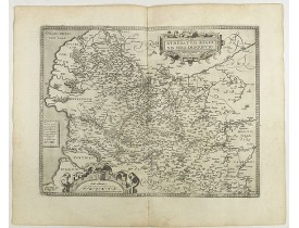
ORTELIUS, A. - Artois. Atrebatum Regionis Vera Descripto.
Published
: Antwerp, 1598
Size
: 375 x 490mm.
Color
: Uncoloured.
Condition
: French text on the verso. Wide margins and a strong and dark impression. In fine condition.
Prepared by Jacob Surhon who made a manuscript map of Artois for which he received 36 Livres from Charles V in 1554. For secu..
200€
ORTELIUS, A. - Artois. Atrebatum Regionis Vera Descripto.
Add to Cart
Add to Wish List
Compare this Product
Ask Question
Ask Question
Location:
1606
LANGENES, B. / BERTIUS, P. - Artesia.
Published
: Amsterdam, 1606
Size
: 85 x 125mm.
Color
: Uncoloured.
Condition
: In very good condition, lightly age toned, with light water stains, all with wide margins, a nice dark impression. Latin text to verso.
A decorative miniature map of Artois, a historical northern French province that borders Belgium. A map full of detail and i..
100€
LANGENES, B. / BERTIUS, P. - Artesia.
Add to Cart
Add to Wish List
Compare this Product
Ask Question
Ask Question
Location:
1606
LANGENES, B. / BERTIUS, P. - Descriptio Veromanduorum.
Published
: Amsterdam, 1606
Size
: 85 x 125mm.
Color
: Uncoloured.
Condition
: In very good condition, lightly age toned, with light water stains, all with wide margins, a nice dark impression. Latin text to verso.
A decorative miniature map of Aisne (Vermandois), a French department in the Hauts-de-France region of northern France. It is..
100€
LANGENES, B. / BERTIUS, P. - Descriptio Veromanduorum.
Add to Cart
Add to Wish List
Compare this Product
Ask Question
Ask Question
Location:
1609
LANGENES, B. - Artesia / Artois.
Published
: Amsterdam/Frankfurt, 1609
Size
: 87 x 123mm.
Color
: Uncoloured.
Condition
: Some marginal paper thinness.
A miniature map including northern part of France. Title cartouche on the left side. First published in 1598 in his "Caert-Th..
50€
LANGENES, B. - Artesia / Artois.
Add to Cart
Add to Wish List
Compare this Product
Ask Question
Ask Question
Location:
1631
JANSSON, J. - Description du Gouvernement de La Cappelle. Par P. Petit Bourbon.
Published
: Amsterdam, 1631
Size
: 370 x 500mm.
Color
: In attactive original colours.
Condition
:
Decorative map of La Capelle in the region of the Nord-Pas-de-Calais in France with three decorative cartouches. The map of ..
200€
JANSSON, J. - Description du Gouvernement de La Cappelle. Par P. Petit Bourbon.
Add to Cart
Add to Wish List
Compare this Product
Ask Question
Ask Question
Location:
1631
HONDIUS, H. - L'Archevesche de Cambray.
Published
: Amsterdam, 1631
Size
: 350 x 500mm.
Color
: In attactive original colours.
Condition
: Papier légèrement bruni, quelques rousseurs.
Carte de l'archevêché de Cambrai figurant les villes de Cambrai, Bouchain, Crèvecoeur, Douai. Ornée de 3 cartouches et d'armo..
200€
HONDIUS, H. - L'Archevesche de Cambray.
Add to Cart
Add to Wish List
Compare this Product
Ask Question
Ask Question
Location:
1640
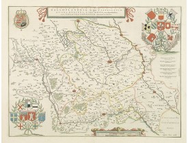
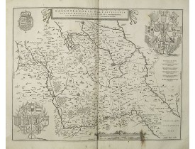
BLAEU, W. - Archiepiscopatus Cameracensis. Archevesché de Cambray.
Published
: Amsterdam, ca. 1640
Size
: 381 x 500mm.
Color
: In attactive original colours.
Condition
: Infimes rousseurs. Texte en français au verso.
Carte très décorative figurant l'archevêché de Cambrai. Ornée de 3 cartouches et d'armoiries en coloris d'époque...
200€
BLAEU, W. - Archiepiscopatus Cameracensis. Archevesché de Cambray.
Add to Cart
Add to Wish List
Compare this Product
Ask Question
Ask Question
Location:
1640
JANSSONIUS, J. - Archiepiscopatus Cameracensis. Archeveché de Cambray.
Published
: Amsterdam, Paris, 1640
Size
: 387 x 496mm.
Color
: In original o/l colours.
Condition
: In good condition.
Map of the north of France centered on Cambrai. Three cartouches and a beautiful coat of arms decorate the corners of the map..
100€
JANSSONIUS, J. - Archiepiscopatus Cameracensis. Archeveché de Cambray.
Add to Cart
Add to Wish List
Compare this Product
Ask Question
Ask Question
Location:
1640
HONDIUS, H. - L'Archevesche de Cambray.
Published
: Amsterdam/Paris, ca. 1640
Size
: 370 x 495mm.
Color
: Uncoloured.
Condition
: Bel exemplaire. Sans texte au verso.
Carte de l'Archevêché de Cambray publiée sans texte au verso vraisemblablement dans un atlas composite français. Ornée de 4 c..
120€
HONDIUS, H. - L'Archevesche de Cambray.
Add to Cart
Add to Wish List
Compare this Product
Ask Question
Ask Question
Location:
1644
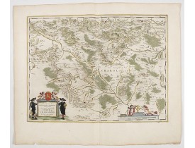
BLAEU, W. - Les environs de L'Estang de Longpendu.. Comte de Charolois.
Published
: Amsterdam, 1644
Size
: 376 x 495mm.
Color
: In original colours.
Condition
: In good condition.
A very decorative map with beautiful cartouches of a province of France by one of the most famous map publishers. From early..
400€
BLAEU, W. - Les environs de L'Estang de Longpendu.. Comte de Charolois.
Add to Cart
Add to Wish List
Compare this Product
Ask Question
Ask Question
Location:
1645
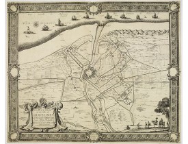
BEAULIEU, Sébastien de PONTAULT de. - Plan et Siège de la Ville de Gravelines assiégée et prise par Son Altesse Royalle Monseign.r le duc d'Orléans.
Published
: Paris, l'Autheur, 1645
Size
: 488 x 608mm.
Color
: Uncoloured.
Condition
: Coupé court au pourtour de la bordure d'encadrement. Large déchirure à droite (20 cm) restaurée.
Plan de la ville et du siège de Gravelines, publié dans : Les "Glorieuses Conquestes de Louis le Grand" dit "Grand Beaulieu"...
200€
BEAULIEU, Sébastien de PONTAULT de. - Plan et Siège de la Ville de Gravelines assiégée et prise par Son Altesse Royalle Monseign.r le duc d'Orléans.
Add to Cart
Add to Wish List
Compare this Product
Ask Question
Ask Question
Location:
1646
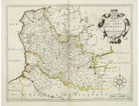
DUVAL, P. / MARIETTE, P. - Carte des comtes d'Artois et Boulenois.
Published
: Paris, Pierre Mariette, 1646
Size
: 379 x 496mm.
Color
: In original o/l colours.
Condition
: Bel exemplaire. - Very good to mint condition.
Carte de l'Artois et du Boulonnais par Duval ; A. Peyrounin fecit. Publiée par P. Mariette en 1650. Ornée d'un cartouche de t..
200€
DUVAL, P. / MARIETTE, P. - Carte des comtes d'Artois et Boulenois.
Add to Cart
Add to Wish List
Compare this Product
Ask Question
Ask Question
Location:
1647
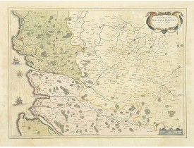
BLAEU, W. - Galloflandria, in qua Castellaniae Lilana. . .
Published
: Amsterdam, 1647
Size
: 385 x 500mm.
Color
: Original colours.
Condition
: Very good condition.
A very decorative map of the Gallic Flanders or Walloon Flanders comprising the Castellanies of Lille and Douai and the Tourn..
200€
BLAEU, W. - Galloflandria, in qua Castellaniae Lilana. . .
Add to Cart
Add to Wish List
Compare this Product
Ask Question
Ask Question
Location:
1650
JANSSONIUS, J. - Boloniae Pontieu. . .
Published
: Amsterdam, 1650
Size
: 380 x 519mm.
Color
: Original body colours.
Condition
: Fine. With wide margins. Paper slightly browned, as usual. Several town spots heightened in gold.
Centered on St. Paul, Hesdin, with the coast of Northern France, including Boulogne-sur-Mer...
350€
JANSSONIUS, J. - Boloniae Pontieu. . .
Add to Cart
Add to Wish List
Compare this Product
Ask Question
Ask Question
Location:
1653
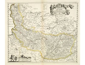
VAN LOCHOM, P. - Carte générale de la Picardie nouvellement mise en lumiere. . .
Published
: Paris, 1653
Size
: 380 x 442mm.
Color
: In original o/l colours.
Condition
: Bel exemplaire. - Good condition.
Rare carte de Picardie publiée par Mariette dans le "Theatre geographique de France…" en 1653. La carte par P. Van Lochom est..
500€
VAN LOCHOM, P. - Carte générale de la Picardie nouvellement mise en lumiere. . .
Add to Cart
Add to Wish List
Compare this Product
Ask Question
Ask Question
Location:
1655
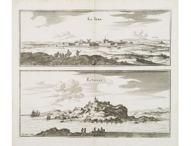
MERIAN, C. - La Fere. Estaples.
Published
: Francfort/Main, 1655
Size
: 140 x 310mm.
Color
: Uncoloured.
Condition
: Légèrement jauni dans les marges.
Two views printed on two separate plates of la Fere et Estaples in Nord, France. Both prints are very well engraved with exce..
50€
MERIAN, C. - La Fere. Estaples.
Add to Cart
Add to Wish List
Compare this Product
Ask Question
Ask Question
Location:
1655
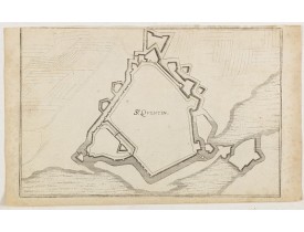
MERIAN, M. - St. Quentin.
Published
: Francfort/Main, 1655
Size
: 190 x 285mm.
Color
: Uncoloured.
Condition
: Pâles rousseurs dans les marges. Coupé juste au-dessus du filet d'encadrement supérieur.
Military plan of St. Quentin's fortifications.Between the end of the 15th century and until the middle of the 17th century, t..
20€
MERIAN, M. - St. Quentin.
Add to Cart
Add to Wish List
Compare this Product
Ask Question
Ask Question
Location:
1660
BLAEU, J. - Galloflandria, in qua Castellaniae Lilana, Duacena, & Orchiesia, cum dependentibus; necnon Tornacum, & Tornacesium. Auctore Martino Doue Gallo-Flandro.
Published
: Amsterdam, 1660
Size
: 415 x 520mm.
Color
: Uncoloured.
Condition
: Some marginal water staining. Some brown spots in lower part of printed area. Printer's crease along center fold.
Map of French Flanders. Blank on verso. A finely engraved map from the most important Dutch map publishers of the 17th centur..
80€
BLAEU, J. - Galloflandria, in qua Castellaniae Lilana, Duacena, & Orchiesia, cum dependentibus; necnon Tornacum, & Tornacesium. Auctore Martino Doue Gallo-Flandro.
Add to Cart
Add to Wish List
Compare this Product
Ask Question
Ask Question
Location:
1675
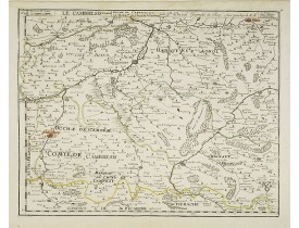
DU VAL, P. - Le Cambresis comte duche de Cambray avec le Lardat du Château de Cambray . . .
Published
: Paris, 1675
Size
: 381 x 486mm.
Color
: In original o/l colours.
Condition
: Very light water stain in upper part of the map with very light foxing of paper.
Uncommon edition of this map of the region of Artois and Chambray with the title along the top.Dated 1675 with the address "p..
200€
DU VAL, P. - Le Cambresis comte duche de Cambray avec le Lardat du Château de Cambray . . .
Add to Cart
Add to Wish List
Compare this Product
Ask Question
Ask Question
Location:
1695
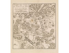
BEAURAIN, le Chevalier de - Carte des camps de Lugny et de Strees les 10. et 21. Aoust 1691.
Published
: Paris, 1695
Size
: 232 x 220mm.
Color
: Uncoloured.
Condition
: Sur papier fort.
Planche n° 20 publiée dans le Tome 2e de "Ordre de bataille de l'armée du Roy en Flandres commandée par Mr le Maréchal de Lux..
50€
BEAURAIN, le Chevalier de - Carte des camps de Lugny et de Strees les 10. et 21. Aoust 1691.
Add to Cart
Add to Wish List
Compare this Product
Ask Question
Ask Question
Location:
1730
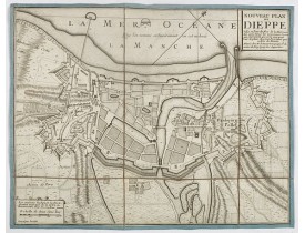
DE BEAURAIN, J - Nouveau plan de Dieppe, ville et port de mer de la Normandie.
Published
: Paris, ca. 1730
Size
: 274 x 348mm.
Color
: Uncoloured.
Condition
: Mounted on linen, dissected in 6 parts, lined with green silk. Dark impression.
Beautiful plan showing the fortified town of Dieppe and the suburbs of Barre and Pollet, engraved by Inselin. Beautiful examp..
200€
DE BEAURAIN, J - Nouveau plan de Dieppe, ville et port de mer de la Normandie.
Add to Cart
Add to Wish List
Compare this Product
Ask Question
Ask Question
1
2
>
>|
Showing 1 to 24 of 34 (2 Pages)
Filter Products